
PantherJustin
-
Posts
738 -
Joined
-
Last visited
Content Type
Profiles
Blogs
Forums
American Weather
Media Demo
Store
Gallery
Posts posted by PantherJustin
-
-
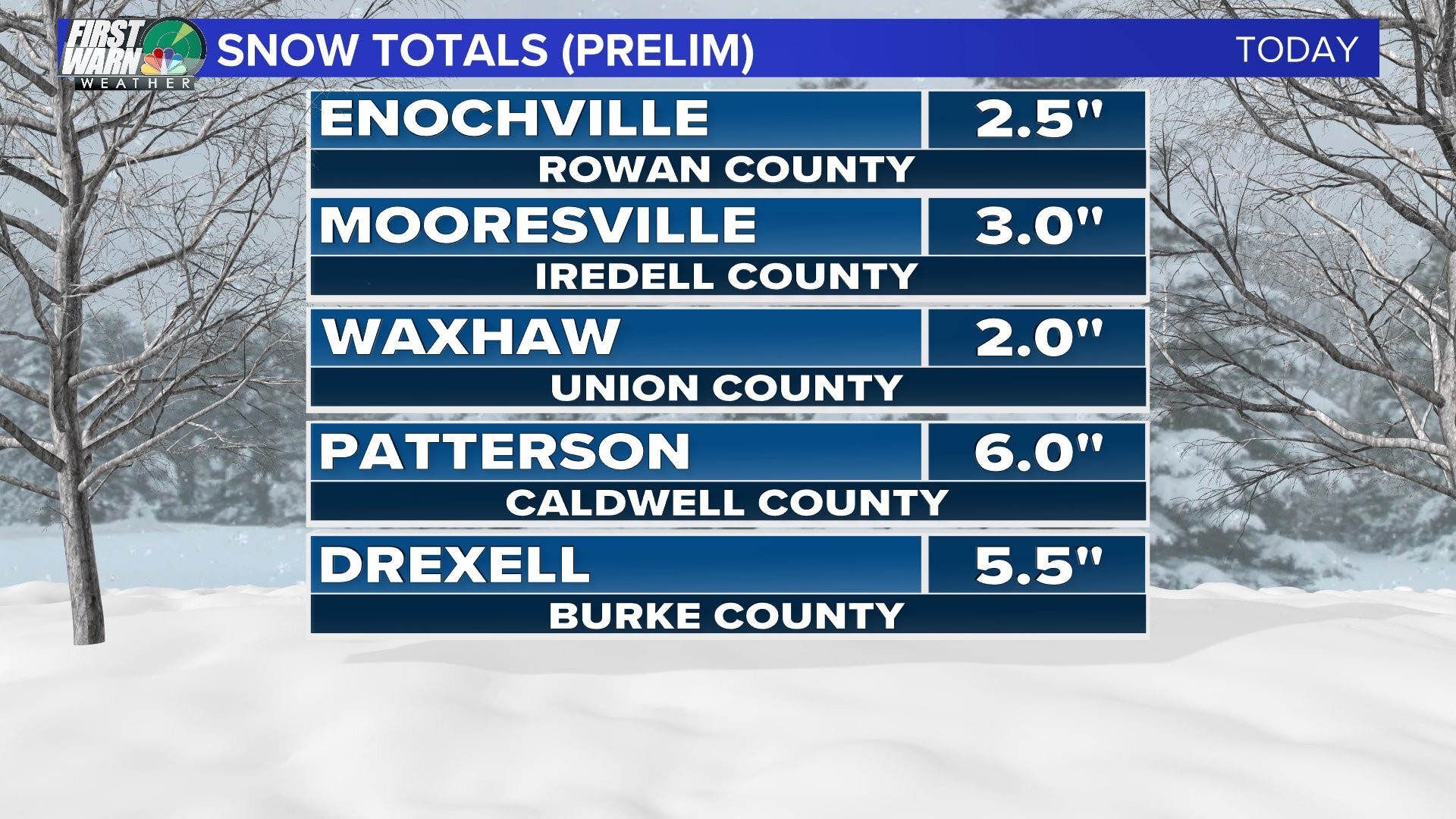
Guys to the South enjoy this last band…. I think this one’s gonna miss me to the South. Final Tally from Mooresville 4.5” of SN/IP very satisfied
-
 1
1
-
-
24 minutes ago, SnowDeac said:
And just like that it’s snowing lightly again near South Park.
It looks like it’s doing it’s best to make it us up here
-
1 minute ago, PantherJustin said:
Doubt it will be…. But the ULL Deform from 2014 is what took me from 8-10” when I lived in Rowan County snowed like hell for about 40 mins and it was gone
-
-
7 minutes ago, kvegas-wx said:
Daughter just showed me some decent snow at Lake Norman again. But my sleet rates here in Kernersville are just ridiculous. I might as well be in thundersleet it is coming down so hard.
Yea I’m in LKN idk where it came from not on radar… but Roughly 4/4.5” here
-
2 minutes ago, PantherJustin said:
4” SN/IP here in Mooresville , never had FRZN. Doesn’t show on Radar but it’s snowing pretty hard right now also…. Congrats to you guys up there was hoping that band would make it Over here to make a run at 6” but all is good lol
This is wild it’s pouring snow I have no clue why radar isn’t picking it up …. Has this happened to y’all today in the hills ?
-
4” SN/IP here in Mooresville , never had FRZN. Doesn’t show on Radar but it’s snowing pretty hard right now also…. Congrats to you guys up there was hoping that band would make it Over here to make a run at 6” but all is good lol
-
1
-
-
1 minute ago, olafminesaw said:
Wow, that's the most bullish I've ever seen them at this range
Yea…. @ILMRoss made a good post about the string signal earlier in AM I believe
-
2
-
-
-
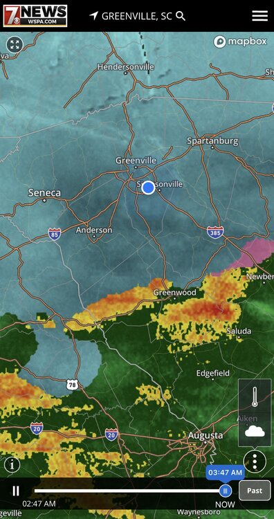
Radar must not be doing the best … tons of reports still upstate/WNC with this last band abs radar isn’t really showing it
-
1
-
-
9 minutes ago, SnowDeac said:
Just checked the rain gauge. 2.25 of mostly compacted sleet just south of South Park. Mostly ZR now with some icing occurring. A few limbs creaking with the wind.
Do we think a deform band will form and swing through? Or will dry air take over soon?
Local Mets seem to think so Brad P said models don’t show it but there will be one at some point this eve
-
That Deform back west in GA looks Pretty good for you guys in the hills idk how Far East it will pivot for us CLT guys but looks good for you all… idk how you wouldn’t get another 2-3” if you get under it
-
3
-
-
I’m a SE Poster …. But just as a heads up for you all…. I’m 30 miles N of Charlotte…. Last nights HRRR nailed it…. I’ve yet to switch to FRZN and I’m at 24 degrees still about 4” of SN/IP on ground it was alone last night showing this scenario while everything else had cut me down to at most an inch or so. Idk if same will play out for you all but goodluck down the line! Reel it in and let’s bring the big one next Weekend
-
15
-
 3
3
-
-
For those in CLT metro area ….. still got a couple hours but 3-4” lines up with HRRR from yesterday

-
5
-
-
43 minutes ago, Brick Tamland said:
Man, the Euro ensembles and mean are a thing of beauty.
Yea more than a 7/8 BIG BIG DOGS in there for 90% of this Forum very impressed.
-
1
-
-
Probably 1/2” or So here in Mooresville picking up a bit now…. 24/22 so about to bottom out
-
Just now, SnowDeac said:
Congrats to those getting the goods. Mostly all sleet here just south of South Park in Charlotte. Decent covering and windy but disappointing as usual to be so close to a better storm. Back to bed.
You should come 40 miles North…. We’re covered that’s insane the difference only 40 miles makes
-
Anyone else very interested in the Deform later this afternoon? Someone in that is gonna get a quick 2-3”
-
1
-
-
2 minutes ago, strongwxnc said:

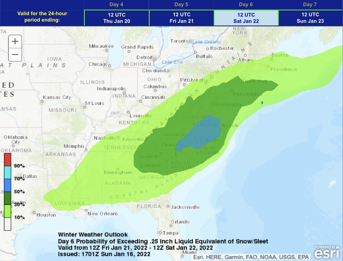
Mesoscale Discussion 0072
   NWS Storm Prediction Center Norman OK
   0302 AM CST Sun Jan 16 2022

   Areas affected...Southern Appalachians...North Carolina and Virginia
   Piedmont

   Concerning...Heavy snow

   Valid 160902Z - 161500Z

   SUMMARY...Snowfall rates exceeding one inch per hour will be
   possible across parts of the southern Appalachian Mountains this
   morning.

   DISCUSSION...The latest water vapor-imagery shows an upper-level low
   moving eastward across the lower Mississippi Valley. Ahead of the
   low, mid-level moisture is streaming northeastward across Tennessee,
   Georgia and the Carolinas, where widespread precipitation is
   ongoing. Surface temperatures within the area of precipitation are
   mostly above freezing. The exception is along the northern edge of
   the precipitation from northern South Carolina into western North
   Carolina where surface temperatures have dropped to near or just
   below freezing. In response, precipitation has changed over to snow
   across much of the southern Appalachians, especially from the
   Appalachian crest eastward. As the upper-level low moves eastward
   across the central Gulf Coast states, large-scale ascent will
   increase across the southern Appalachians. In response, bands of
   heavy snowfall will likely develop. Snowfall rates could exceed one
   inch per hour from far northeast Georgia into the western Carolinas
   and far eastern Tennessee. Later this morning, heavy snow will also
   be possible in western Virginia.

   ..Broyles/Edwards.. 01/16/2022
I-85 …. Climo wins very nice!
-
8 minutes ago, lilj4425 said:
Looks like it’s almost all the way down to Greenwood (city) now.
Too early to say HRRR scored again? I don’t remember Saluda/Greenwood having much of a shot before last eve…. By the way snowing here in Mooresville 31 degrees
-
Does anyone have the current soil temps?

-
Ik it was posted in main thread…. But the low looks to be Way down over Mobile Bay/Pensacola…. HRRR at current time had The Low up around Selma/Montgomery AL…. Umm that’s a tad off unless I’m looking at it wrong (I am new) but if I’m not the Hrrr initialized about 50 miles too far N than the surface …. What that means for us later is TBD but interesting to me
-
1
-
-
34/25 here in Mooresville
-
28 minutes ago, LiQuiDBuD said:
Wow, you're not kidding. That's a LOT of moisture. Looks like a tropical storm.
Sent from my Pixel 6 Pro using Tapatalk
Getting ready to Bring the pain In CLT Metro …. Hope y’all got a Generator


Winter Storm Izzy Obs Thread
in Southeastern States
Posted
Ik this is the Obs thread…. BUT score one for GFS and HRRR imo