

Intensewind002
-
Posts
767 -
Joined
-
Last visited
Content Type
Profiles
Blogs
Forums
American Weather
Media Demo
Store
Gallery
Posts posted by Intensewind002
-
-
75/50 feels great outside
-
2 hours ago, SRRTA22 said:
Outside of tropical systems, we had that squall that delivered widespread wind damage I think it was around late August of 2020.
It's frustrating, you'd think with better moisture content and heat we'd be looking at better storms but it's been the complete opposite.
I remember between 2005-2010, we would get these monster bow echo complexes that'd rip through the area well through the night... Doesn't happen anymore.
My favorite squall line to this day, though not really severe occured June 1, 2006 which tracked southeast from the buffalo area. I've never seen lightning that frequent since
Summer 2019 we had a few severe storms impact LI, I remember someone getting 80+ gusts on their PWS, also got some hail back in june of this year
-
 1
1
-
-
Saw a decent sized tree down up the block from me, maybe it was rotten or diseased because winds weren’t too severe maybe around 40 mph
-
Absolutely electric over the beaches right now, frequent cloud to ground
-
2
-
-
Got some 30-40 mph gusts but no lightning. The sky was beautiful as the storm was coming in though
-
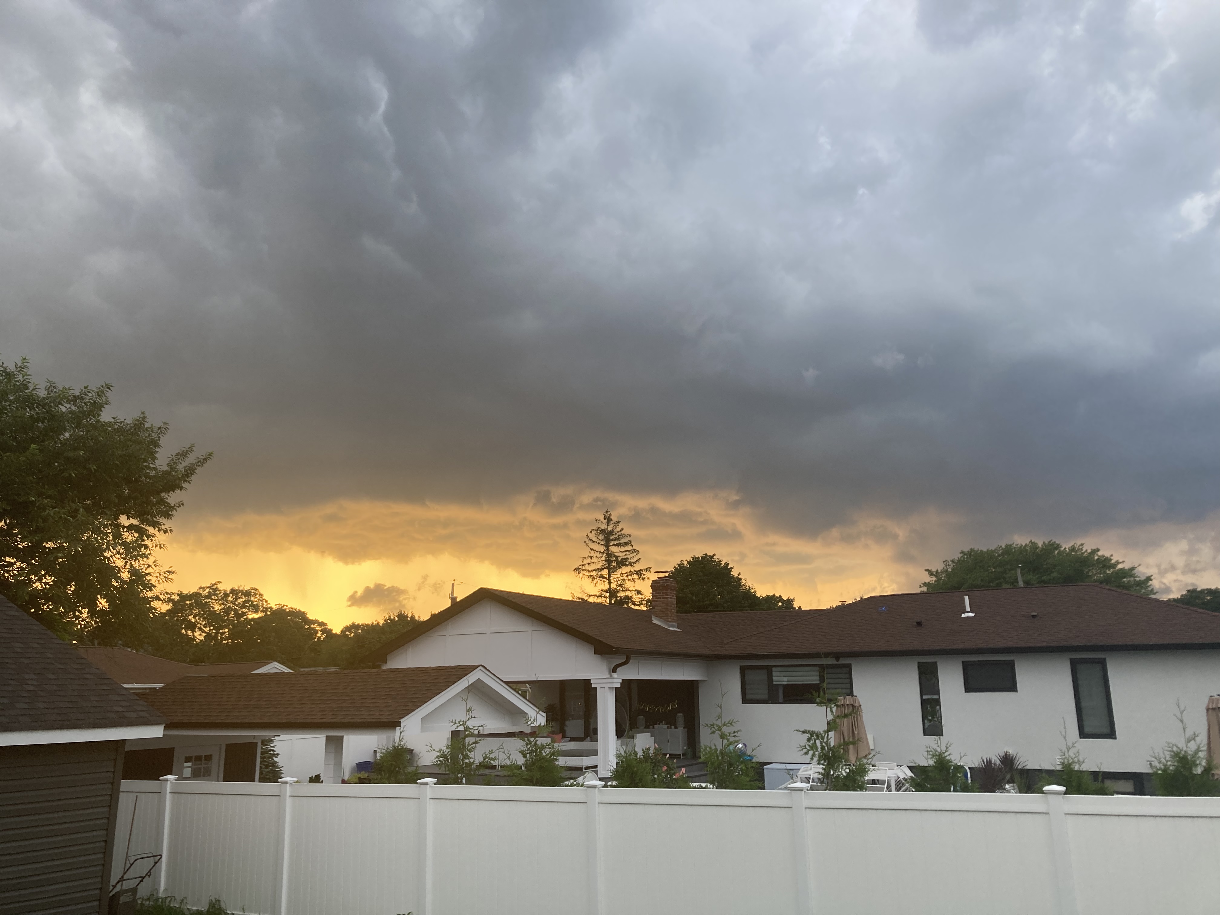
Ominous Skies

-
16 minutes ago, jm1220 said:
We need our severe events to come from the NW. When they come from the W they die out. The Ambrose Jet is already established so tons of marine layer. Hopefully I get a quick thundershower like the other night. Some rain would be helpful since we’re going back to a dry pattern.
I take that back, Severe T-storm warning up now. Although yeah 90% of the time, our best severe storms always coming from NNW, or last summer we had a supercell develop along the sea breeze boundary so i guess that can happen too
-
Looks like the third busted severe event of the week east of the city…
-
Currently 88/76/99 which is the max so far for today, I don’t believe I’ll hit 90 now so technically not a heatwave then since I only got 2 90+ days in a row but it feels plenty hot enough…
-
Frequent lightning from that cell offshore
-
91/73/100 currently not as bad as yesterday but technically hotter by a degree. 6th 90 of the summer for me
-
1
-
-
29 minutes ago, psv88 said:
These pulse storms are the worst. Can’t hold together for more than 5 min before collapsing.
It looked good on radar until about the Nassau-Suffolk border, it looks like central suffolk got some nice storms again too
-
Wow very frequent lightning with the storm to my northwest
-
6 minutes ago, jm1220 said:
Brief shower with some thunder.
Yeah thought I saw a flash of lightning just now from the south shore, but radar showed nothing
-
90/78/105 nasty out right now
-
87/69/91 for the max today, four 90s for 2023 and I should add 3 more over the next few days
-
1
-
-
Storm pulling the ol “break apart as it gets to LI”. I didn’t expect much today but I’m still disappointed…
-
0.01” of rain here, most of it looks to miss to the south but i can maybe squeeze out 0.2-0.4
-
Picked up 0.53” of rain here. Still need a true drought buster in my locale…
-
Impressive temperature drop at FRG it went from 82 to 72 in half an hour
-
2 minutes ago, LongBeachSurfFreak said:
Serious flash flooding in lynbrook!!!
Radar estimates already have you between 0.5” and 0.75” all within what 10-15 minutes?
-
84/74/91 currently, high for the day was 86
-
2 hours ago, Stormlover74 said:
Damn that’s way too young. Rest in peace
-
The event looks largely over but I did pick up another 0.02” giving me a final total of 0.91” for the day
August 2023
in New York City Metro
Posted
I honestly forgot there was a severe threat today