SUNYGRAD
-
Posts
257 -
Joined
-
Last visited
Content Type
Profiles
Blogs
Forums
American Weather
Media Demo
Store
Gallery
Everything posted by SUNYGRAD
-

Southern Crippler - Get well soon Jimbo Storm Obs
SUNYGRAD replied to BooneWX's topic in Southeastern States
Just 5 miles SW of Winston Salem, had snow/sleet mix mainly overnight. About 3/4 of inch and 16 degrees. -
I think this idea is good but wonder if too dry and the frontal boundary precip at end of event for Triad----more freezing rain? Mix??
-
Cataloochee Ranch - Resort Cams. A little bit of snow falling at high elevations in NC for sure.
-
Not sure any one model is totally correct at moment.
-
Beech Mountain Resort Cam - Resort Cams
-
...still strong CAD signal representation this hour.
-
I agree with 1-
-
Surface temps are too cold at GSO on HRRR and some others according 12Z sounding at GSO. About 5-degree difference on HRRR and 4 versus NAM 3K.
-
-
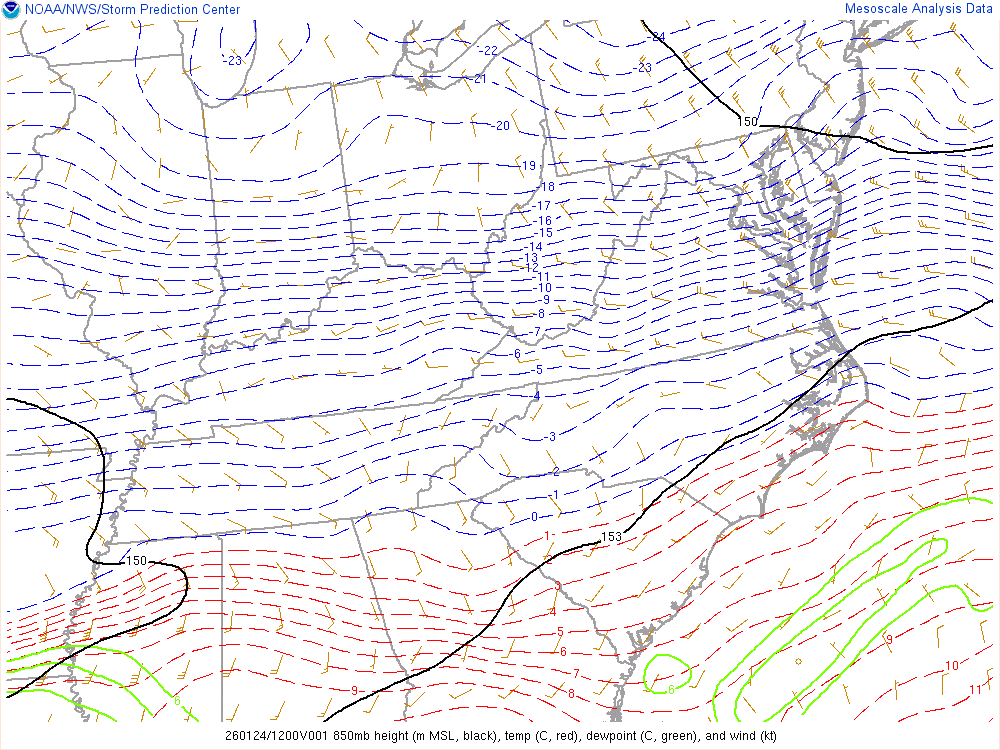
RGEM is a tad too warm at 850 on 6z run according to SPC analysis in western third of NC.
-
That's pretty cool display of info.
-
Who remembers using LFM and facsimile for maps in ether school or work? I was remembering following storms, and it cracks me up with all the data now, it is still tricky.
-
MY opinion----I think the NAM maybe a reasonable depiction----maybe too dry in NC. I would not automatically discount. Perhaps scattered precip on Sunday for several hours. The FV3 and HRRR (if you look southwest) maybe picking up on idea.
-
My local electric company is referring to the storm as "Winter Storm Fern." for heads up on preparations.
-
I like to see all of the 12Z model and ensembles, but the drier solution for NC is possible.
-
Any Miller B storm can be tricky, let alone a weaker system. There could be some wrinkles yet to come.
-
-
I'm heading to Linville Gorge and reflect.
-
Wow to Weather Channel map
-
creates more moisture over NC earlier.
-
...and a fair share of ensembles.
-
Agree, and in our favor for more snow/sleet.
-
-
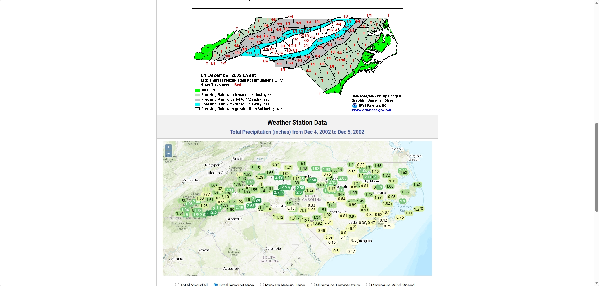
Winter Storm Event – Products | North Carolina State Climate Office
-
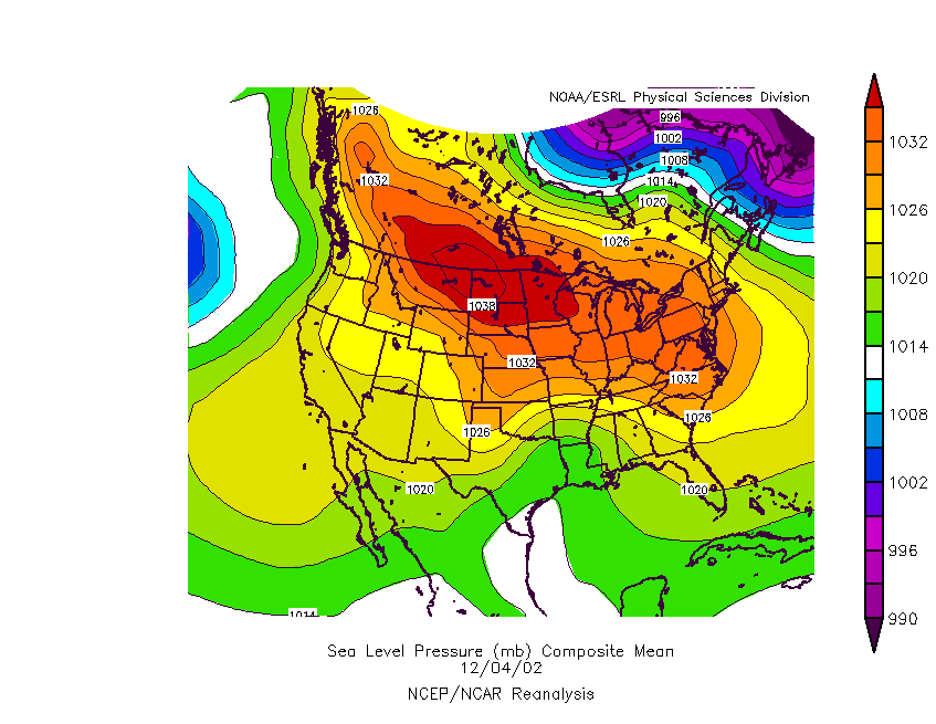
The High wants to anker in place driving the cold air down for sure.