Warwick WX
-
Posts
62 -
Joined
-
Last visited
About Warwick WX

-
"Don’t do it" 2026 Blizzard obs, updates and pictures.
Warwick WX replied to Ginx snewx's topic in New England
Parking ban here in Warwick until 6pm Friday, with snow plowing continuing all week and no trash pickup. The community pulled together where I am, with snowblowers running up and down the street based on a lack of immediate plows. I have a police officer across the street and firefighter next door, so it is important for them to be able to report during the storm. We are only a few turns from Route 1 with a quick ramp to I-95, so looks like I'm in the clear to get around okay. -
"Don’t do it" 2026 Blizzard obs, updates and pictures.
Warwick WX replied to Ginx snewx's topic in New England
Yes I wasn't around for '78 but in talking with some work colleagues of a certain age this morning the big difference was the crushing up north of Providence to Worcester back then, with Woonsocket around the jackpot zone. The impacts were also exacerbated by the surprise arrival, so it took over a week to clean up due to all the abandoned cars amongst other infrastructure difficulties. For sure this takes the cake as far as SE MA is concerned which had 16-20 inches in '78 based on the old accumulation maps I found. The firehose in '78 settled from the north shore through the western Boston suburbs through extreme northern RI over to around Putnam CT. This time it was about the same shape but starting from the south shore instead. -
"Don’t do it" 2026 Blizzard obs, updates and pictures.
Warwick WX replied to Ginx snewx's topic in New England
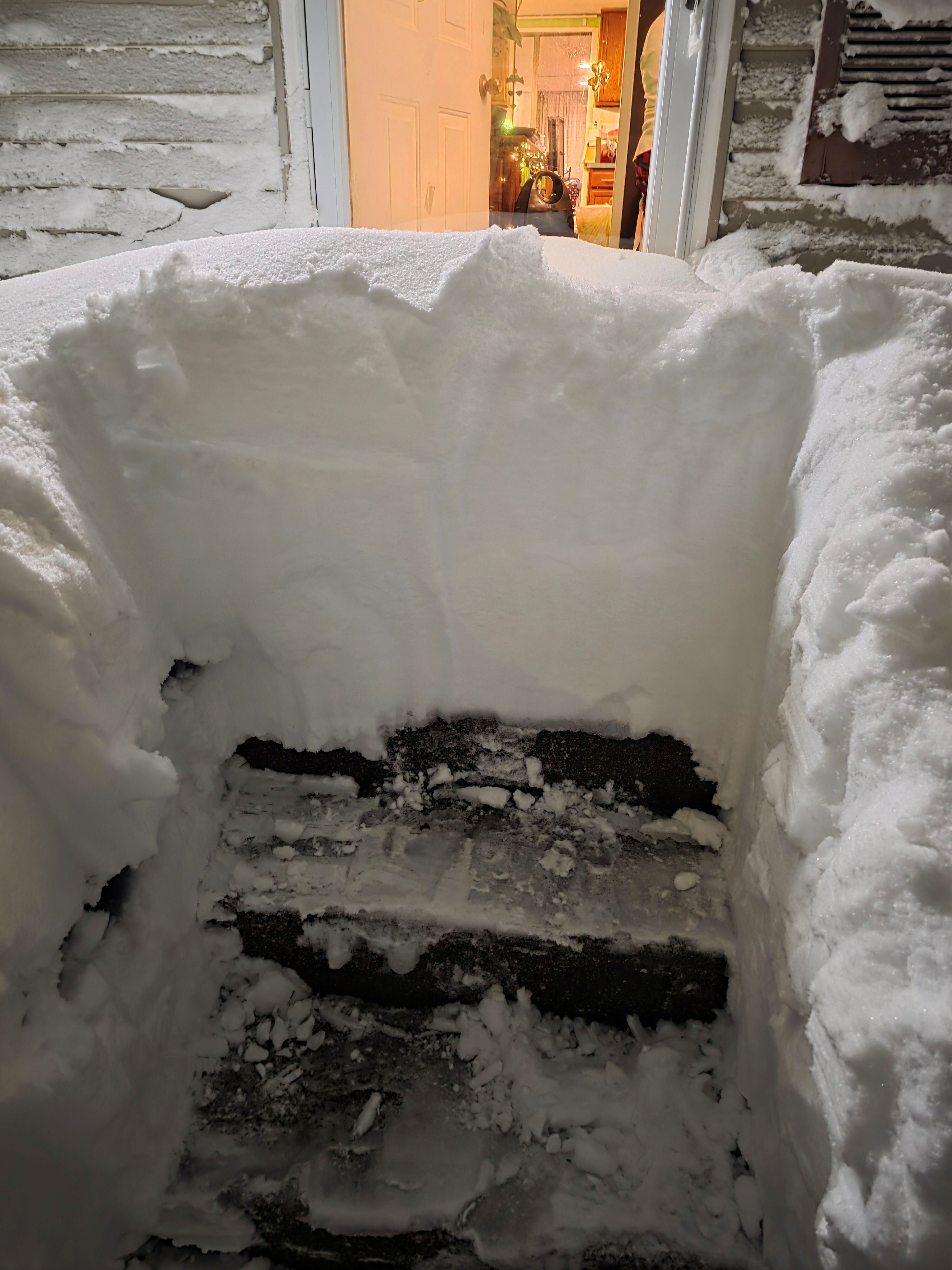
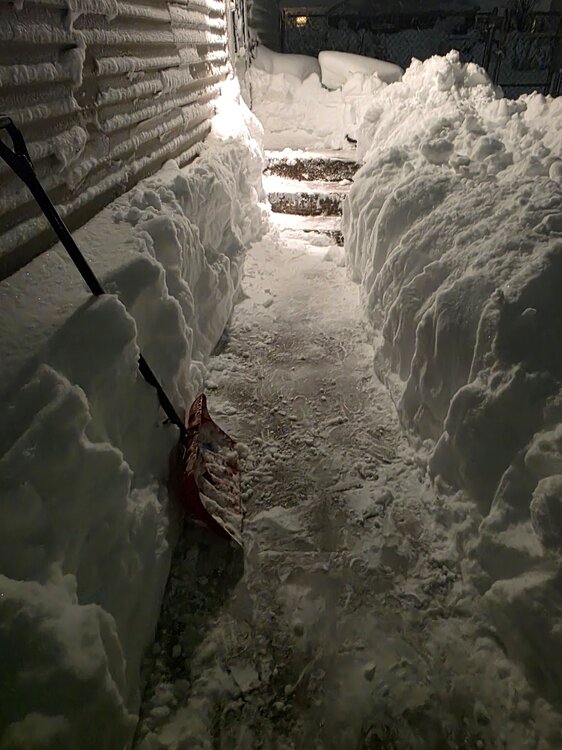
A few photos of my effort to dig paths - had to squeeze out the side door and attack my front door from the outside, seeing as there was no way of opening it. No way am I ever seeing 38 inches again in RI, or anywhere as the only place I plan to move is to a warmer climate upon retirement!
-
"Don’t do it" 2026 Blizzard obs, updates and pictures.
Warwick WX replied to Ginx snewx's topic in New England
MOAR SNOW coming through here at the airport, visibility has dropped again with falling snow joining the blowing snow from the ground. Just an absolute pounding: my mom informed me the all-time record where she grew up in Presque Isle, ME is 28.6 inches. Crazy to see Warwick overtake the northern frontier in any type of winter record. -
"Don’t do it" 2026 Blizzard obs, updates and pictures.
Warwick WX replied to Ginx snewx's topic in New England
And they're out! Lol -
Possible coastal storm centered on Feb 1 2026.
Warwick WX replied to Typhoon Tip's topic in New England
Excited for the chase, but my upper back and neck are wincing from the potential of MOAR SNOW REMOVAL each new run... -
I only know that the my local airport's official precip amount is 1.43".
-
Wind-driven stingers out there right now. Ended my shoveling just in time to avoid face damage.
-
Oh my, I am seeing a nice blob about to head onto land from Block Island. Going to be major dumpage here in an hour or so...
-
“Cory’s in LA! Let’s MECS!” Jan. 24-26 Disco
Warwick WX replied to TheSnowman's topic in New England
There was a local contest to win gift certificates for exact snow amounts, and my final call for PVD airport was 16.6 inches. Well Cotton, we'll see if it pays off... -
“Cory’s in LA! Let’s MECS!” Jan. 24-26 Disco
Warwick WX replied to TheSnowman's topic in New England
That channel 7 weenie is trying to find paydirt via the three-way (RI/CT/MA border). -
Yeah if debris is going that high, who knows how far laterally toward your friend it can be tossed? Nevermind if the funnel expands...
-
To put it on a bumper sticker, Peace River = Peace Out. You can also let him know if the surge doesn't get him, the river length of 106 miles and drainage basin of 1,367 sq. mi. per wiki will carry a crap-ton of rainfall/runoff at a great enough depth to threaten flooding from the inland side.
-
Visiting my bro on Saturday just north of NYC I was telling him 1-3 inches for him and 4+ inches for me. Looks like we are both staring a 10 spot in the face. To be fair, I am more subject to a snow hole and he may actually out-perform my total.
-
Alas I went the other way right after my post, huge snowflakes turned to rain. But now right back to sleet trying to flip to snow again. Sent from my SM-G991U using Tapatalk