
Imneversatisfied
-
Posts
85 -
Joined
-
Last visited
Content Type
Profiles
Blogs
Forums
American Weather
Media Demo
Store
Gallery
Everything posted by Imneversatisfied
-
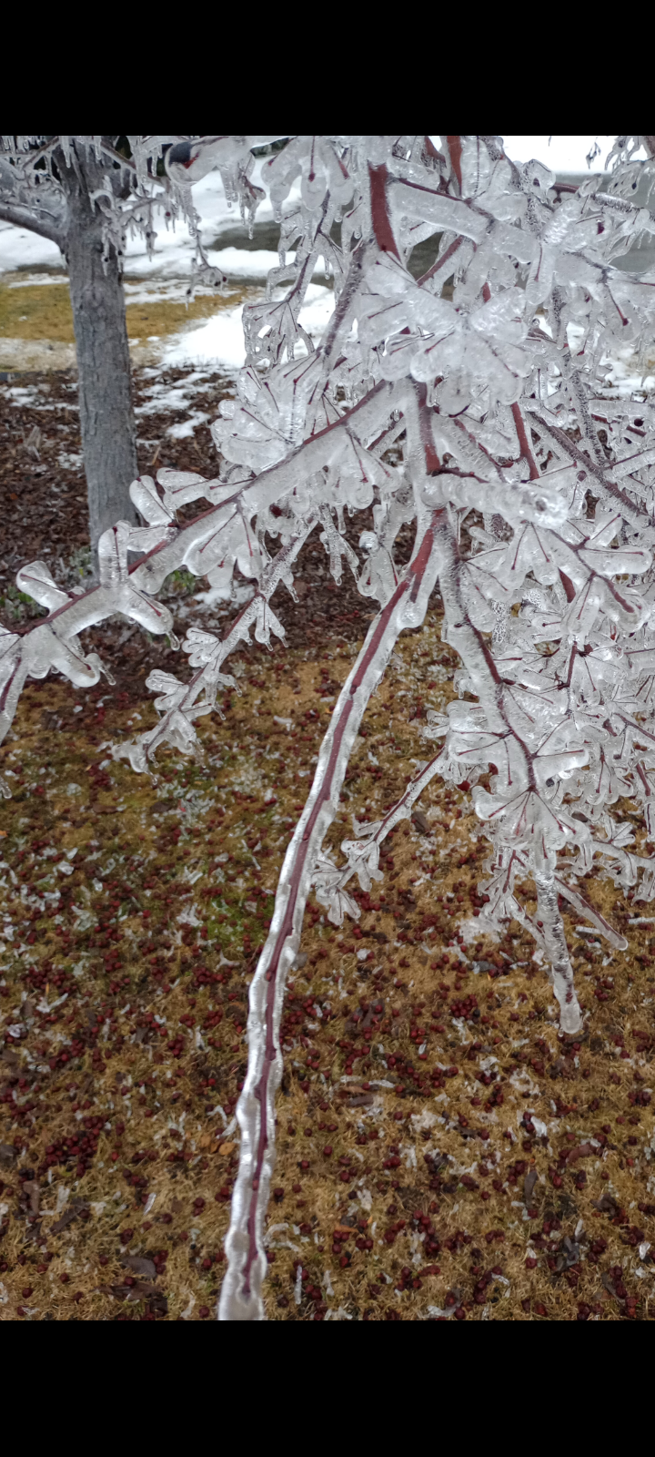
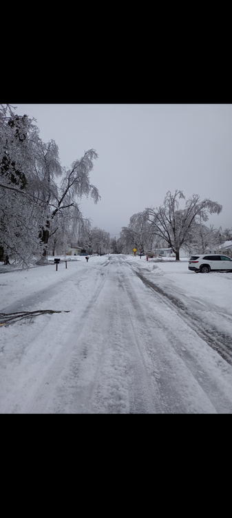
I think this year it's worse here. Here was a year ago.
-
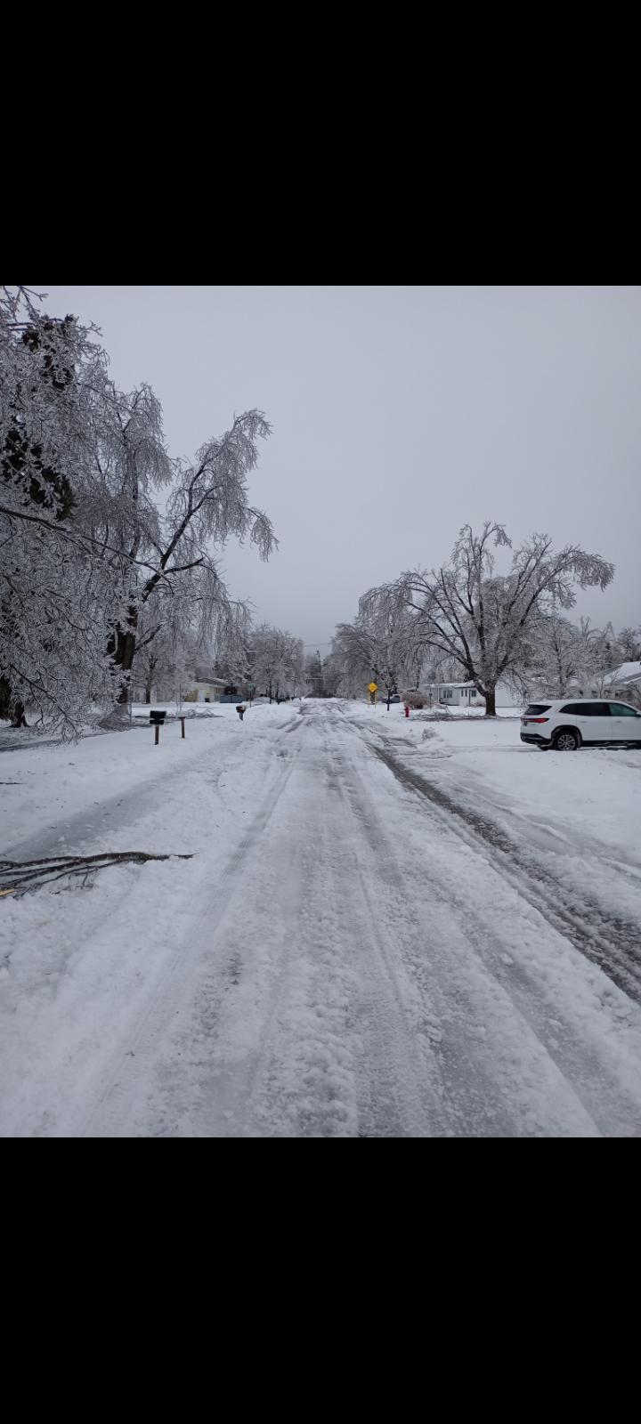
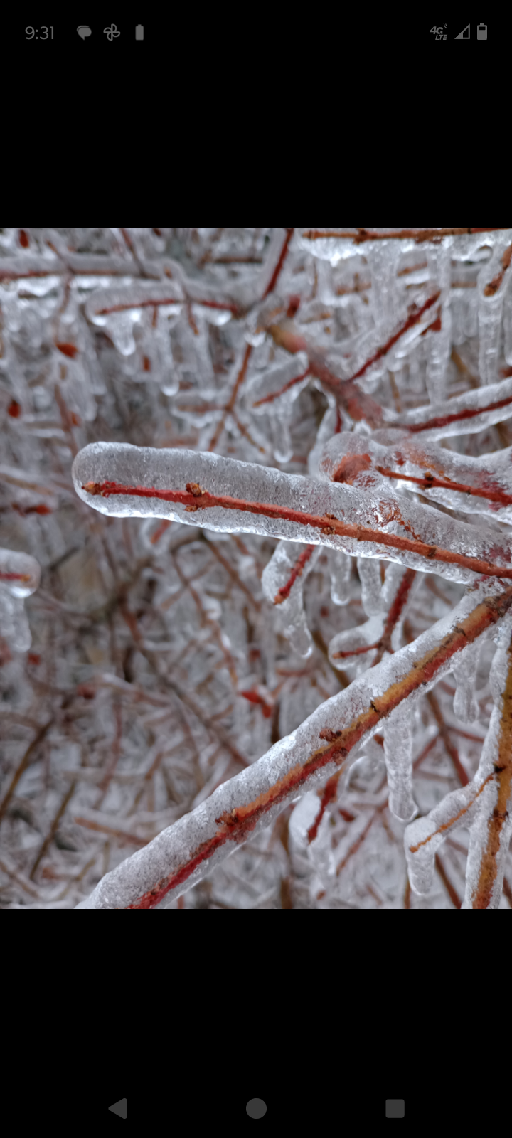
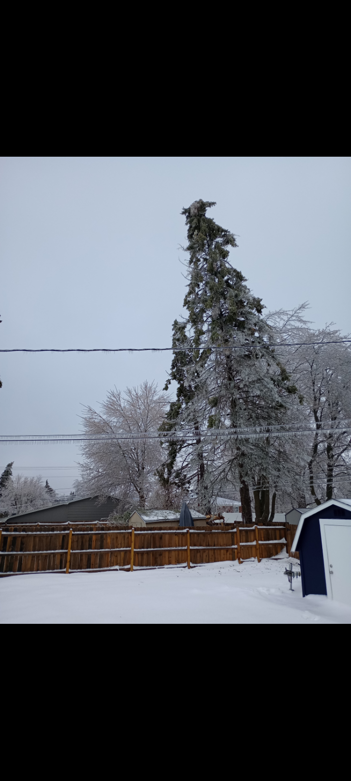
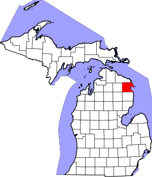
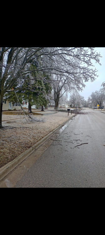
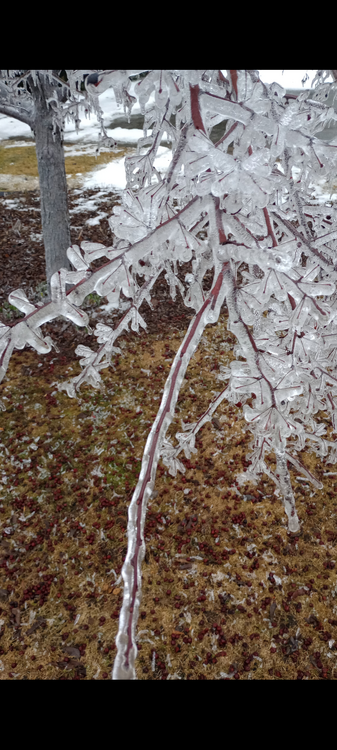
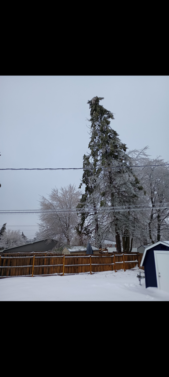
Here in Alpena we got a second once in a century ice storm just like last March. Got 4" of drifted cement Sunday morning,then over .5" of ice accumulation. Lost power at 5 am after my neighbor's tree fell on the line and then watched 4 transformers blow. 65 percent of town has no power. Trees snapping constantly. 40 mph winds and 1" of snow forecasted tonight will be a kick in the nuts!

-
Am I correct that most 18z models shifted the low se about 50 miles?
-
Will someone please post the 18z FRAM?
-
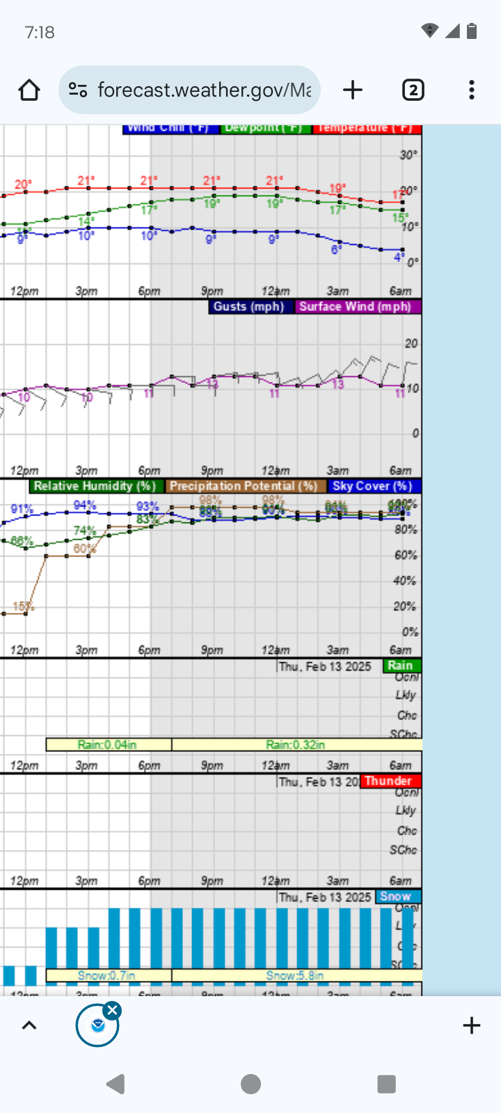
APX just issued an advisory here in Alpena,MI for 5" then maybe just plain rain Sunday night and Rogers city a warning for 8" and .50" of ice. Only 25 miles difference,so can definitely change. They aren't confident at all,but admitted it. Now cast it is!
-
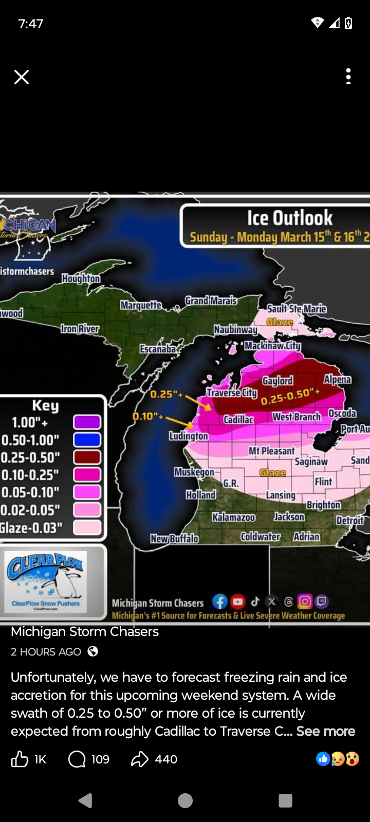
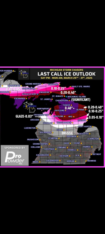
Here's Michigan Storm Chasers ice forecast map for this weekend vs last years storm forecast.

-
Im almost always lurking on the forum,just don't post much. Looks to me like 18z GFS and NAM are pretty similar with a SE shift.
-
Thanks Josh. Damn! Still big ice totals. Im getting plastered in Alpena right now as it is. I got food,gas,propane and my two snowmobiles ready to go.
-
Will some please post the FRAM forecasts?Thanks in advance.
-
Anyone care to share the 18z King Euro snow and FRAM maps?
-
Oh God NO! 2"+ of ice on gfz 18z in Alpena.I need a SE shift!

-
Thanks. OMG! Im in Alpena Michigan with 1.02" ! We just got 0.40" of ice yesterday that hasn't melted off trees.Tomorrow 6" then the big one. We suffered greatly during last March's ice storm like Josh.
-
Can someone please post the FRAM forecasts for Michigan?
-
Im coming out of lurking to hopefully drag this beast SE by 50 miles so I get crushed with a blizzard. As is I'll be riding a fine line between snow and freezing rain Monday night. Alpena had .40" of ice yesterday. Forecasted to get 6" of snow tomorrow and then Sun either 6" of snow, 1" of ice,then 6" more of snow or 24" of snow. Fun times!
-
Up here in northeast Michigan I could see a "severe" ice storm tonight and tomorrow. Can someone please post the FRAM forecasts? Thanks
-
Thanks! Not looking good...
-
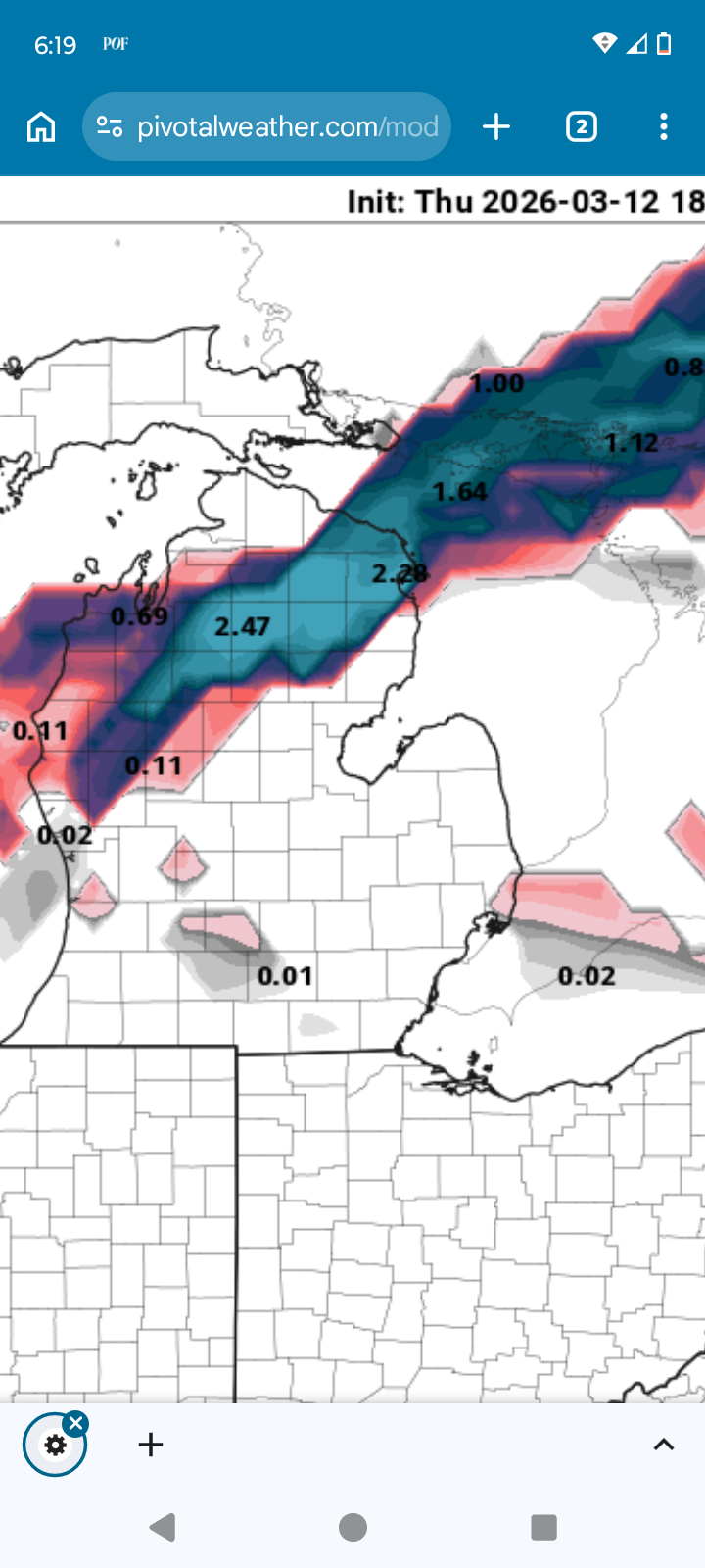
It's looking like a high impact freezing rain event for northern Michigan this weekend. Both GFS and CMC have freezing rain falling for over 24 hrs! Does anyone have freezing rain accumulation maps? I can't seem to find any.
-
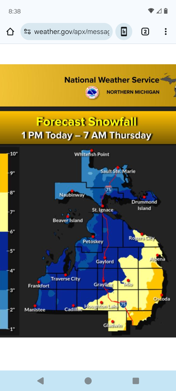
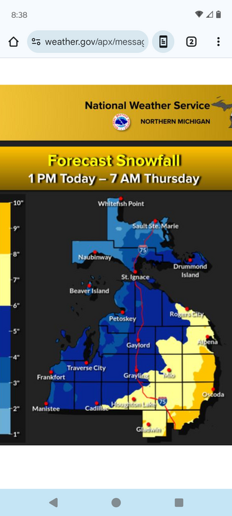
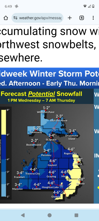
Under a warning for 6-8" in Alpena. Supposed to start around 1 pm and snow till 7 am Thursday. I can't wait to wake up tomorrow morning if I can sleep at all lol

-
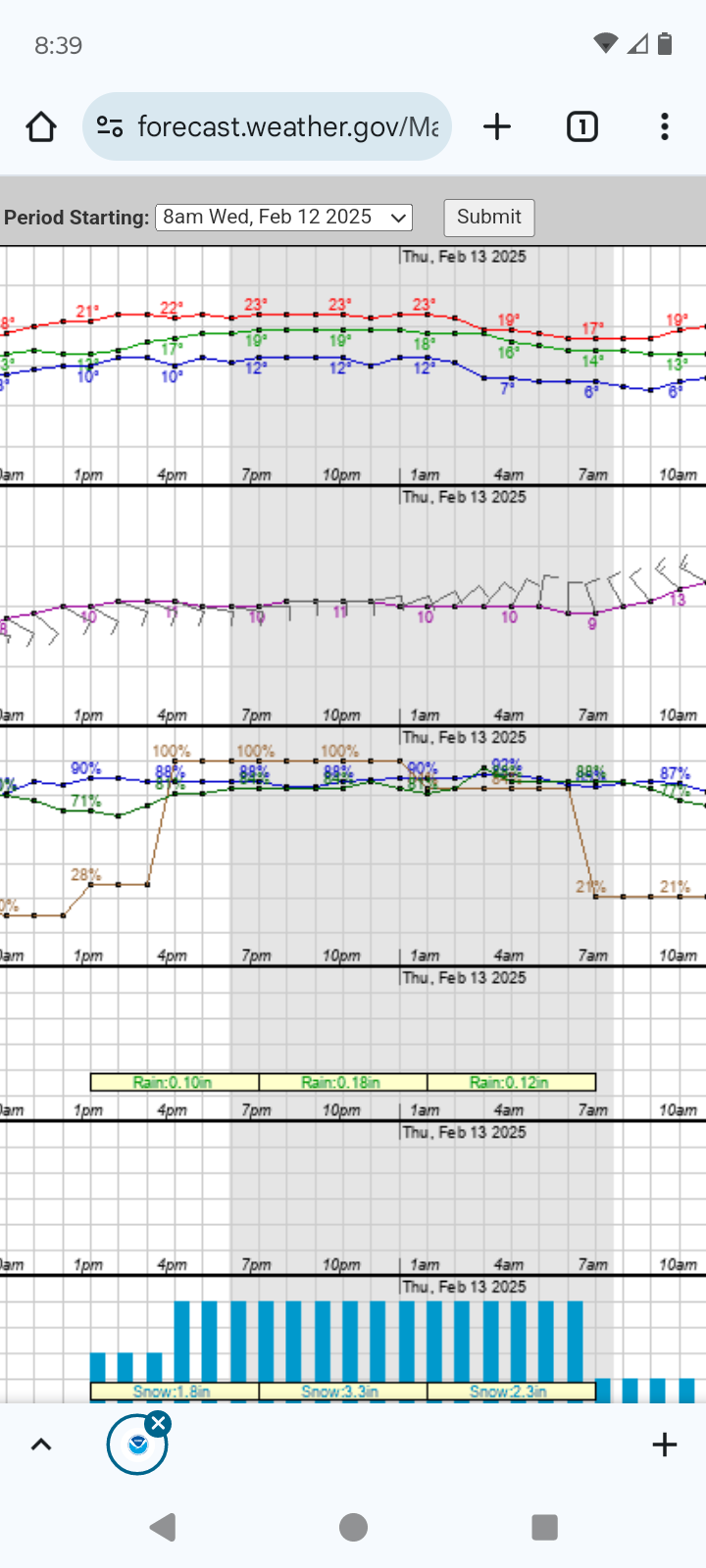
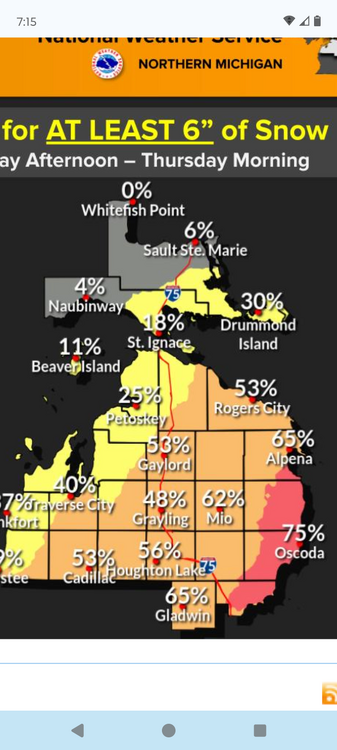
I'm surprised to still be in the game after all the model changes. My call of 6" still looks good for Alpena. Knock on wood.
-
I'm still looking good in Alpena. Hoping for some rare lake enhancement off Huron to help accumulation. Going with a 6" total by noon Thursday. Only 48 hrs to go! Now I'm jinxed lol
-
2/14-2/15 Potential Major Winter Storm
Imneversatisfied replied to A-L-E-K's topic in Lakes/Ohio Valley
I've been addicted to model porn since I was 12 lol -
The NW trend might bring me the first 6"+ storm I've had this winter like most. Hoping for some easterly lake enhancement too off Lake Huron.I've been lucky to nickel and dime my way to about a foot on the ground so far. Gaylord,MI has had over 150" and Alpena 40" and is only 60 miles west out of the lake effect zone.Been riding my sled each day for about 3 weeks now so can't complain too much. Will be nice tho to not dig down into grass and gravel.
-
Winter 2024-25 Medium/Long Range Discussion
Imneversatisfied replied to michsnowfreak's topic in Lakes/Ohio Valley
Suicide weather here in Alpena,MI with bare ground probably for the next week or two I would have traded my white Christmas to still have the 4" of snow we had then now.
-
4/2-4/3 Significant Late-Season Snowstorm (WI/MI)
Imneversatisfied replied to Geoboy645's topic in Lakes/Ohio Valley
Everything but the kitchen sink coming down here in Alpena. Seems to have more snow mixed in during heavier banding. Winds E at 30mph. Already 1k without power. -
4/2-4/3 Significant Late-Season Snowstorm (WI/MI)
Imneversatisfied replied to Geoboy645's topic in Lakes/Ohio Valley
Cold,rainy,windy night for me. Could have have been a hell of snow storm... This one's going to leave me burned for awhile... Tonight Rain. Patchy fog between 11pm and 2am. Low around 36. Windy, with an east wind 30 to 35 mph, with gusts as high as 55 mph. Chance of precipitation is 90%. New precipitation amounts between 1 and 2 inches possible.