

Prismshine Productions
-
Posts
3,560 -
Joined
-
Last visited
Content Type
Profiles
Blogs
Forums
American Weather
Media Demo
Store
Gallery
Everything posted by Prismshine Productions
-
honestly my focus today isnt even on weather, college football is on so watching the Citrus Bowl
-
saw the same up here on the way home from the store... it was amazing
-
I am thinking the following week
-
same here
-
we are right at 240hrs... NW trend is real, js
-
mhm
-
well this GFS run is gonna be different... closed vort off the oregon coast at hr93
-
the heck i do?
-
eh, it will be 01-01 0z soooo...
-
wine actually
-
Ok everyone... last 0z run for 2024 on Goofus, place your bets if it got into the champaign early
-
ICON really tried there but better seperation after it with a piece of energy sent down to northern Mexico...
-
actually is... more wave spacing out through hr120 (this would be the 6th storm)
-
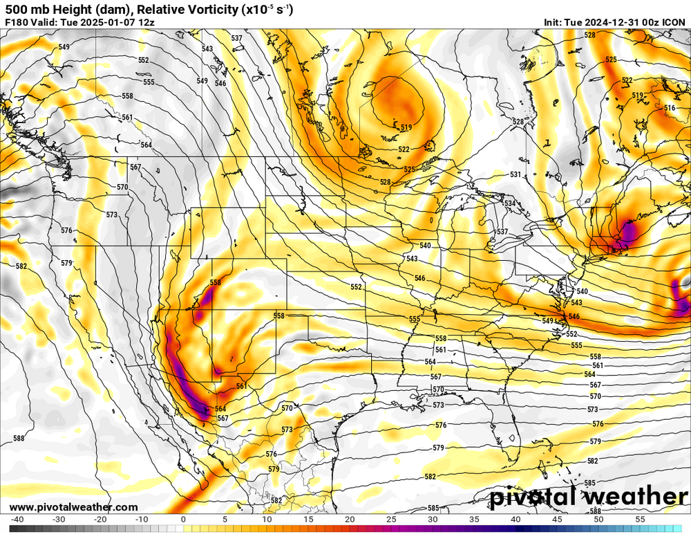
0z ICON possibly an improvement at H5 through 108 hours
-
story of the modern climo...
-
good weather for pond fishing at least
-
pffff this made me giggle
-
what is with everyone at each others throats today good Lord
-
Ouchhhhhhh Sent from my SM-S146VL using Tapatalk
-

Mid to Long Range Discussion ~ 2024
Prismshine Productions replied to buckeyefan1's topic in Southeastern States
No regrets getting married and moving to Vermont! Sent from my SM-S146VL using Tapatalk -
Had a rule of thumb growing up in South Carolina that my grandparents taught me: "If it feels like Spring around New Years (which meant, for my childhood area, 70s) a big winter storm is around the corner and winter is returning worse than it left" It most certainly feels like Spring today (58°) Sent from my SM-S146VL using Tapatalk
-
It is a beautiful partly cloudy day here in the valley with a temp of 55 Sent from my SM-S146VL using Tapatalk
-
I got a feeling this post is not going to go over well... Sent from my SM-S146VL using Tapatalk
-
Storm got can kicked by three days due to the air mass block Sent from my SM-S146VL using Tapatalk
-
Well... Sent from my SM-S146VL using Tapatalk


