Prismshine Productions
-
Posts
3,560 -
Joined
-
Last visited
Content Type
Profiles
Blogs
Forums
American Weather
Media Demo
Store
Gallery
Everything posted by Prismshine Productions
-
Yeah you right, can't imagine how that would crank with it being that cold Sent from my SM-S146VL using Tapatalk
-
Got the 8,688 hour model goin' already? Sent from my SM-S146VL using Tapatalk
-
-
This belongs in a frame...
-
just a matter of where
-
gfs warmer
-
New Winter Weather Advisory just issued for me... tenth of an inch of freezing rain expected tomorrow
-
hiding since torchmas did not happen, but in all seriousness, Forky been in the political sector of the forum
-
me and you are fine

-
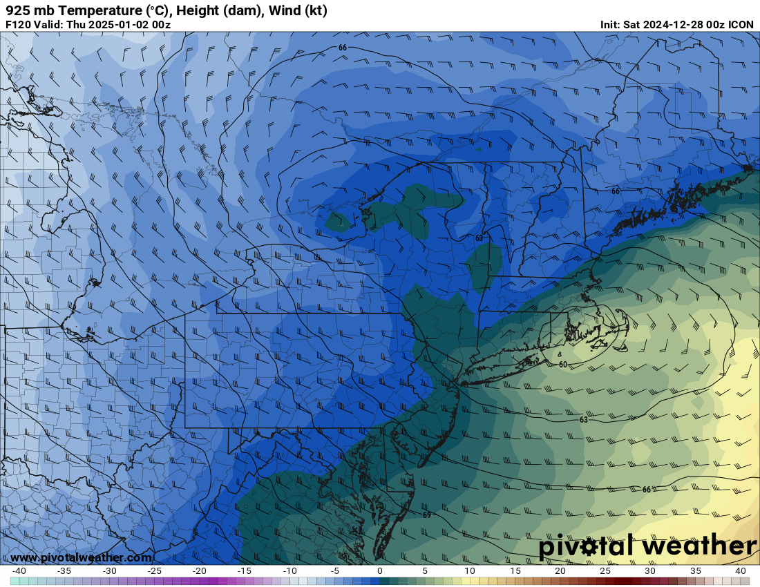
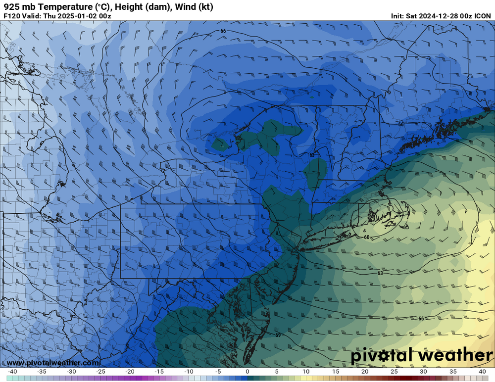
I'm thinking sleet, we all know how these events trend
-
Sacrifice Forky and omega Sent from my SM-S146VL using Tapatalk
-
Hi Sent from my SM-S146VL using Tapatalk
-

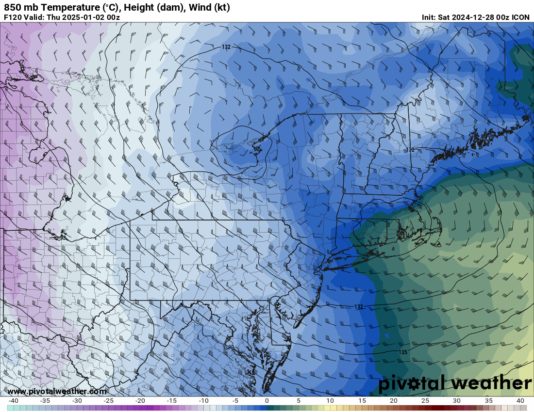
January 1/2 has gaining interest.
Prismshine Productions replied to Typhoon Tip's topic in New England
Oooo I get sleet, fun sledding weather Sent from my SM-S146VL using Tapatalk -
What exactly is that member showing?... Sent from my SM-S146VL using Tapatalk
-
30" at 10:1 leads to some rather simple math... 3" Liquid Sent from my SM-S146VL using Tapatalk
-
Hopefully for me and you too up here in the Connecticut River Valley... Sent from my SM-S146VL using Tapatalk
-
...no wonder Benchmark would be angry Sent from my SM-S146VL using Tapatalk
-
540 line down to Orlando, when is the last time we saw that? Sent from my SM-S146VL using Tapatalk
-
Let me guess... Get slapped in the screw zone? Sent from my SM-S146VL using Tapatalk
-
Anybody with Pivotal Plus got the Kuchie?... Sent from my SM-S146VL using Tapatalk
-
12z Euro has a big CNE hit on the 7th Sent from my SM-S146VL using Tapatalk
-
January 1/2 has gaining interest.
Prismshine Productions replied to Typhoon Tip's topic in New England
Euro also has it inside vs off the coast Sent from my SM-S146VL using Tapatalk -
Then there is me who has never seen anything over 10 (and that was the big thumper back in April)... Sent from my SM-S146VL using Tapatalk
-
Out of curiosity, was Snowmeggedon Historic or Biblical? Sent from my SM-S146VL using Tapatalk
-
btw Mt. Everest's peak is at H3 in case anybody is interested in that little tidbit Sent from my SM-S146VL using Tapatalk