

binbisso
-
Posts
728 -
Joined
-
Last visited
Content Type
Profiles
Blogs
Forums
American Weather
Media Demo
Store
Gallery
Posts posted by binbisso
-
-
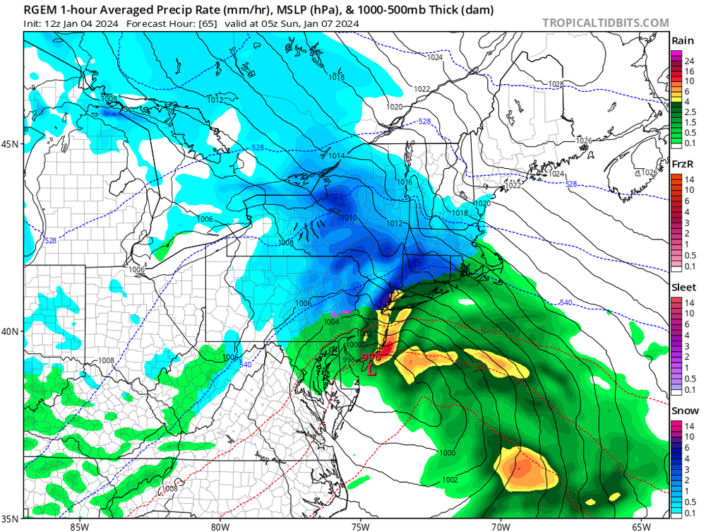
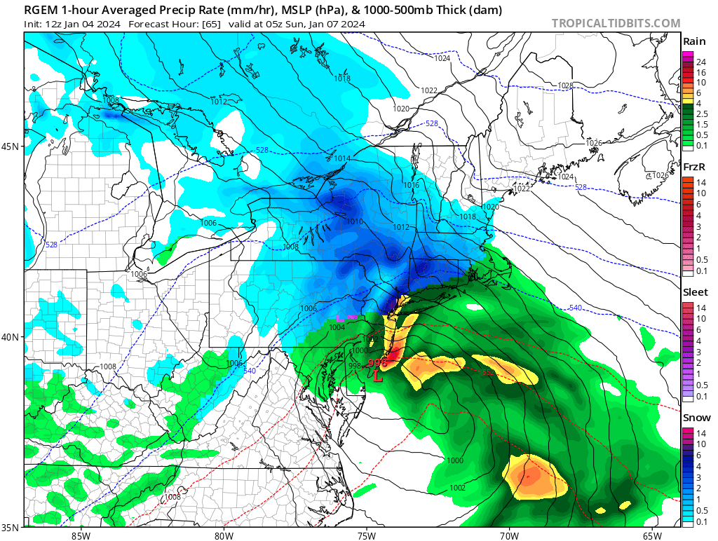
The rgem has very heavy precip right over nyc and adjacent nj early on. Model shows snow. I believe we will need heavy rates and wet bulb to snow there. Clown map just for fun.

-
 1
1
-
-
1 minute ago, Stormlover74 said:
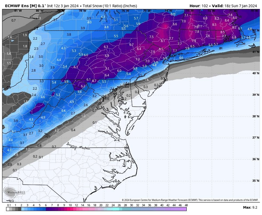
Is this the max?
No. That's the mean. In the new England thread they have the different percentiles
-
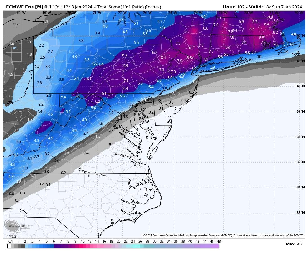
Taken from mid Atlantic thread. All is not lost. Hopefully we can get a few inches out of this.
-
 2
2
-
-
1 minute ago, ORH_wxman said:
Euro looks a bit more amped than 06z through 60 hours.
Confluence as much better through hour 72.
-
1
-
-
Man you have to love el-nino. What an active pattern. We should have plenty of chances the next two weeks. Maybe we fail but fun to track
-
2
-
-
7 minutes ago, Allsnow said:
Lots of highs in southeast Canada will try to keep us cold for most of these storms. Anything amped up will go west of us. I bit more of a ridge on the gfs at the end of the run out west
Yup. Gfs has another one on the 15th.
-
The two positives are The snow will fall at night and temperatures Friday night will be in the low 20s away from the immediate shore and heat islands.
-
1
-
-
For the tenth we need that trailing s/w on the 7th to amplify as it moves towards the Canadian maritime. Set up a nice 50/50 low
-
Big hp in Eastern Canada. Those are hard to move in January
-
1
-
1
-
-
Wow at the cmc for the 10th. Gfs also.

-
It looks like the storm on the 11th setting up nicely on this Euro run.
-
17 minutes ago, brooklynwx99 said:
the temp anomalies in Canada are a bit overrated IMO. look at Feb 2022. Canada was an icebox, but it didn't matter because the 500mb pattern sucked and the mean storm track was to the west. I would much rather have an above normal Canada if the 500mb pattern leads to coastal storms
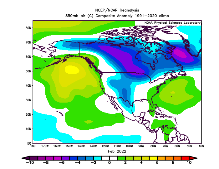
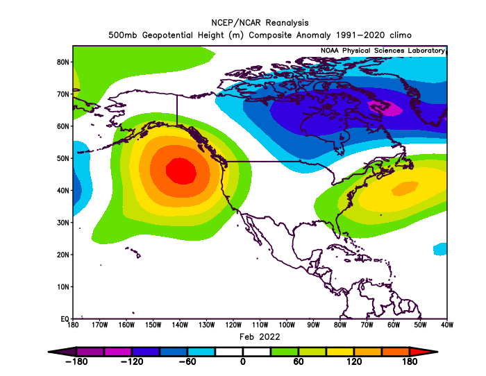
A 100% agree. Just get us to near normal temperature wise on January 1st and I'll roll the dice with that 500 MB pattern the ensembles are showing
-
14 minutes ago, Brian5671 said:
That's true in January-you don't need a crazy cold airmass like you do in shoulder months like Dec/Mar
Yeah I don't get it. By January 1st were starting to get to peak climo. Who wants 15° for a high temperature and 0 for a low? We don't need that. We need a favorable 500 mb Pattern with storm sliding on south of us, which is exactly What guidance is showing. Otherwise it's congrats Richmond.
-
2
-
-
37 minutes ago, snowman19 said:
Bingo!!A plus 4 temperature departure at 7 AM January 1st is plenty cold to snow In much of the sub forum. At that time my normal low is 25°. As long as the system is beneath us, which is what guidance is showing,
-
1
-
 2
2
-
-
I like seeing these strong hp to our north and the trough underneath us. Also n/s short waves sliding down the ridge in Central Canada will give us chances until that ridge moves west. Should be cold enough for frozen if they slide under us. So while this December will be solidly above normal I think we should have some opportunities for snow
-
Ukie is also plenty cold with Temps in the upper 20's for Tuesday night/Wednesday morning
-
1
-
-
Cmc, ukie, and icon all have the trailing n/s vort. Ukie looks the best ATM
-
1
-
 2
2
-
-
25 minutes ago, weathafella said:
Ch ch ch changes. GEFS. Perhaps New Years dawns a new weather day.
Yup. Maybe sooner.

-
4
-
-
30 minutes ago, EastonSN+ said:
If we can get the trough to retrograde a little we can hopefully shunt the maritime air a bit.
.thumb.png.3884c0e274654106e29d645431a7ee3d.png)
Yes. Give me all The Pacific puke air all you want in late December and especially January just keep that trough beneath us. There's snow in the forecast just Northwest of all the big cities this weekend. Reading this forum that would seem impossible.
-
 2
2
-
1
-
-
4 minutes ago, Allsnow said:
Haven’t plowed snow since January 2022. Coming up on two years now
I wonder how many times the plows came through from December 96 through March of 2000.
-
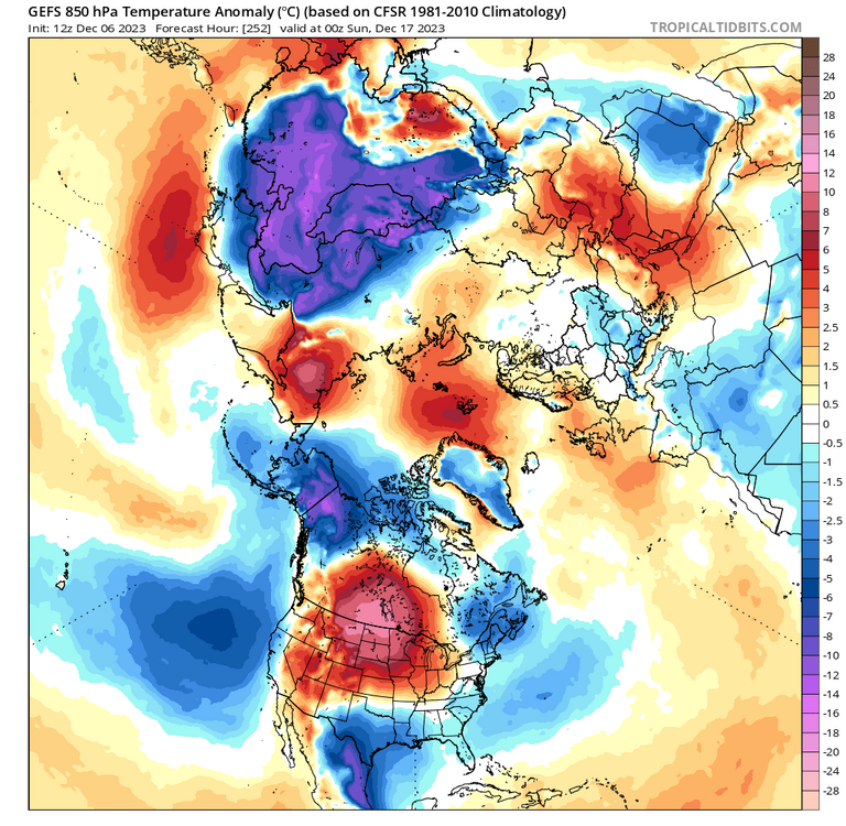
850's
-
1
-
-
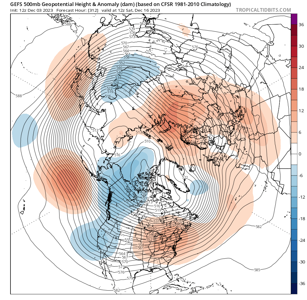
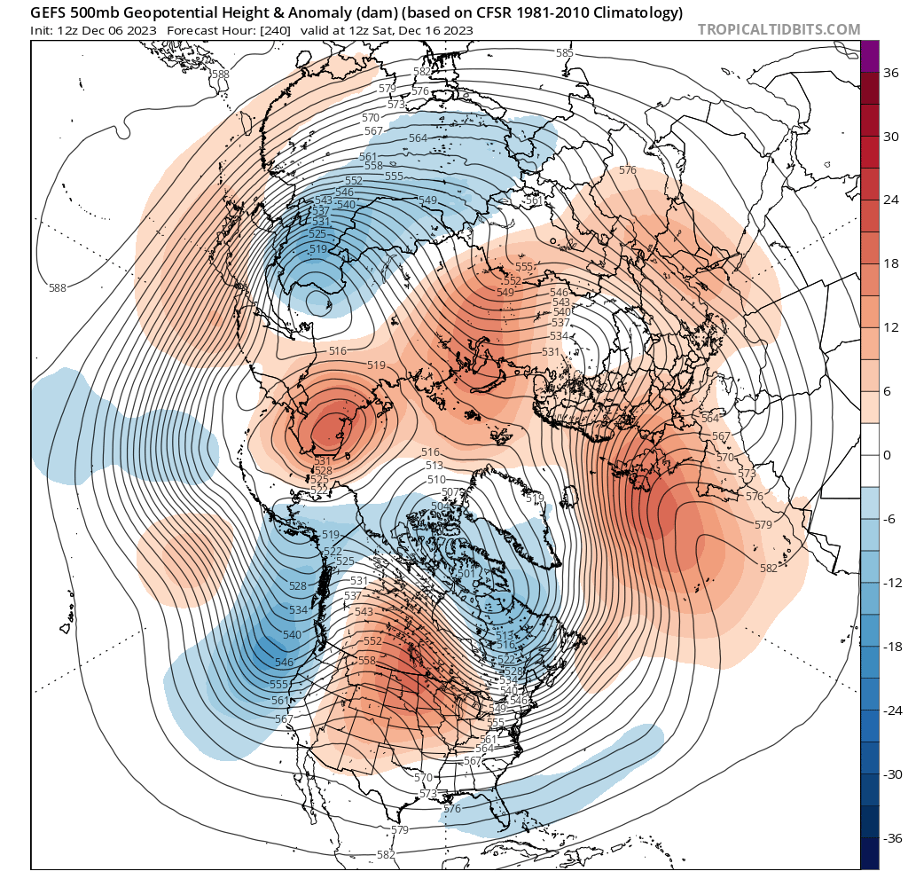
I wonder if we can sneak and event here in the 8 to 12 day period. There's a big PNA spike on the GE FS And the pretty significant change from the ensemble from several days prior.
New run
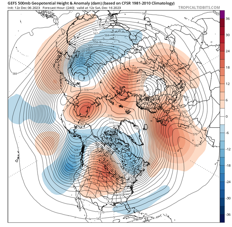
Old run


-
2
-
1
-
-
12 minutes ago, SnowGoose69 said:
In the absence of a pronounced and persistent SE ridge you won't see something 2015 like. 97 maybe, Dec 97 relative to 2015 and some other recent Decembers was not THAT warm. Something more like a December 99/14/18 is more likely in this pattern. One of the interesting things myself and a couple other Mets discussed in recent days is how the Op GFS/GEFS are doing the inverse of what they did last winter. Last winter we so often saw the GEFS look sort of decent days 7-12 yet the Op runs were torches. This last few days we see the reverse often, semi ugly GEFS runs but Op runs that have shown periodic colder shots and chances. Last winter more often than not those Op runs verified closer to reality. Its possible that in this regime we are in enough ensemble members are being fooled to skew the mean too far one direction.
I have noticed that too. It looks like we will have our chances thru mid month. After that who knows. Climo is still against us as we need at least - 5 or better departures for snow down to the coast in early December. Most likely We will ave +1 or so thru Dec 15th with both colder and warmer periods. Plenty of S/W coming in from the pac just have to time one right.
-
1
-
-
I have a question. Does it even matter at this point if region 3.4 goes over 2.0 tri monthly? The earliest that could happen would be early February. Isn't there a lag. Right now oni Is high end moderate. Shouldn't seasonal forecasters look for analogs using where oni is now?
-
1
-


.png.007fb7a85eac9d2c2ab3d073eec0d77e.png)


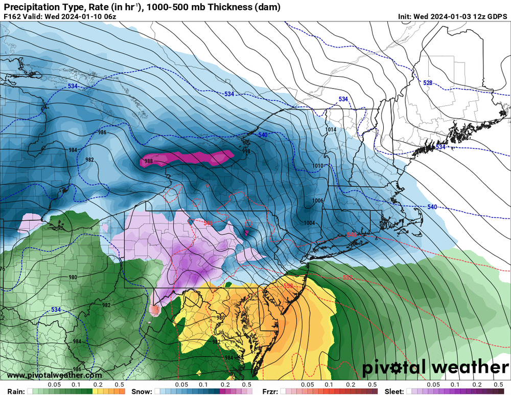
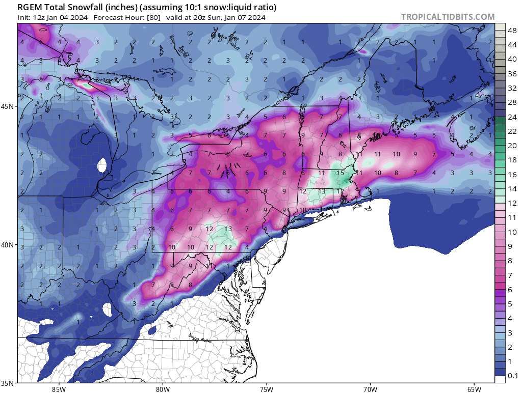
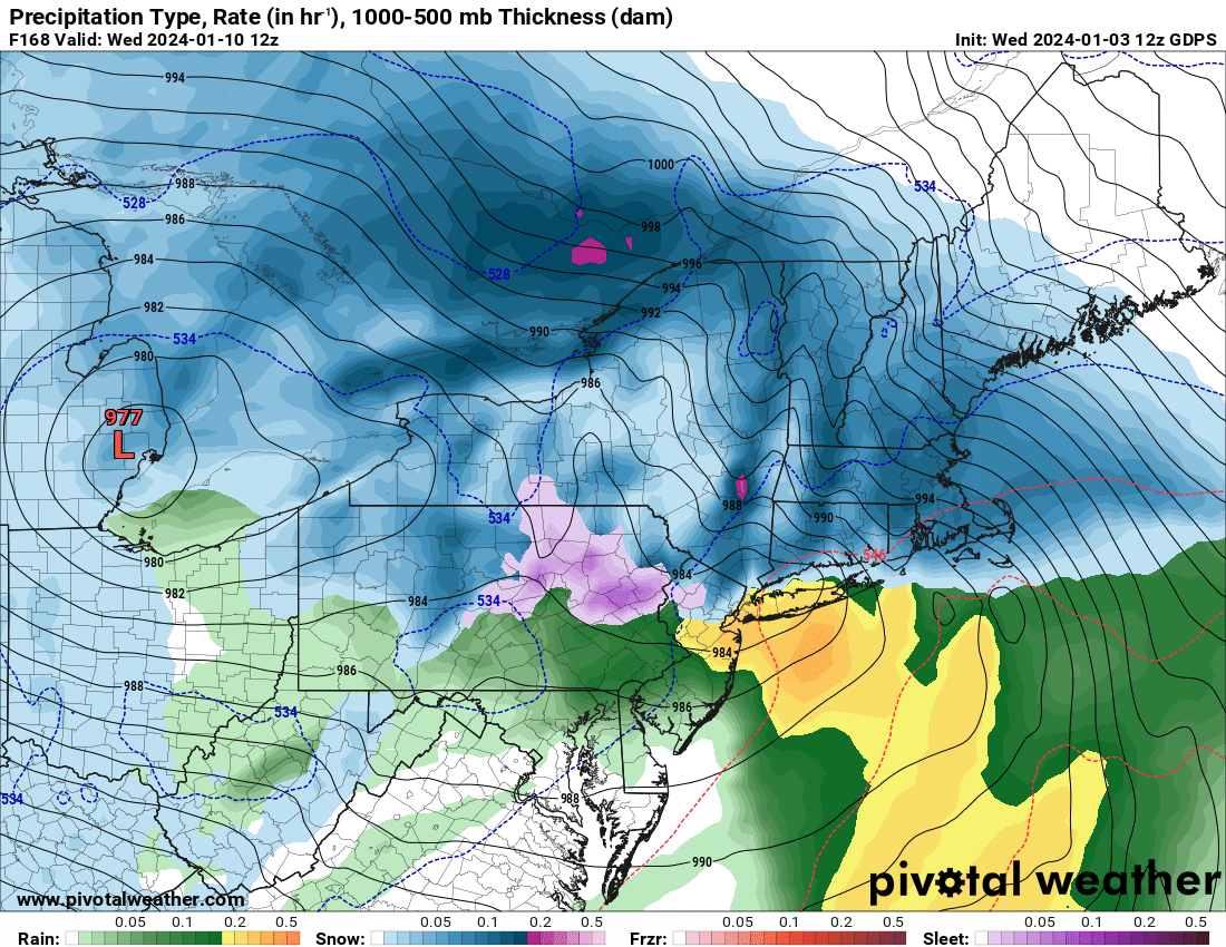
Two Mdt to high impact events NYC subforum; wknd Jan 6-7 Incl OBS, and mid week Jan 9-10 (incl OBS). Total water equiv by 00z/11 general 2", possibly 6" includes snow-ice mainly interior. RVR flood potential increases Jan 10 and beyond. Damaging wind.
in New York City Metro
Posted
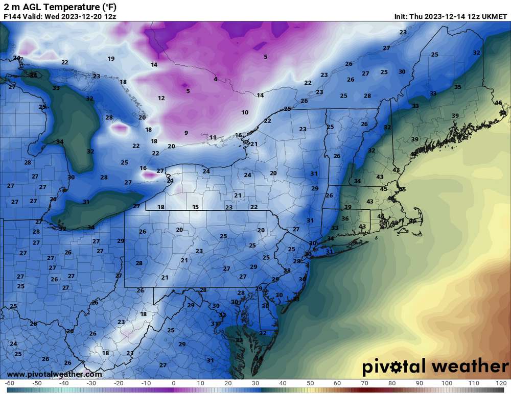
The trend so far on today's 12Z guidance Is the lead short wave is further East. We need that as Far East as possible before it turns the corner up the coast.
That should allow for a more northeasterly component to the wind and help lock in whatever cold air we have.