Bob's Burgers
-
Posts
510 -
Joined
-
Last visited
Content Type
Profiles
Blogs
Forums
American Weather
Media Demo
Store
Gallery
Everything posted by Bob's Burgers
-
Rick rolled.
-
HRRRV4 paints a more interesting image; possibility of strong boundary huggers possible
-
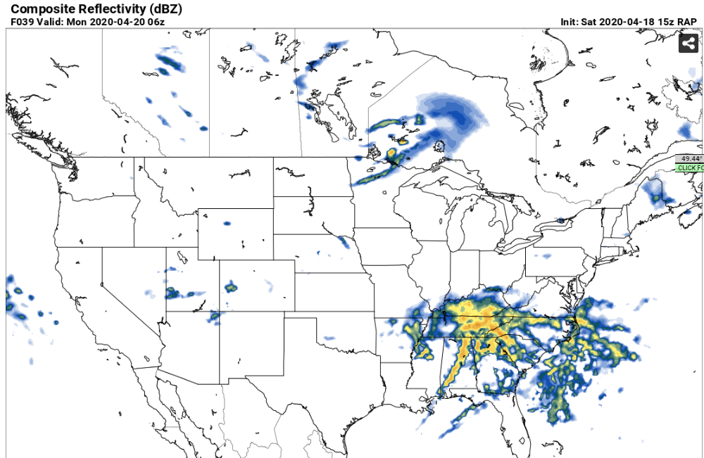
That is not an innocent squall line
-
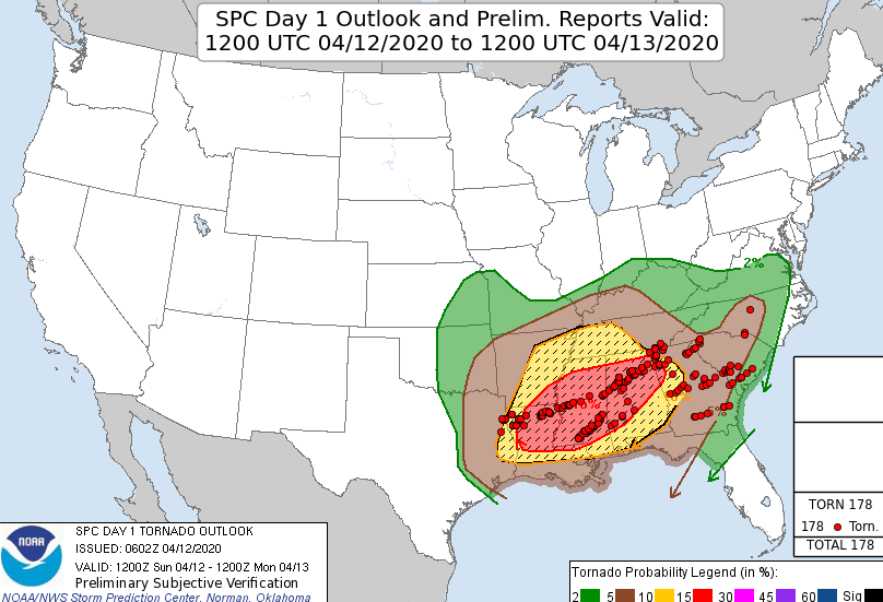
I hate to say this, but I'm worried about the nocturnal tornado potential again with this system. Large area of EHI in the 3-5 range well after 0z Monday.
-
Very impressive critical angle
-
We may not see anything like this again for several years
-
-
2.25 miles wide
-
Bunch of new data points added to DAT; several EF-4 tree damage points added
-
Wind speeds already increased to at least 178 mph per DAT data, the path width is more interesting at this point since it's in record territory (already has the state record)
-
-
UKmet soundings out of Louisiana Sunday
-
also, hrrrv4 is back on COD, so get ready for 48 hour HRRR forecasts haha
-
yeah i mean the 12z gfs wasn't far enough out yet so i had use that 06z gfs. 12z gfs looks less impressive than the 06z gfs for sure
-
-
-
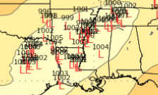
here's the spread so far
-
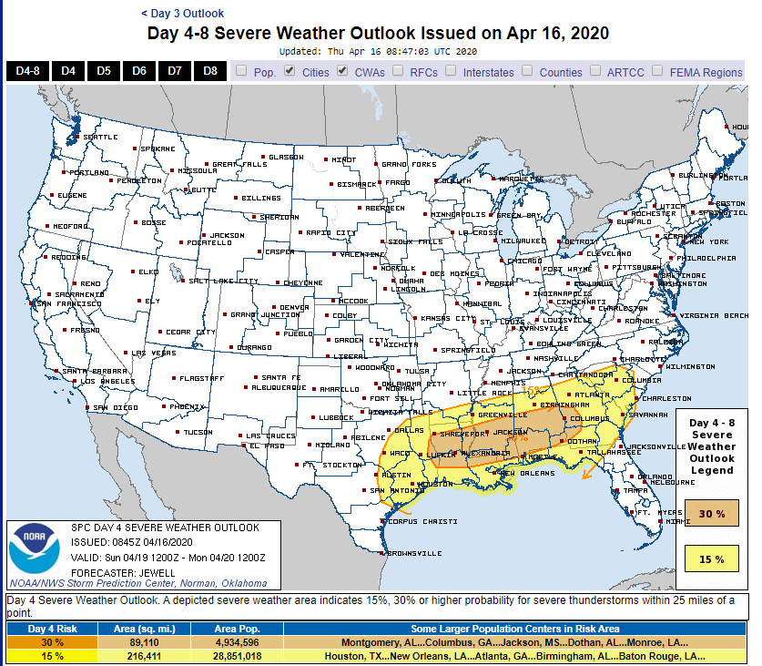
ZCZC SPCSWOD48 ALL ACUS48 KWNS 160845 SPC AC 160845 Day 4-8 Convective Outlook NWS Storm Prediction Center Norman OK 0345 AM CDT Thu Apr 16 2020 Valid 191200Z - 241200Z ...DISCUSSION... Models have come into better agreement depicting a shortwave trough moving quickly from TX Sunday/D4 morning to GA by 12Z Monday/D5. Low pressure is forecast to develop over the Red River during the day Sunday, shifting east toward the lower MS Valley by 00Z. Ahead of the low, a warm front will lift north across the Gulf Coast states, with upper 60s F dewpoints likely into central MS, AL, and GA, with low 70s F along the coast. MUCAPE to at least 2000 J/kg is likely by 18Z from TX into AL, with strong westerly winds aloft and 500 mb temperatures on the order of -10 to -12 C. Storms are forecast to form relatively early over east TX, where the environment will support large hail and damaging winds. Supercells are possible initially, with an eventual MCS likely. A tornado or two will be possible despite marginal low-level shear. Meanwhile to the east, warm advection may support supercells well ahead of the MCS across MS, AL, GA, producing a tornado or two along with hail. The primary severe risk in terms of coverage will likely be an MCS tied to the surface low as it quickly moves along the east-west instability gradient across LA, MS, AL and into GA. Significant convective feedback is present in the models, supporting the notion of a well-defined MCS with damaging winds. While SRH will not be very strong initially, it should increase after 00Z, with enhanced wind and/or tornado potential. The corridor of maximum threat will likely be adjusted in later outlooks.
-
-
first multi-violent tornado outreak since pilger 2014
-
-
embedded supercell rating from SC in
-
I think to go DOD10 upper bound, they have to bring in another team to survey it. Maybe some local engineers as well.
-
Looks like the wind speed will be increased to at least 178 mph based off DAT
-