StormySquares
-
Posts
71 -
Joined
-
Last visited
About StormySquares

-
I found the location of the photo Andy posted. 41°18'14.9"N 94°27'11.7"W
-
Forgive me if I'm wrong, but didn't it look like the velocity signature weakened some as it went into Greenfield?
-
Severe Weather Threat 3/27/21 - NETX/LA/AR
StormySquares replied to cstrunk's topic in Central/Western States
VAD from Shreveport had around 300 0-3km SRH -
Severe Weather Threat 3/27/21 - NETX/LA/AR
StormySquares replied to cstrunk's topic in Central/Western States
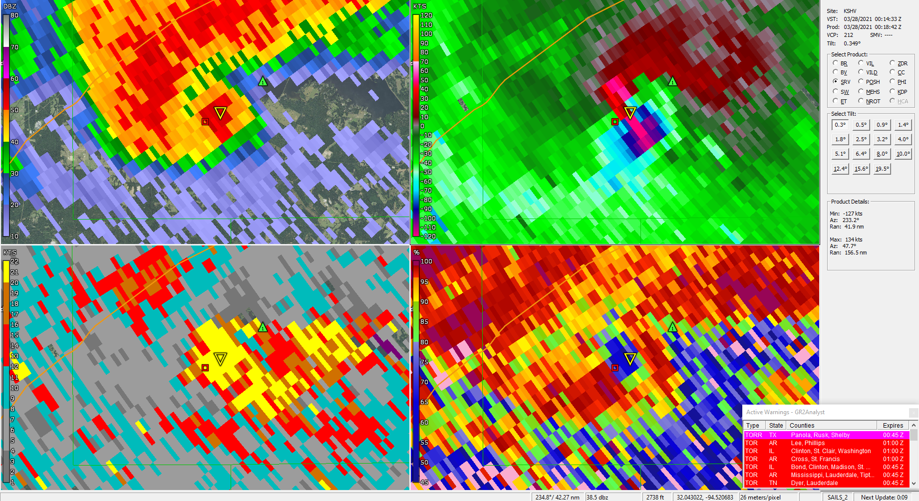
Sig tor on going southeast of Carthage, TX
-
I think the 12z HRRR redefined what the ceiling may be
-
I agree. It doesn't feel right that last Wednesday had the same probs as 4/27 or 5/24. This Thursday looks pretty impressive.
-
For what it's worth a 45% did verify in Alabama. A large high risk area verified for much of central Alabama and eastern Mississippi.
-
March 17-18 Severe Weather Event
StormySquares replied to DanLarsen34's topic in Southeastern States
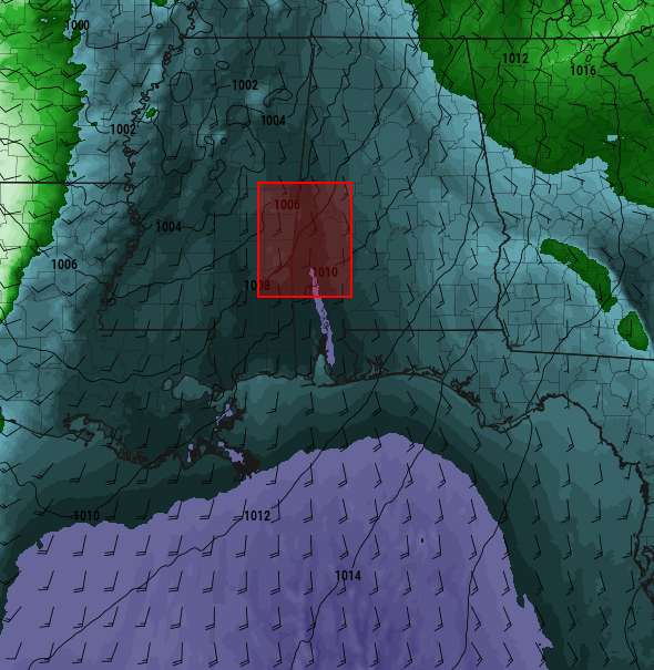
Possible SVC feeding into the Selma storm enhancing tornado potential. -
March 17-18 Severe Weather Event
StormySquares replied to DanLarsen34's topic in Southeastern States
The cells coming into Alabama be I-20 could cause some problems in the next few hours. -
March 17-18 Severe Weather Event
StormySquares replied to DanLarsen34's topic in Southeastern States
New PDS watch up. 80/80 props -
March 17-18 Severe Weather Event
StormySquares replied to DanLarsen34's topic in Southeastern States
Not with the pacific front still back in Texas. It's only 22:30z. Up until this morning the main tornado threat wasn't until after 00z. -
March 17-18 Severe Weather Event
StormySquares replied to DanLarsen34's topic in Southeastern States
The TOG on the Brookewood storm is literally on the 4/27 path. -
March 17-18 Severe Weather Event
StormySquares replied to DanLarsen34's topic in Southeastern States
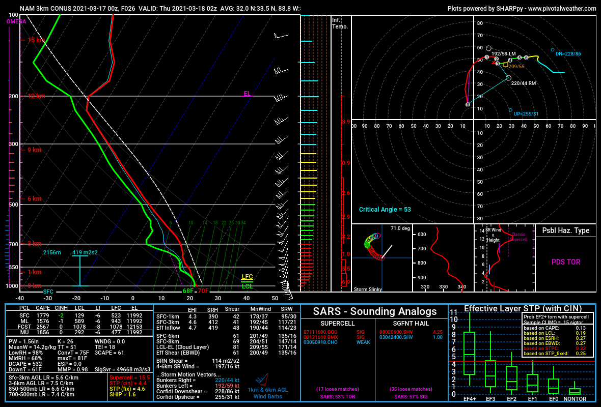
Area average sounding from the 3kNAM at 02z. Downright scary.
-
March 17-18 Severe Weather Event
StormySquares replied to DanLarsen34's topic in Southeastern States
Spann has done a pretty good job of saying the primary threat for Alabama may not be until overnight.