ORH_wxman
-
Posts
93,092 -
Joined
-
Last visited
Content Type
Profiles
Blogs
Forums
American Weather
Media Demo
Store
Gallery
Everything posted by ORH_wxman
-
If you retro that UK/Iceland/Scandi ridging, then the pattern becomes very loaded for snow....that's prob the one way to get any type of sustained period for snow threats as we go into early March. I currently put it at a low probability but high enough chance that it is worth watching
-
Yeah it is pretty similar description to what the weeklies did on Thursday....they started cooling off right near end of month and then went cold/stormy look for first 3 weeks of March.....ensmebles today are similar for end of Feb...colder, but not frigid. Gradient look....trying to build eastbased NAO ridge too, but I'm not buying that until its inside 10-12 days.
-
How would anyone have the weeklies yet? They don't come out until after the regular ensemble run is finished.
-
A -NAO is good to have for what Tip calls "sub-index events"....basically like in a -PNA/-NAO pattern, you have that firehose of shortwaves spraying the west coast and they run into the NAO block and get forced south of us as overrunning events or SWFEs or "NJ model" redevelopers. When you have a big +PNA, it's probably bad to have a monster west-based NAO block....that's congrats Carolinas up to Mid-atlantic...and I agree with Tip that the PNA rising is the bigger correlation to large-scale big-ticket QPF events (aka, our "big dog" storms) than the NAO. One of the reasons winter weenies like the NAO blocks (myself included) is that they make it harder to get cutters so if you have snow around, its less likely to get melted out in a big rainstorm or warm sector. It keeps it wintry....more useful in mid-winter for that than March admittedly where we are fighting the solar insolation more and more each day.
-
Yeah...might get going in the first week after the 4th or 5th, but otherwise, I'd think the meat of it would be like Mar 7 to the equinox....at least that is what the weeklies showed, but it's hard to trust them, even at week 3. I'm going to assume no NAO blocking until it's pretty solidly inside of 12 days.
-
Yeah it was a little more pressed with PV....still not as good as EPS, but we're talking clown range here. And I don't think this Feb 23-Mar 4 period is going to have just non-stop cold/snow anyway. It's a gradient pattern where we'll prob get a cutter too....but at least we'll have the chance at an event or two with so much cold lurking in Canada. Any chance for sustained snowy threats would have to be due to a big block forming like the weeklies showed. Plenty of reasons to be skeptical of that.
-
06z GEFS looked better than 00z....you can see it trying to form an NAO block as we close out the month...if that retrogrades a bit, that's how we'd get a nice March period
-
Getting pushed south toward us a bit from that UK/Iceland ridging trying to form…that’s what the weeklies went wild with another week later by retrograding that ridge into greenland. I’m skeptical, but if we’re looking for a fun ending, that’s what we’d be watching.
-
PV trying to creep down into northern Hudson Bay…that’s typically where it starts to get pretty interesting for us. It’s what help set up the historic cold shot a week ago…though we didn’t capitalize in terms of snow. Need to get it inside 10 days.
-
Remember when CC made a permanent ridge out west because of the “pacific warm blob”? Guess that fad is done. Now it’s the SE ridge’s turn to be the new fad. Get ready for a new one next year if we get El Niño and SE ridge goes poof.
-
The east-based NAO trying to form near the end of those runs is probably the thing to watch if there’s going to be a more sustained period of chances. Both GEFS and EPS are starting to show that…starts with Scandi ridging and then tries to start building into Iceland. Whether it goes into a full-blown block beyond that like the weeklies show is the question but that is probably the one path to a more prolonged “exciting” period.
-
I’m not talking about the next 10 days. I’m talking beyond that. Obviously the caveat is that it is clown range. We’re essentially arguing whether we think persistence will break. If it doesn’t, then yeah, no argument that it will stay warm. But persistence is a funny thing…it works great until it doesn’t. That particular type of AO neutral pattern (with PV displaced south a bit) didn’t look warm to me at our latitude.
-
It’s good to be skeptical of changes this winter. They’ve typically either not happened or they have been short-lived. I just felt the need to comment that the LR did not look warm to me. I can see how it theoretically goes warmer. We still have a SE Ridge. But we actually have above normal heights for once in S CAL/Baja, so the lower heights in the PAC NW don’t bother me as much. There will still be cutters in that pattern too…but with so much cold lurking north, it’s not hard to get a decent snow event either.
-
I dunno…one run and there’s a 50/50 minimum in the height field. It didn’t look warm.
-
Yes. It’s a pretty cold look there. I’m not arguing prior to that, but prior to that has looked pretty warm for a while (though I’ll say it wouldn’t be surprising if that 2/20-2/22 period goes colder…could be a torch too but a lot of uncertainty there on guidance) Almost all the analogs for that type of look have had a pretty cold stretch rolling forward (1967, 1959, 1990, 1997, 1994, etc)…maybe it doesn’t happen this year, but if we’re trying to stay objective, then I gotta acknowledge the possibility.
-
The post-24th period doesn’t look any different to me. If anything it’s gotten colder on ensemble guidance. I’m not believing it yet but some of the discourse in here sounds like we’re ready to go into March with 2010 or 2012 on our minds.
-
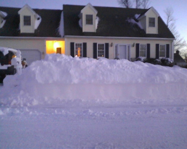
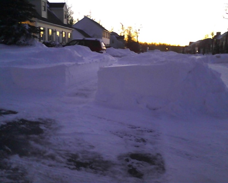
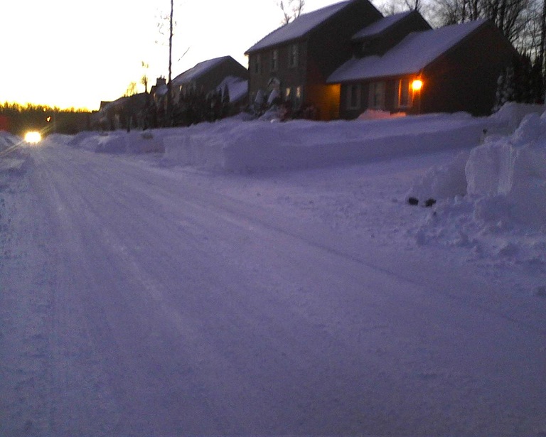
This are mine after Feb 2013
-
Yep. And to respond to pickles, I’m not talking about posts like Scott where he’s like “I’m not looking at the model guidance like I normally do”….I’d agree with that. I’m not looking at stuff that closely because I know the next 10 days are dogshit so I just take quick glances each cycle….but we all will spring to life the instant an event appears in non-clown range. And yes, one 6-10” event won’t change what this winter really is. A ratter. But that’s not what I was talking about anyway. We’d need something pretty special from 2/25 through end of March to bring this out of ratter territory. Like a 1993 ending or 2001 or 1956 or something similar. I just find some of the discourse really amusing about futility and pretending knowing what will happen 3+ weeks from now.
-
Yep. The objective side of me thinks it’s hilarious when all of us are like “I’m done with snow so let’s torch it!” or “this season has shown its cards, it won’t snow again in any meaningful amounts”as if we have any control whatsoever or as if we have any idea what it’s going to be doing 3 weeks from now. Sure, we speculate (that’s what these forums are for), but I’ve heard it so many times over the years on here. I’m ready to punt winter too but I know it doesn’t care what I think. Lol. If models are showing a 8-10” run-of-the-mill warning SWFE for Feb 26th or Mar 2nd or whatever inside of 5 days, 90% of the snow weenies will be all over it like flies on shit. Lots of people will “check back in” after “checking out” on winter. I find it amusing from a Tip-psychological aspect.
-
You know this winter is starting to erode the objective side of us when Mitch at 2200 feet in S VT is thinking of putting the snow blower into hibernation in mid-February.
-
Pope is easily triggered these days. They don’t forgive like they used to.
-
Yeah and even in the few days after that there is a ton of cold lurking north. It only takes a scooter streak timed well and a shortwave coming out of the Midwest for a random high end advisory or warning-level SWFE….yeah it’s been like pulling teeth this winter for that to happen, but we shouldn’t forget that they happen almost every winter…even shitty ones frequently have an event like that.
-
Yes. It would at least be a realistic scenario if we went the rest of the month snowless. It would still be unlikely though…BOS needs like 1.2 inches to ruin futility. ORH needs 3.7”. BDL would be a little more interesting since they would need 5.4”. But we’re not at the end of February yet. Something could easily pop in the final week we can’t see yet.
-
That would be 6th or 7th I think.
-
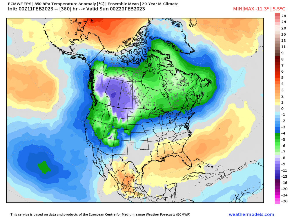
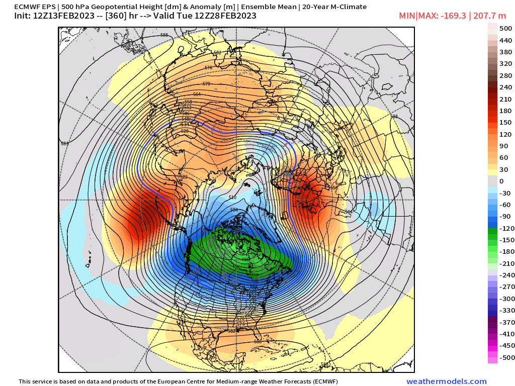
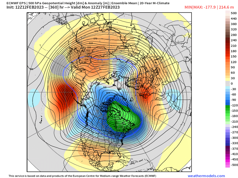
It’s an H5 map…not a temp map. That’s cold for New England. I’m skeptical of it verifying but when you look at the temp level, it’s cold.