

Ruin
-
Posts
1,204 -
Joined
-
Last visited
Content Type
Profiles
Blogs
Forums
American Weather
Media Demo
Store
Gallery
Posts posted by Ruin
-
-
On 3/24/2025 at 5:11 PM, Yardstickgozinya said:
Exactly my point. You're counting up a loss/win for a forecast that never existed outside of social media. I don't buy into most of this winter stuff either, but I at least have some grasp on how this all works. Can you tell me who how and with what that 8-14 day forcast you posted was created? I thought you didn't buy into any forecast. You're a very complicated and complex individual.
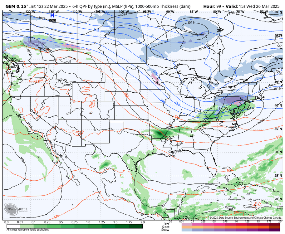
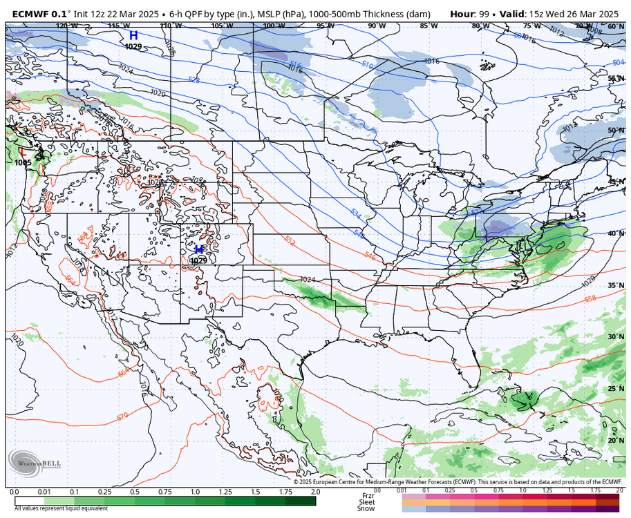
Just as I said we were not going to get any of that snow. I hate the fact the models are this garbage but they are people need to face the facts
-
4 hours ago, Yardstickgozinya said:
Exactly my point. You're counting up a loss/win for a forecast that never existed outside of social media. I don't buy into most of this winter stuff either, but I at least have some grasp on how this all works. Can you tell me who how and with what that 8-14 day forcast you posted was created? I thought you didn't buy into any forecast. You're a very complicated and complex individual.
yes because models that claim they show a snow storm for this time frame dont pan out because the temp forecast shows warmer then average so yeah.
-
4 hours ago, canderson said:
I thought it was supposed to rain overnight.
I dont believe anything they say any more the forecasts have been getting worse and worse and worse even short term precip. today mostly cloudy with rain early. This afternoon warmer high 64 with windy conditions. about the only thing they are right about anymore is the wind its always windy. atm its still 48 by this time the temp was forecasted hourly to be 55
-
12 hours ago, Yardstickgozinya said:
I didn't realize there was a projected winter storm in the forcast. No mention of this on any forcast I can find. What agency did you here this from ?
-
after this projected snow storm doesnt happen models will be 1-13
-
1 hour ago, Blizzard of 93 said:
12z Canadian & Euro both like the idea of a little CTP snow on Wednesday am.
Lol really
-
forecast is 61 still at 46
-
The perfect weather 70 no humidity no beating down sun
-
6 hours ago, Voyager said:
66.2 was my high today. Nearly 10 degrees above the forecasted 57.
Yep last 2 to 3 weeks temps have been. Way off. I'd say under of over fibe by more then 7 degrees 5 times
-
17 hours ago, Mount Joy Snowman said:
Low of 27. Beautiful days ahead.
i see a 72 in my forecast a little to soon imo for that but yeah spring is here. soon we will see flowers bloom and tree pollen on cars
-
5 hours ago, Yardstickgozinya said:
I'm surprised. To me it looks like a storm snapshot projected directly through your brain out your eyes and onto my screen.
Nah won't happen if you want to believe in pixie dust and unicorn shit i got a bride to no where you can buy.
-
55 minutes ago, Blizzard of 93 said:
The 12z Canadian is trying to brew something wintry up on day 10.
So hard to buy this. It be nice but models have been way to off
-
 1
1
-
-
50 minutes ago, canderson said:
36 was my low. Windy day again today ahead but we miiiiight hit 50 again.
Yeah to windy thought the winds were supposed to die down about 4am
-
3 hours ago, WmsptWx said:
This is just simply not true. Bubbler and the Trainer post every day, multiple times a day, four seasons of the year and I haven't seen Bubbler post in about two weeks and the Trainer came on just to address somebody's asshurt over a fun post.
I think your presence also may have something to do with it.
Winter is dead lol all the trends are saying so
-
26 minutes ago, mahantango#1 said:
Yes I agree we can now probably stick a fork in this one for the most part. But that doesn't mean that something winterwise cant happen within the next month. I remember I think the first day of Spring in 2017 we had a snow event that stuck on the roads in the middle of the day and afternoon that turned the roads to ice underneath the snow cover. I remember going home from work and it was nasty driving.
yes f the trends still had cold but the temp forecast went from maybe another artic outbreak for march to above normal over night. one of the few times this winter the temp guidance was wrong. now if we were still having shots of cool or cold air id agree. but I just dont see any chances for cold air at all. the coolest I see is 55.
-
1 hour ago, Yardstickgozinya said:
There's actually a strong signal for a Dec 16 . There already talikg 18 to 24" . Its only 6808 hours out .
haha thats funny as fuck
-
13 hours ago, WmsptWx said:
I don't even know what happened. But this place went from being fun to quiet.
winter died thats what went down
-
 1
1
-
-
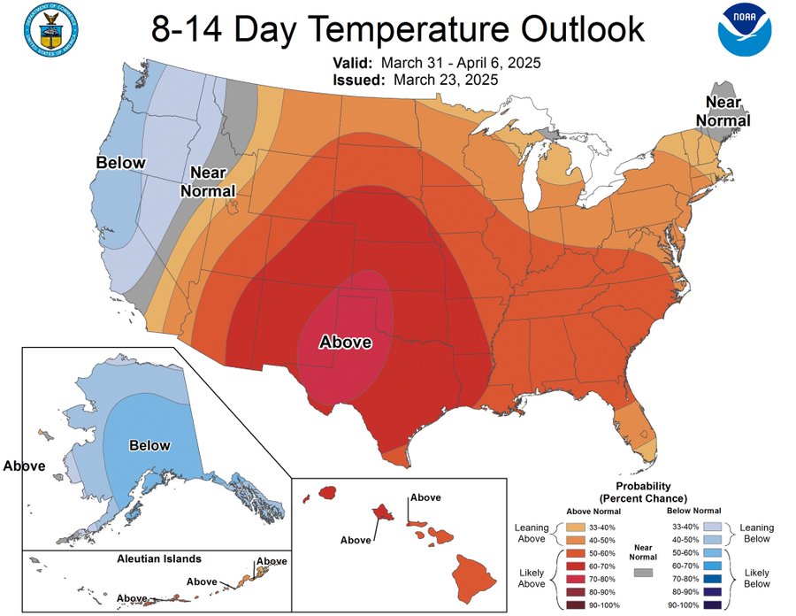
Temps mostly in the 60s next week near the end looks a bit cooler lower 50s. No signs of any cold or snow. Looks like it's time to put a fork into winter:(
-
1
-
-
17 hours ago, Voyager said:
Thank God no other model shows anything like that and CTP is partly to mostly sunny the entire weekend.
Yep models are not even close 80% of the time model shows snow no other model shows. Then Forcast is 56 and sunny lol
-
 1
1
-
-
40 minutes ago, WmsptWx said:
Which is the way it should be. I think we have proven we can't handle it.
Yeah I agree we deal with political stuff all the time this is a weather forum
-
7 hours ago, Yardstickgozinya said:
You got a whole bull wagon full of words desparato, for a dude wrangler that's all hat and no cattle. I've dealt with sap sucking, yellow belly's like you before. A coward like you ain't worth a spitting dime’s worth of dogs meat. Why I reckon if it came to it, we can draw at high noon, unless you ain't got the guts partner.
huh? lol you make no sense with all that slang you know? go head attack me personally I could care less
")
-
1 hour ago, canderson said:
Weather.gov
lol they use the same models
-
8 minutes ago, canderson said:
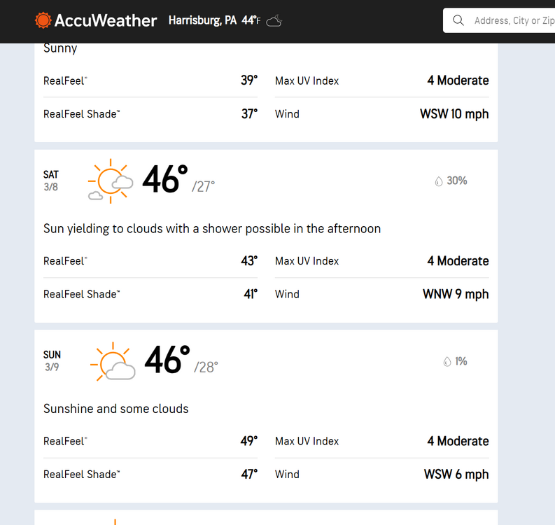
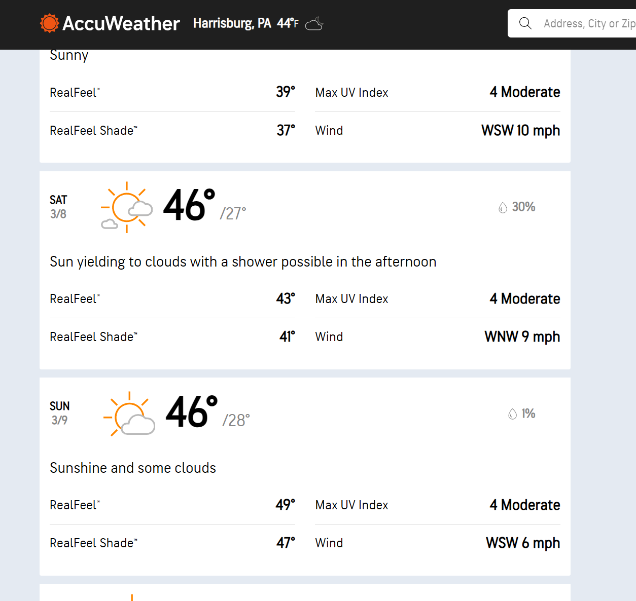
Why the f are you using accuweather? No wonder you complain about every forecast.
ok who should i use? weather.com abc27? lol most of them all use the some models to go off of. lol What site doesnt use these models do tell.
-
On 2/26/2025 at 7:51 AM, Blizzard of 93 said:
sadly nothing is forecasted for this time frame


Central PA Spring 2025
in Upstate New York/Pennsylvania
Posted
Lol really mature. The fact zi was right about this outcome called mo snow vs models calling for it made you post this lol