

Cary67
-
Posts
1,372 -
Joined
-
Last visited
Content Type
Profiles
Blogs
Forums
American Weather
Media Demo
Store
Gallery
Posts posted by Cary67
-
-
2 hours ago, A-L-E-K said:
Sad
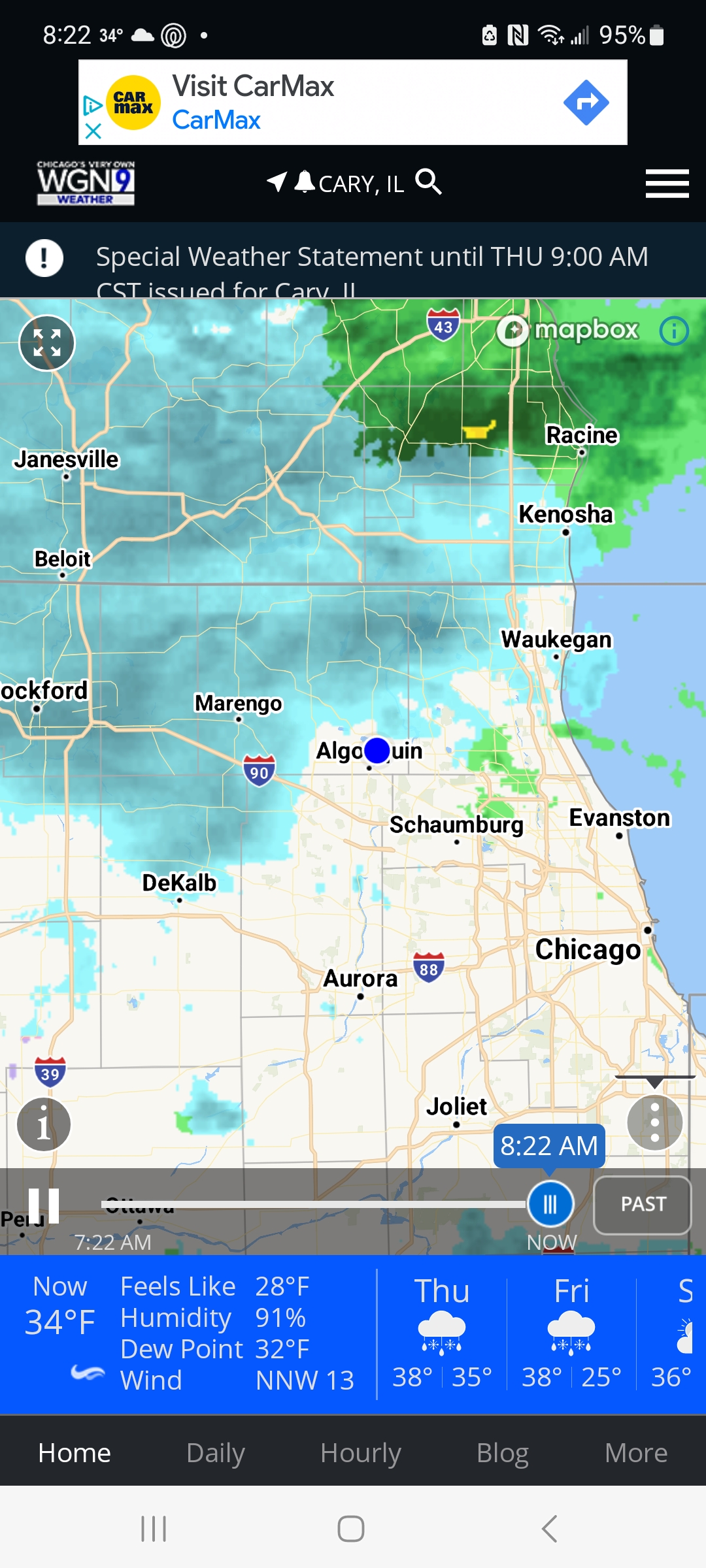
Final call 1.5 imby, 4 at ORD
Ground zero: Fox River Grove 5.2"
-
 1
1
-
-
19 minutes ago, A-L-E-K said:
final call after 12z runs?
Definitely
-
1
-
-
Nothing legit till globals show it on Sunday
-
3
-
-
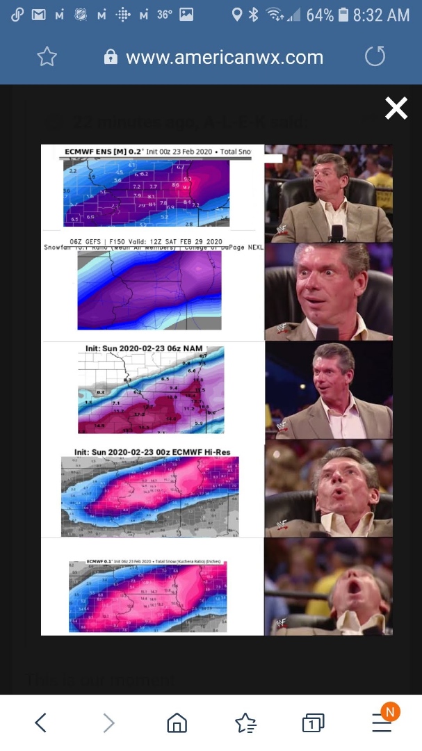
6 hours ago, SchaumburgStormer said:
Euro would have alek posting the eurythmics while SE Iowa to NW IL get smoked. Most of LOT would do solid.
Models have been rug pulling for so long that it’s tough to buy in at this range, agreement or not.
edit- forgot the image

Memories of 07-08
-
8 minutes ago, Chicago Storm said:
S WI, E IA and NW IL will end end up the winners with this second round.
Should end up with advisory level snowfall accumulations in that corridor.
.Yeah saw Antioch had whitened up. We have a little snow falling now but that area will shift west of us to the areas you mentioned. This time Lake Michigan isn't the best climo
-
1
-
-
-
7 hours ago, michsnowfreak said:
Southeast Michigan is well outside of the snow belt obviously, but we do get accumulating lake effect snow every winter (pick your suburb for whether you like west or northwest flow...for me, west is best). But I always feel one of the more underrated bonuses of Lake Michigan is the enhancement it provides to synoptic systems. Lake enhancement with clippers is usually noticeable, but sometimes little pieces of energy just cross the lake and give it a boost and voila, you get snow. But all that said, i'm sure luck plays to it as well.
2022-23: 37.2"
2021-22: 47.6"
2020-21: 47.0"
2019-20: 43.8"
2018-19: 31.9"
2017-18: 62.5"
2016-17: 41.6"
2015-16: 35.0"
2014-15: 48.5"
2013-14: 96.2"
2012-13: 47.9"
2011-12: 25.5"
2010-11: 69.4"
2009-10: 46.1"
2008-09: 64.8"
2007-08: 78.2"
2006-07: 36.3"
2005-06: 41.9"
2004-05: 80.7"
2003-04: 36.6"
2002-03: 66.9"
2001-02: 42.5"
2000-01: 47.3"
1999-00: 29.3"
1998-99: 52.1"
1997-98: 27.2"
1996-97: 35.9"
1995-96: 31.3"
Yeah the differences the last few winters are stark. I will look at RFD numbers also just to remove LES and enhancement totals that ORD and MDW receive. Gives a better idea about general synoptic snow activity across Northern IL in a given winter. Not a huge stats guy but have to guess there is a substantial difference in numbers over the years between DFW and RFD. As for Lake Michigan enhancement, synoptic snow systems have been in short supply here the last few years.
-
6 hours ago, michsnowfreak said:
Winter of 2011-12 sucked, make no mistake about that. In fact, it is my least snowy winter (25.5" in 29 years of keeping track) However, there are 2 things that really make that the poster child for sucky winters, and that is a combination of the record warmth in March which literally stopped winter at the end of February, and with the fact that that winter was surrounded by a period of unusually severe winters. When you look back at 150 years of winters, there were many great ones and many duds, but they all had their own unique character. These days, it's actually become a pet peeve of mine that anytime we are in a sucky mild pattern, you hear the inevitable "2011-12, 2011-12".
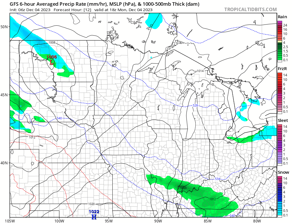
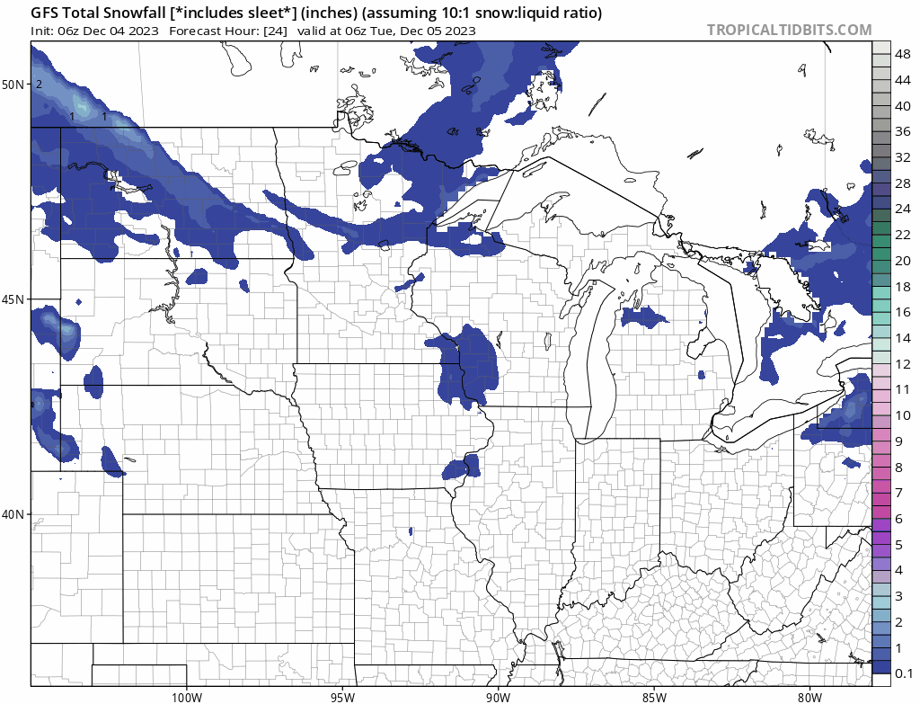
November 2011 was warm and record wet. November 2023 was cool and top 20 record dry. November 2011 had no winter until the very last day when a flooding rainstorm turned to wet snow in places. November 2023 had a period of wintry weather. December 2011, while very mild overall, was fairly active and did at least have several wintry systems. December 2023 is warm and mostly zzzz.
And winter is just beginning. Way way too early to tell if it's going to have a good comeback or end up an overall dud, but i could probably find dozens of better matches to date than 2011-12.
The fact you have had only one winter in 29 yrs of snow records that was 25.5" or less is interesting. You either are getting lucky or your area receives some decent LES contributions. I looked up the Barrington snow records in the NW burbs which is pretty much devoid of LES and they have registered four winters with less than 25.5" since 2011. Should be about as far north as your locale.
2012(22.8"),2017(22.1"),2022(19.7"), 2023(21.5")
Even 2016 barely cleared the threshold at 26.3"
-
Could make a run at <25" seasonal snowfall for a third year in a row.
-
WAD alert..

-
 3
3
-
-
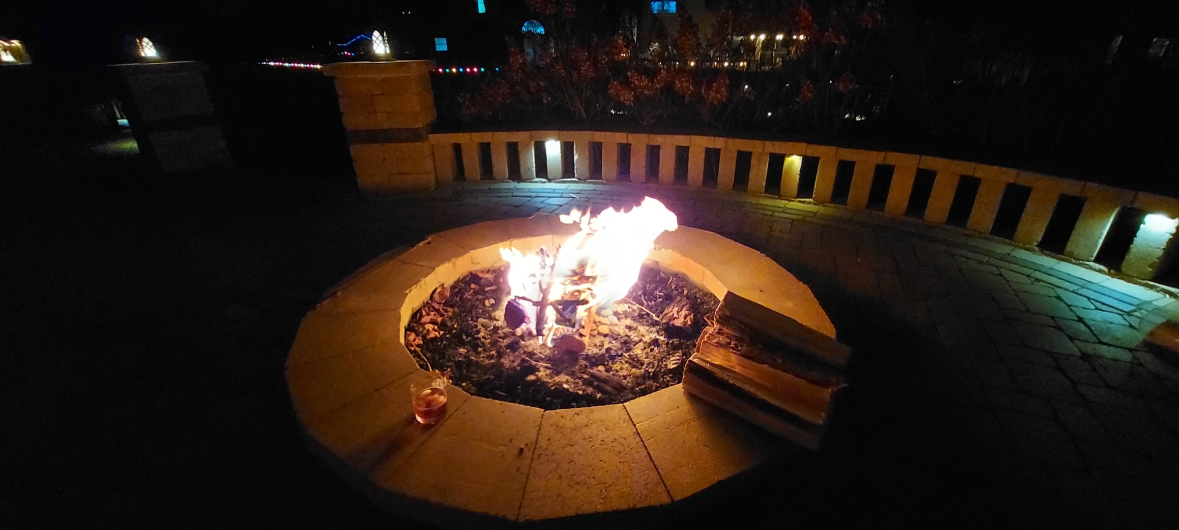
On 12/7/2023 at 9:38 AM, hardypalmguy said:
hey man i hope you're taking advantage of the 50s to near 60 next three days over there.
Have to adapt. Nothing says Xmas like firepit, Xmas lights, and a Buffalo Trace Old Fashioned.

-
6
-
 1
1
-
-
Initial thread to RIP in 30hrs. But not close to one of the great model collapses.

-
4
-
3
-
-
1 hour ago, A-L-E-K said:
remember events?
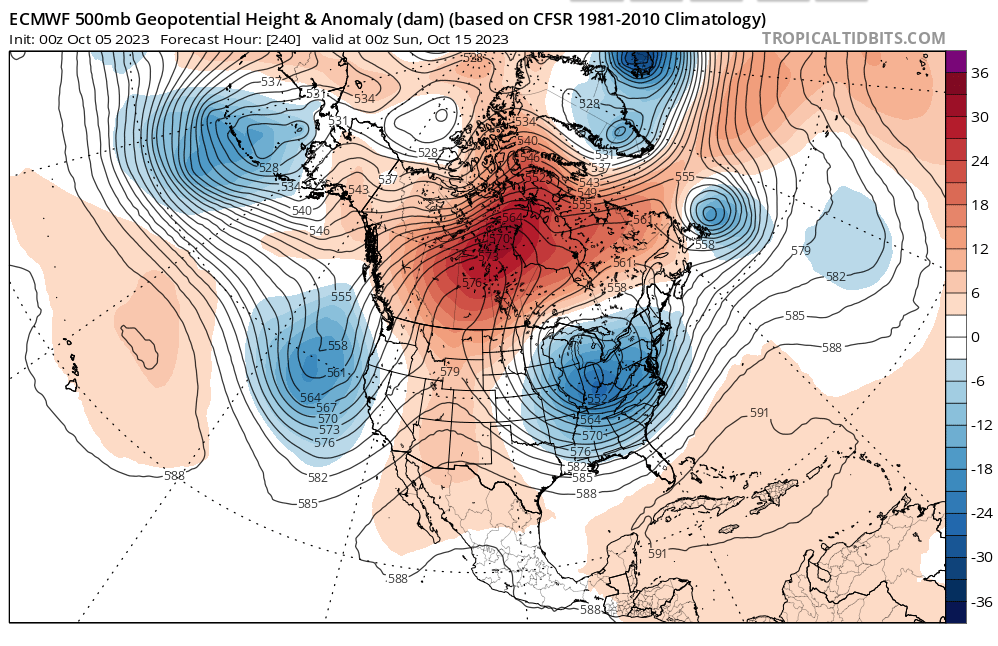
Figure our chance for a big winter slid by just to the NW last year. From ORD (20.2"),RFD(35.1"),MSN(71.8") to MSP(90"). Steep gradient with storm track favorable to Great Lakes during the windows of opportunity. This year think when wintry windows appear(Jan-Feb)it will come with a -NAO favoring a track from lower OV to mid Atlantic and up the coast. Will keep tabs on the dusters to see how they stack up.
-
2
-
-
Grass duster part 3. Halloween, Nov.25th-26th and now today. Tis the stuff seasonal totals are made of.
-
 1
1
-
-
-
May help the forums and perhaps bring in more posters if we had a strong winter for this region. It's been awhile since 2013-14, 2007-08, GHD1 and 2. Too much thread the needle with no widespread arctic air to tap and lack of phased storms. Not to mention the recent Decembers.
-
4
-
-
Let the 14 weeks of winter(for N IL) commence.
-
3
-
-
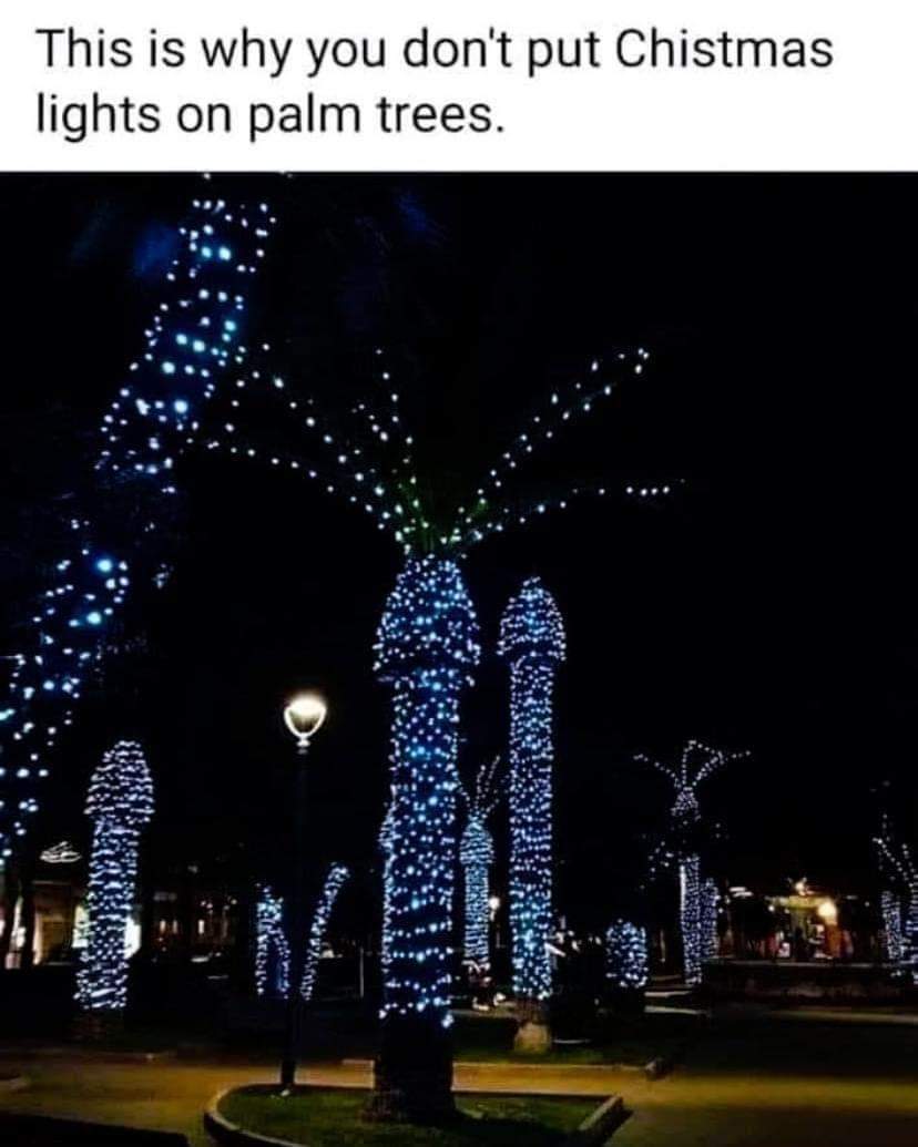
On 11/15/2023 at 5:48 PM, hardypalmguy said:
Thank youSome holiday lighting recommendations for you
-
4
-
-
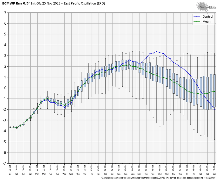
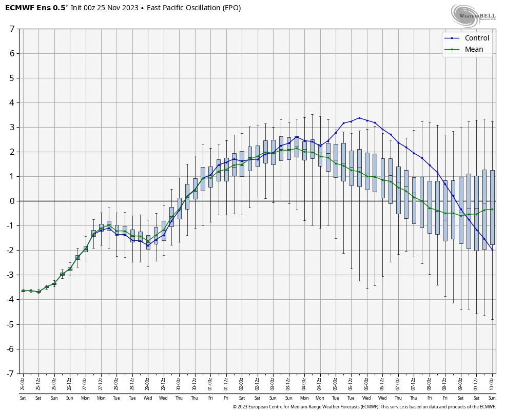
No guarantee this verifies but a -EPO has increased our chances of seeing wintry weather.
-
2
-
-
1-2" here
-
1 hour ago, Baum said:
as they say....zzzzzzzzzzzzzzzzzzzzzzzzzzzzzzzzzzzzzzz
Let WAD with small intervals of CAD commence. Consider core of winter from Dec1st-March 10th for our area.
-
Way too young at 57. Heartfelt condolences to his family.
-
4
-
-
12 hours ago, Baum said:
snow on Halloween is never a good sign longer term.
Definitely fools gold
-
22 minutes ago, A-L-E-K said:
yup cashed out
Timed the Door County weekend perfectly. Not..
-
3
-
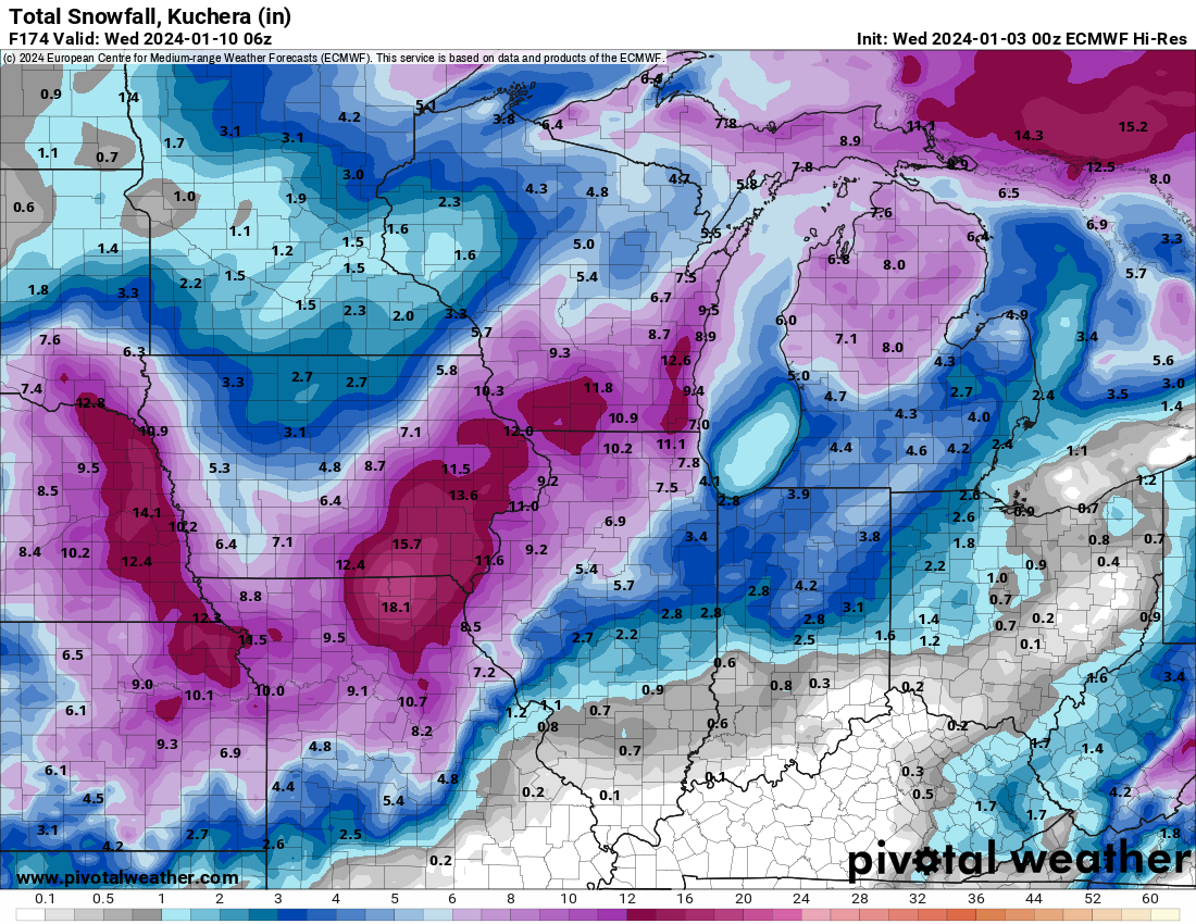

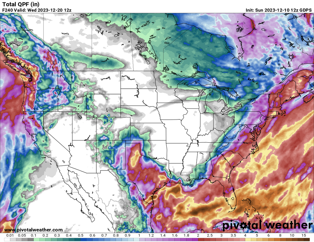
1/8-1/10 Potential Winter Storm
in Lakes/Ohio Valley
Posted
Smallest window for front end thump then about 1-3" Tue morning before dry slot and drizzle with switch to light snow at the end. Final call 3.8"