clskinsfan
-
Posts
10,783 -
Joined
-
Last visited
Content Type
Profiles
Blogs
Forums
American Weather
Media Demo
Store
Gallery
Everything posted by clskinsfan
-
Not trying to be a deb downer. But that is a lot of blocking being modeled over the top. Anyone else worried about storms being squashed IF that verifies.
-
I would be fine with it just like that. No rain for us out here. Snow to ice to dry slot. Which would then become a glacier for a few days. It is a decent run.
-
The Australian long range MJO forecast was all in during the fall with us going through 7-8-1 in the heart of our best climo. The majority of the spaghetti plots still go through 8 but at a low amplitude. They dont make it to 1 though. I didnt keep records back in 93' 94'. I was in Loudoun then and I do remember it being very icy. I found a pretty good site with write ups on some of the worst storms of that season: https://tornadogenius.fandom.com/wiki/1993-94_United_States_winter_storm_season
-
If the MJO makes it to 781 during late Jan early Feb then the long range MJO models would have been spot on. I was looking at them in late Nov and salivating at the thought of that happening.
-
Hi Res Euro last night had a pity half inch for those of us west of the Catoctins. At this point I just want to see a flake fall. 12Z GFS has about the same for out my way. Has a nice little 1.6 inch jack for the Frederick, MD area.
-
Not just the EPO region but that Scandinavian ridge might be what ends up saving the Atlantic as well. Get it to press the PV a little south and it could be game on.
-
Agreed. No SE ridge in sight. Also heading into prime climo means things can pop up in the shorter range and surprise us. After all of these years of doing this I am still convinced that the models are still pretty much useless outside of 5 or 6 days lead time.
-
The line matters a ton too. When we were younger we did Carnival, Royal and NCL a lot. Whichever was cheaper. And yes. Some of those cruises were shit shows. We have since moved on to Celebrity and it is just much more laid back. Anyway. Dont want to hijack the thread.
-
I must be pretty low than. Because I love cruising. And it is still the best value in a vacation you can get.
-
January 22/23 2016 images archive thread
clskinsfan replied to Midlo Snow Maker's topic in Mid Atlantic
One more. Total snowfall by obs: -
January 22/23 2016 images archive thread
clskinsfan replied to Midlo Snow Maker's topic in Mid Atlantic
This one just because its so ridiculous we may never see it again. 36-48! You gotta be ****tin me. And this one because its so cool. Thunder snow captured by the Space Station. -
Best Mid-Atlantic winter storm of the last 50 years
clskinsfan replied to AnEndlessMaze's topic in Mid Atlantic
I pulled my vote for PD2 and placed it into GB16. Just an incredible experience yesterday. -
January 22/23 2016 images archive thread
clskinsfan replied to Midlo Snow Maker's topic in Mid Atlantic
Heres a couple of my favorites so far: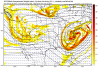
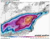
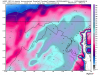
-
Best Mid-Atlantic winter storm of the last 50 years
clskinsfan replied to AnEndlessMaze's topic in Mid Atlantic
Nice call!! -
Best Mid-Atlantic winter storm of the last 50 years
clskinsfan replied to AnEndlessMaze's topic in Mid Atlantic
I was here for all of them. It is amazing the differences that occur in accumulations in our subforum. 79 was not a huge event west. But east got slammed. 2003 I got absolutely mauled while east was a nice storm. 96. Just crushed all of us as well as 2010. But the second 2010 event was huge east and north of me. trix got like 10+ more inches than me just 10 miles to my north from the second event. It is a wild area that we live in when it comes to snow. -
Best Mid-Atlantic winter storm of the last 50 years
clskinsfan replied to AnEndlessMaze's topic in Mid Atlantic
Ill never forget this Feb 2010 satellite image because it shows the NYC north screw job so well. Probably a once in 20 year type event. But it doesnt make my top 2 storms: Edit: I should say once in 20 year out here. You guys to east did much better with part 2. Feb 4-7 Total: Snowmaggedon totals: -
Best Mid-Atlantic winter storm of the last 50 years
clskinsfan replied to AnEndlessMaze's topic in Mid Atlantic
Agreed. But when it comes to snow its all about MBY. -
Best Mid-Atlantic winter storm of the last 50 years
clskinsfan replied to AnEndlessMaze's topic in Mid Atlantic
2003 by far. I had 3 feet. Honorable mention to 1996: -
I "only" got 26 inches with the superstorm. We got dry slotted for a bit of the storm. It is still in my top 3 because of the wind and drifting. It definitely deserves to be in my top three weather events of all time. I was tempted to swap the 10 and 79 storms. The third highest snow total I have ever recorded was with the 2010 storm. But I was 10 in 1979. That is the storm that has forever hooked me on Noreasters. Good picture of the dry slot from the superstorm.
-
Agree on your three biggest. 96, 03, 93, 79 and 10 are the best in that order for me. 96 and 03 both dropped 3 feet in my area.
-
Was a great storm. But it was not even in my top 5 of all time. It was the start of the most incredible winter ever for the Mid Atlantic though. The February bombs blew this storm away.
-
Drift on a fence. Glad we didnt need the AC for a while. Getting destroyed.
-
If it had been the only storm of the winter it would have been unreal. But we got crushed even harder later in the winter. Best winter of my life, by far.