

largetornado
-
Posts
126 -
Joined
-
Last visited
Content Type
Profiles
Blogs
Forums
American Weather
Media Demo
Store
Gallery
Posts posted by largetornado
-
-
1777 tornadoes with the first high risk coming on April 23rd in central illinois
-
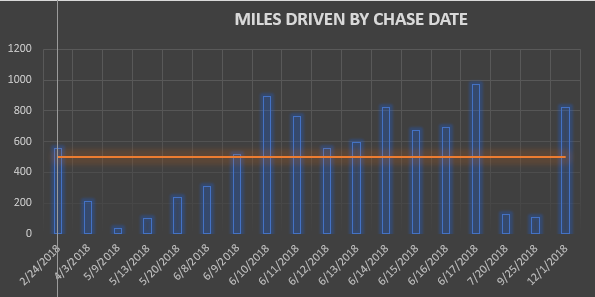
Thought you all might be interested in some chase stats. 2018 was a long year. 8972 miles. 5 tornadoes (1 in February and 4 in December). Got some pretty cool shots in the plains. For how bad 2018 sucked, I had a decent year.
-
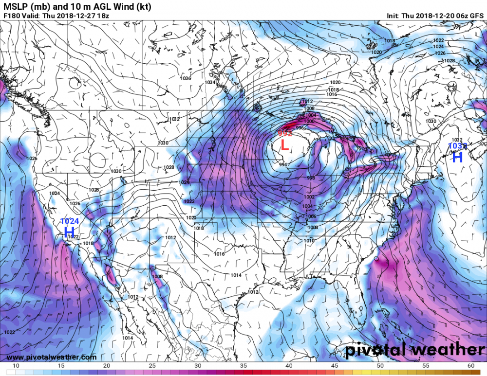
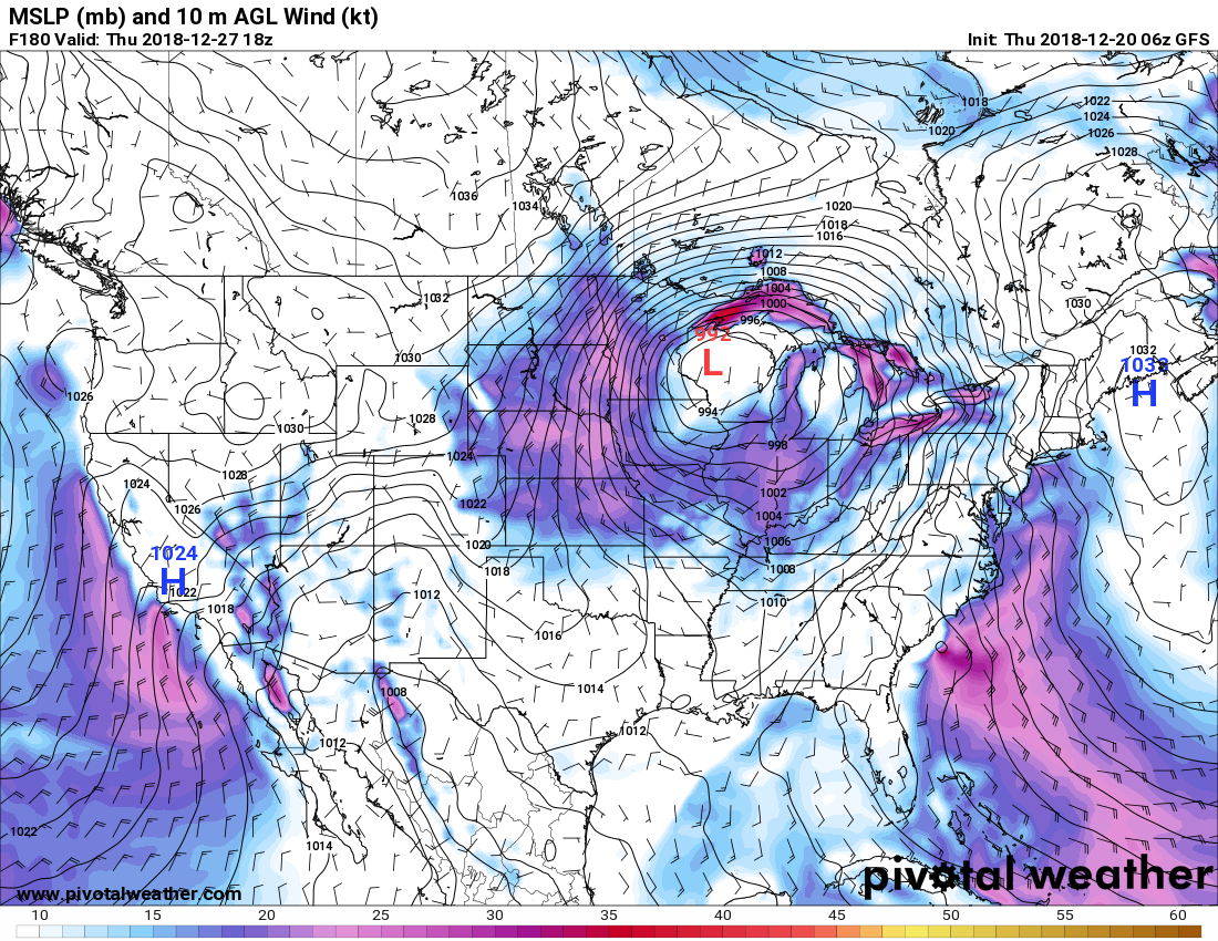
FWIW, there may be the *potential* for some severe around 12/27. GFS has been fairly consistent and the EURO has a similar low as well.
Obviously pretty far out still but the D7/8 period looks somewhat intriguing.
SPC D4-8 Outlook.
Quote...DISCUSSION... High-PW air mass will be shunted off the Atlantic coast during the day2 period. Current medium-range model guidance suggest numerous fast-moving short waves will traverse the CONUS such that moisture/instability will struggle to return north until Christmas day when a significant moisture surge is expected across the western Gulf basin into TX. This moisture surge will be induced by a significant trough that will progress across the southwestern US/southern Rockies region. While models agree broadly that destabilization should occur across the southern Plains, timing of the ejecting trough may greatly influence potential severe threat with this feature. Will not introduce severe probs at this time but organized convection may ultimately evolve during the day7/8 time frame.
-
3 minutes ago, Central Illinois said:
Nice pic considering it was night time!...how far was this away from the Casey’s gas station up there when you got this shot?
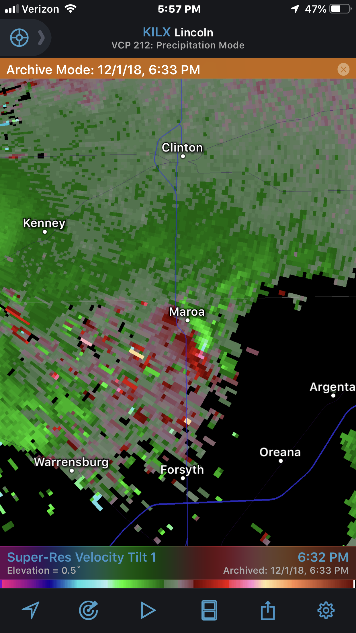
.Thanks. was actually a screen grab from an iphone video. my gps tracker put me about 3 miles wsw from maroa.
On a side note, I wrote a program that logs all my gps points on a 1 second interval. Pretty handy for post analysis.
3 minutes ago, Central Illinois said:-
 1
1
-
-
50 minutes ago, Central Illinois said:
was this your pic or was it posted by ILX? I was on the south side of Maroa when it happened just before you get to Caseys gas station
It’s my pic from a 15 second video I shot. Time stamp of video 6:35. Official time was 6:31-6:33
-
1
-
-
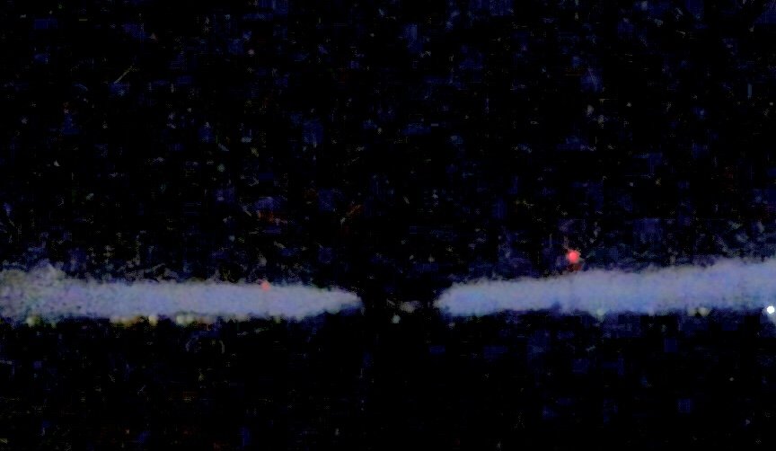
Shitty screen grab but the Moroa tornado was big . 320 yards according to NWS Lincoln
-
40 minutes ago, SchaumburgStormer said:
Taylorville had a 41 minute lead time between warning and the tornado hitting. That’s incredible and most certainly saved lives. Real nice work by the NWS
NWS Lincoln as well as spotters did a phenomenal job Saturday. Nearly every tornado report has verified and no loss of life
-
13 hours ago, SchaumburgStormer said:
Found it on archive mode. Pretty much went right over a buddy’s house out there in the farmland.

I was on this. Jives with the power flash I reported. Also saw what I thought was a tornado.
-
NWS Lincoln confirmed 4 more in McLean county.
total is now 22 with surveys on going. Now the largest December outbreak in Illinois history.
-
-
Just now, Hvward said:
167mph vector around the eye. Could be a Catagory 5.

Whats the beam height?
-
I think the slight risk for tomorrow needs to be expanded east. SE Indiana is looking very interesting.
-
there *might* be a chance for some severe north of i80 Sunday (Michigan)
-
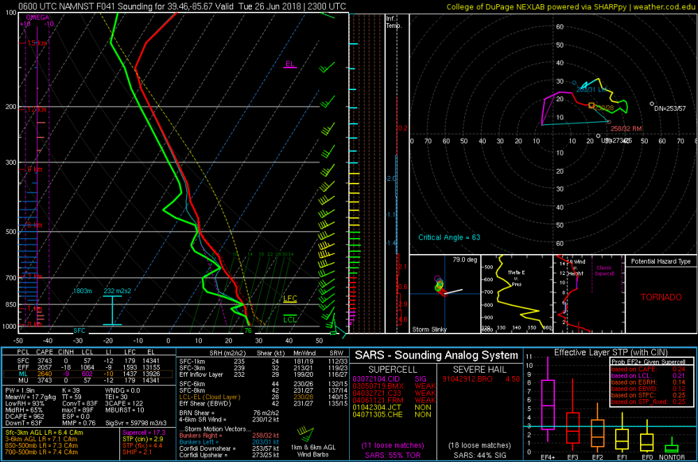
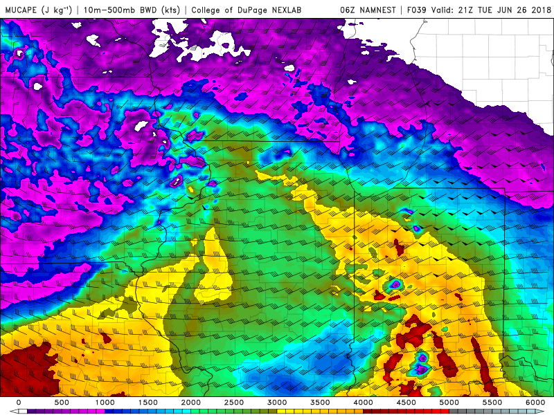
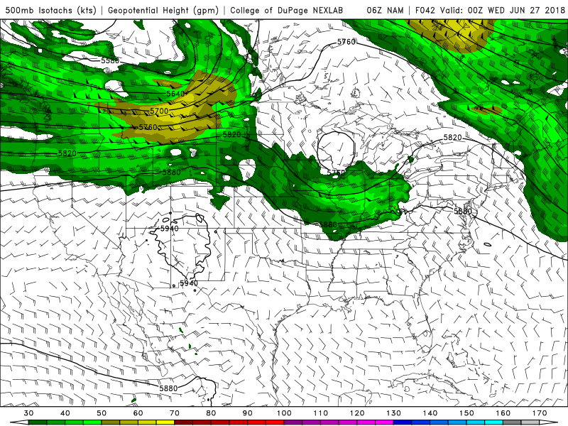
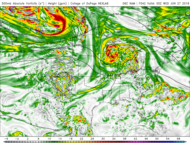
Some of the soundings for sunday along the warm front are encouraging. Mid level flow is a little weaker than ideal but 40-45 kts would get the job done. Excellent turning from 0-1 with good speed shear. It looks chasable to me.

-
15 minutes ago, CheeselandSkies said:
Yeah. Honestly, after hitting rock bottom over the weekend, things are looking up a bit for the coming weekend into the following week. Should be at least a few opportunities. Saturday in particular has my eye now that the GFS actually forms a surface low.
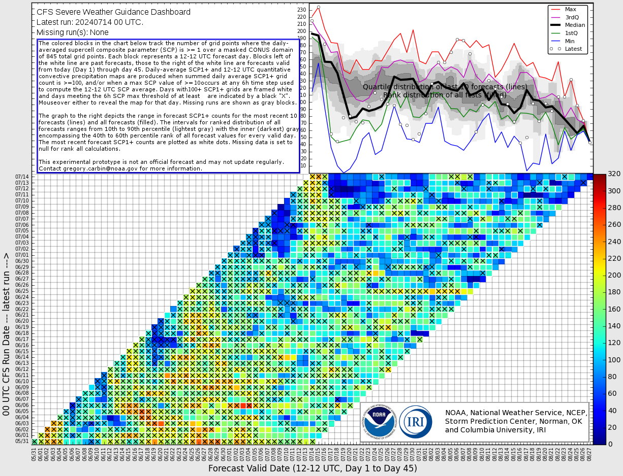
CFS disagrees lol
-
30 minutes ago, andyhb said:
Lol @ not being able to get 40 kts of flow at 500 mb in f*cking May.
Legit question...Will we even see 600 tornadoes this year? At 320ish now.
-

This nugget in the D4-8 outlook.....

-
1
-
March 13th-14th Severe Weather
in Lakes/Ohio Valley
Posted
First tornado warning of the day