

largetornado
-
Posts
126 -
Joined
-
Last visited
Content Type
Profiles
Blogs
Forums
American Weather
Media Demo
Store
Gallery
Posts posted by largetornado
-
-
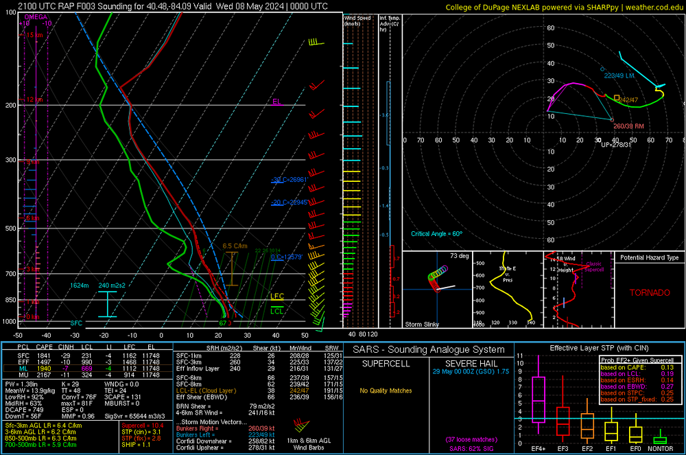
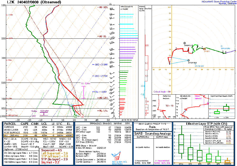
Rap sounding from northwest Ohio. What prevented a mode significant tornado?
-
23 minutes ago, nwohweather said:
Definitely deserving of a moderate risk today. Hot take, the NWS being in Norman, OK comes with biases
I really think they need an office for the northern plains, central plains, Midwest, and Dixie. All have those areas have their nuances with tornado forecasting
-
24 minutes ago, Chinook said:
radar doesn't cover it too well, but it is of great importance to my brother!
Did damage west of oakwood.
-
17 minutes ago, HillsdaleMIWeather said:
If we somehow outperform the OK event that would be something
The daytime portion definitely busted. The nighttime portion still has time but we will see.
Ohio warm fronts are bad news.
-
 1
1
-
-
1 hour ago, nwohweather said:
Agreed. NW Ohio/rural SE Michigan and NE Indiana is very similar to Oklahoma, especially NW Ohio
TDAY is down until further notice. Anyone chasing in that area will be critical to the early warning process as the lowest WSD88 beam is 5-7k ft in parts of Ohio.
-

Slight risk for D2. Little surprising
-
well thats a concerning development. NAM is starting to show a secondary low over illinois.
-
1 minute ago, Chicago Storm said:
don't get ahead of yourself...
I definitely got ahead of myself. Runs today have significantly downtrended the northern end of the threat.
-
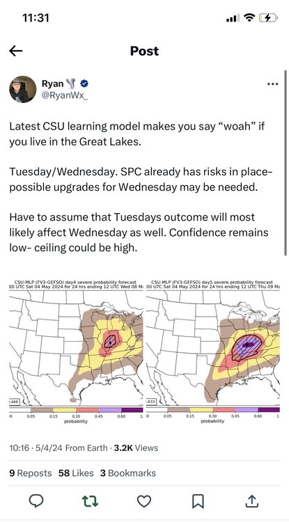
https://x.com/ryanwx_/status/1786761871485219061?s=46
Tuesday and Wednesday continue to look impressive
With a decent EML advecting in, morning convection shouldn’t really pose that much of an issue. Per the nam, fairly discrete storms could be expected
-
4
-
-
Tuesday is now coming into range of the nam. Looks like a stout MCS forms in the evening on Monday and rapidly moves east. Based on trends, I expect illinois to be rain free by 15z Tuesday. Also seems like a faster solution is more likely pushing the threat further east on Tuesday.
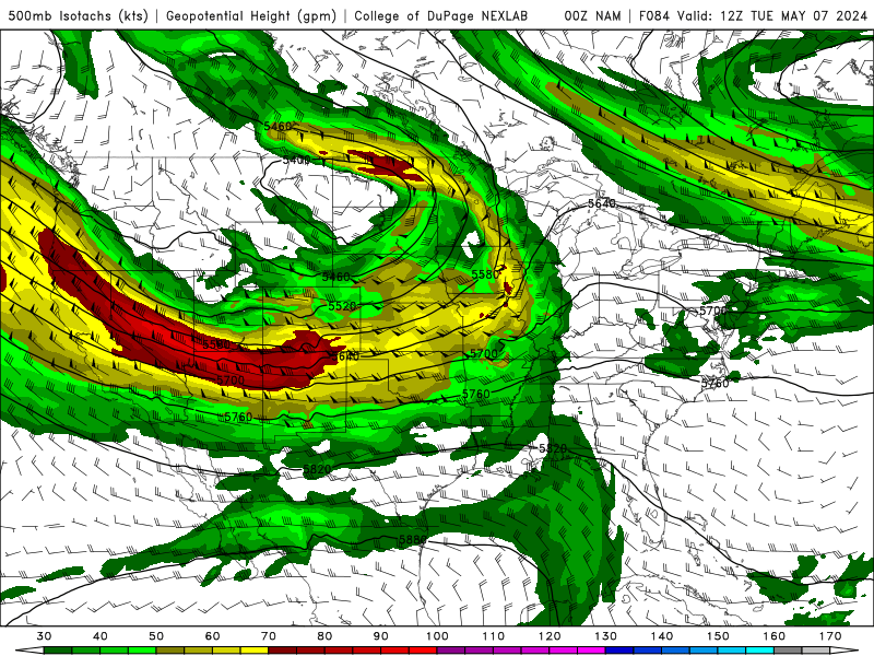
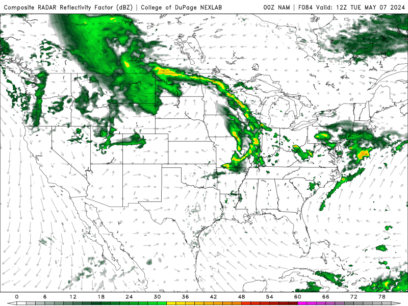
18z euro is a little bit more amplified and a little slower.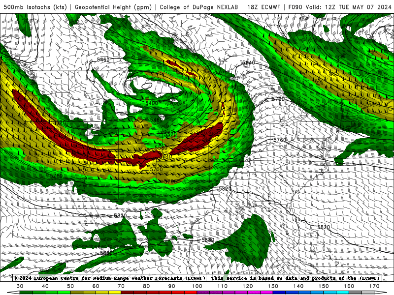
-
1
-
-
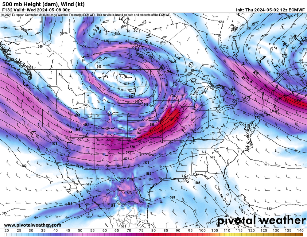
So there has been a consistent signal of severe weather for various portions of the subforum next week.
Right now, Wednesday looks to be the day but Monday-thursday all show some potential. With multiple waves, it is going to be a complicated week.
The only thing that we know at this point is that there will be more the sufficient upper level flow over a very favorable parameter space.
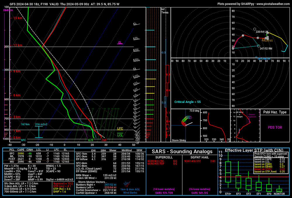
Selected sounding is from west central ohio on wednesday.
If this thread is premature, feel free to delete it.

-
3
-
-
1 hour ago, andyhb said:
Tuesday has some serious potential pending the convection from Monday. You do not troughs of this magnitude come through in May very often and that secondary jet streak rotating around the southern periphery of the occluded upper low should amplify flow fields considerably with a (potentially) very large and strongly unstable warm sector available.
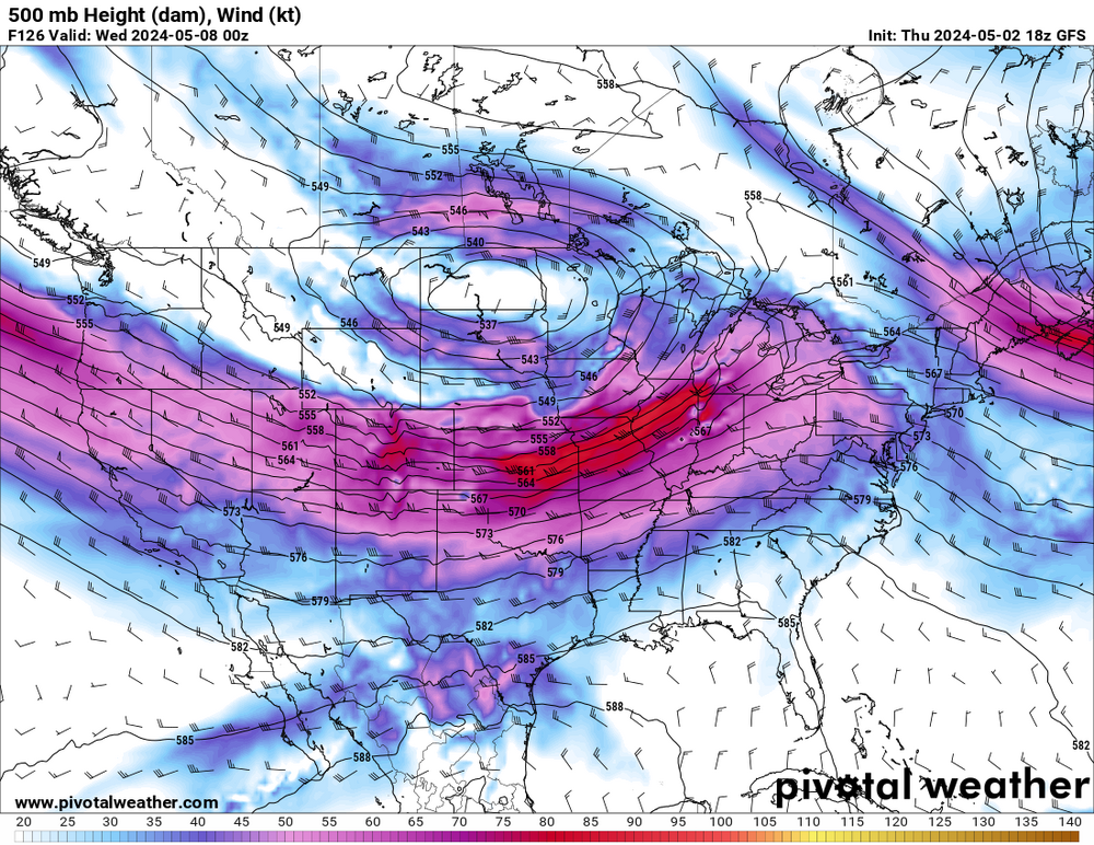
Surface winds look fairly backed. Care to post a sounding or two from the euro?
-
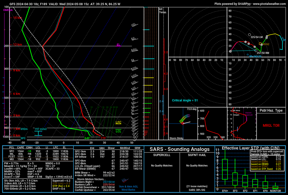
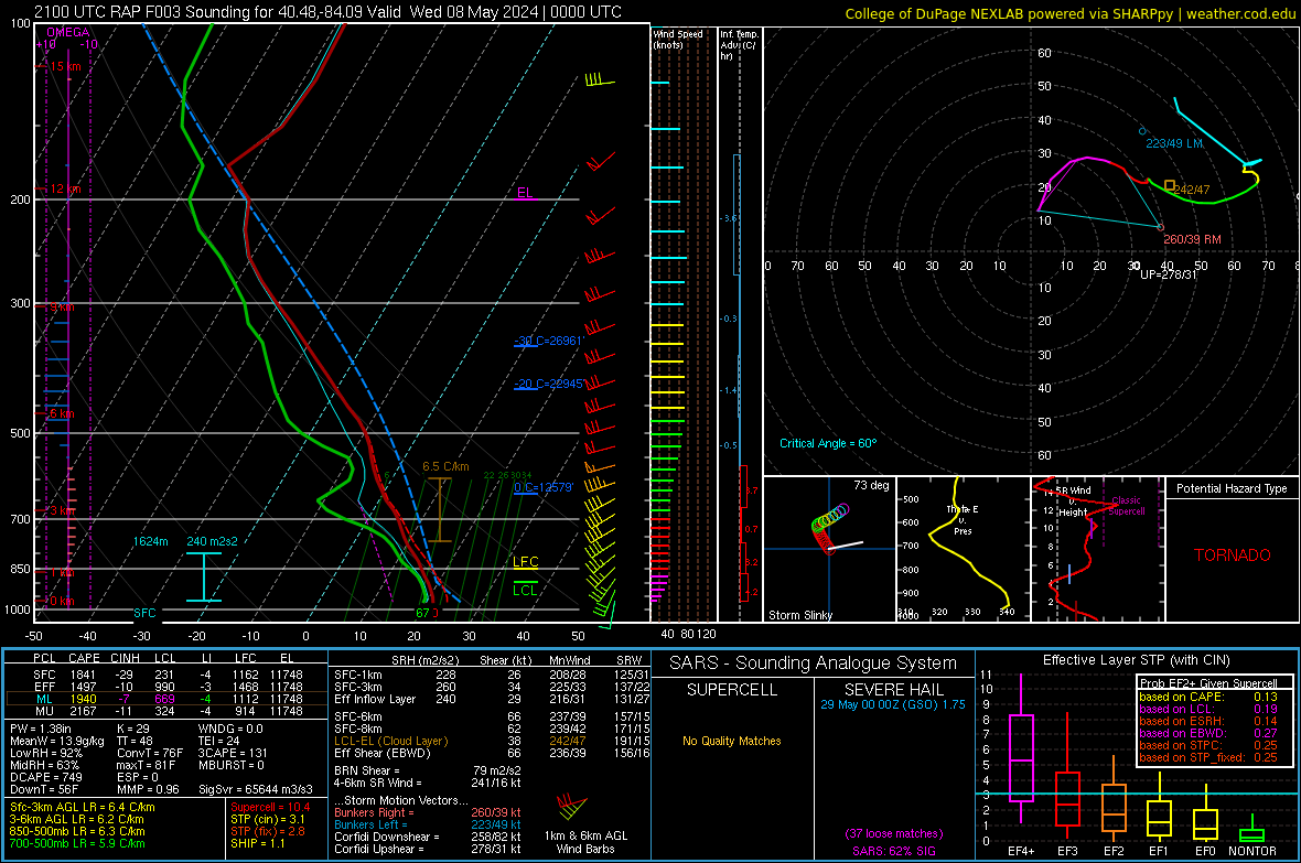
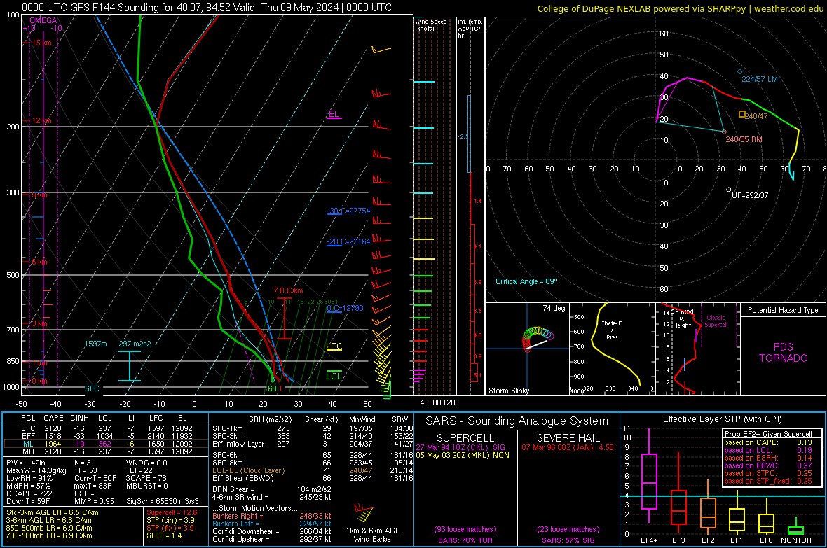
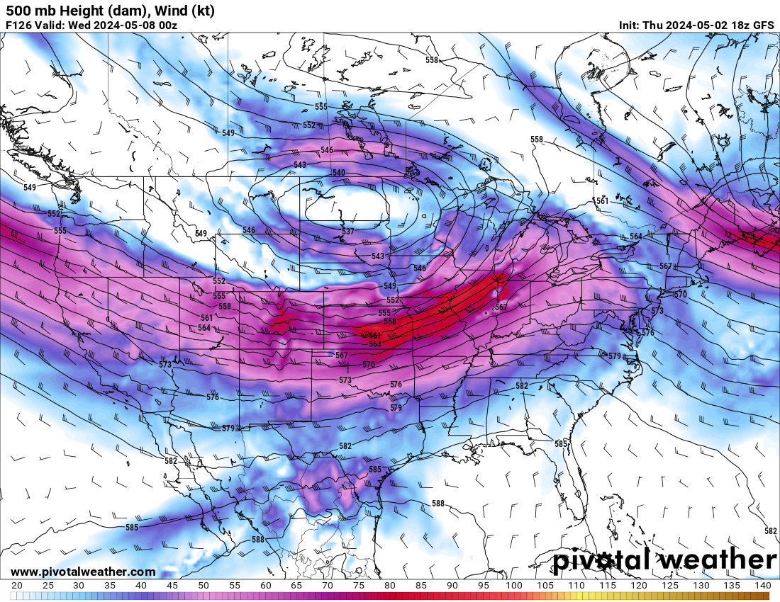
Next wednesday, 5/8 is worth keeping an eye. GFS is spitting out PDS soundings with limited precip in the morning. With an EML present at 15z and 850 temps remaining around 15-16c, storms would be fairly discrete. A little shortwave over Indy and plenty of forcing, could be a big day. The winds are a little more veered than i would like to see but with WSW flow at 500 mb, there is still some good directional shear present.

-
2
-
-
25 minutes ago, nwohweather said:
Might just need a little more humidity for this to really get going. The atmosphere is solid at the moment, I'm shocked nothing is really taking off
There is a dry slot right out in front of these storms. Wonder how much that plays into it. Nothing to the east or south of existing storms has been able to sustain
-
-
On 4/4/2024 at 8:46 PM, CheeselandSkies said:
I mean, it only goes 24 hours out so you wouldn't have the 10 days of hype.

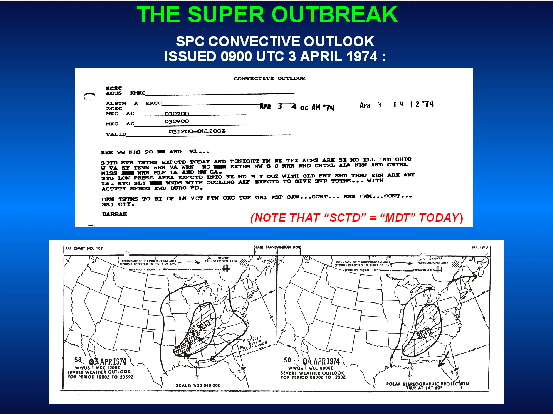
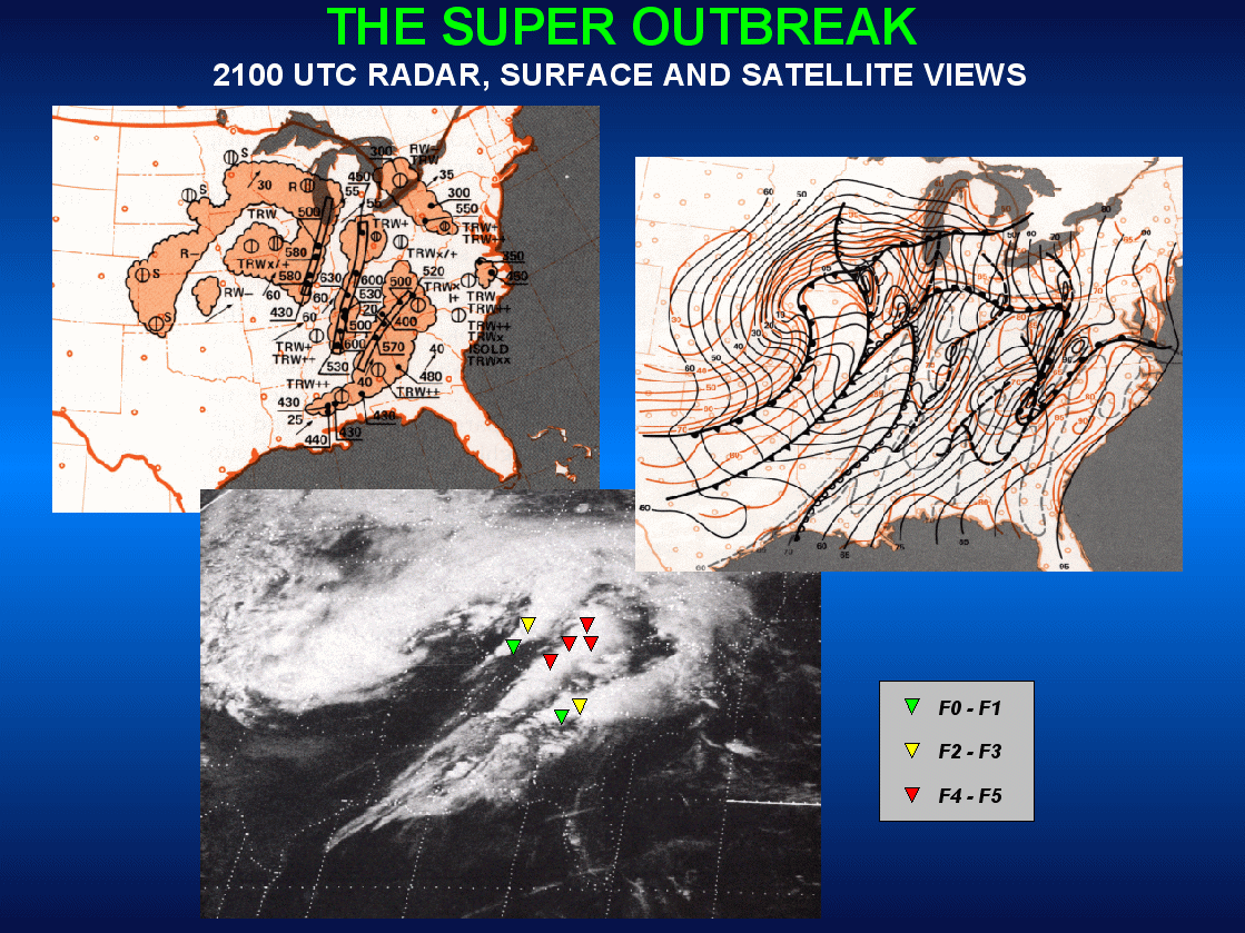
I will say, the simulated reflectivity for the late evening Alabama supercells (that produced Guin, Tanner 1+2, Jasper and Redstone Arsenal) looks somewhat less impressive than I would have expected. Around 02Z-03Z when those storms would have been peaking, it just looks like strung out line segments in the northwest corner of the state, not monster supercells producing some of the most violent tornadoes of what stood as the most prolific tornado outbreak on record for 37 years.
Interestingly, the SPC had a SCTD risk for d1 convective outlook which translates to moderate todays
-
1
-
-
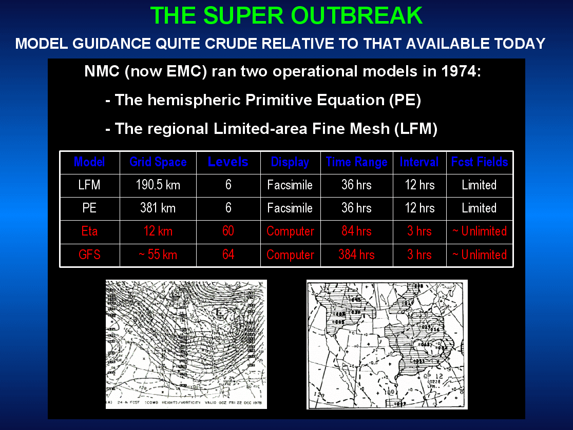
Found this on Twitter. WRF simulation of 4/3/74. thought it would be interesting to post this and see how a thread would go based on this model output. https://www.goldenhorseshoewx.ca/case_studies/SuperOutbreak1974/
another model https://x.com/jacob_feuer/status/1775667383816143284?s=46-
1
-
-
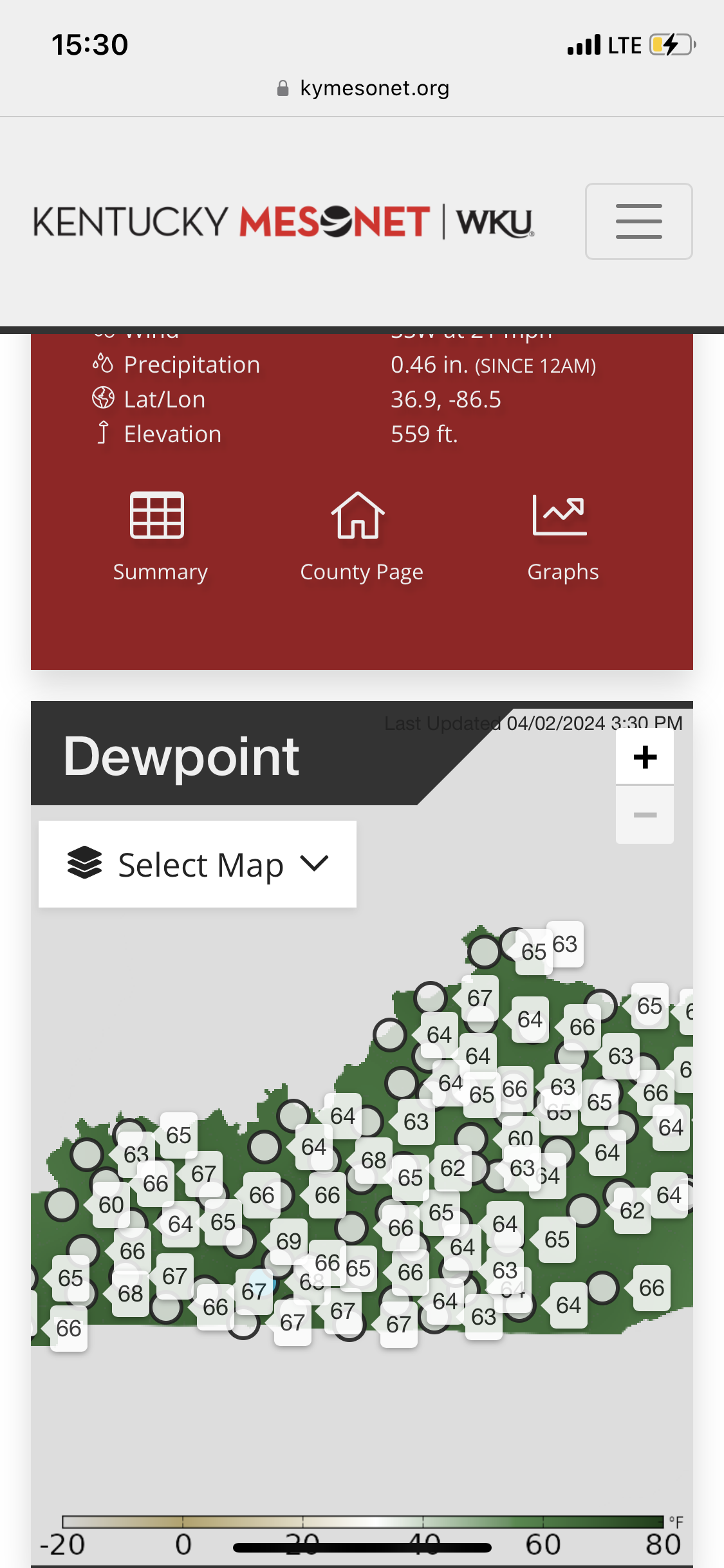
Dew points rebounding in ky nicely. Winds are pretty veered though.

-
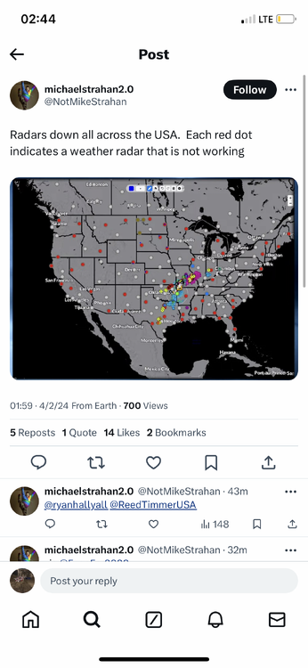
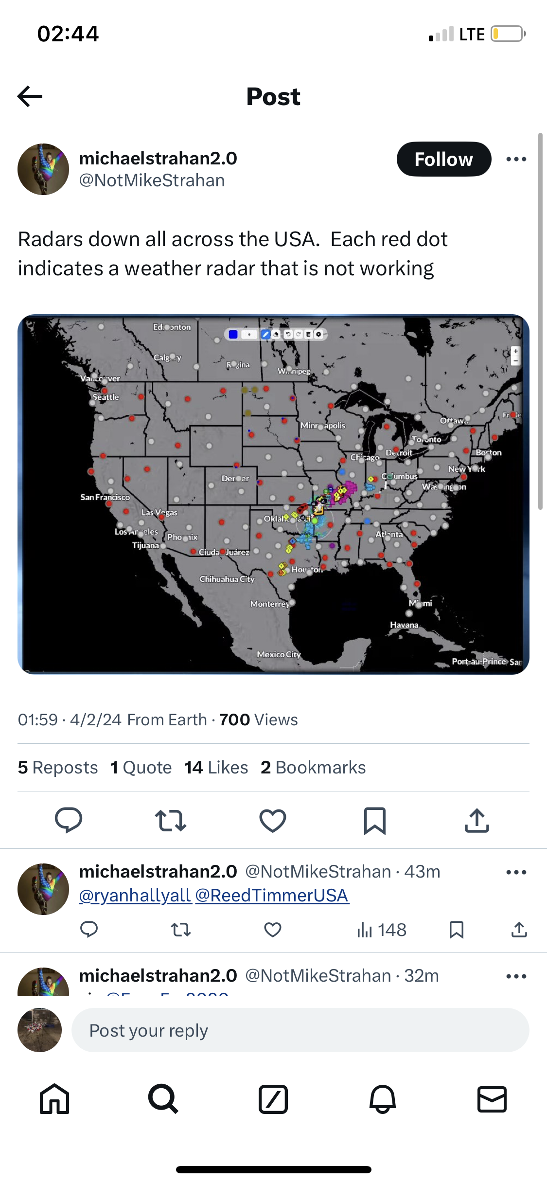
Anyone know if the radars being down affect model inputs? (From my understanding, NWS offices can still see their radars but the feed is down.)
-
2
-
-
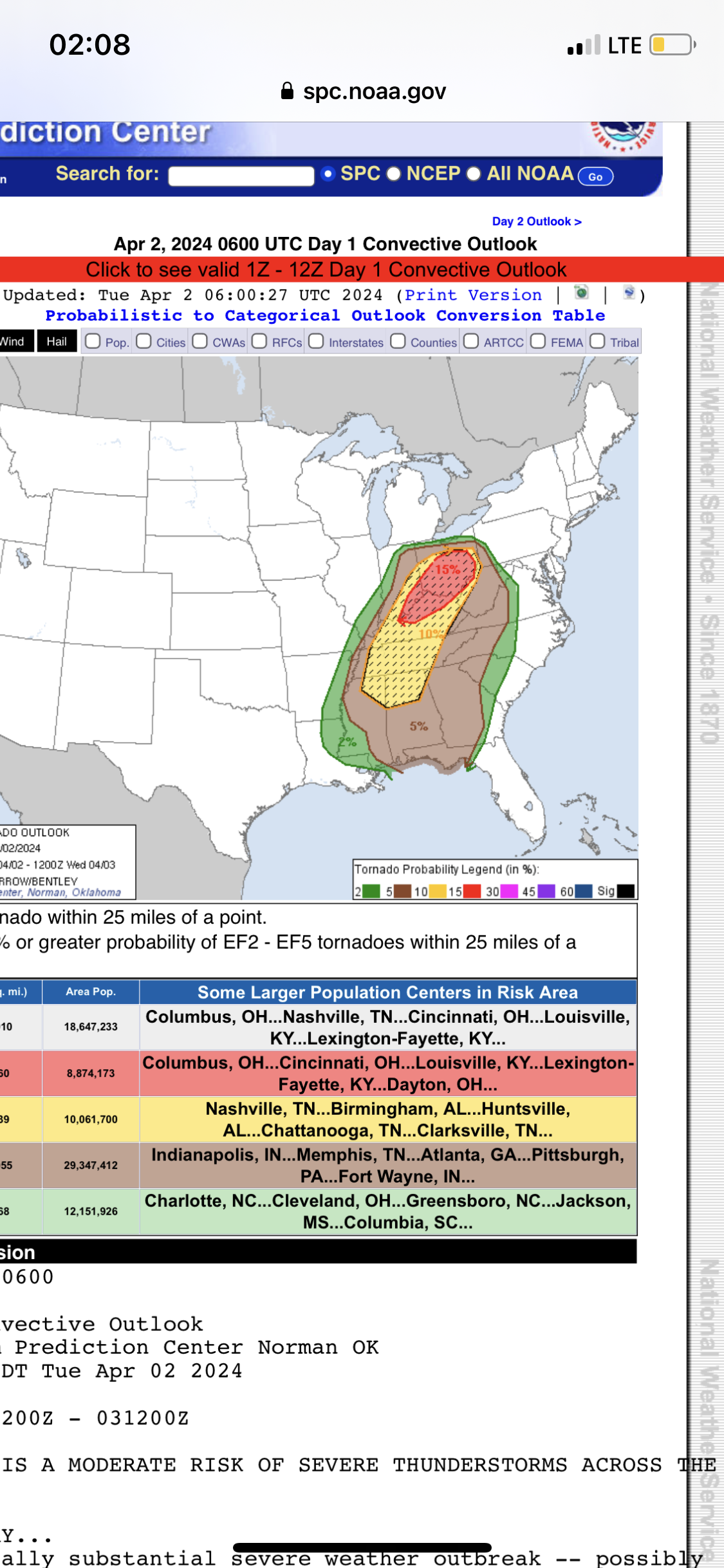
SPC sticking with the moderate with a massive hatched tornado risk
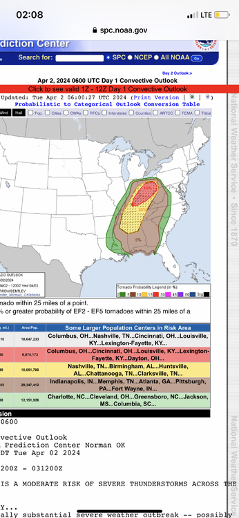
Spc basically said ignore the namQuoteIt's not entirely clear if ongoing convection will allow the warm front to lift appreciably north of its current position. However, large-scale pattern is quite dynamic and favors surface low deepening over southern Lake MI during the latter half of the pattern. NAM struggles to reflect this scenario, thus weaker instability is forecast at higher latitudes. Tornadoes, damaging winds, and large hail are expected with supercells that evolve across the warm sector. Some tornadoes may be long-lived and strong
.
-
1
-
-
03z HRRR takes the pressure down to 987. Time for bed and we shall see tomorrow.
.thumb.png.e8dac992c2652e532f5f0eeaead9c334.png)
-
6 minutes ago, andyhb said:
A lot of convection over OK and MO that is going to need to be worked out before we figure what tomorrow's ceiling is. I will say that this is on the "more inhibitive" side in terms of convective coverage from what I've seen in past events.
At this point, will the EML in Arkansas/Southern MO/TN be eroded by that ongoing convection or will it inhibit it?
-
3 minutes ago, OHweather said:
Considerable uncertainty, largely driven by ongoing/earlier-day convection, is definitely a familiar feeling for the Ohio Valley. There certainly is higher-end tornado potential if a portion of the warm sector is relatively clear and can recover through at least the mid-afternoon, and I feel like that's more likely than not to occur somewhere in the vicinity of central/southern IN, western/southern OH, and perhaps adjacent northern KY. Where exactly that occurs and how large of an area it is are certainly in question.
From a messaging perspective this is kind of brutal...I'd consider northern and even central (especially east-central) OH to be on the fringe. If ongoing convection and clouds clear quickly enough there's still a viable scenario where those areas recover enough to have a threat, and given the amount of shear in place that needs to be messaged. However, it's also possible that little happens on that northeastern fringe. We've already gone all-in with a tornado-driven moderate risk, so while I'm personally hoping for (and sort of leaning towards) nothing too noteworthy happening in the Cleveland metro and my immediate vicinity just south of Cleveland, a total whiff in the northern/eastern half of Ohio would be a strike against public trust in the severe wx forecasts.
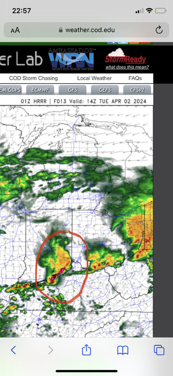
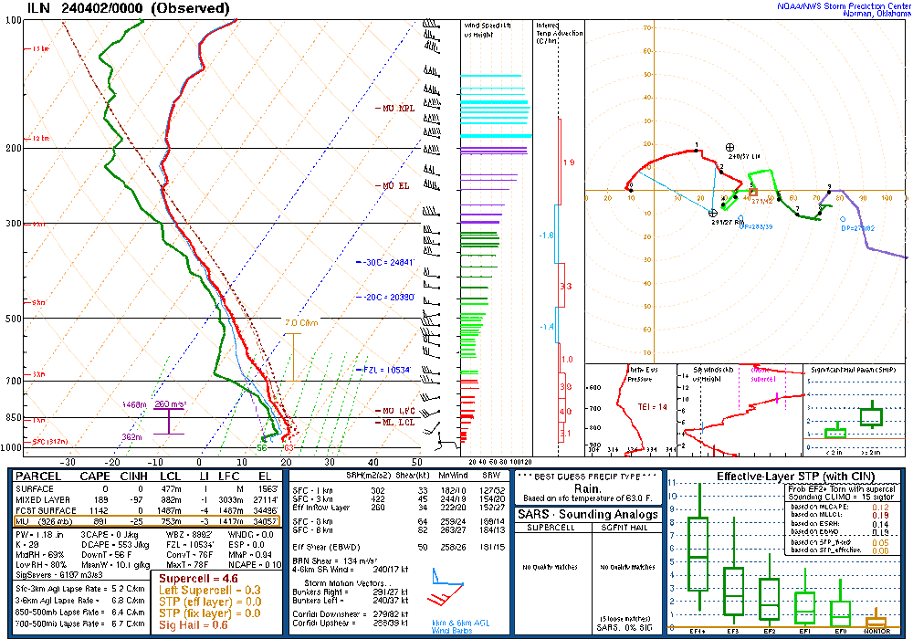
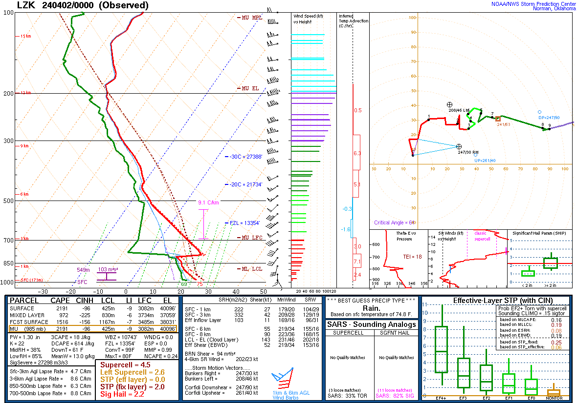
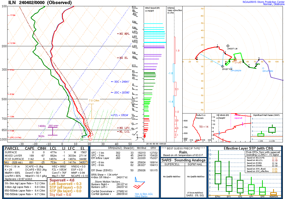
Yes from a messaging standpoint, this could be a mess. The miss earlier this month may or may not have played a part with the 15%. I would assume the afternoon outlook was late because there was a significant amount of discussion around the 15%. Realistically I think it’s a good forecast if the area circled in red does not materialize. If it does, the threat for Ohio would likely be significantly degraded. 0z sounding from ILN shows a minor inversion. Might prohibit some early morning convection?
-
Some disagreement between rap, hrrr, nam, and nam3k. It’s a wake up and see kind oF a day which is typical for the OV.


.png.c8d86572ac1324c76d72b49a4ead0b7f.png)

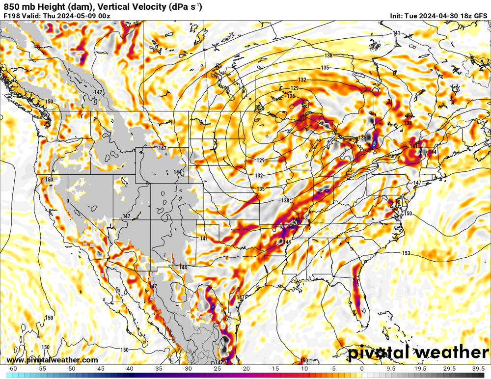
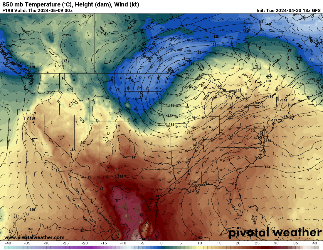
5/6-5/9 Severe Threats
in Lakes/Ohio Valley
Posted
Yesterday had more tor reports than Monday