

largetornado
-
Posts
126 -
Joined
-
Last visited
Content Type
Profiles
Blogs
Forums
American Weather
Media Demo
Store
Gallery
Posts posted by largetornado
-
-
13 minutes ago, crossbowftw3 said:
And when was the last 15 hatch across Ohio again?
11/17/13 is only event i recall but the tor risk only extended into western ohio. 3/2/12 was mainly kentucky and SW ohio. For the entirety of ohio, nothing comes to mind.
-
 2
2
-
-
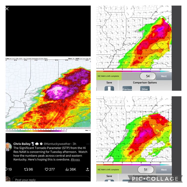
An impressive run for sigtor ingredients

-
While tomorrow is looking very volatile, the nocturnal threat tonight is not something to sleep on.
.png.917ef8b93f22b6d71881a898adc03be7.png)
.png.d4c19350c94098561aab8bef8623dfa1.png)
.png.075f76e8aff43237c616f2f65960014d.png)
-
1
-
-
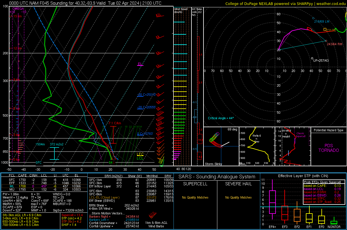
0z HRRR keeps the biggest threats south of the Ohio river. 0z nam brings the threat basically to Michigan. Either way, the hires models are trending towards a significant severe threat on Tuesday. Sounding is north central ohio

NWS ILN current thinking:
Quote.LONG TERM /TUESDAY NIGHT THROUGH SATURDAY/... CAM guidance continues to show an MCS carving through the Ohio Valley early Tuesday morning as a stalled frontal boundary remains laid out through our CWA. The heaviest rain from this complex appears to be south of I-70, focused more towards the Ohio River. At this juncture, PWATs will be 200-300% of normal as most of the CWA will be above 1", with locations near the OH River falling in the 1.25" - 1.50" PWAT range. Thus, there is a concern of flash flooding from this complex of storms given the repeated rounds of rainfall prior to this particular MCS, leading to wet antecedent soil conditions. The evolution of storms becomes a bit more murky the rest of the day on Tuesday because of this MCS. Synoptically, the low pressure center does become more progressive in its northeastward propagation, eventually swinging a cold front through. Majority of models do show the center of this low tracking through a portion of our CWA, near or just north of the Tristate area. The track of this low is of concern, primarily for altering the orientation of surface winds and potentially backing these near-surface winds. This is resulting in better hodograph curvature in the lowest few kilometers, increasing the potential for rotating storms. Some models are much more aggressive in how the environment rebounds, which would combine favorable thermodynamics along with strong deep- layer shear, heightening severe weather concerns with all hazards at play. Will have to monitor how CAMs handle the evolution of the morning MCS and how the atmosphere responds through the rest of the day.
-
2
-
-
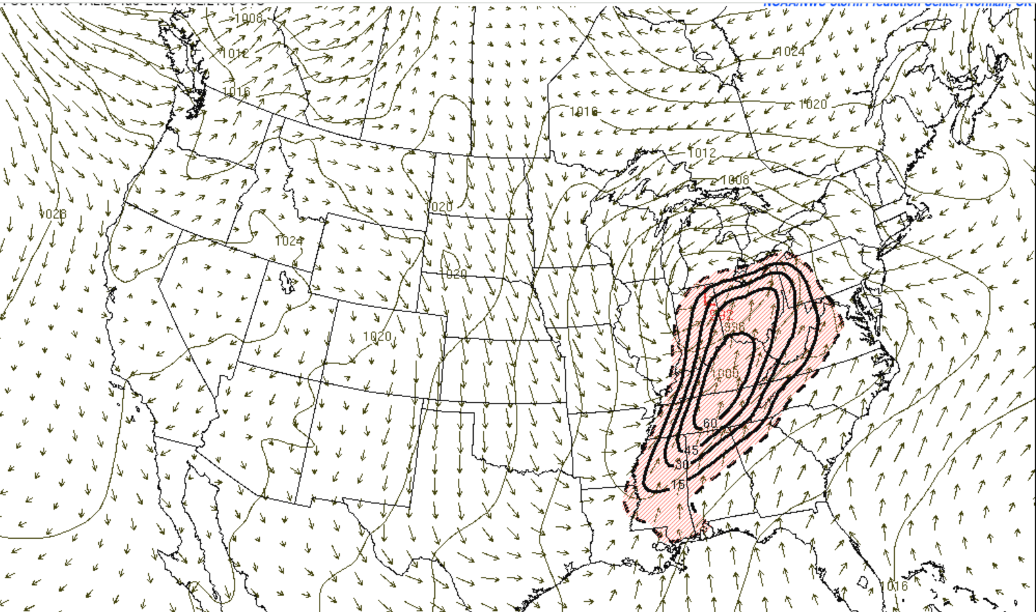
18z suite continues trend of 12z. Large area of substantial STP.
-
1
-
-
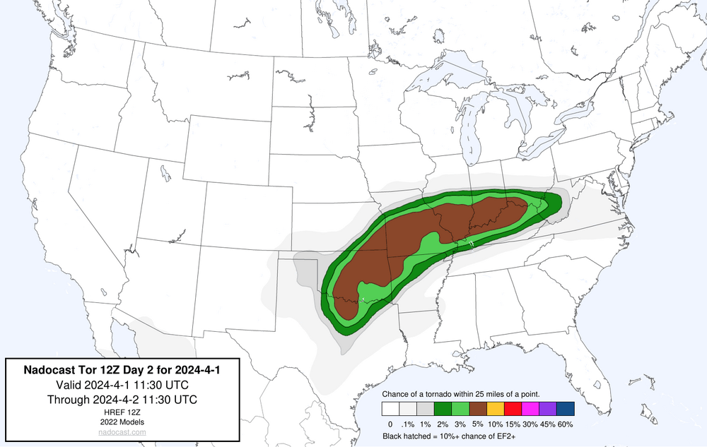
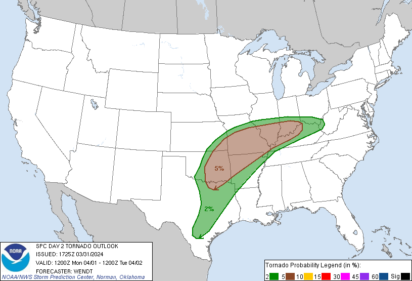
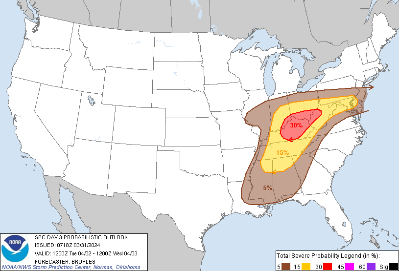
Multi day severe threat expected for southern portion of subforum 4/1-4/2. As of now, the SPC a 5% risk of tornadoes along I64 for Monday and a 30% general risk for Tuesday. Most concerning to me is the nocturnal threat monday into Tuesday. Biggest question that remains is how veered winds are.
-
5 hours ago, andyhb said:
Yes the 18z NAM is absolutely nasty on Tuesday. Granted, that probably won't hold, although its 500 mb setup isn't much different than the other models.
The low levels will make or break this along with prior convection from Monday.
yep, didnt hold in the 0Z suite. However, the warm front on Monday has that look to me and the D2 outlook hits on that.
-
1
-
-
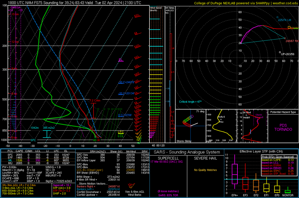
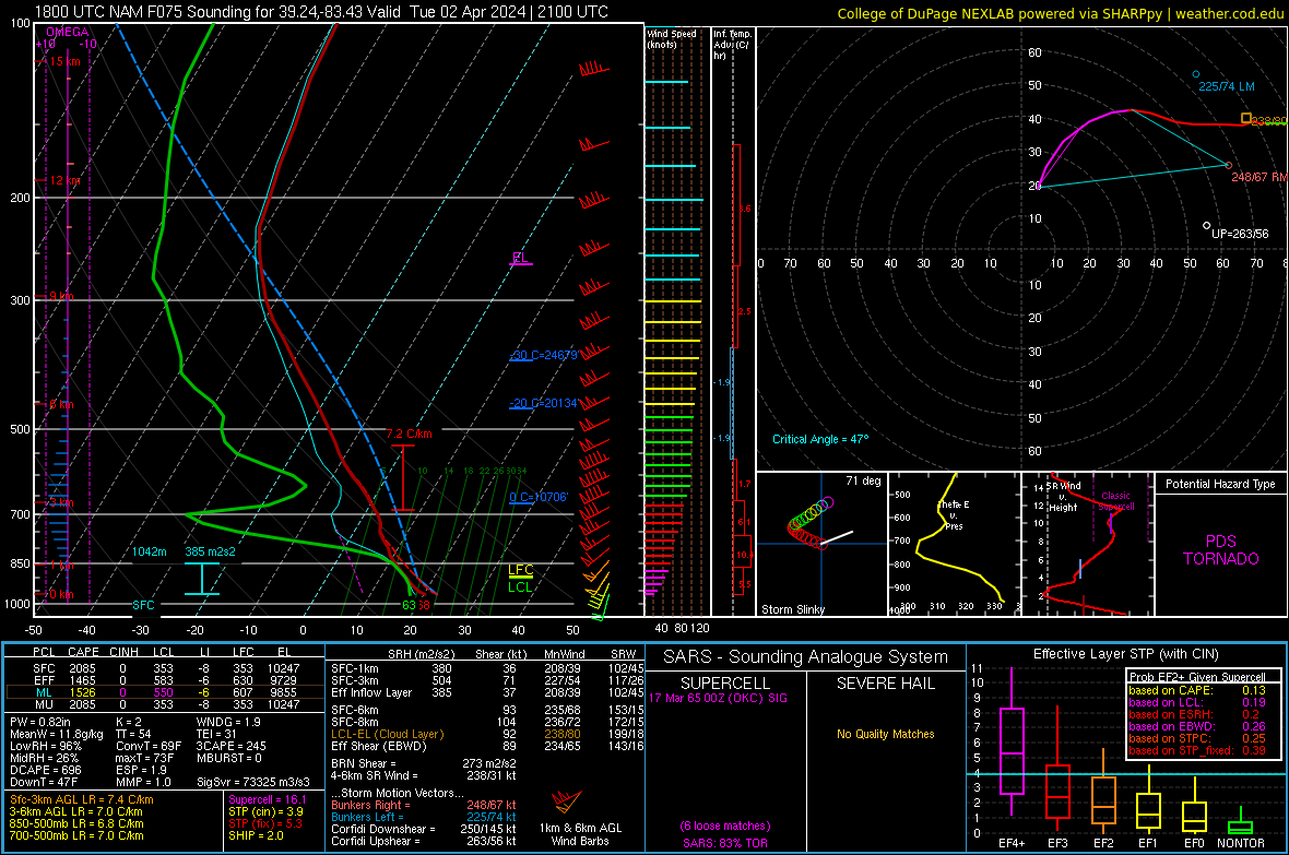
NAM not as veered. Sounding from southern Ohio on tuesday
-
-
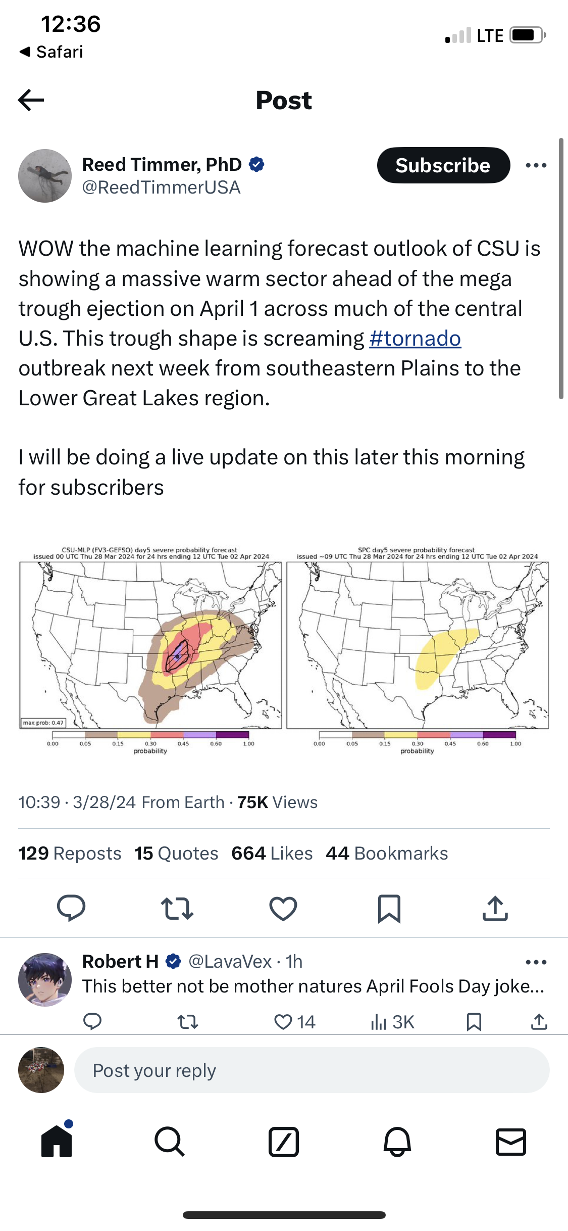
Based on the GFS over the past 4-5 days, looks like our next chance of severe is going to be 3/28-4/3.
-
37 minutes ago, nwohweather said:
Well said. If I’m not mistaken they were anticipating storms lining up, which never happened. Also, I believe instability and shear were all considerably higher than modeled in the morning.
Still, I’ll admit I didn’t expect to see multiple long track supercells. The Wapakoneta Storm was tornado warned from Indiana to ColumbusILN was on it. Give them props.
There will be time for airmass recovery in western Ohio/eastern Indiana later this afternoon and evening, with model consensus of lower 60s dewpoints advecting in along and south. A pretty concerning supercell environment is depicted with a mid level jet streak providing ample deep layer shear, low level curvature in the hodographs, and deep instability. Supercell mode is possible if not likely, thus threats in terms of impact seem to maximize in the 5P-11P timeframe in southeast Indiana, western Ohio possibly as far east as central Ohio with large hail and a a tornado or two.-
1
-
-
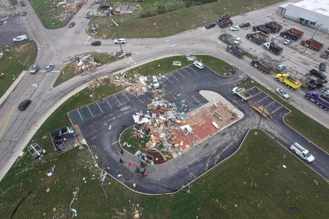
1 hour ago, IWXwx said:
Where the Taco Bell in Winchester used to be:
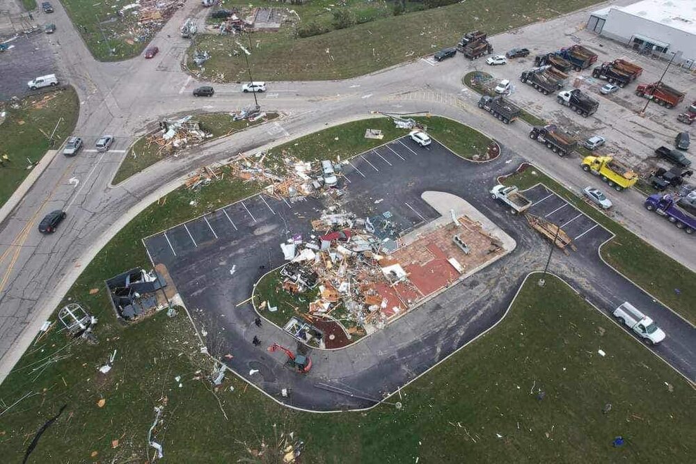
Minimum ef4 damage right? Swept off slab?
-
by my latest count, 4 killed in Winchester and at least 6 killed in Ohio.
-
3 minutes ago, Floydbuster said:
While I agree with the sentiment, this event (from my point of you) didn't look that impressive until late afternoon. I'm still surprised by how powerful some of these twisters were in western Ohio.
Look at the STP Map from the 18z HRRR. And the mesoscale analysis had STP of 3+ for a lot of Ohio throughout the day that could have been caught by the 4pm update. Additionally effective SRH(IMO the signal biggest predictor of strong/violent tornadoes) was 300+ on the Mesoanalysis. I’m just saying to not raise to an enhanced, was a mistake based on the signals I saw. My guess is the SPC was thinking veering would tamper any threats which veering was specifically mentioned in the 4pm update
-
1
-
-
3 minutes ago, HillsdaleMIWeather said:
I know it's kinda the thing everyone says lately but the SPC really dropped the ball this evening when it was obvious the event was uptrending, they didn't even increase the areas that got hit by likely violent tornadoes to a slight risk until the 9PM update.
Agreed. There was a clear signal a 10% was justified by noon.
-
At least 3 killed in winchester per Jenny dressier on twittter . Mobile homes hit
-
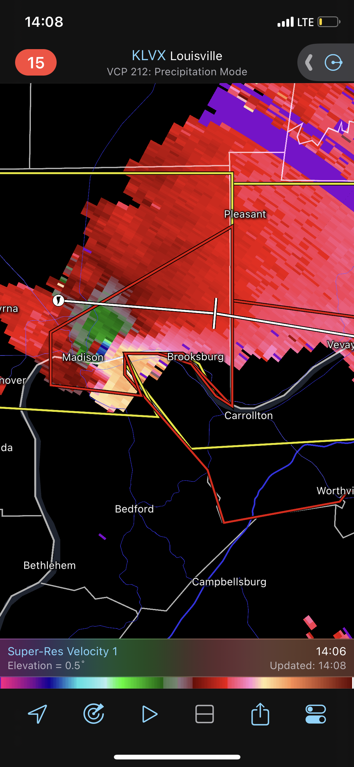
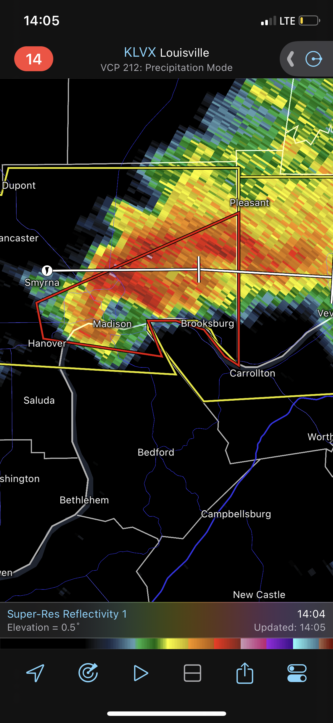
-
SE Indiana tornado warning. Confirmed

-
Quote
There will be time for airmass recovery in western Ohio/eastern
Indiana later this afternoon and evening, with model consensus
of lower 60s dewpoints advecting in along and south. A pretty
concerning supercell environment is depicted with a mid level
jet streak providing ample deep layer shear, low level curvature
in the hodographs, and deep instability. Supercell mode is
possible if not likely, thus threats in terms of impact seem to
maximize in the 5P-11P timeframe in southeast Indiana, western
Ohio possibly as far east as central Ohio with large hail and a
a tornado or two.
Full disco:
Per a very stable / consistent signal in the past 4-6 HRRR runs, expect this convective line to continue to move east-northeast and into the ILN forecast area early this afternoon (1-2PM) and then steadily east and out of the area by 5 PM. A concern here is the ambient boundary layer in front of these storms is not moist, with dewpoints in the 40s, which will slowly increase into the mid 50s ahead of the line. This may temper storm intensity somewhat, but on the flip side the inverted-v type soundings seen in the HRRR/NAM in front of this line will augment mixing of stronger convective winds to the surface. Low level shear is adequate, but lacks curvature in the 0-1km layer, and is more impressive on 0-3km layer where SRH is in excess of 250m2/s2. So there will be a potential for line-embedded mesovortices for optimally oriented segments of the line to the low level shear vector, but it is noted that the vector is somewhat line-parallel, which may keep mesovortex formation much more isolated. Something also showing up in numerous CAMS is the potential for a southern tail supercell with strong updraft helicity swath somewhere in vicinity of the Ohio River or just north mid-late afternoon. This seems plausible, and needs to be watched for a larger hail threat or more localized brief tornado threat. The signal has been in most HRRR runs, and many of the other 14.00Z runs. There will be time for airmass recovery in western Ohio/eastern Indiana later this afternoon and evening, with model consensus of lower 60s dewpoints advecting in along and south. A pretty concerning supercell environment is depicted with a mid level jet streak providing ample deep layer shear, low level curvature in the hodographs, and deep instability. Supercell mode is possible if not likely, thus threats in terms of impact seem to maximize in the 5P-11P timeframe in southeast Indiana, western Ohio possibly as far east as central Ohio with large hail and a a tornado or two.
Unusually bullish from ILN.
-
60/40 tor probs issued for Ohio valley.
-
8 minutes ago, andyhb said:
Holy hell…
Strong strong tornado right there. Damn
-
2 hours ago, SolidIcewx said:
One day we won’t expect it but we will get our teeth kicked in. Never know when a MCS or MCV could stroll thru
Was the random kokomo wedge in 2015?
-
Silly hobby
-
 2
2
-
-
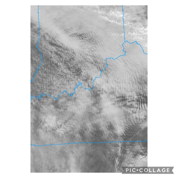
Look at all the gravity waves
-
 1
1
-


4/1-4/2 severe threat (southern portion of subforum)
in Lakes/Ohio Valley
Posted
18z HRRR isnt backing down. Brings the threat more towards indy and reflectivity is showing a more discrete environment, with cells starting to grow upscale after crossing into ohio.