-
Posts
4,907 -
Joined
-
Last visited
Content Type
Profiles
Blogs
Forums
American Weather
Media Demo
Store
Gallery
Posts posted by midatlanticweather
-
-
86.5 today was quite hot honestly. Not humid though. Watching the storms/rain progress slowly south.
-
 1
1
-
-
Sleet and snow now in Purcellville. Mainly sleet
Shall move to Discobs since it is not severe related from now on
-
 1
1
-
-
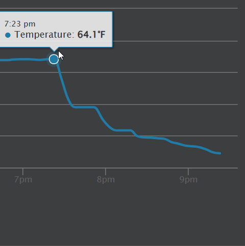
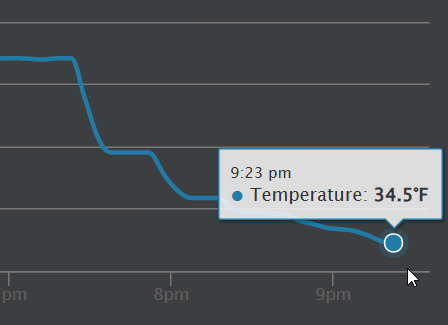
That is impressive! almost 30 degrees in 2 hours!


-
 1
1
-
-
Down to 36 here in Purcellville. Windy and rainy
-
Ominous temperature out right now!

-
 4
4
-
-
24.4 for a low. 25.5 currently
-
Snow now and down to 36.
-
 1
1
-
-
Basically, had a heavy shower that made things go to all sleet and even some slush balls, but as soon as it got lighter it went back to rain with some sleet and now just light rain with an occasional pinger. So, type of precip seems rate dependent which makes sense. Close to 38..was a bit cooler in the heavy precipitation
-
Rain mixing snow and sleet. 38.1
-
41.9 here in Purcellville. Temp dropped 2 degrees the last 20 mins. It was 72 around 4am. Pretty dramatic changes
-
26 minutes ago, Nomz said:
In accordance with tradition from another weather community I'm in, I'm committing to a salt bet: If DCA reports 0.1" or more of accumulated snow, I will eat a tablespoon of salt.
You must record it and share
-
-
Spidy sense on that storm north of Luray.
-
84.7 for a high. That is crazy. Ac was tested today
-
18 minutes ago, Roger Ramjet said:
40's to around 50 dewpoints are far from humid.
True! Just not ready for the heat!
-
81 in Purcellville! Hot and humid!
-
 1
1
-
-
76.1 for the high today. 80 seems in reach tomorrow and/or Wednesday
-
73.7 - warmest day of 2026 so far.
-
The deck was icey for sure! Had to clean it for the dog and family not to slip. Roads are fine, but the trees, combined with the wet snow from yesterday, are weighted down quite a bit. 31.7 degrees! Just a little bit longer for winter's last gasp and then the warm up begins.
-
Had a chance to get to the shaded spots of the deck. Over 2 inches of snow still this evening. Pretty good snow today here in Purcellville. Currently 29 degrees.
-
Almost 2 inches for a very short period of time when my temps were beat down to 28 degrees.. As soon as it got light it has been steady melt. Sitting at 31 and light snow.
-
 1
1
-
-
Snowing well out here in Purcellville! White ground. Roads are fine. 29.2 degrees
-
 1
1
-
 1
1
-
-
Rain/snow mix in northern Loudoun.
-
 1
1
-
-
People in Northern Loudoun have sent me video of rain/snow mix in that heavy band.


May Discobs 2026
in Mid Atlantic
Posted
38.4 degrees for the low. No Frost but pretty cold