

PackWxMan
-
Posts
90 -
Joined
-
Last visited
Content Type
Profiles
Blogs
Forums
American Weather
Media Demo
Store
Gallery
Everything posted by PackWxMan
-
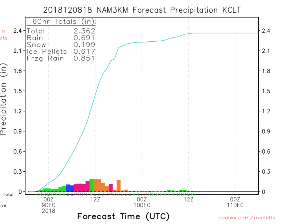
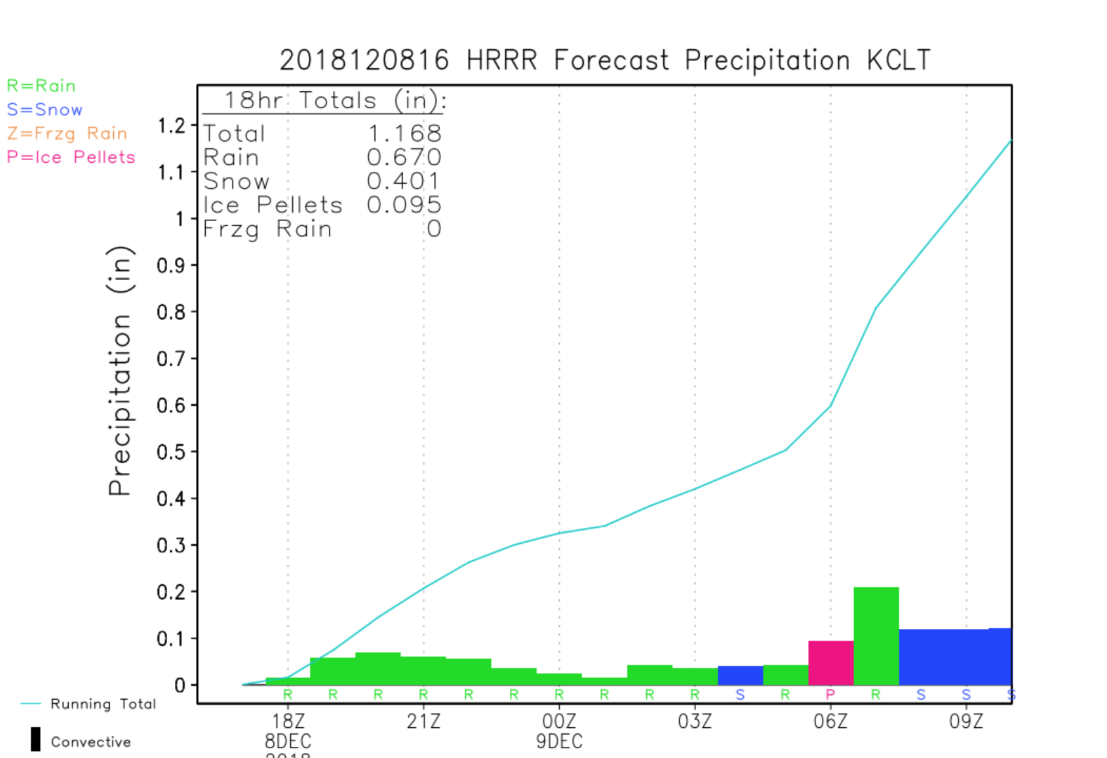
“Seeing pretty considerable sleet in my part of Charlotte, unfortunately expecting a lot more where that came from overall w/ this storm tonight & into tomorrow right up thru RDU even though taking the HRRR, RAP, & other models at face value says otherwise (bad idea).” - Eric Webb Sleetfest for the metro area is imminent.
-
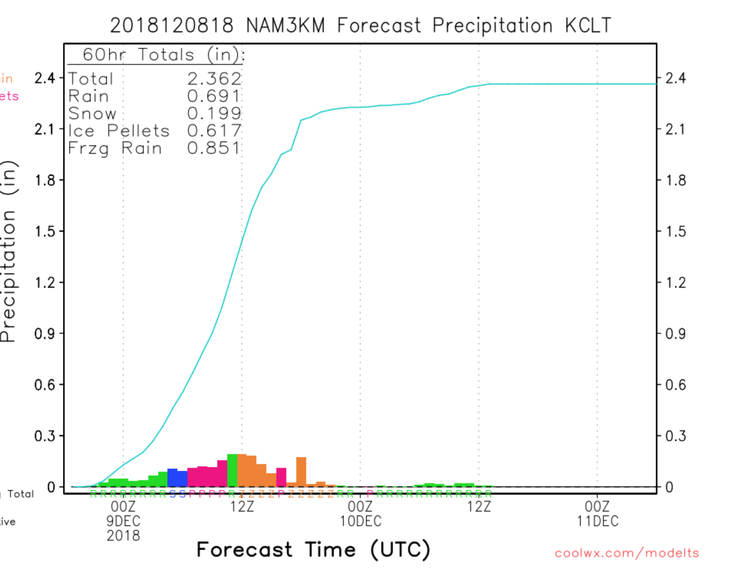
That would be significant. However, with the dry air, I see a lot of initial moisture eaten up. My guess is 1.25-1.5 for Guilford county
-
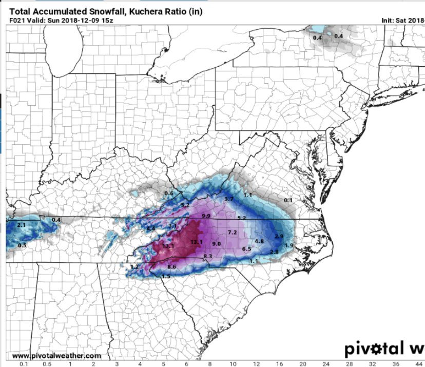
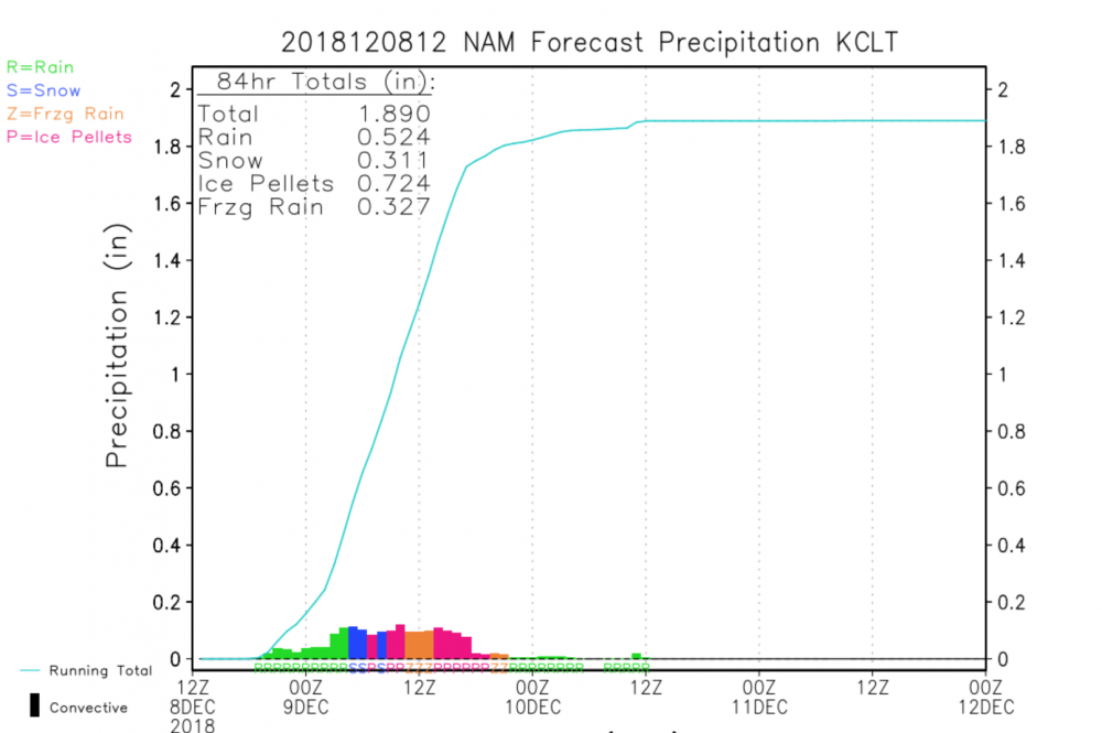
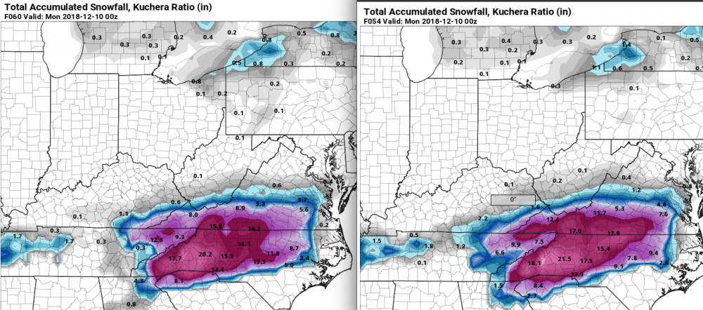
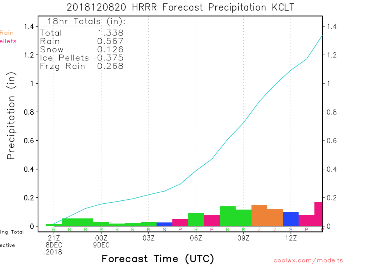
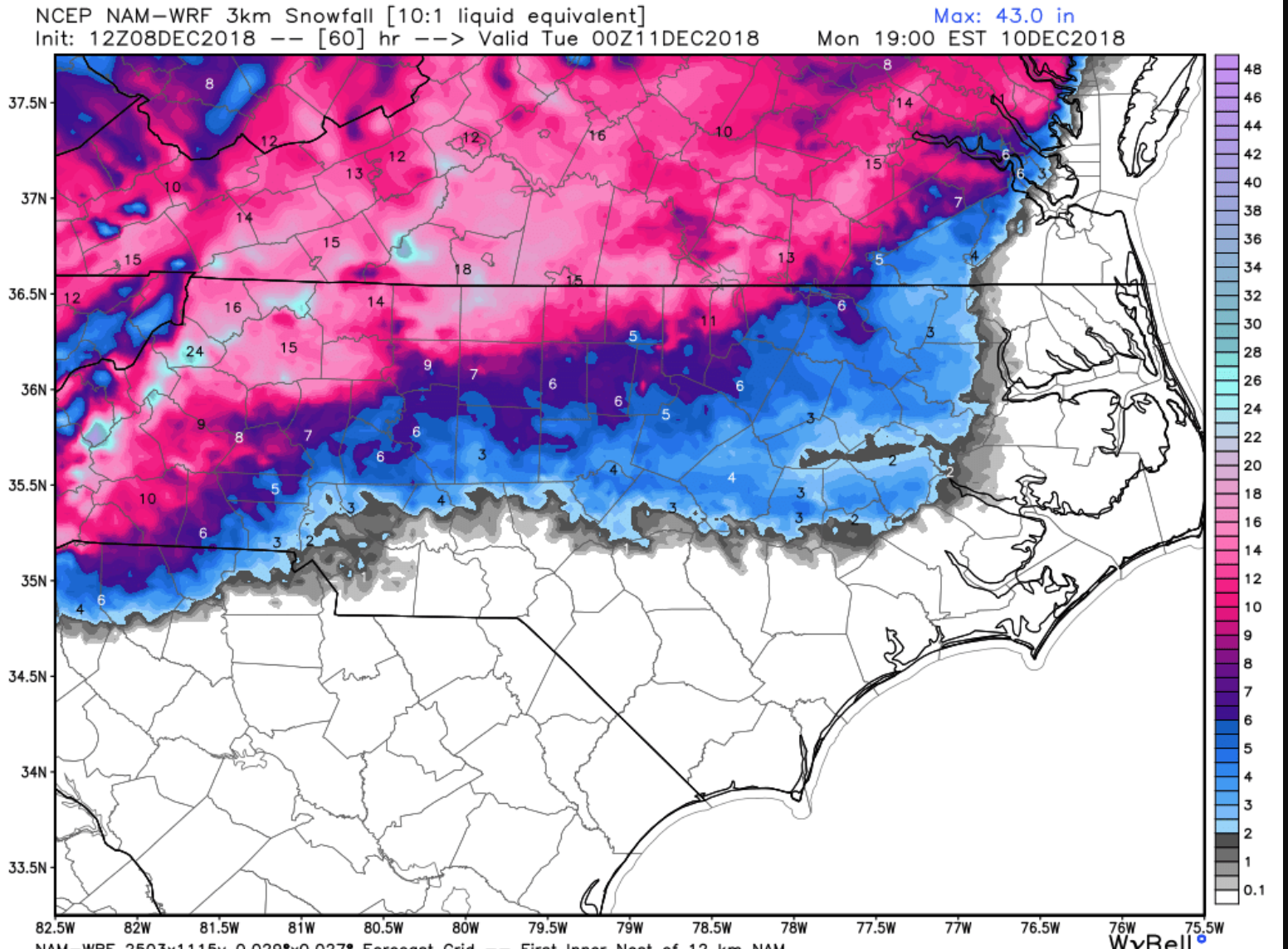
HRRR / RAP and Global’s have CLT and RDU in the game. NAM not so much. After studying some upstream results HRRR performed best on my score list. However, Texas (Lubbock) doesn’t deal with CAD. climatology and watching some upper level jets suggest the cad will be eroded in the 850 layer due to a strong jet. My my prediction is Best case for the two metros would be 2-4. Greensboro cash’s out with 6-10. Foothills and mtns upwards of a foot and higher.
-
Coming into scope now... Sleet and Rain (both normal and freezing) the primary elements in CLT. Strong SWly jet going to be too much and will help erode CAD aloft.

-
FWIW
-
The HRRR is holding on - its historically good with eroding CAD on model verification scores. It's still looking good. However, there is a 50+KT SWly jet aloft, that doesn't bode well.
-
Nobody is “jumping off a cliff” - people are consuming the data. Right now it follows what most expected. A warm nose eroding cad.
-
As the HRRR enters the picture

-

-
While the GFS likes central NC. The EURO had a strong shift north. Im guessing the EuroENS will follow the op run. NAM did so well last winter, now that we see Euro adjusting towards NAM it worries me that it is simply getting a better track on the L and the warm air aloft that comes with it.
-
yes. The warm nose will almost always win out.
-
Merry Christmas!
-
As mentioned yesterday this is a sleet storm for most (CLT/RDU even the Triad). While I do think the Triad can see maybe 8 inches (and thats a lot, this remains a snowstorm for Winston West and a mixed bag of let down (if you like snow) for the majority.
-
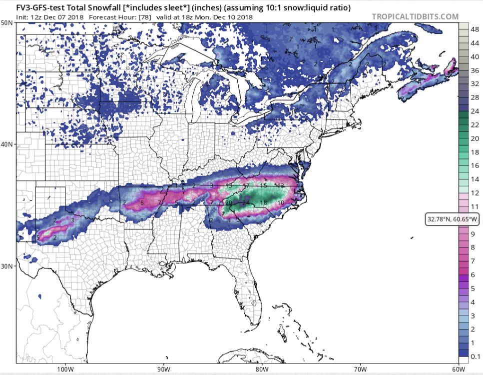
FV3 a Actually the FV3 jogged north on this run. Which includes sleet.
-
This isn’t a 10:1 ratio event. That would equal 2-3 inches. Still nice though!!
-
Yeah. Western N.C. will see snow. However the majority of us in NC are in the metro areas. CLT / Raleigh and even greensboro. I like the runs yesterday but today it’s been a nose dive into warmer temps aloft and fading precipitation at the hands of the CAD. All good. It’s early dec. plenty more months. Sleetfest 2018 incoming.
-
Reports to the west of warmer mid levels than modeling showed. Nam going north, GFS calming down. All we can hope for is the FV3 and Euro hold. That’s all sleet tho. This is a sleet of r cold rain for majority of us regardless of what models show.
-
New Euro for all the weenie clowns
.thumb.png.ad85e76019fafe1ce8476645c7dec51d.png)
-
I blended the FV3 / Euro Ens / NAM and Im telling you, RAH looks good and Fishel will be caught with pants down if that concoction verifies.....
-
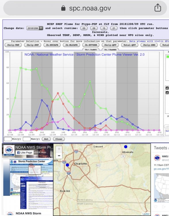
Yeah, was it 2015 when the SREF plumes showed like 12-15 for Raleigh and we got like 2? lol . Plumes are garbage.
-
FV3 doesnt show sleet.
-
The plumes are a big buzz kill - stay away
-
Wow - thanks Fish. You just explained EVERY snow storm in Raleigh. Which ensembles is he referring to? For those unfamiliar with Fish, he is typically the most conversative forecaster on earth
-
Yeah........ nah.
-
lets see it


.png.10265a3d78ea80542ceda08836634014.png)
