

Tar Heel Snow
-
Posts
345 -
Joined
-
Last visited
Content Type
Profiles
Blogs
Forums
American Weather
Media Demo
Store
Gallery
Posts posted by Tar Heel Snow
-
-
several other tweets on his profile show that JMA has been really really accurate out to 2 weeks for the past month or so. A sign of hope perhaps.
-
 1
1
-
-
3 hours ago, FallsLake said:
It's not over yet. We've been lucky and have had at least one good storm the last few years. Not looking good right now but we still have time for things to change. Maybe mid February into the first week of March we'll get that storm.
For sure! You never know. Just discouraging, but we can stay hopeful!
-
This is just...sad. I figured I’d at least get a flake this year. Crazy things can happen but, oof.
-
Hope is dwindling, but it’s hope
-
 1
1
-
 1
1
-
-
Just now, Queencitywx said:
I feel pretty confident in that, too. Latest temp fxcast from the GEFS(almost 11 day freeze streak thrown in for good measure):

Perfect, we need to cool those ground temps before we get anything!
-
0z GFS brings back some ZR/Sleet action
-
GFS stays with the interesting pattern for sometime between the 16th and the 20th. Good to see that at least hanging on this run.
-
1
-
-
Call it unrealistic, but the late hours of the GFS throws VA/North-Central NC a bone. First time we’ve seen anything, even in the long range, in a couple of weeks. Fits the relative pattern the CFS has shown over the past few runs of the pattern changing at the tail end of January. Something to (hopefully) watch!
Edit: The GEFS average at the same time has most of NC and a good chunk of eastern SC with at least a bit of snow accumulation.
-
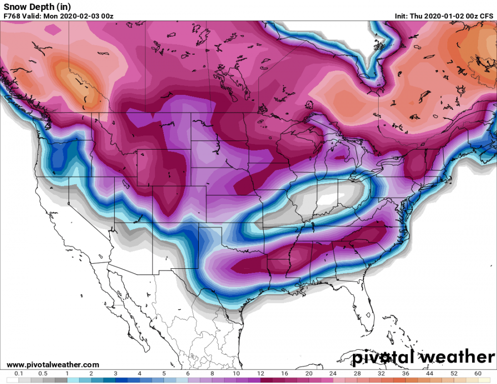
Well we haven't had a chance to see a clown map in awhile, so here you go from today's morning CFS one month out
 . This is exactly what this model should be used for and everyone should take it verbatim!
-
4
-
1
-
 1
1
-
-
-
18z GFS seems to have completely lost the weak wave for next Tuesday. Go figure.
-
2
-
-
I’d love to see the EPS members in the coming days. Tail end of today’s 12z Euro looked intriguing.
-
3
-
-
1 hour ago, franklin NCwx said:
Why Is anyone looking at any op model at day 7 let alone day 13???? That's why they have ensembles.
I think it would be fascinating to somehow quantify how data access and availability changes our perception about weather. I'm sure if the Euro and other models went out to 384 hrs like the GFS does, it would be just as bad.
At the same time, the fact that OP models are mostly free and easy to access makes it so that more people can see them and more easily take the extremes they may bring seriously, particularly when it comes to the GFS. Tropical Tidbits and similar sites make shiny and fun maps so easy to come by in the long range that it can cloud our perceptions. Pivotal recently made more ECMWF data free, but most data from it and all the ensembles are behind pay walls.
If it were the other way around and the Euro/the full range of the EPS, GEFS, etc. were free and easily accessed, I would be willing to bet we'd have different conversations on this site.
That's not to criticize the data being behind paywalls, people deserve to make money, but since that's the reality, it limits the conversations most of us can have (aside from screenshots from some generous posters in this thread) to long range GFS OP runs.
-
 1
1
-
-
1 hour ago, ryan1234 said:
If you follow Brad P. and watched his outlook for winter, he mentions more than once that overall, this was going to a mild winter. But he thinks we’ll have above average snowfall. It’s not even Christmas, still plenty of time to salvage a good winter. And it’s a lot easier to get snow in Oklahoma and the Midwest, they don’t have those pesky mountains to delay cold snaps or precipitation.
.Lol just give it a few thousand years and you won’t have to worry about the mountains!
-
6 minutes ago, Cold Rain said:
Sound meteorology does work. It's just that there's a lot of wishcasting that happens on message boards and in the Twittersphere that lures a lot of people to grasp at false hope. Last year, you could see going into January how bad things were and once we got into the second week of February, you knew that it was basically done, in terms of a sustained cold pattern. The other thing is, it's just easier to be warm than cold right now. Why that is the case is a whole other discussion. But regardless of the reason, it is just that way right now.
That said, if you look out and pin your hopes to a 240+ GFS snowstorm, you're going to be disappointed. But if you look at things happening around the globe and put those together with model output and incorporate an understanding of how models work and why they show what they show, then you can at least make an educated guess as to how things might shake out. None of that guarantees cold and snow, even if all of the weenies or "trusted sources" are honking for it...because quite frankly, there's a lot of mishonking that happens every year.
Hopefully, we know who's full of it by now and hopefully understand the biases of posters/professionals that we tend to follow.
Wish I could like this a dozen times. As long as you keep your expectations in check based on the realities of our climate and our geography, this stays fun. If you get too caught up from model run to model run (which admittedly can be exciting!) you’re begging to be deceived.
Any run or set of data can be spun in a way that makes us hopeful, and it can also be spun to make us hopeless.
-
1
-
-
8 minutes ago, Buddy1987 said:
Looks like 0z nam and 18z GFS are a little different wrt southern energy. Nam is slower with the energy but nam also weaker with n/s s/w over the plains/northern us. Could still work if the nam went out in time with n/s maybe being able to catch a slower ejecting southern us s/w. Both highs looks good in eastern canada around 1042. Bored waiting for the GFS so figured I'd nitpick
The high is a little bit further north on the NAM, and out to 84 it's marginally warmer than the GFS at the same time. Something to keep an eye on.
-
4 minutes ago, jjwxman said:
At that time frame the HP is not in the ideal spot for a CAD setup. Ideally you want the HP over PA or NY. Also you’re going from 6am to 2pm so it’s not really anything to do with the players it’s more to do with daytime heating.
I figured it had to do with the time of day, I see. Thanks!
-
Question for someone actually qualified, how is it that there's such a small change in where the HP is located, yet such a large increase in temps in just 6 hours? Is that purely the time of day and that it's afternoon? Just weird to see the cold retreat so quickly with such a marginal change in the locations of our main players.
.thumb.gif.aa238b509ad6708de5a7608d28992cd1.gif)
-
7 minutes ago, ryan1234 said:
I swear, if this yet another I-85 and N storm, I am going to personally demolish the entire interstate and move it 50 miles south. Yes, it would be easier to move, but I am tired of that being the case with literally Every. Single. Storm.
Or at least just straighten it out, that’d cut plenty of time off the Raleigh to Charlotte drive!
Anyway, it seems like right now, there’s still quite a few moving pieces but there’s certainly reason for cautious optimism and pessimism. Remember @Cold Rain’s “so what did we learn here?” thread
")
-
2
-
-
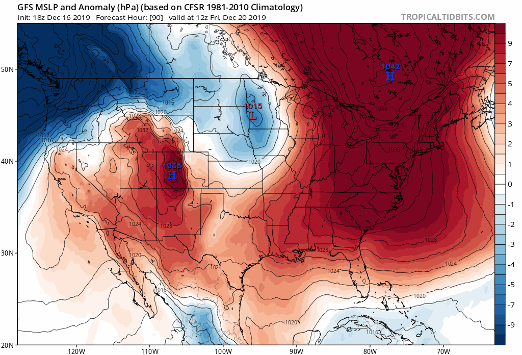
“Oooooh Canada...our home and native land!”
-
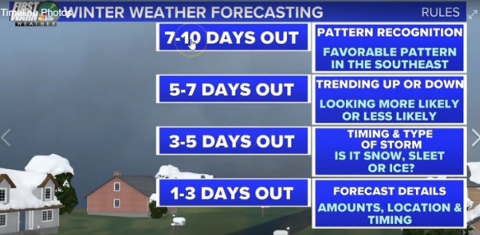
Brad P posted this graphic in his video a week or so ago about the small ice event from this past week. It’s great to keep in mind for stuff like this. Right now, we’re still very much in the “looking at trends” phase. We’re not looking at amounts, we’re not looking at precip shields, we’re seeing if trends continue in the right direction. Today? We had a couple small steps in the right direction on one model and an ensemble.
We still have a long way to go, if we’re lucky!
-
2
-
-
Will be interested to see how the trend moves on the GEFS
-
Looking at upper level trends, the high has been digging in a more ideal spot over SE Canada each of the past few runs. Exactly what we want to see. Specific outputs notwithstanding, we have something to track. Hopefully over the next few days the trend becomes clearer and even more ideal. At about a week out, you can't ask for much more than that.
-
This run looks a lot more like the 6z than the 12z GFS out to 12z Saturday


.gif.b0ab80850934a76860e479328c374c61.gif)

Banter Thread
in Southeastern States
Posted
More from Newfoundland