

Tar Heel Snow
-
Posts
345 -
Joined
-
Last visited
Content Type
Profiles
Blogs
Forums
American Weather
Media Demo
Store
Gallery
Posts posted by Tar Heel Snow
-
-
27 minutes ago, StantonParkHoya said:
Euro definitely mixier than other models
Granted, wasn’t it pretty rainy most of yesterday?
-
What exactly is the ferrier snow equivalent? How is it different than kuchera?
-
I’m getting biiiig Jan ’17 vibes

-
 1
1
-
-
16 minutes ago, SnowJoMoJo said:
Maybe model upgrades have fixed a lot of this, but maybe time to reflect on Cold Rain's thread from about 3 years ago...
My favorite line from the post " Pink areas on a p-type map indicate slightly colder rain than the green areas. "
I was going to repost this! Thank you for including it!
-
-
3 minutes ago, BullCityWx said:
This is one heck of an event

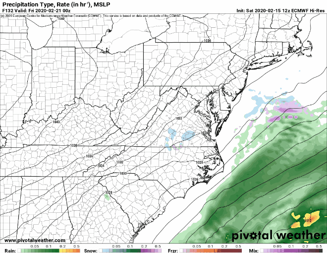
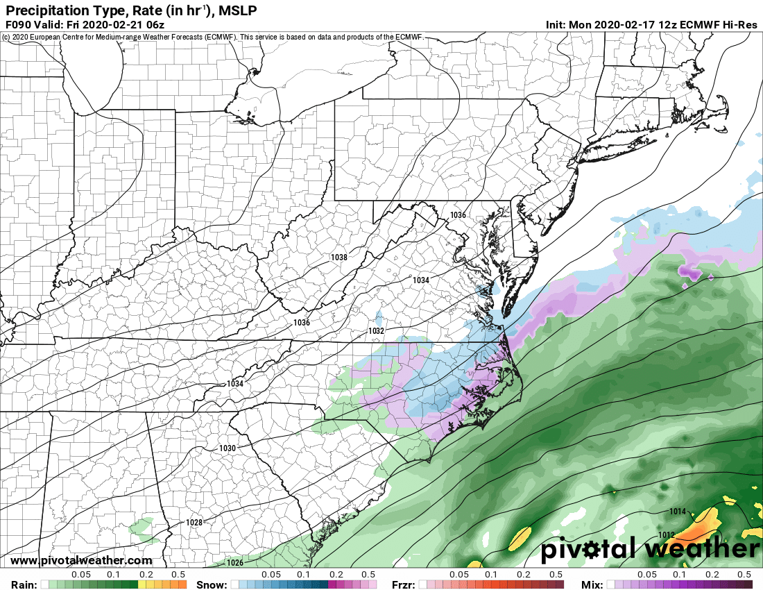
For those less educated (like me!) Could you explain what we're looking at here? Thanks!
-
 1
1
-
-
Thread^
-
 1
1
-
1
-
-
We really need an eyeroll reaction for this board lol
-
“NAM is excellent at picking out warm noses.” I can still hear the effects of that Jan ’18 Storm where people ignored it.
-
Still looks nice for MBY but it’s clear we have a ways to go. Good to see it not deviate from the main idea of the system at this point.
-
3 minutes ago, griteater said:
This run of the NAM pretty much matches the track and precip footprint of the GFS/Euro, but it's simply much heavier with the precip on the north side owning to potentially resolving the higher resolution dynamics at play (heavy frontogenesis). Maybe the NAM is too heavy with the precip and maybe the globals are too light
I just wish this run were happening two days from now! Excellent runs of the NAM for a lot of the board.
-
2
-
-
If only the 3k NAM went out to 84...
-
We've got about 72 hours to go before we start seeing some precip in our area, we're in NAM range, and I'm seeing a lot of hot threads lately. Let's do the daggum thing.
-
5
-
-
At this range is it better to trust the short range models for temps/rates, while we look at the globals to keep the overall pattern? Obviously we have a little ways to go before we get into the 3km NAM, RGEM, HRRR range, but what should we be looking for in regards to the pieces we need in play?
-
Next frame:

-
1
-
-
Oh hai Euro! Precip continues to trend back, still unsure about temps, but they look to be in mid-upper 30s across the region at these time frames
-
1
-
-
Also putting this here bc it's not really sanitarium material but that seems to be the only banter thread we actually have going
4 minutes ago, Tar Heel Snow said:"With glooowing hearts we seeee thee rise, the true north strong and freeeee.
From faaar and wide o Caaaanada, we stand on guaard for theeeee!"

-
1
-
-
"With glooowing hearts we seeee thee rise, the true north strong and freeeee.
From faaar and wide o Caaaanada, we stand on guaard for theeeee!"
-
3 hours ago, burrel2 said:
arw-2 looking juicy for Northern GA/western upstate!

Advanced a few frames and it actually keeps the precip shield solid through central NC and south-central VA
-
1
-
-
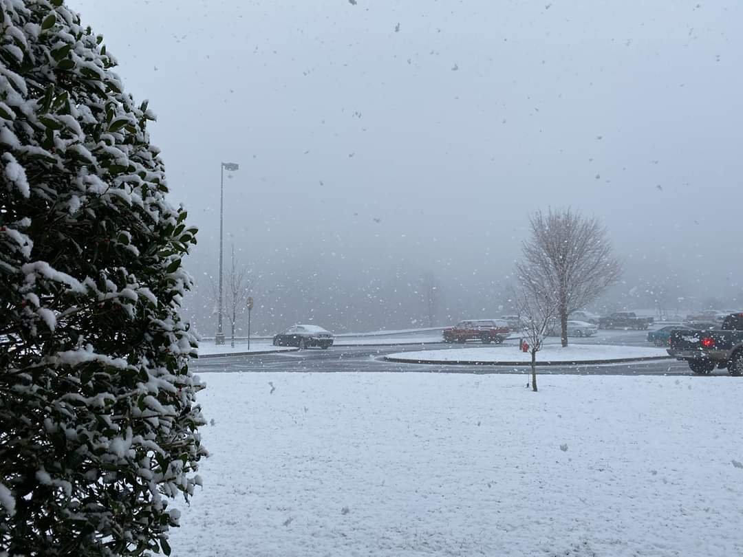
4 minutes ago, SnowDawg said:
Amazing morning. Caught me completely off guard to say the least but I needed that. 400+ day snow less streak is officially over here in Clayton, GA.
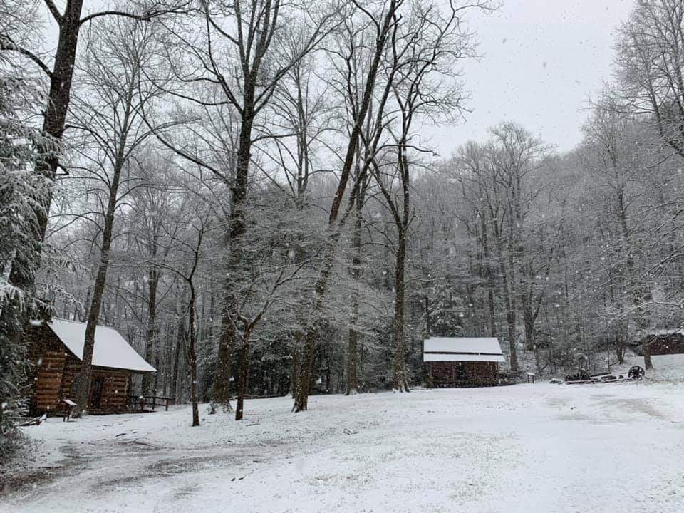
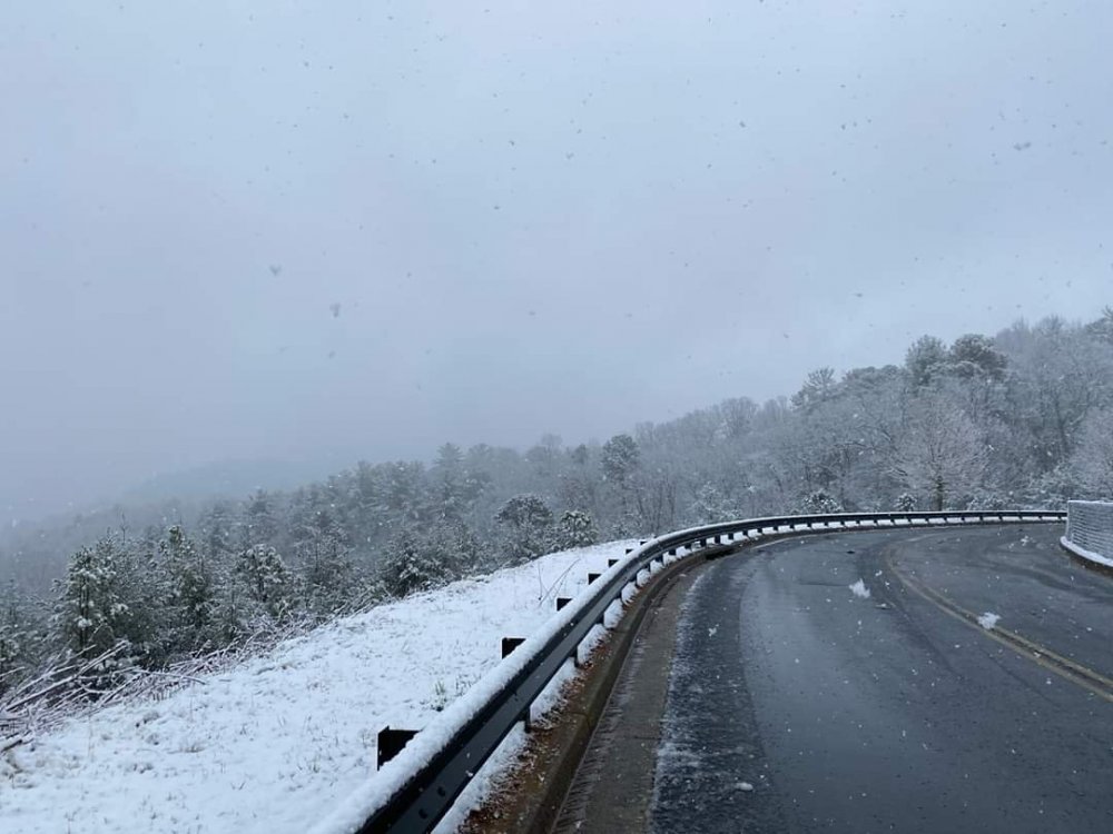
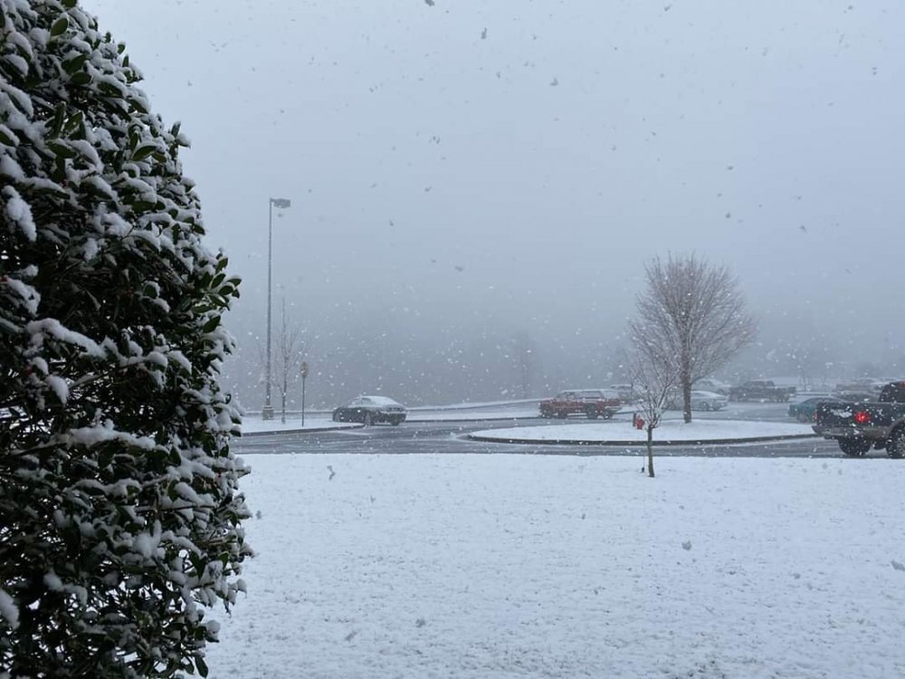
This is the content you LOVE to see! Enjoy that!!
-
3
-
1
-
-
A little bit of icy drizzle here in Chapel Hill
-
First time I can remember not even having a legitimate threat to seeing a flake.
That said, yes patterns as a whole have changed, but many people on this board could use a lesson in recency bias.
-
-
0z CMC with some snow for western and central NC Thursday still

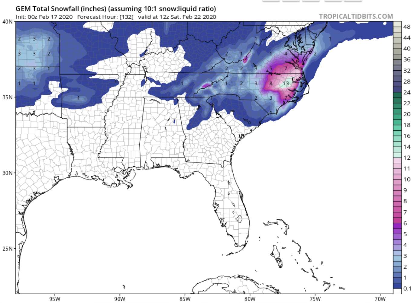

One More Shot: Feb 20-21 Event
in Southeastern States
Posted