ams30721us
-
Posts
670 -
Joined
-
Last visited
Content Type
Profiles
Blogs
Forums
American Weather
Media Demo
Store
Gallery
Everything posted by ams30721us
-
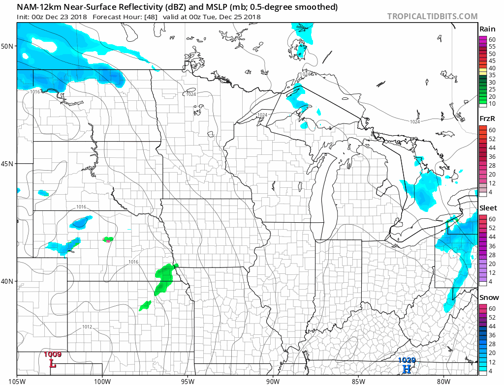
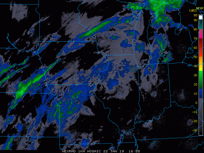
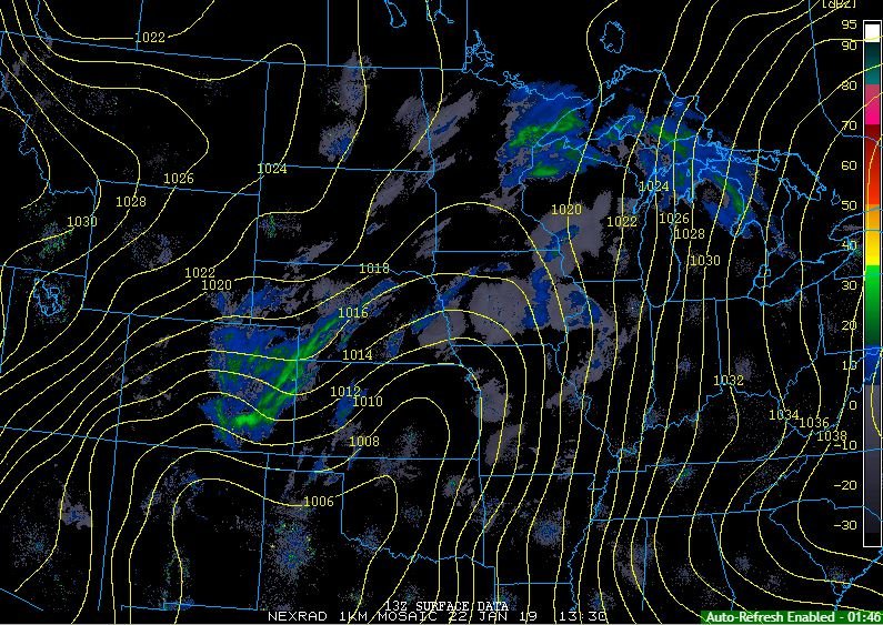
Suprisingly, those heavier echoes Here in the QC are producing sleet & snow. I figured we would be Frz. rain to start for sure.
-
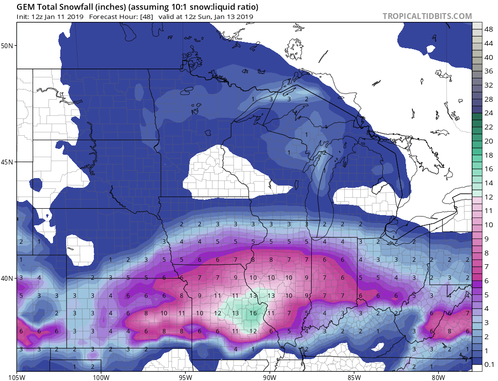
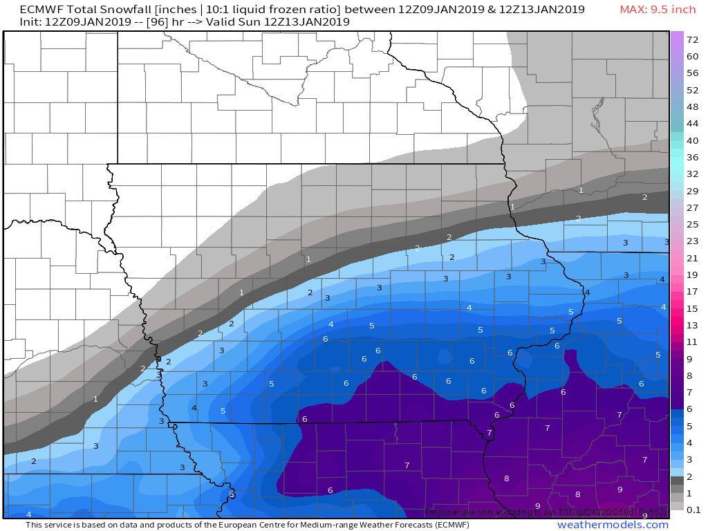
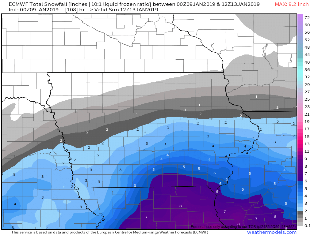
12z Euro

-
-
Oh my!
-
-
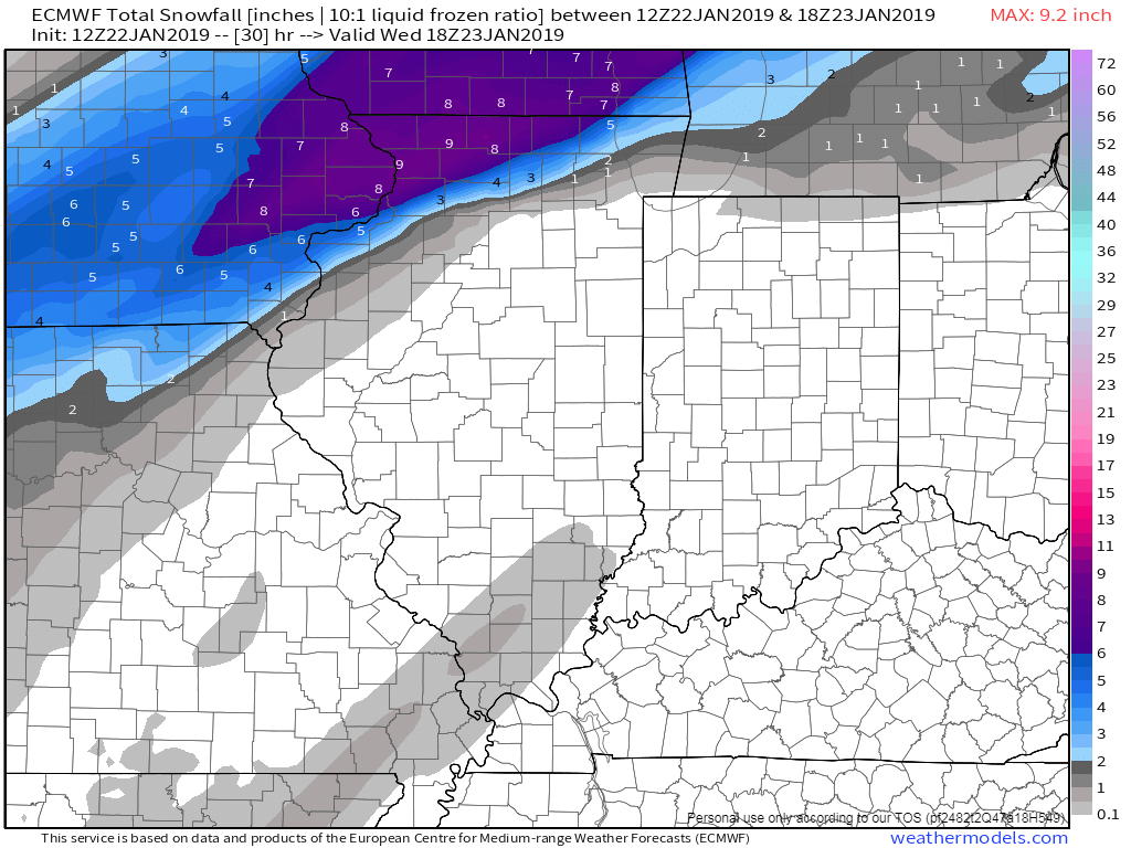
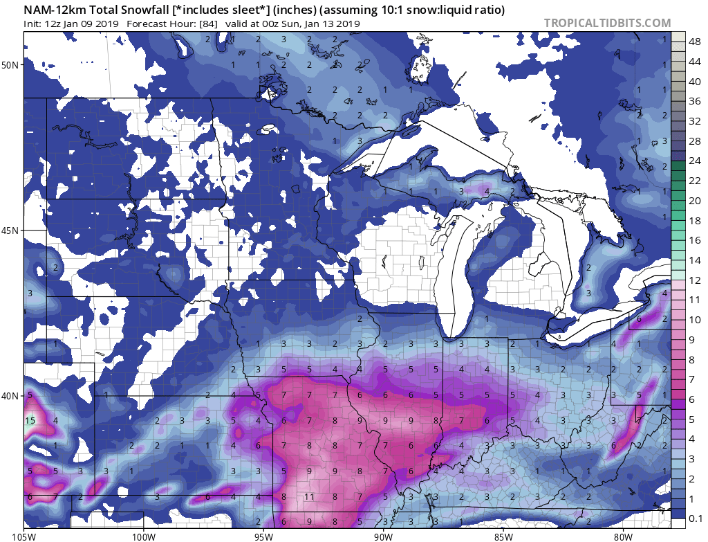
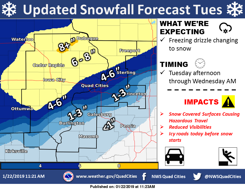
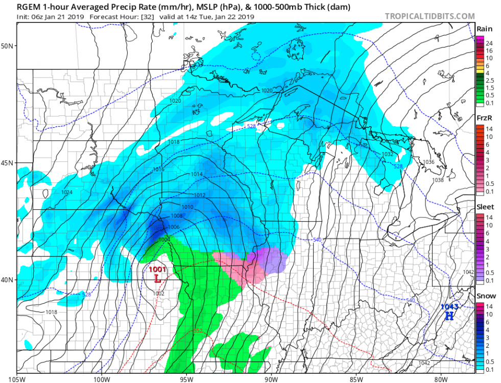
Yikes, just woke up to peak at the overnight data. Now looking more and more like a Icy mess today for the QCA with a bit of everything, followed by a few inches of wet snow overnight into Wednesday morning. 00z Euro now popping out 4"+ for the QC, although I would be inclined to believe more of a 1"-3" for the Metro itself, after a decent frz. rain and sleet early event. Just a mess.
-
-
This system is fairly complex, but its going to bring a moderate risk in my opinion of decent impacts for some locations. For the Quad Cities, temps are below zero this morning, after hanging out below 20 all weekend, along with a very decent snow pack. Models are showing strong, warm air advection setting up, especially aloft, shooting temps from the teens Tuesday morning, to the mid to upper 30s Tuesday afternoon with precip arriving around Midday. My thinking right now, is a front end dump of snow to sleet/ frz. rain to possible plain rain by mid-afternoon if the warm advection is as strong as being advertised on the Globals. However, my primary concern actually comes Tuesday evening into Tuesday night, in the form of a Flash Freeze in spots. Temps are also projected to drop from the mid to upper 30s during the afternoon into the low 20s by midnight, and well down into the teens by Wednesday morning. Even if all precip falls as regular liquid during the afternoon, the already frozen ground may not be able to absorb the moisture, and with temps plummeting during the evening & overnight hours, this could set us up for some very icy conditions Tuesday evening thru Wednesday morning.
-
Steady light snow beginning here in the QC now. Should be rocking by 9pm thru 2am around here!
-
-
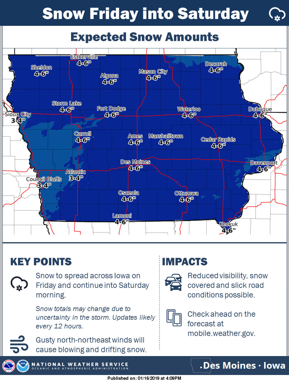
I think this is a good average starting point for around here. Let's see how things trend as we get some sampling going on Thursday. DMX: DVN:
-

-
What a Beaut!
-
Another nice storm in the QC: Moline: 7.0" DVN: 6.4" Even a healthy 2.0" in Dubuque. I was hoping to cash in that amount here in DVN just the other day. As a southerner, I love these bigger snowfalls this Winter and last, but I always regret them when having to clear the car and driveway before work at 2am each morning! Ha Well at least it's not too frigid!
-
Lol! The QC Metro now added to the Winter Storm Warning. I;ve got a little over 6" here in Downtown Davenport with radar still looking healthy back to the west. Hard to believe this time yesterday I was hoping to average 3-3.5" here as a big coup. Haha
-

-
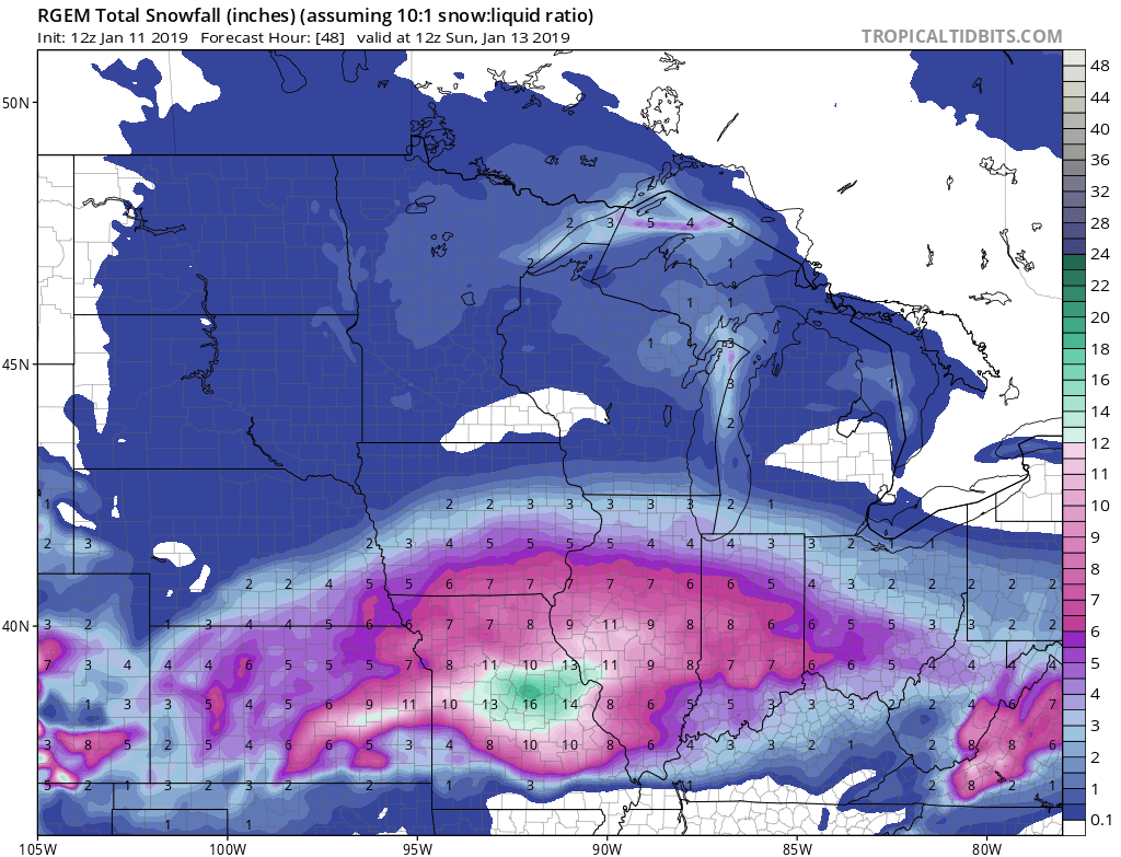
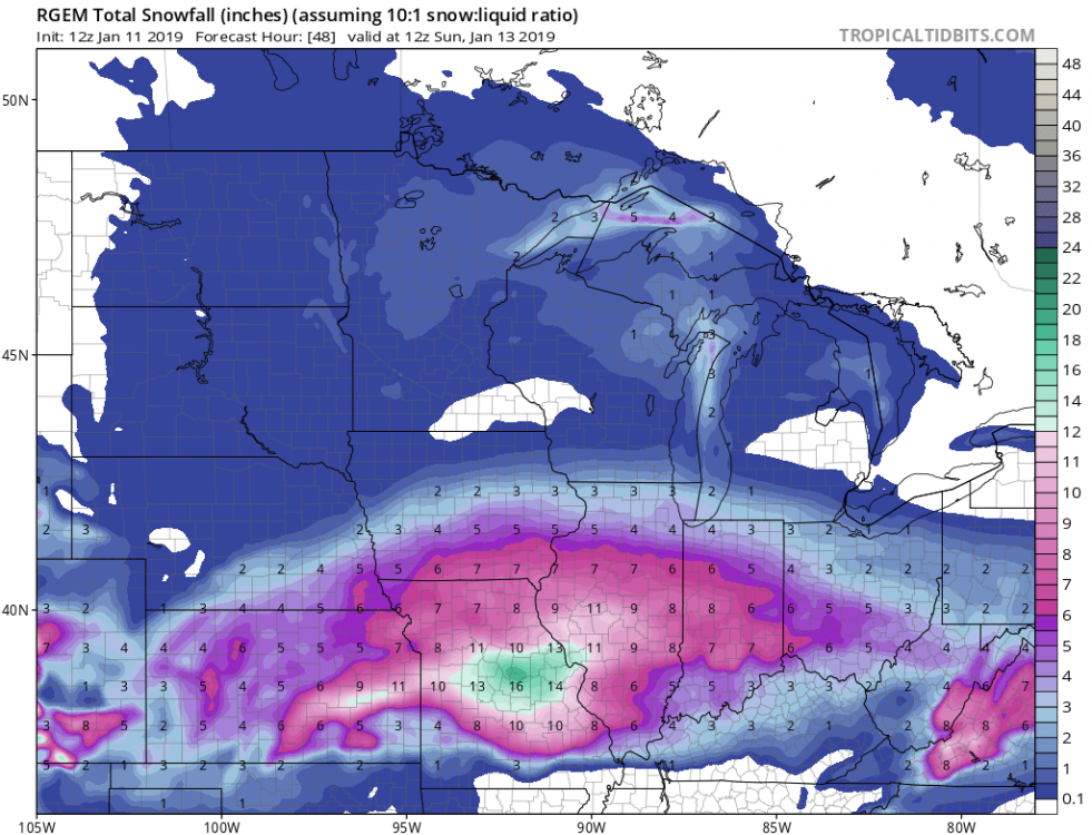
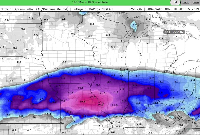
Yep, RGEM a little more juicy near I-80 also.
-
Yea, looks more like the FV-3. Brings heavier totals 3-5"+ totals right to I-80 corridor.
-
Yep, numbers continues to increase for DVN CWA also.

-
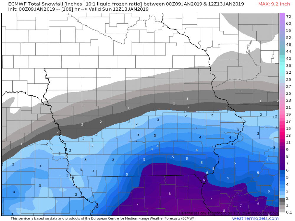
Just glanced at the 00z Euro and it def. had a generous bump in potential numbers for folks along the I-80 corridor in IA & IL. More in line with the NAM. Let's see if these trends continue or we start to go the other way in future runs.

-
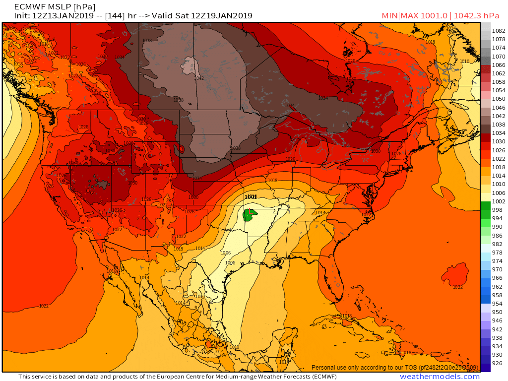
FWIW 12z Euro seems onboard with a system.
-
Yep, agreed. In fact temps have been off a bit in the models the past few days, leading to Friday's light freezing rain event here, and todays below forecasted temps. If trends of tonights 00z data continue through tomorrow mornings data set, i'd expect advisories to be issued for parts of central & eastern Iowa, and potentially northwestern Illinois. Looks like a light glaze of ice during the morning commute on Monday, followed by the potential for a few inches of snow by the afternoon & evening commute, especially along & west of the Mississippi.
-
This new wave of snow moving in this evening in Davenport is pretty impressive, especially with all this wind. A nice little taste of Winter at least today.
-
Nice little surprise! It was in the mid 50s here in the QC when I went to bed last night around 10:30pm, and I just woke up to some freezing drizzle and a nice dusting of snow on the grass and car tops at 5:30am with WWA in place for today. Looks like maybe a little better chance of some snow showers late morning into early afternoon as a new disturbance arrives from the west.
-
Winter 2018-19 Medium/Long Range Discussion
ams30721us replied to snowlover2's topic in Lakes/Ohio Valley
Surprisingly, 00z NAM still pretty excited about spitting out some light snow for portions of the Sub Monday night into Tuesday.