Disco Lemonade
-
Posts
21 -
Joined
-
Last visited
About Disco Lemonade

-
Simply incredible, one day I hope I can re live a storm like that. I know you've posted that once before wasn't that off midland?
-
Southeast Sanitarium - A Place to Vent
Disco Lemonade replied to Jonathan's topic in Southeastern States
Just missed me -
December 8-10, 2018 Winter Storm
Disco Lemonade replied to Orangeburgwx's topic in Southeastern States
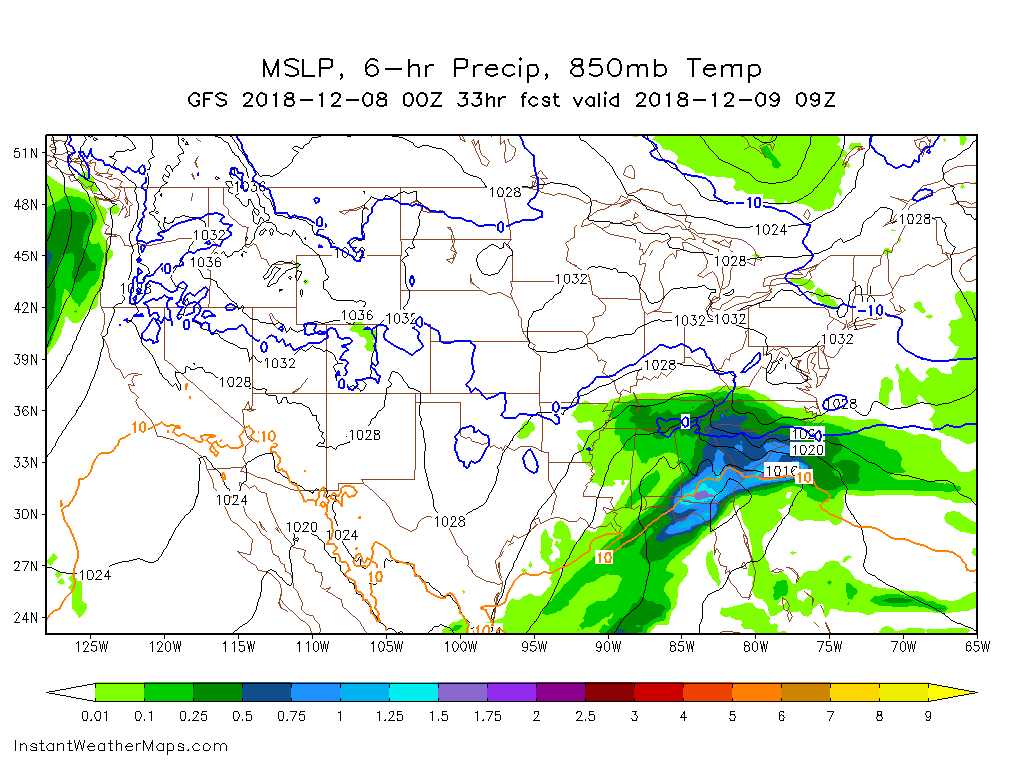
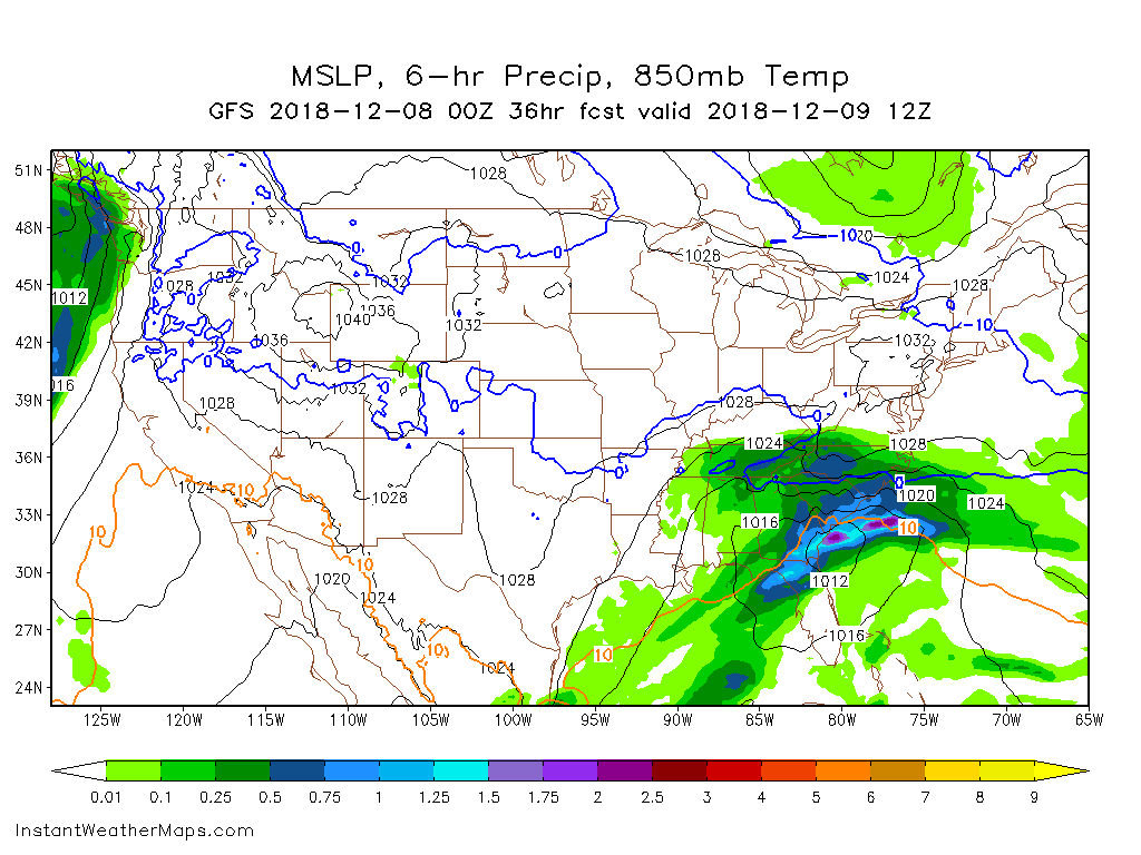
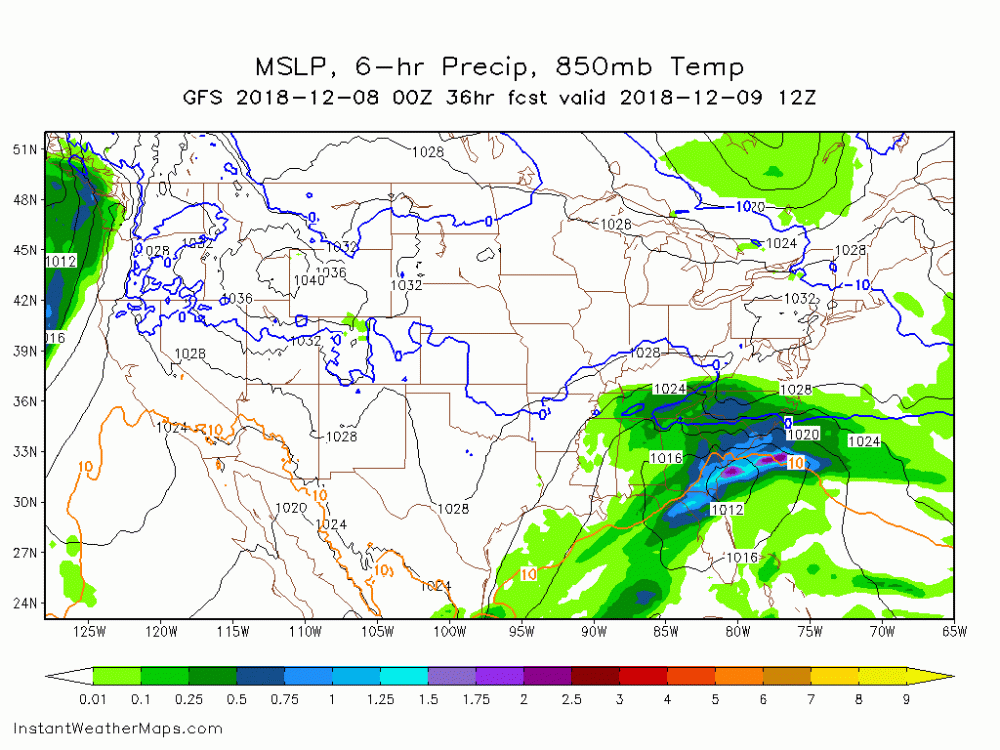
fwiw hr 33 0z gfs hr 36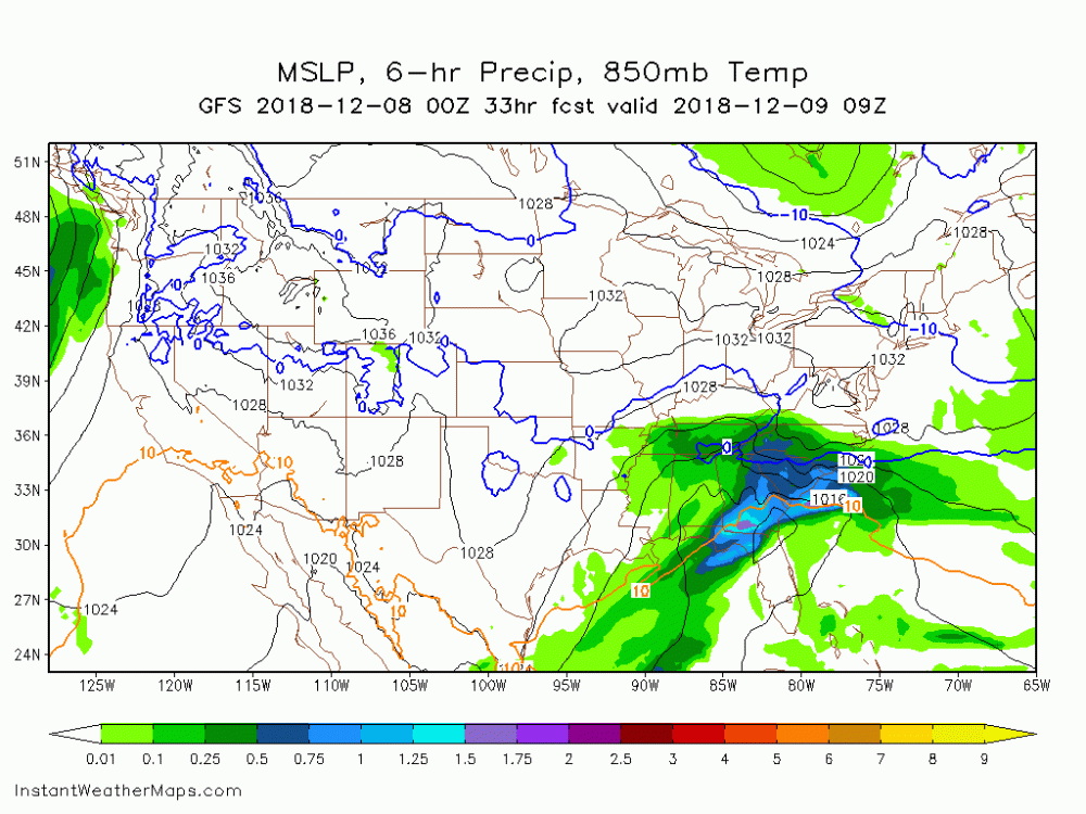
-
December 8-10, 2018 Winter Storm
Disco Lemonade replied to Orangeburgwx's topic in Southeastern States
Wow wasnt expecting this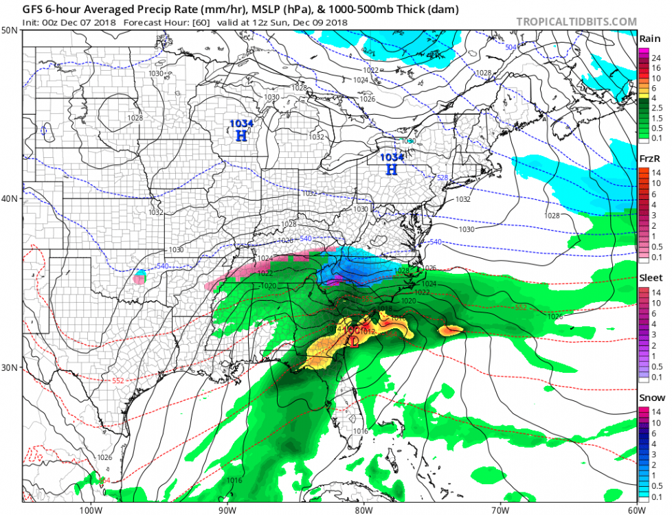
-
December 8-10, 2018 Winter Storm
Disco Lemonade replied to Orangeburgwx's topic in Southeastern States
It is this is non kuchera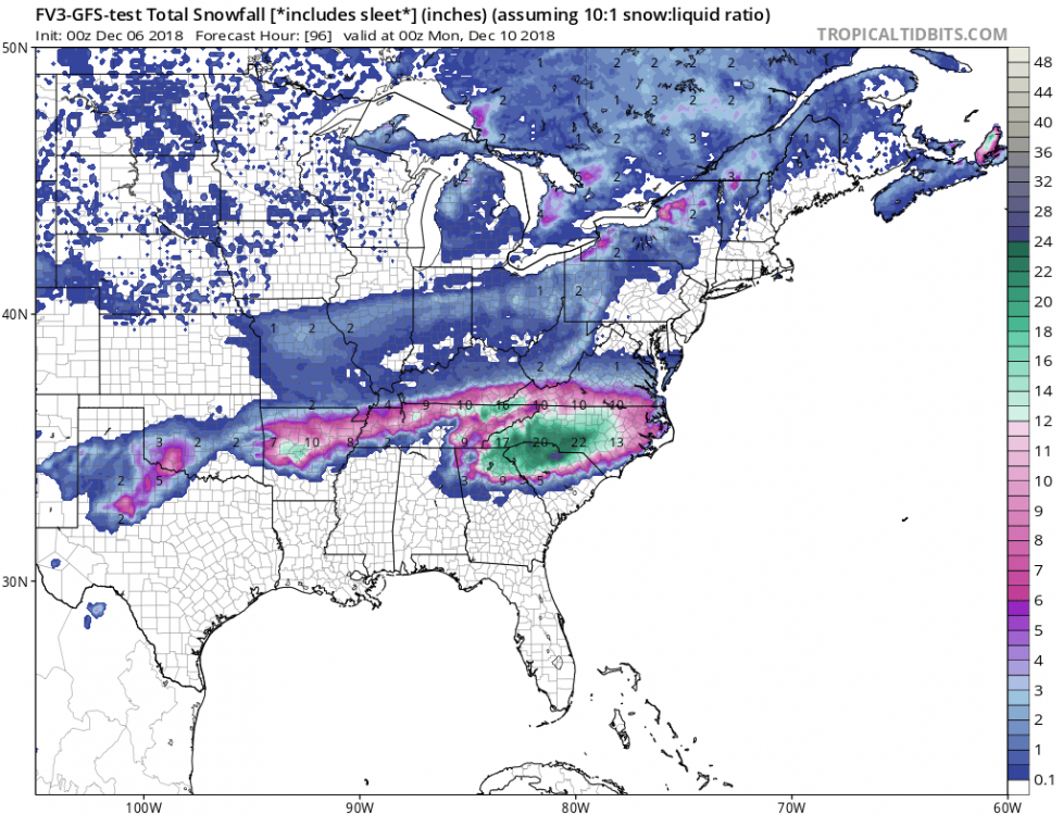
-
December 8-10, 2018 Winter Storm
Disco Lemonade replied to Orangeburgwx's topic in Southeastern States
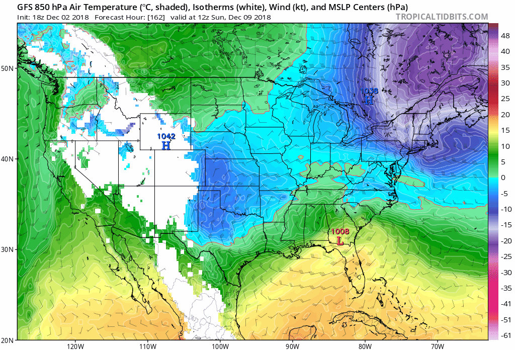
Interesting, GEFS really stalls it out. High really has the "banana" look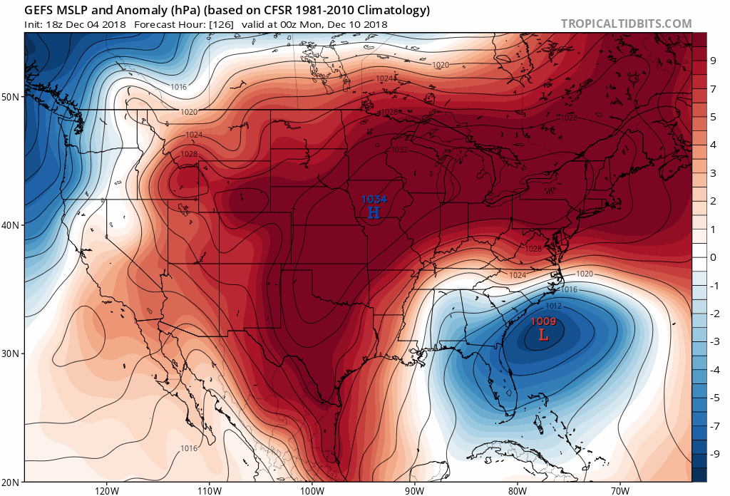
-
December 8-10, 2018 Winter Storm
Disco Lemonade replied to Orangeburgwx's topic in Southeastern States
GEFS is slower, maybe a touch south in some spots. -
December 8-10, 2018 Winter Storm
Disco Lemonade replied to Orangeburgwx's topic in Southeastern States
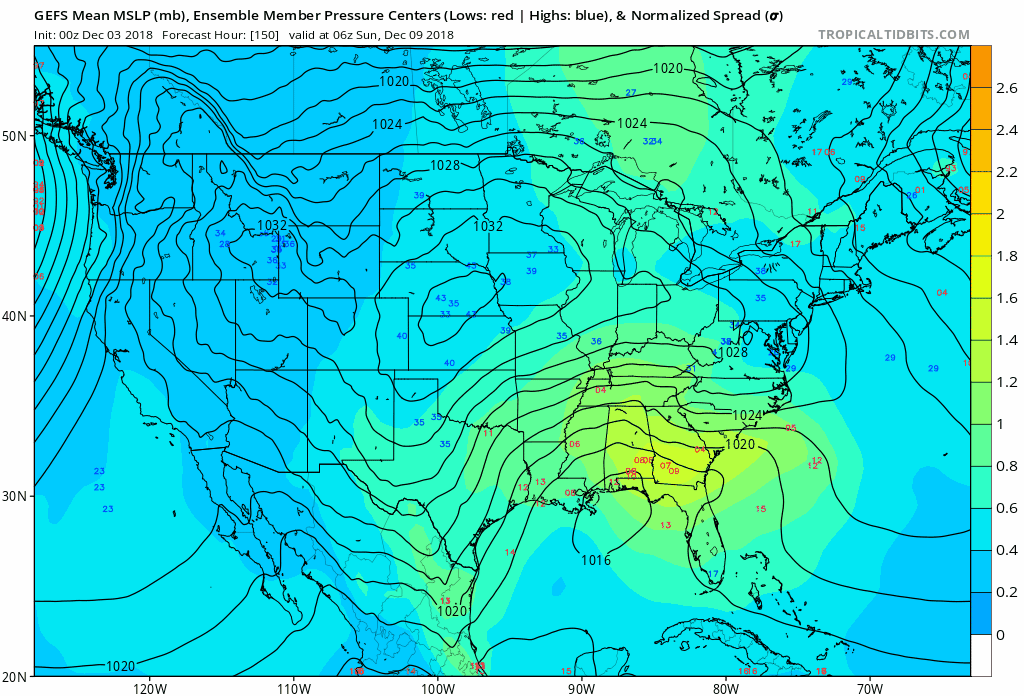
Check this out, I like the grouping of lows beginning to cluster around the southern Mississippi/ Georgia border. Then look at the next frame, cluster appears to have moved due east. Perhaps this may imply a track closer to the gulf?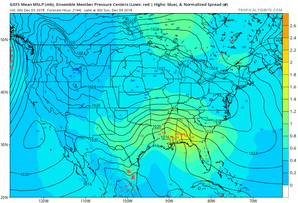
-
December 8-10, 2018 Winter Storm
Disco Lemonade replied to Orangeburgwx's topic in Southeastern States
Nice, wish I could be at the cabin this weekend. Winter looks to be getting off to a good start. Hopefully a sign of things to come! -
December 8-10, 2018 Winter Storm
Disco Lemonade replied to Orangeburgwx's topic in Southeastern States
Oh well, no worries we'll get ours in central NC this winter. Good thing it's still early. I think this will do well in the NC mountains, possibly a snow to rain situation as the low get worked up off the coast. Then as it pulls away I'd bet we see some flurries through the ped and sandhills... which lets be honest would be a huge win, more then I saw during the entire 2011-12 winter. -
December 8-10, 2018 Winter Storm
Disco Lemonade replied to Orangeburgwx's topic in Southeastern States
looks like GEFS continues the idea of a weaker low further south. This is what we want to see.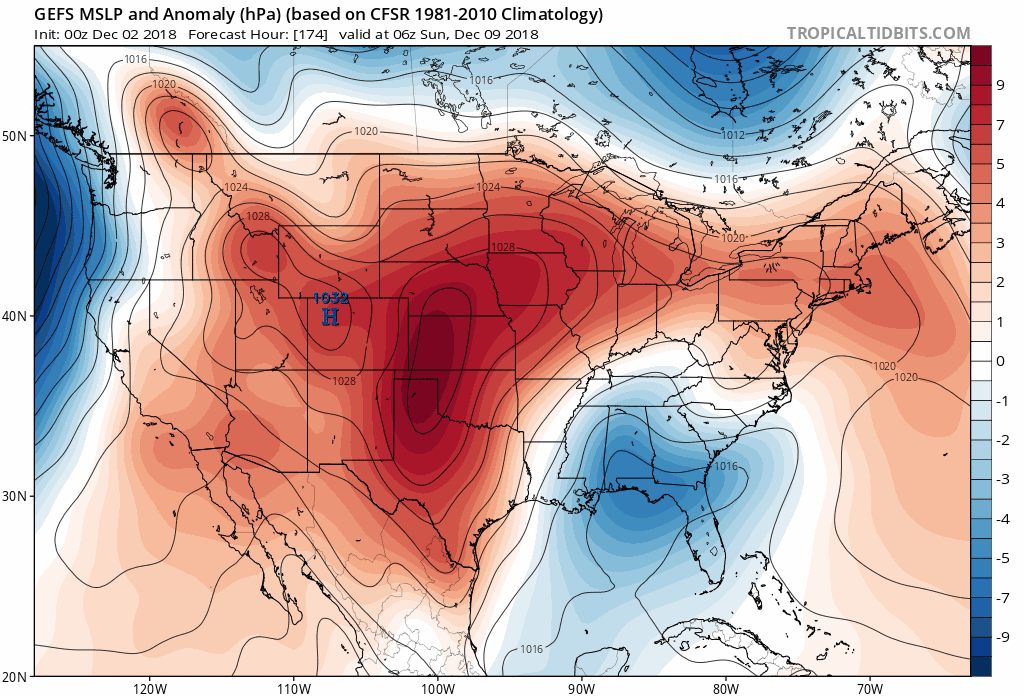
-
December 8-10, 2018 Winter Storm
Disco Lemonade replied to Orangeburgwx's topic in Southeastern States
Agreed, I feel as though we may be splitting hairs here. Funny it's actually colder...