MAG5035
-
Posts
6,054 -
Joined
-
Last visited
Content Type
Profiles
Blogs
Forums
American Weather
Media Demo
Store
Gallery
Everything posted by MAG5035
-
I think the biggest thing that would concern me for a possible detriment to a average or above average snow is the moisture aspect over temps given the very dry October into first part of November we just had. I’m worried about a longer term below average precip regime persisting. Hopefully, this much needed rainfall tomorrow associated with the significant frontal system pulling Nicole up will be a catalyst to get us into a wetter pattern. Otherwise yea I think we will see the usual Nina issues with perhaps more cutters than we’d like to see and some big temp swings. We tracking at a moderate Nina right now which is forecast to continue that way through at least the first half of the winter so there definitely will be some influence there. What happens with regard to the dominant pattern in the mid-latitudes and Arctic region (NAO/AO/ Pacific, etc) will determine whether we see much of the “colder” or “warmer” La Niña effects (or both). Again, my worry snow wise is having the cold but not the active wet pattern to go with it. I agree to a point with the reduced Nor’easter threat but SSTs in the Northwest Atlantic are significantly above average (as they have been this time of the year the last however many years it seems). The Nina influence may not be overly conducive to an active southern jet and a train of coastals but if we do get a setup for one, and we usually do a couple times a winter even in less favorable overall patterns.. those +SST’s would figure to be a factor into really winding one up. If we get a fast starting winter on the front end I think this would be the best chance for us to score something like that early since we’re further inland from the coastal plain (that region can be too warm with the +SSTs and a low that tracks too close to the coast in an early season storm).
-
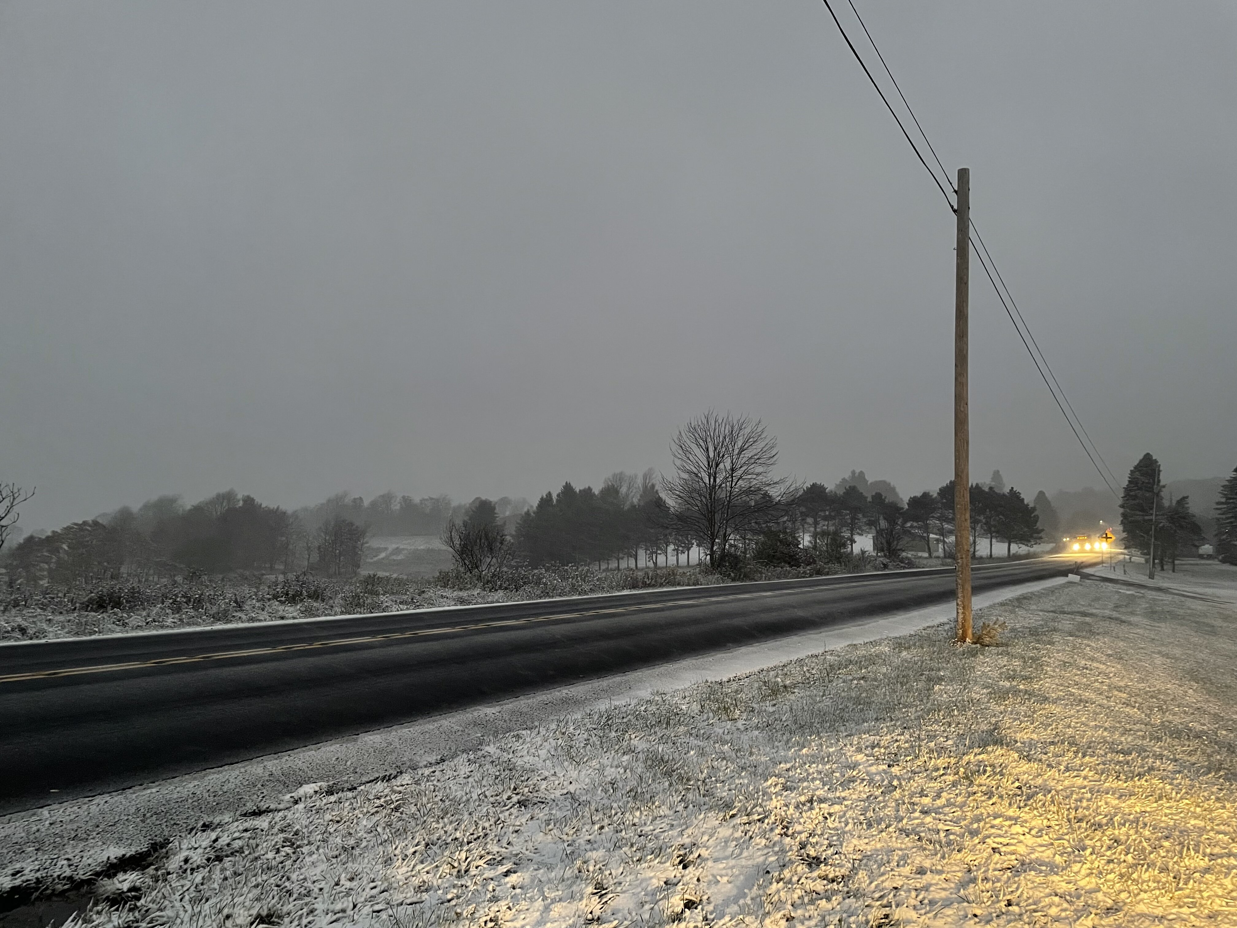
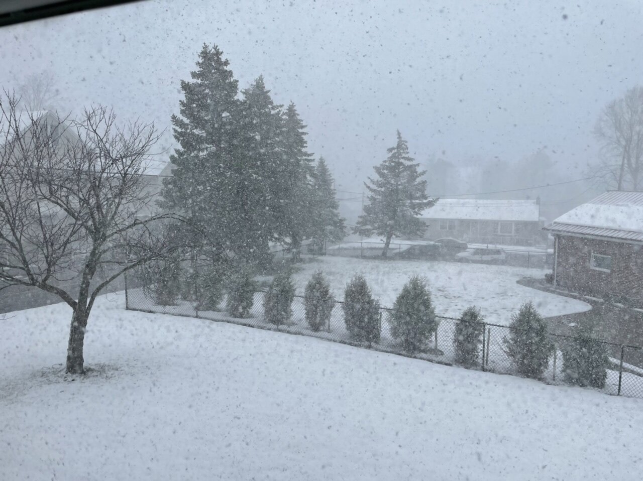
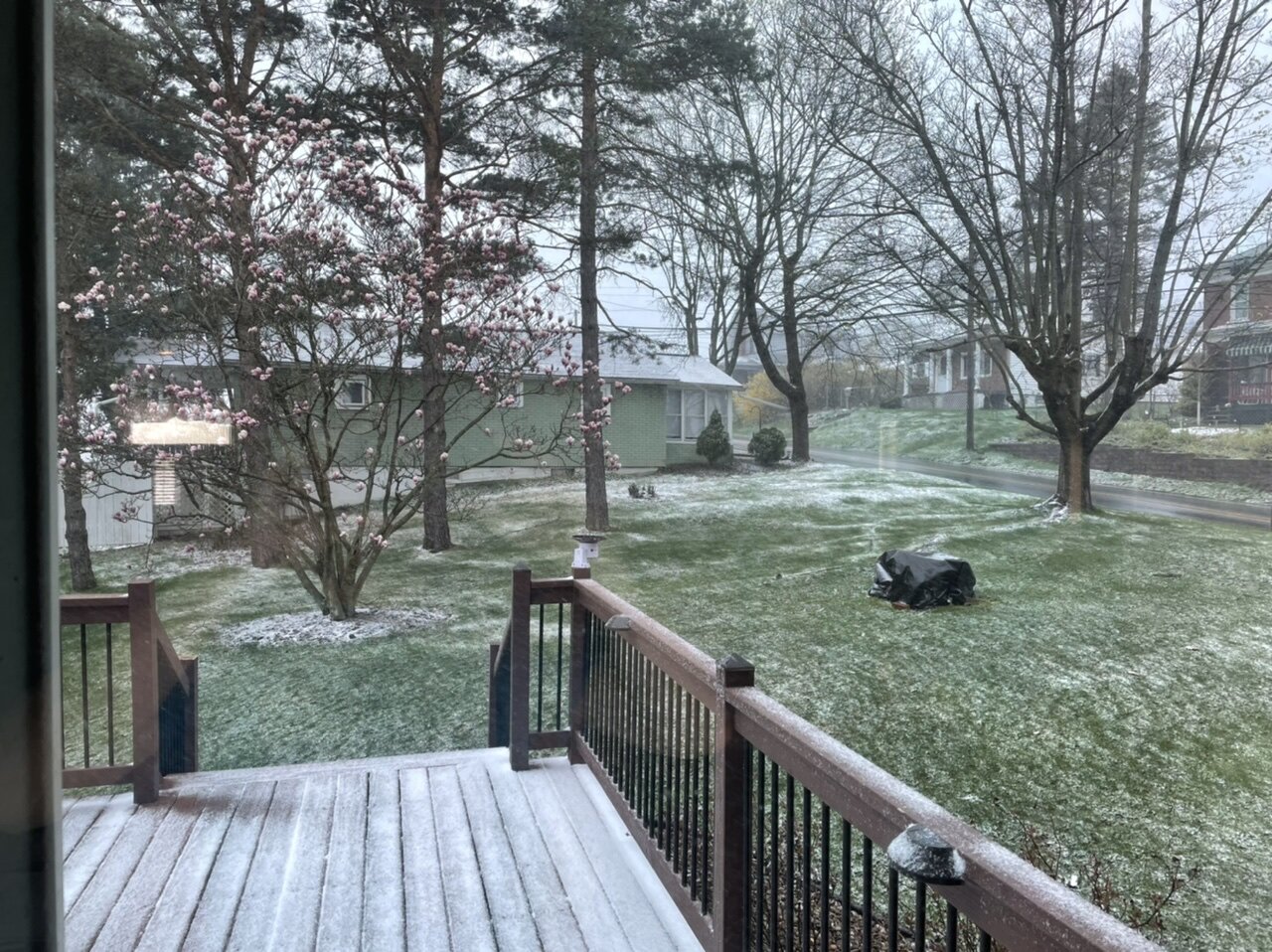
Here with the first snow/roads slightly caved pic of the season. This is a few miles west of Ebensburg in Cambria Co currently. Also I promise I’ll be back to posting more often soon. I’ve been really busy lately.
-
I would imagine you’ll get a piece of the stuff that’s just east of State College, but likely what you said with maybe some heavier rain and thunder/lightning. Mixed layer CAPE is trying to build into eastern PA but there’s also a good amount of CIN (convective inhibition) from the lingering cloud cover/much lower surface temps on that end of the state (not to mention current convection is shooting a lot of high clouds eastward. Really surprised at the lack of initiation of convection in south central PA though (west of the Sus where the sun really broke out). I thought that to be a ticking time bomb this afternoon given parameters and approaching front. SPC did trim but maintain the tornado watch, likely a hat tip to said parameters which are still good, but I’m not as concerned as I was this afternoon. There was really a split in convection between the north central PA stuff and the more robust stuff sagging south just west of Pittsburgh.
-
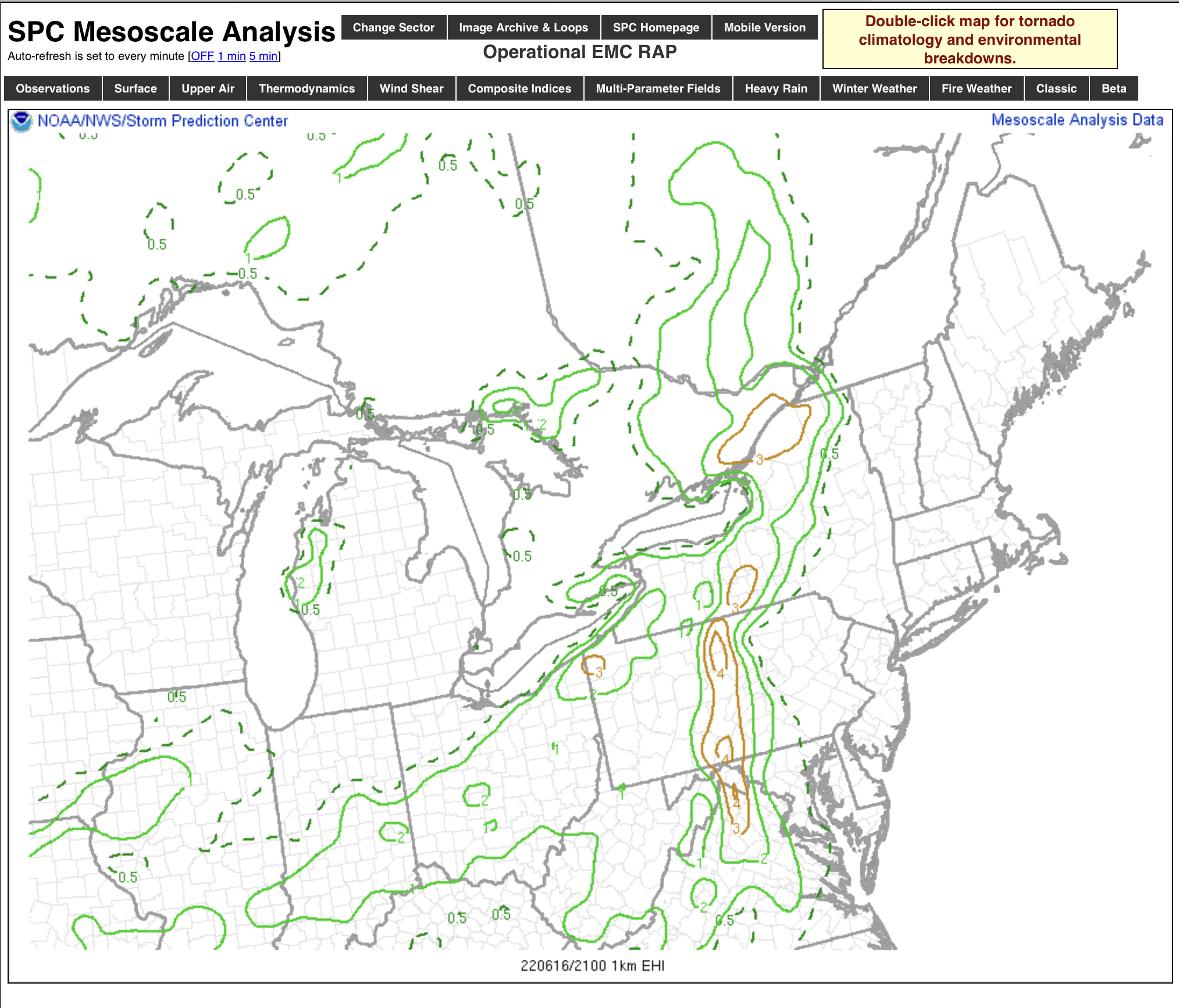
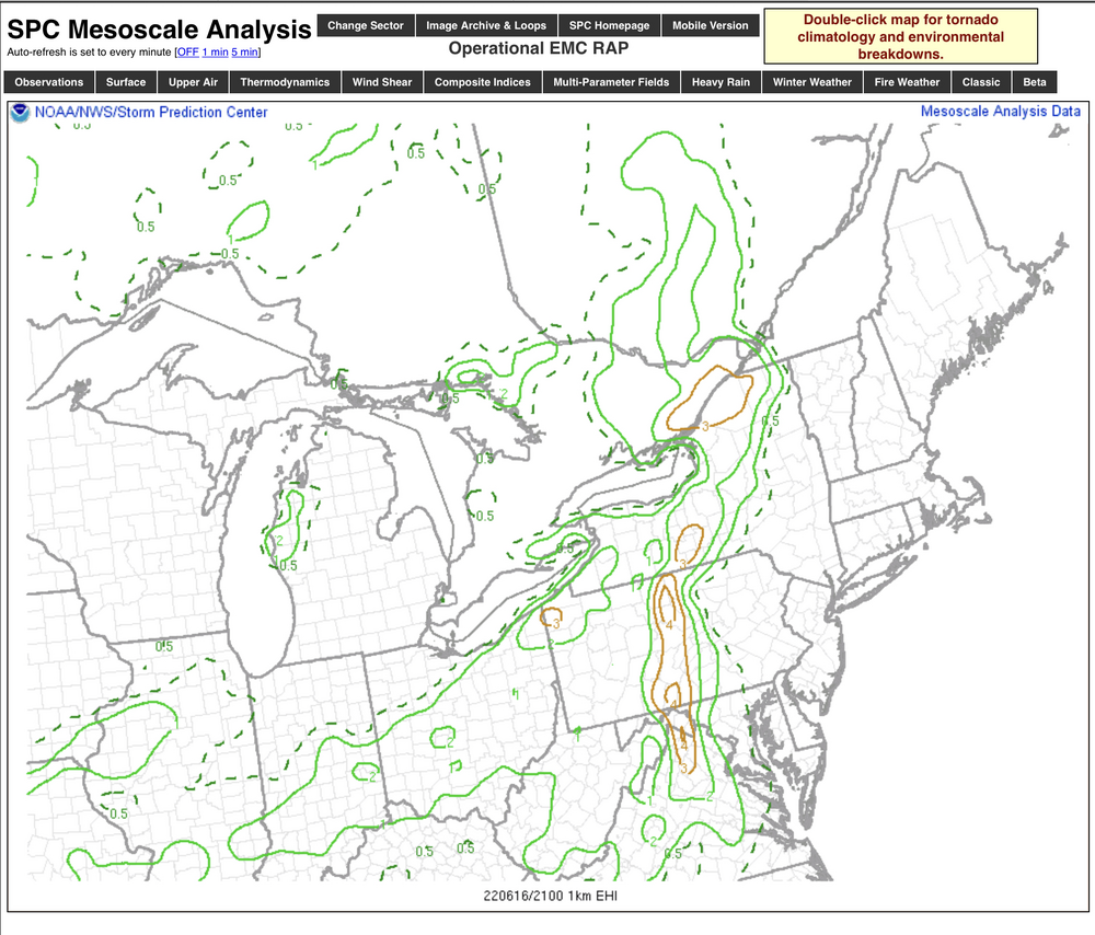
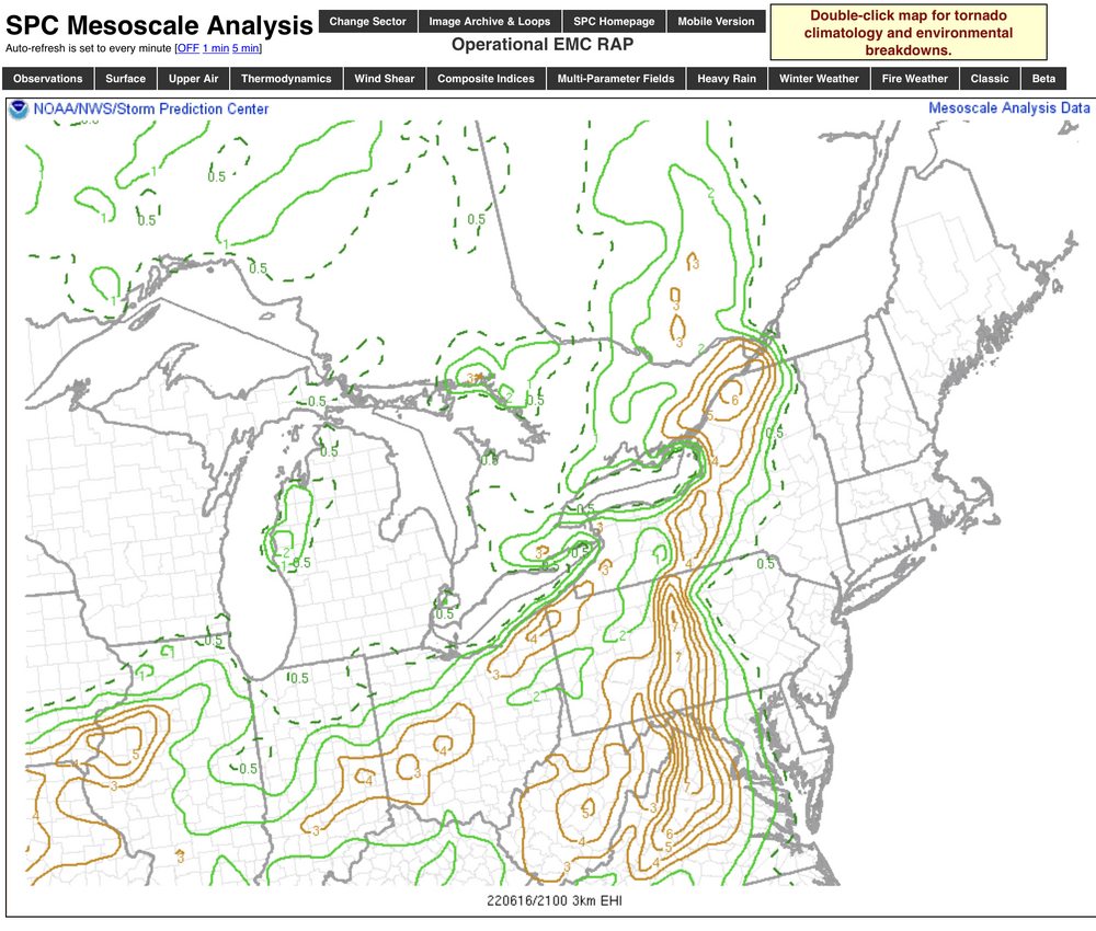
This is definitely one of the better summertime significant severe/tornadic type setups I’ve seen recently around these parts, at least “on paper”. Lots of heat, high dewpoints (at or above 70), large CAPE, high LI, decent shear, BRN values supportive of discrete supercells, etc. The combination of these has all the composite indices (supercell, hail size, significant tornado parameters) very high today on the mesoanalysis. The radar split is definitely notable right now, as the hole figures to translate into the portion of PA that has some of the best severe indices. With that said, the portion of PA between here and Harrisburg really needs to be watched for discrete cell action if it does fire up as the EHI values being generated there honestly concern me a bit. A 0-1km EHI of 1 is enough for possible tornadoes. 4+ is significant. And the 0-3km values are stupid high. This ribbon does extend up into northern PA where current action (and the Elk County tornado warned cell) are moving towards. I’d also look for the Sus Valley to become more favorable with the late clearing this afternoon. 0-1km EHI 0-3km EHI Significant tornado parameter
-
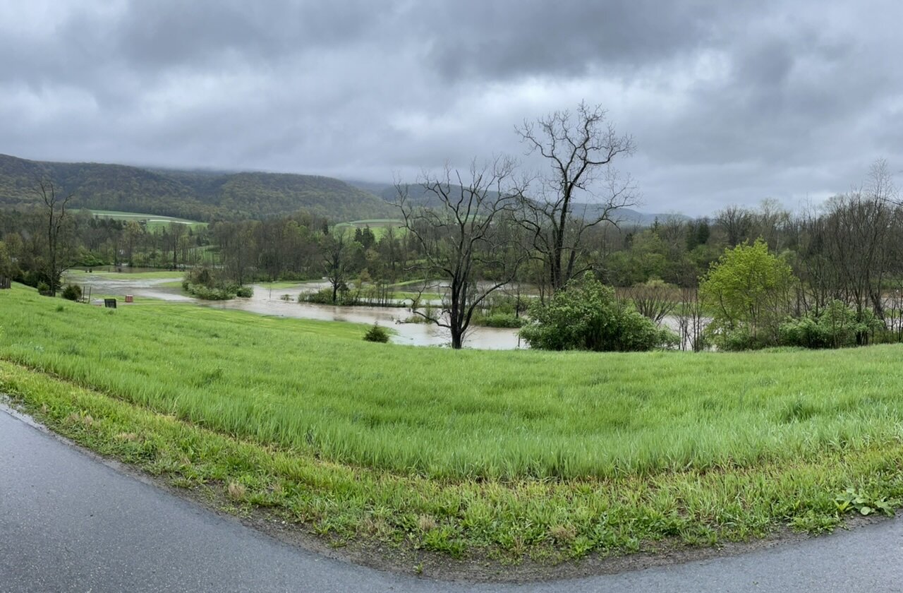
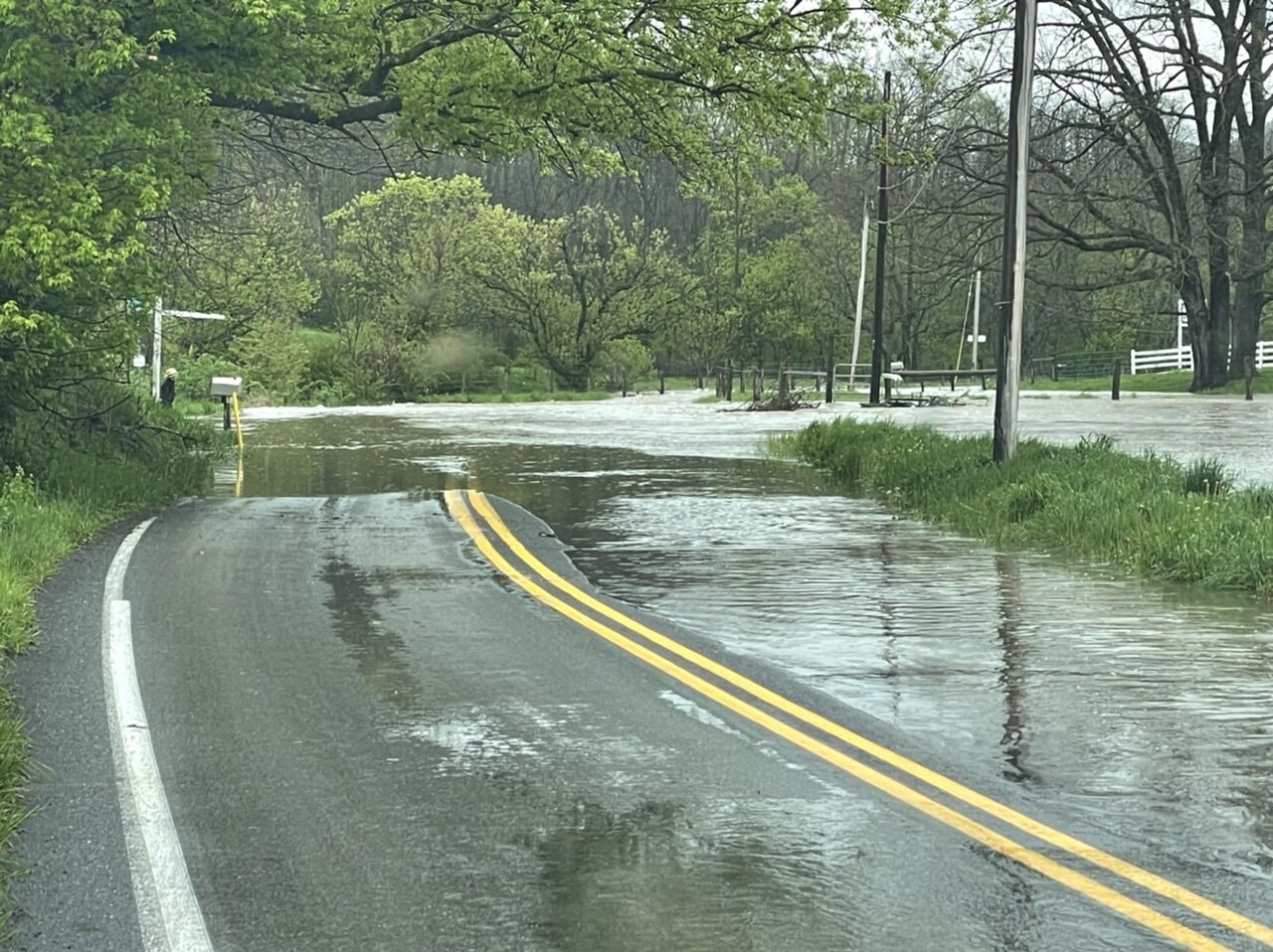
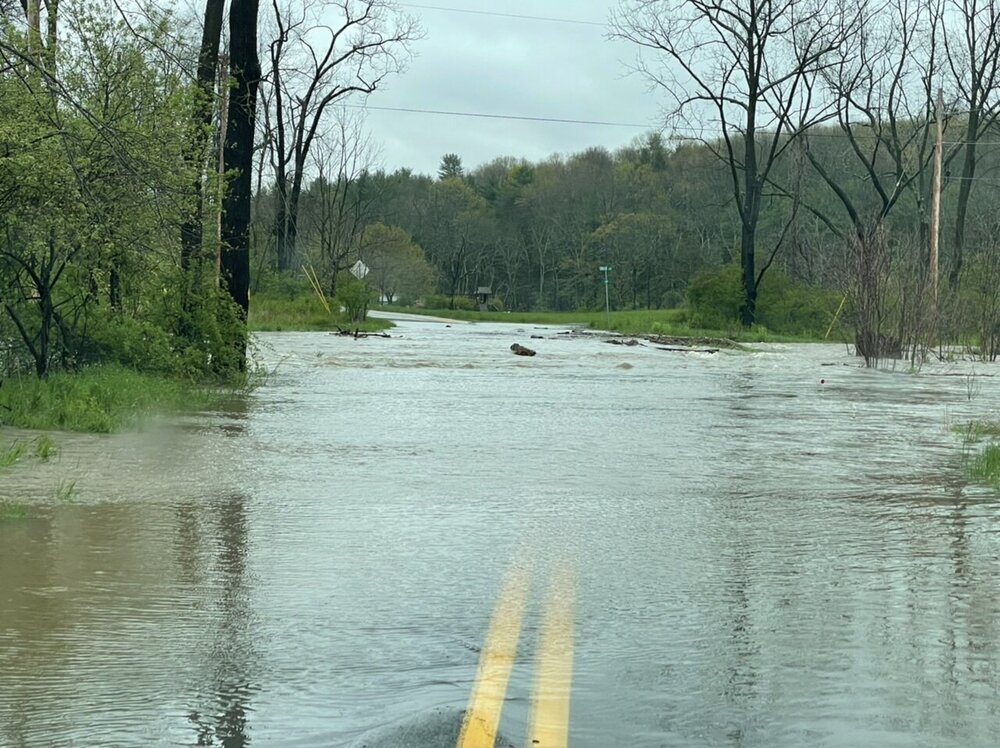
Well, I obviously would have rather seen a storm like this in the frozen form in Dec-Feb but I did score some flooding pics. This was in the next valley over from Altoona (Sinking Valley). Definitely lots of runoff coming out of that valley. These flooding pics are from a minor tributary, not the river it eventually feeds into. Fortunately that heavy enhanced stuff did stay east this afternoon or this would have been a much more significant river flooding event around here. The local stuff is currently cresting mostly in the minor category. Rain totals here at home are up to 3.71” for the event and also 5.07” for the week with the rain/thunderstorms we got Tues eve into Wed morning. That additional rain earlier in the week was likely a factor in why the Juniata basin was the more vulnerable area for this event.


-
Continued light to moderate rainfall currently. 3.58” is the total rainfall so far as measured by my gauge (Ambient WS-5000 station). 2.7” through midnight yesterday and 0.88” so far today since midnight. A check of other stations on the network around town have similar amounts as well (generally within a couple tenths of my amount). It looks like CCX radar has been low balling its precip estimates with this event. It has seemed mostly like a very efficient type rainfall and I wonder if a different VCP setting would be more accurate in that regard. Either way a really impressive synoptic event with the signature highly anomalous easterly fetch drawing in a boatload of moisture.. Minor flooding issues in the usual spots are ongoing, but definitely concerned this afternoon if that enhanced stuff lurking in between Harrisburg and Williamsport manages to back its way back into here. We’re at a point where a period of heavy rainfall is going to escalate flooding issues pretty quick.
-
I’m sure the higher Laurel’s ridges are racking some snow up with the strength of these squalls today. I probably would have added another couple inches here so far today if it was the dead of winter. I’m impressed that a good bit of yesterday’s snow is still on the ground. I’ll add that I have definitely been ready for the warmer seasons to take hold. The last several weeks have really reminded me of 2018. Most of that April was brutal too.
-
Spring is going to return later this week but definitely not today haha. Getting whacked with a snow squall at the moment.

-
Still some steady snow falling. The total for the event is currently 4.6” here at 1300’… the majority of which (about the first 3” or so) fell between about 12-3pm. I caved and brought the snowblower back to clear the driveway this afternoon. I got a rough measurement at the top of Wopsy Mountain 4 miles away (at 2400-2500’) at around 930. There was about 8” up there.

-
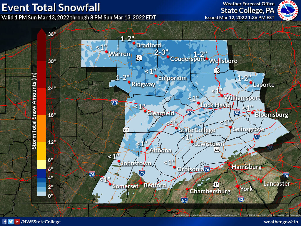
It’s right in the middle of the forecast range right now for the advisory, which for this county was 2-4 with up to 6 on the ridge tops. The ridges probably do have a bit more but in general the elevational component is out the window at the moment in this area. The key late this afternoon into part of the evening is going to be how the precip shield evolves as the coastal winds up. If we remain in the steady moderate to heavy precip which seems to be a possibility on the last couple runs of the HRRR than yea, this is definitely going to overachieve and probably be a warning event. But if we get a lull or miss the banding that winds up from the coastal, it’ll probably be close to what was forecasted. Either way, this is impressive for being right at the max solar part of the day.
-
Just measured 3.2”, still heavy snow and 31.5ºF. What a beat down.
-
I was about to say that the best part of this is that it’s probably the best synoptic rates I have seen the entire season and it’s happening on April 18th.

-
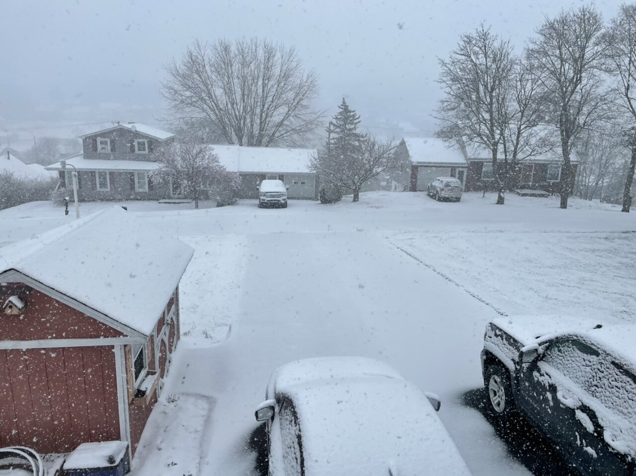
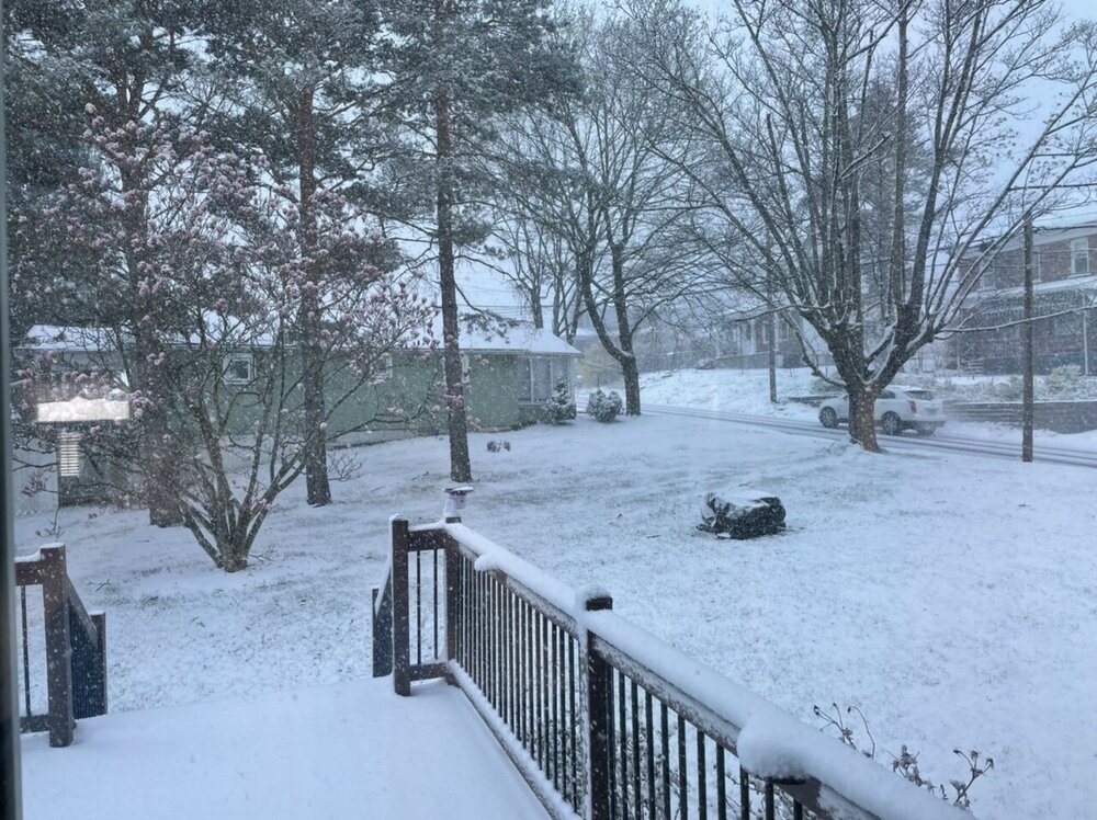
Past an inch on the ground, it is pouring snow right now. All paved surfaces are caving. Temp is 31ºF.
-
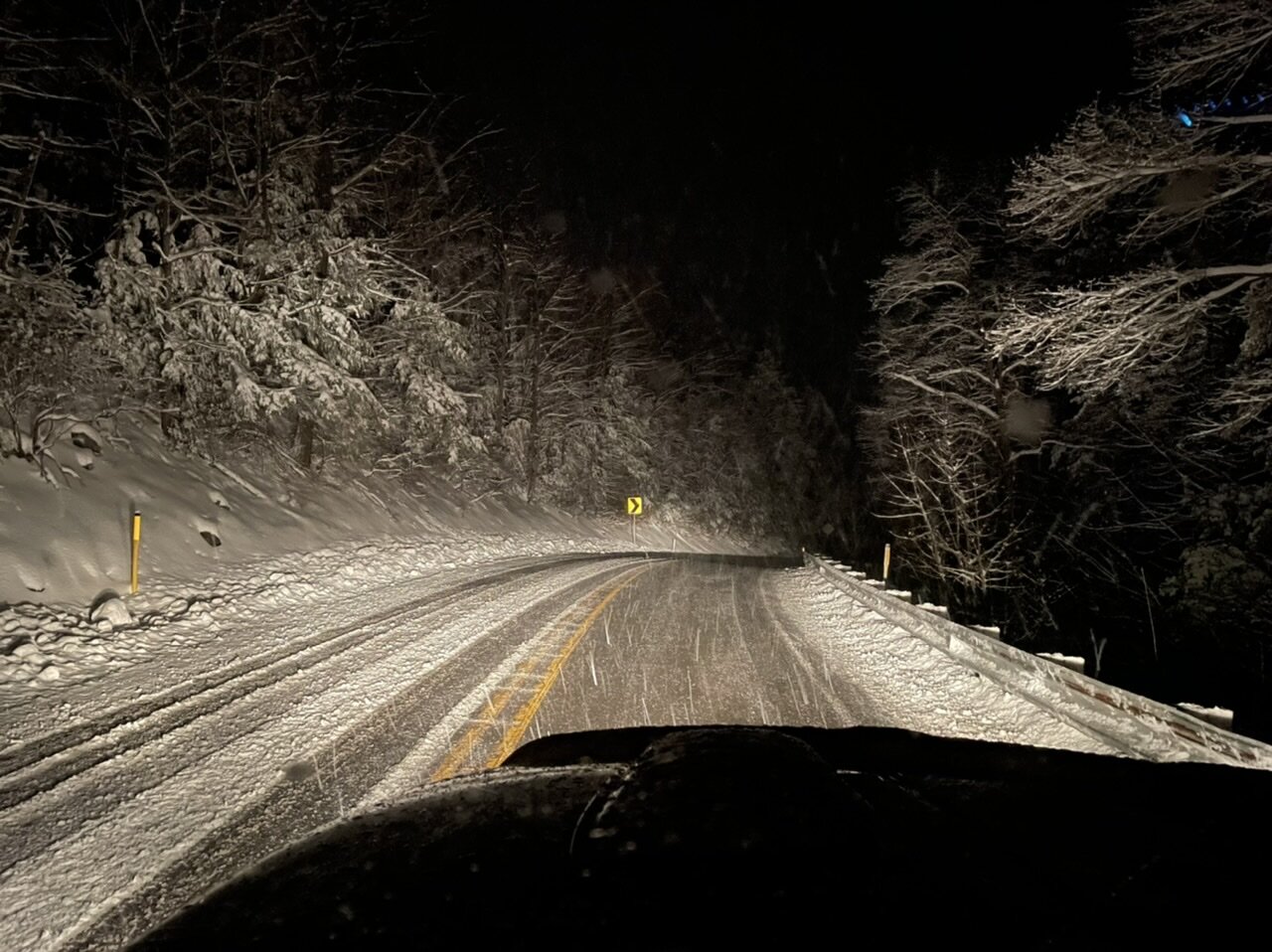
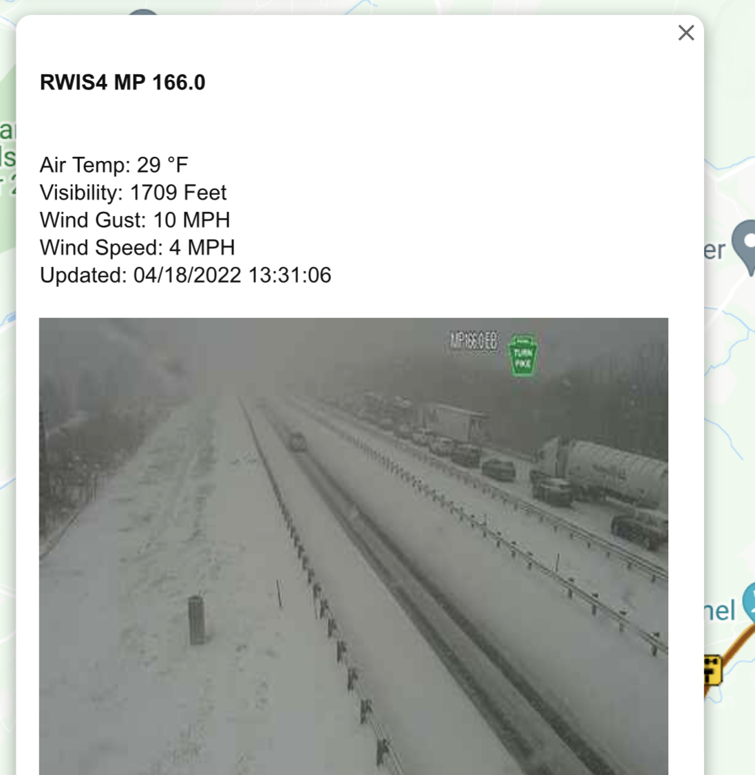
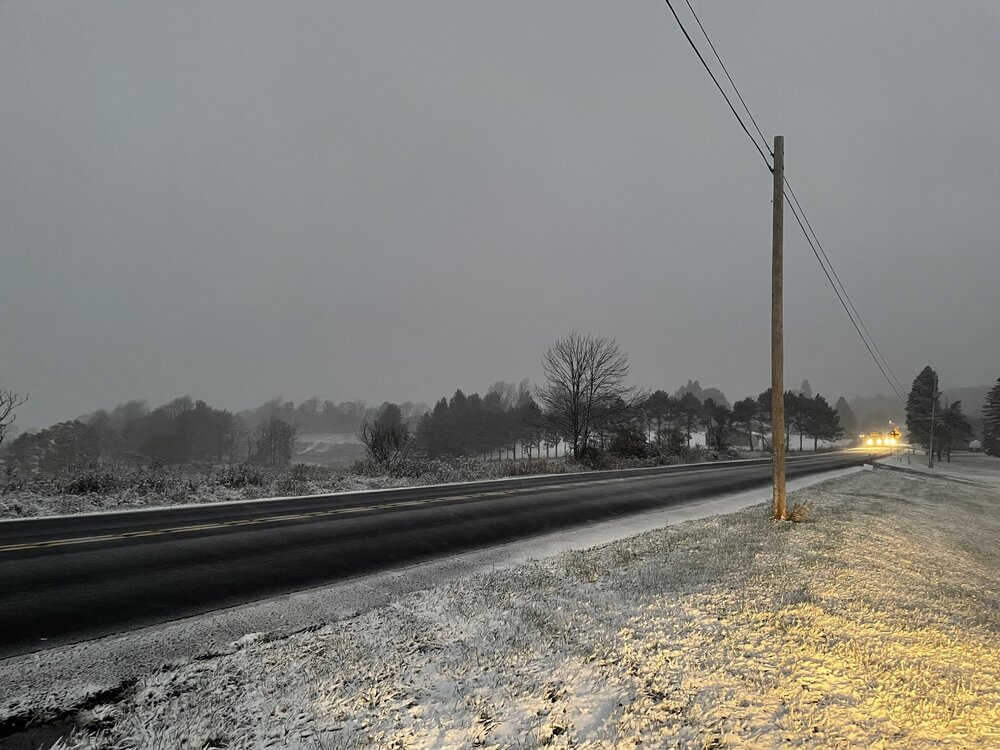
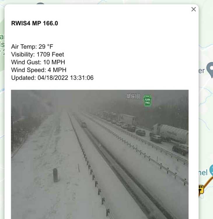
Even the turnpike is fully caved. It seems like Bedford and Fulton are getting whacked right now. This screen grab is just east of Breezewood. That stretch from Bedford to Breezewood is all covered. This was what I was alluding to yesterday with all bets being off regardless of elevation if we had heavy rates collapse the column and a quick/clean transition to all snow. That stretch of the turnpike is not a high elevation area other than the Sideling Hill area.
-
Snow rates have really increased with a pretty heavy rate currently. Temp is down to 31ºF and accumulations are starting to occur on most non-paved surfaces.

-
Over to all snow now with 36/21. Some 511 cams already have snow on roads down in Somerset County, even on the turnpike near the Allegheny Tunnel and also 219 near Meyersdale..
-
Light precip just commencing here on a pretty stiff southerly wind gusting to about 25 mph or so. Mainly pingers so it’s already a frozen form. Temp is 38ºF but the dewpoint is 18ºF, so I expect a clean snow transition and a quick temp drop to freezing when the much heavier stuff on the doorstep arrives.
-
Some trees have blossomed out along with stuff like daffodils and Magnolia blossoms but at least in this area there is basically zero leaf out of anything to this point thanks to what has been quite the bi-polar month that has been chillier more often than warm so far. And that’s down here at this elevation in the valley (and also in town), so fortunately if there are significant amounts that aspect shouldn’t be a factor.
-
It took a minute to jog my memory since I was thinking of another late April cold snap and snow but yes I remember this storm. In fact, the C-PA thread at the time is still back on about page 10 of the Upstate NY/PA forum ( I linked it below). Obs/pics were discussed roughly in the Page 18-20 range and I didn’t get too far into it but I’m sure there was plenty of lead up discussion. Really shows that the C-PA thread has been going for a long time (with several of the same personalities as well) haha. Anyways, I think that storm was a stronger one but I do believe this one might have better preceding cold. Certainly at 850mb.. this event looks to be starting tomorrow with temps at that level easily below 0 in central/eastern PA. We actually don’t need the dynamic top down cooling to initiate changeover as it will already be cold enough. It’s a matter of overcoming warmer boundary layer temps which is where the elevation factor/solar/timing plays in. Back with that 2012 storm, it went from zero accumulation in the valley to 6-10” at the top of the Allegheny Front here. I honestly don’t expect that kind of variability with this as I’m expecting something notable on the ground at my spot (at least a couple inches). This probably doesn’t have a problem mixing with snow in a lot of places into the Sus Valley but if there’s a clean transition period in some region of C-PA with heavy rates then I think all bets are off and decent accums happen in lower elevations as well. I still think you need to be above 1000ft and west of the river for seeing any accums.
-
I think it’s possible it could mix with snow some in the metro areas, or certainly at least the Harrisburg area… not sure about all the way in York/Lancaster though I certainly wouldn’t say the chance is 0%. I do expect it’ll be mainly rain SE of I-81 except for some of the ridges which may have some snow and maybe some minor accumulations. The low track’s pretty good if not a tad inside but it’s a matter of getting cold enough air to the low levels in eastern PA and this is a more dynamically driven setup with getting it cold enough. So I don’t think it’s quite there to get much into the Sus Valley. Between here and the Susquehanna River in the ridge and valley region will likely present the greatest variability in potential snow accums from an elevational standpoint with the deeper valleys. This is probably a >1000’ elevation type deal to see accums and like a >1500-1600’ to see advisory+. A total collapse of the column and heavy rates could mitigate the elevational variability but that seems mostly likely to happen deep in the central and esp northern part of the state.
-
Had some flurries this morning. This makes it 2/2 for snowing on Sunday this month and the last 3 Sundays in a row.. I’ve been fairly busy and not able to post much but have been keeping an eye on tomorrows system. It did catch my attention that models across the board have been pretty robust on accums the last few days in the central counties and it looks like CTP is finally starting to oblige to that reality with ramping up their grids. It’s probably not enough either. Laurel’s and north central counties are likely looking at some kind of a headline event. This is obviously a highly diurnal and elevational situation, seems like arrival of significant precip is slated for the late afternoon and going into a good bit of the evening. It looks like a pretty decent slug of moisture so that coupled with the developing coastal low will probably promote a quick changeover to snow in the central counties and remain so if rates remain steady and moderate to heavy. If it’s heavy it will eventually accumulate on most things despite all the ad nauseam springtime disclaimers, especially getting towards the evening (after 5 or so). Not sure what to expect here, though the top of Wopsy 4 miles up the road from me at 2400’ (and similar elevations in the Laurels could get a lot of what the new 3k NAM is throwing down. Down here? It very well could end up an advisory type event with a quick decisive changeover and heavy rates. Certainly expect to see some kind of accumulation at this point being at 1300’. I will say the overwhelming factor in favor of me seeing 8-10” is the fact I rolled the dice and I pulled the mower out of the storage garage and put the snowblower away yesterday.
-
Definitely, and he barrels up on this wreck seemingly unaware at a point when people are out of cars and stuff is on fire. Do a lot of truckers just not utilize things like CB radios as much anymore? And I even hear a CB radio in the background toward the end of that video.
-
Temp was briefly under 20ºF with the passage of a brief snow squall. 25.5ºF is as high as it’s gotten this afternoon. Peak wind of 41mph today. Just a brutal day as March 28ths go.
-
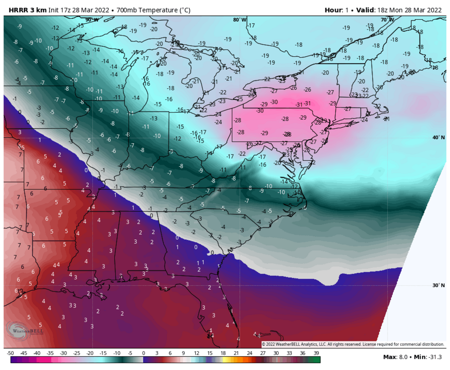
Insane cold temps aloft today, certainly a big driver in terms of lapse rates and instability with these snow squalls today and their long reach away from the lakes/mountains. Then you add in the late March solar/diurnal component. Core of cold at 700mb is moving over PA this afternoon with near -30ºC temps. Given heights, that’s only at approximately the 9200ft level. You have to go above the Arctic Circle to see similar cold at that level anywhere else in the N Hemisphere.
-
Well for some of the western and northern zones, that next nugget comes tomorrow in the form of a sneaky clipper haha. I don’t think much of that will make it into the Sus Valley though.