BooneWX
-
Posts
3,669 -
Joined
-
Last visited
Content Type
Profiles
Blogs
Forums
American Weather
Media Demo
Store
Gallery
Everything posted by BooneWX
-
4.85” - Granite Falls NC
-
Per recon data, it looks like the beginning of the RI cycle might be commencing.
-
It’s definitely ticked east overnight in real time and on guidance. The caveat I didn’t mention last night in my response is that a big storm is likely to resist the tug as well regardless of strength, so I think we’re seeing that. We’re really in territory we haven’t been in for a while. I feel like we’ve been spoiled with tight compact storms for years and we finally have a large lumbering beast.
-
1.58 last night, that’s almost 5 inches in the last 48 hrs at my home. Lake is looking high this morning and we’re not even close to the main show.
-
@Shackive honestly had the same question for a while but most of the hurricane models have initialized as much as 10mb too low compared to obs from hurricane hunters. Sort of speaks to the need this nation has for better funding and resources being allocated to our weather data.
-
I can’t directly speak to the reasoning behind the NHC being on the western side of guidance but if I had to take a stab at it, we have a complex interaction with the upper level low over the Ozarks. I think they may be banking on Helene feeling that tug to the west a bit more than the models indicate. Also important to note that the models are initializing Helene as a stronger cane than it currently is. A stronger system will resist the tug from the ULL and try to go more poleward. Since the models seem to be overdoing intensity at the moment, they’re probably going to be spot on with the track being further west than guidance.
-
Also Blowing Rock was hit by a tornado this evening. I ironically almost zero metered it out of pure chance driving back from a Boone meeting. Shoutout to @Tyler Penlandfor the coverage he’s getting on the socials rn!
-
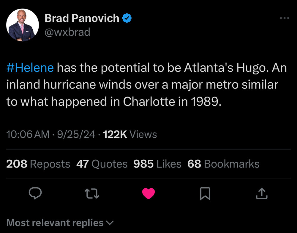
Edit: he said Atlanta but obviously that includes everyone south
-
I’m afraid this is going to be a generational wind event for you guys and all of Georgia. Brad Panovich said it well today: “this is Georgia’s Hugo.”
-
Storm discussion aside - sending everyone prayers and positive vibes this evening as we begin what’s likely to be a historic event for this region, impacting many folks harshly. I wish I could use the term historic to describe a winter storm but this is what we have for now!
-
SW Nc may get Hugo’d based on some of these wind estimates.
-
Helene now appears to have a closed eyewall per Cuban radar. She’s primed for takeoff.
-
The consistency of the icon and gfs have me nervous
-
You can already see the southerly flow really cranking on radar. We’re going to have some overachieving cells this afternoon.
-
An image worth archiving
-
We’re in rarified air. WOW.
-
I don’t know how much stock to put in the in-house models for weather stations but in Brad Ps update, the winds were knocking on the 70 mph door outside of the high elevations as well.
-
Interesting battle going on at the moment: globals are west slightly from yesterday but 3 out of the 4 hurricane models have wobbled east and like the idea of landfall near Steinhatchee and Perry. Impacts are widespread regardless but an eastern nudge wouldn’t bode well for us in Western NC.
-
3.03” of rain since 5 pm yesterday
-
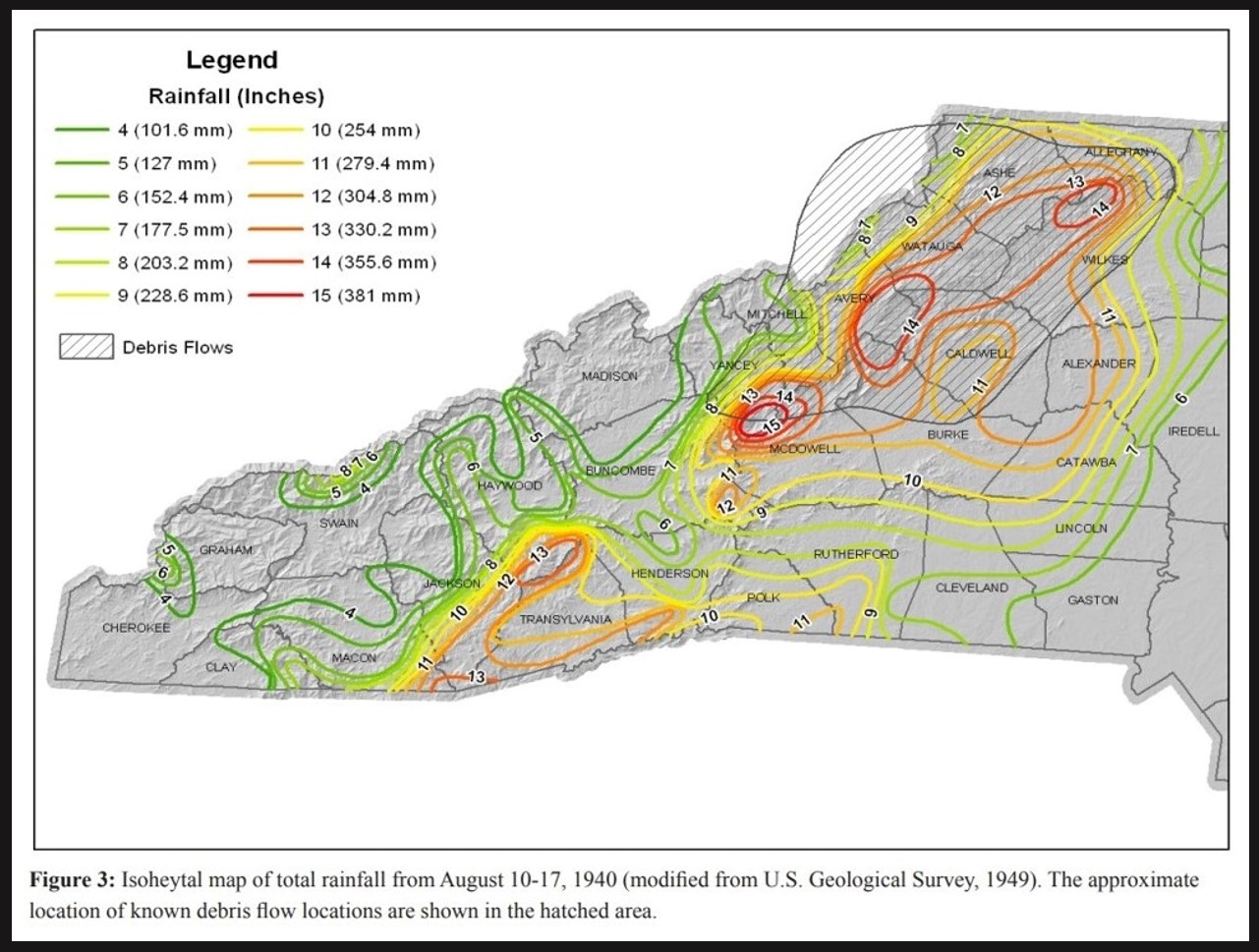
Digging around tonight into some local history. These were the rainfall amounts for the great flood of 1940. While idk if we hit the maxes in the illustration, this storm certainly will dump elevated totals on a larger area. In short - worried about everybody but especially worried locally for the Wilson Creek gorge and those downstream of Johns River and the Catawba.

-
If the coc gets a close shave with the Yucatán but doesn’t make landfall, we could also be looking at friction with the coast tightening up the primitive core.
-
Respectfully, every wobble right now could have major impacts downstream.
-
Quite the wobble north on the last several frames. This could have major impacts downstream. Sheer is nearly gone, outflow is starting to establish a nice moist envelope ahead of it. If it can avoid landfall in the Yucatán…. Bombs away. I’m actually wondering if a close shave with the Yucatán could be a worse case scenario. Friction with the coast could tighten up any primitive core quickly. That scenario would also lend credit to the models projecting landfall just north of Cedar Key - which increases the odds of putting the remnant core directly over western NC and the Upstate.
-
It looks like it’s moving due north quickly at the moment. Worth monitoring.
-
We went from dry to wet as a region at exactly the wrong time.