

AMZ8990
-
Posts
1,167 -
Joined
-
Last visited
Content Type
Profiles
Blogs
Forums
American Weather
Media Demo
Store
Gallery
Posts posted by AMZ8990
-
-
3 minutes ago, John1122 said:
Winter weather advisories are up for the Western Valley, from Eastern Arkansas, West Tennessee, Northern Miss and SW Kentucky.
Ice should develop overnight in these areas and transition to snow by tomorrow night. 1-4 inches look likely across most of the Western Valley with isolated spots possibly going higher. Per Memphis NWS the area will spend 48 hours below freezing just above the surface with surface temps struggling to rise above freezing. Very impressive event for any month there, let alone mid-November.
There is also a chance of some brief freezing precip in the far NE Valley, though that may be contained to Western North Carolina.
Thanks for making a thread John, I didn’t want to do it myself cause I didn’t want to jinx it! Haha. Looks like it’s gonna be an interesting couple of days. It’s definitely an impressive event, I’m anxious to see how it all pans out.
-
5 hours ago, Carvers Gap said:
Just looking at the evolution of the past few runs of the GEFS and EPS, I am growing more confident that the beginning of December will open cold. I never say it is a sure thing, because one year it looked awesome and went poof! That runs against my idea of a slightly AN idea for December...but I am fine with that. Very tough to nail a seasonal forecast with consistency. But hey, it does open the door for a thaw later during the month...so it might still verify depending on the early departures. Like I said, my preference would be for the cold to arrive during the second or third week of December. I like Christmas cold. Again, if you haven't read isotherm's winter forecast, you need to get your hands on it. While it does not fit my ideas exactly, I think for us hobby folks...we can learn a lot from something like that. Again, I am putting most of my LR stuff here so as to give the middle and west TN folks room to discuss the short term this week.
As a side note....instead of rolling the Winter Speculation thread into the Winter thread. I suggest in a week or two that someone create an actual December thread. IMHO, we are just about into actual forecasting mode as the EPS and GEFS will have Dec 1 well on their radar by then. And this year, I would suggest doing separate threads for each winter month as last year's winter thread became a monster! For example....December 2018 Winter Discussion. That is not the gospel, but just a suggestion. I think it will make things a bit easier to find during later years....
When I see December show up on the LR models in a few days...I know it is "game on" or whatever young folks says these days! Ha!
I will make a December 2018 Winter Discussion thread right around thanksgiving CG.
-
 2
2
-
-
9 minutes ago, John1122 said:
Many times it's where the maximum amount of moisture that can still fall as frozen will set up. Basically the colder the atmosphere the less moisture it holds. It seems to play out often when it's snowing south of here along the northern gulf states. You'll see an area around 20-40 miles north of the rain/snow line that gets hit harder than surrounding areas.
Ok Cool, that makes perfect sense. Thanks for explaining! Hardeman County is now under a Winter Weather Advisory from 3AM wendesday to 6:00AM Thursday. First one of the new season!
-
38 minutes ago, John1122 said:
Right where the rain/snow line sets up will probably see the heaviest snow, tough to ever tell with these systems though, wobbles of 30 or 40 miles have major effects on the ground. I'd like my chances best in SW Kentucky or NW Tn still, not sure that the totals the models are throwing out will verify but I'd say they might in isolated areas. It's usually not a bad idea to shave off 40 percent of what they show.
Great point John! I’m just curious, what about the rain snow line makes you think that would be where the heaviest accumulation is?
-
1 hour ago, BlunderStorm said:
It's always good news to have the euro on your side for an event. A few days ago when the models were teasing the possibility of snow over here the euro never really supported it at least as I recall. I hope yall get something out of this.
I love snow and I can enjoy the novelty of sleet but freezing rain is where I draw the line and am typically not in favor of it. It's wet, yet at the same time freezing ,and all surfaces turn into an ice skating rink. Weather wise it would be interesting though. I have my eye on the back end of the event where cold air wraps around and I have a chance for snow the next evening/night. If the upper layers could just get a little colder maybe it could be sleet or perhaps snow early Thursday morning but I highly doubt it. I did notice the higher pressure north of here on the euro but the center of high pressure is still over New England.
Thanks bud, I was definitely glad to see the euro on board for this possible Wednesday/Thursday event. It’s tough not to be cautiously optimistic with it on board. It’s amazing How powerful this early season cold blast is! I’m sure I speak for all of us when I say it’s wonderful to have so many weather events/variables to dive into and break down, especially in mid November!!
-
2
-
-
13 minutes ago, Holston_River_Rambler said:
For snow for folks Nashville west or upper plateau/ KY, it's all going to depend on where that upper low tracks. At 72 hours (6 PM Thursday), the 0z EURO and CMC are further south (by maybe 50 - 100 miles) than the 6z GFS and NAM. I counted 30 EPS members that were south of the 0z EURO operational. Around 10 0z GEFS members are south of that operational. American models trending slightly north the past 12 hours, EURO and CMC slightly south, and east. But........the problem with looking for trends in this case is that it all depends on the time you use. If I went back 24 hours from the above time, (to 6PM Wednesday) the EURO is actually trending north and east.
Bottom line for me is now wait and see. Upper lows gonna wobble. I will say the trend for the weather W TN this AM has been colder and snowier than was forecast 24 hours ago. Even today's 6z NAM was showing rain for areas that are seeing snow right now, so hopefully some of you will see a similar trend as we get closer to Thursday. Good luck to all out that way!
Bad luck to all ice! As far as I can tell most models show the ice line setting up in the usual CAD place we talked about last winter (around a line from Tazewell south to Marion and then east), east of Blunderstorm. I hope all in the forum area are spared ice.
I’ll take colder and snowier all day long, if it comes to pass then I’ll have to give The euro some major Props since it was the first model to really start showing the cold/snow on my side of the state. I’m Definitely intrigued and am keeping an eye on it. We’re only 48 hours or less from this event so today’s runs will hopefully give us a better depiction of what will happen. High is only 37 today too so it’s gonna be a chilly day!
-
3
-
-
59 minutes ago, John1122 said:
I'll be in Florida by then, so flakes are almost a guarantee. The Euro is very bullish for West Tennessee, even down to Memphis. Nice SE shift for those guys.
I’ve been keeping an eye on this the past few days. It’s pretty cool how this system just popped up within the last few days. It will be interesting to see what the high pressure over the Great Lakes does as the low down south pushes east northeast. Ive got my fingers crossed that we can score some flakes!
-
1
-
-
31 minutes ago, Carvers Gap said:
I am on the cool winter train(been there a while)...just not on the cold December one - yet. That said...check this out from the CPC today. Now, I really like winter storms showing up around a dip in the NAO and its following rise. Now, the forecasting of the NAO has been abysmal recently and that is one positive trend that will be tough to buck. But that drop would be something else....


Wow, your right. That is a pretty stout decrease for sure. Late November/ Early December would be interesting if that comes to pass.
-
31 minutes ago, Carvers Gap said:
Great share. That is textbook weak/moderate El Nino. I am now more than just a little interested in how December shakes out. Honestly, we probably ought to hope that it gets warm...because that is likely a good setup for December in the long run. Just roll that pattern forward a week in my post from yesterday. Again, I think the American models are likely too fast...the Euro might be too slow. If we can dodge this warm-up, that likely means that we are entering a base state that is cooler than normal. In other words, when in doubt...go BN. That is quite the opposite of some winters. Color me cautiously optimistic. I am probably the last person to hop on the band wagon, but it might be time...give me a couple of more days! LOL.
Go on and hop on the train CG!
-
 1
1
-
-
Just now, weathertree4u said:
Well, yea, thanks for all the information. To throw a wrinkle in it, I may be deciding between two schools that direction, ETSU or ASU in Boone, may come down to which one reliably gets the most snow and not $ lol
I think Boone is in a prime spot for big time snows. Seems like every year they play one football game in the snow too.
-
2
-
-
31 minutes ago, Carvers Gap said:
These threads are starting to run together(November and winter...I can't remember which threads have which comments...LOL)...definitely pulling for a cold November. I would be surprised if we got to record territory by the end of the month. Temps during the last week of the month are going to take a chunk(of debatable proportions) out of departures. If TRI goes AN or BN it will likely be close. Definitely will be interesting to watch. I am leaning(at least for today) towards the warmth being short in duration relative to the seasonal timeframe, maybe lasting 10-15 days. Then, maybe we get to see the Nino pattern that we have all waited for. But TRUST ME, I am definitely OK with November going BN...but I still think the warm-up is probably coming during that last week and likely significant. Gladly will be wrong. I really like this type of weather - the cold kind to be specific. The more, the better. Sometimes I wonder if the cold modeled will verify at those levels....In my own thinking, I go back-and-forth on whether the models are backing off compared to earlier runs. I could probably cherry pick either idea. Whether November finishes warm or cold, what is important is that we are getting a significant cold shot that has some duration. So, whether TRI is slightly above or slightly below, I think "John's teleconnection" will still likely ring true here. So, one thing that we do know is to be careful when the models show weak amplification in the medium to long range...if this next week is any indicator, future troughs might actually be stronger than modeled. Something to tuck away for later use. If the cold is stronger than originally modeled, that can be a good sign for later...I never like winters where cold is always weaker than modeled. Anyway, going to enjoy a great Tennessee win tonight...so not talking too much weather.

Great win indeed, I’m pumped about it too. CJP has us going in the right direction. Not to mention butch only had 1 top 25 win in his first 2 years. CJP now has 2 in his first year alone!!!
-
1
-
-
17 minutes ago, John1122 said:
Euro says the ground may get white in a few areas, far NW Tn being the most likely place it happens. That same area gets buried by the experimental GFS. Looks like classic cold chasing rain, models usually over do that significantly, so for most of us, hope to see some flakes. For our W/NW areas, hopefully you actually get smacked with a nice snowfall.
Yeah north west Tennessee tends to always be in the best position for snow with just about any system. Maybe just maybe I can get in on the action if northwest tn is in in play. Your right though, a lot of discrepancies with when the freezing line pushes threw and where the precip is once that happens. We might get close to a record low next week too, I’ll have to check the analogs and see what the record is currently in my area and around the state!
-
2
-
-
Gfs trying to double down with this mornings run, Euro is still warm until the precip moves out. Starting to see some similarities between the gfs and cmc the last few runs but I’ll believe it once I see it. Models are definitely hinting at something though, today and tomorrows runs outta start to sort this thing out as we approach Monday. Nice to see a few models in somewhat of an agreement though. It would be nice if the euro would join the party though. Hope everybody has a blessed Friday, be safe out in the rain today!
AMZ
-
1
-
-
3 hours ago, John1122 said:
The 12z GFS is a Miller A dream track from the Plateau and West, if it were a month from now it'd be a state wide dream come true. That path from Lake City Florida to just ESE of Columbia, SC would bring home the bacon. There have been unusual snows well South of us in recent years, it'd be nice if we managed one at one at some point in our region.

The Canadian went way south and looks to bullseye East Tennessee with it's latest run.

Nice to see these solutions continuing to show from run to run, definitely a real possibility that someone sees some wintry precip: I’ll be interested to see if the models have a similar solution Next run or if they lose the storm all together.
-
1
-
-
32 minutes ago, Carvers Gap said:
Yep. The most snow during one day happened on November 21st, 1952. TRI recorded 16.2". Even then, that must have seemed really strange!
Wow, 16.2 is a big time event. That’s amazing that it was in November. I don’t know about you, but 16.2 anywhere in our forum in one event would seem other worldly. Ha.
35 minutes ago, Carvers Gap said:There have been a few. One year, it seemed that we "used up" all available cold on this side of the planet during November...but can't remember what year it was. Seems like winter went pretty warm after that - I don't see that as a problem this time just trying to remember cold fronts. It has been interesting to see the models miss this upcoming amplification. To me, accumulating snow during mid-November is like snow during early April...it can happen, but just rare. But if there ever were a pattern that would yield snow during mid-November, we are potentially looking at it. The thing is, great patterns sometimes don't yield snow even during the best of times. The atmosphere is so much different right now than it is during mid-winter...it is still in transition to winter. But snow can happen during November in the valley, but it is rare. That said, that is a pretty rare pattern on the models with the trough potential being that deep. I generally think accumulating snow in November is some bad mojo. LOL. I am likely superstitious with that...no idea if any science supports that. With Sandy we had huge snows in the Smokies and maybe another one around the South Carolina game a few years back(hoping I am not remember the same event - meaning the Gamecock snow and Sandy are the same year). Seems like the following winters went to the dogs. Come to think of it...that November that I mentioned above, it took the cold like two months to reload which is why that was a weird deal...I actually think the cold is a good sign regarding this winter along with the precip.
Maybe someone can look, but maybe a 24 hour snowfall record or overall even record was set during a November...I am not calling for that, but just pointing out that while this month is normally void of accumulating snows...there are times when anomalies happen during November.
I’m with you on being superstitious, I think we all have one thing or another that makes us weary. Snow in November is rare so I could see where it could make u superstitious. Nice to know there is a good chance of more cold air after this upcoming event too. It is some pretty intense cold air being shown on the models, the hunters will definitely be excited about that. Models are all showing some sort of precipitation around that time frame with the cold air, could be a cold air chasing the precip situation though. The 11th threw the 14th timeframe is looking more and more interesting though. GFS has had a consistent look the past three runs with some sort of wintry weather hitting some part of the state of tennesse, CMC has had great, to so-so looks the last 4 runs, 2 good chances of some wintry weather, and one rainy look with the other run being a dry look. It will be interesting to see which looks come back around as we get closer to November 11th-13th. Cold air definitely looks like it is going to be around during the mentioned time period though.
-
1
-
-
15 minutes ago, Carvers Gap said:
We have a really good team. Pat Summitt used to speak about teams needing to learn how to hand both success and failure. I am definitely interested to see how we handle success. I think Barnes will keep them level headed. We will get everyone's best game, but I really like how he emphasizes rebounding and defensive basketball. Every time a ball is rebounded, it takes a possession from the other team....it is like a mini-turnover. If they will buy-in and rebound...they have the potential to go far. And also, really likable guys who represent UT the right way. Looking forward to a very fun season. I hope I am sitting in front of the wood stove on many snowy nights watching the Vols play a great brand of basketball.
14 minutes ago, Carvers Gap said:On the wood stove front...looks like I am going to get to fire that baby up next week!
Great point, they did a pretty good job of handling it last year but that’s with no expectations on the team. Preseason top 10 rankings can do strange things to teams sometimes, hopefully our veteran players realize that and won’t let anything bad happen. Our guys on this team are great embassadors of Tennessee, it is fun to see them play the right way. We sure lucked out getting coach Barnes here. His recruiting is on the upswing too which is a nice bonus. I with u though, I think we can make some noise this year if we stick to the game plan coach b has set. I wish I still had a wood stove, nothing like chopping Kin lin on a cold night. And your right, it definitely looks like your gonna need to fire it up next week. Can you remember the last time we had such a stout cold front so early in the season??
-
3 minutes ago, nrgjeff said:
Thanks AMZ8990! KU let MSU back in it, but made for an exciting finish. Duke and Kentucky decided on an NBA score, lol, also entertaining. Kansas is excited about the Lawsons. Thank you U. Memphis! Nice to have another big man with Azubuike. Grimes looks like another new star. Plus KU returns some experience this year. Jayhawk Nation is fired up.
You can thank Tubby Smith for that, haha. If it wasn’t for penny then Memphis fans would be unbearable this year in regards to complaing about losing the Lawson’s. Glad to hear jay hawk nation is fired up, should be a fun season for you all as well as VOL fans!
-
How about them VOLS last night @Carvers Gap? I thought we looked pretty good considering it was the first regular season game. We’ve got 5 or 6 guys who can lead us in scoring on any given night, that imo is gonna pay huge dividends for us as we move through the season! Duke looked absolutely amazing against Kentucky last night, (i knew their preseason ranking was to high, lol). @nrgjeff- your Jayhawks look good, the Lawson kid will be a man amongst boys for you all this year!!
-
1
-
-
27 minutes ago, John1122 said:
We're going to Marco Island. Leaving Wednesday evening next week. A week ago the forecast high was 86 upon our arrival. Now it's changed to 73/56.
Have fun on your trip, John. Just don’t go bringing back any warm Florida air with you. :). Next week does look interesting for sure, I can’t remember how many years back it was but I do remember us having a November dusting on my side of the state several years back, maybe 2012 or 13. Either way though it’s just fun to have something to keep an eye on!
-
22 hours ago, nrgjeff said:
Next week is an awfully cold pattern, with ECMWF backing. In fact the Euro has that look of a 'hidden' system(s) in the southern stream. GFS hinting. Guess just banter now though.
Remember to vote, but don't stress over election returns. Champions Classic is tonight! My Kansas plays Michigan State followed by the Kentucky Duke nightcap. Can't wait!
If only we could get so lucky to snag an early season system, it does look like the cold will be in place though. I’m just excited to get some winter temps in here honestly. Anything past that is just a huge bonus for November. It’s Definitely something to keep an eye on though. GFS also had a massive storm showing 350+ in its latest run, it’s always fun when we have fantasy possibilities to look at this early in winter. Side note- That should be a great game, Jeff. What are you and others around the program thinking about the Lawson kids potential this year??
-
1
-
-
Who’s up for a November to remember! Lol.
-
1
-
2
-
-
Looks like the first real frost of the season could come this weekend. We’ve only gotten down into the mid to upper 30’s so far this fall so 29 will feel pretty cold if it comes to plan on the 9th.
-
4
-
-
Winds are starting to gust pretty good In west tn now. Definitely starting to feel this front pushing in.
-
44 minutes ago, Carvers Gap said:
Nothing quite like setting the alarm for the midnight run of the EPS and seeing like 10-15 folks logged-on and doing the same thing!
So true, we’re all gonna have jacked up sleeping schedules for the next 4 months no doubt. We just have to perfect our technique of getting out of bed quietly so we don’t wake up our wives!!
-
1
-

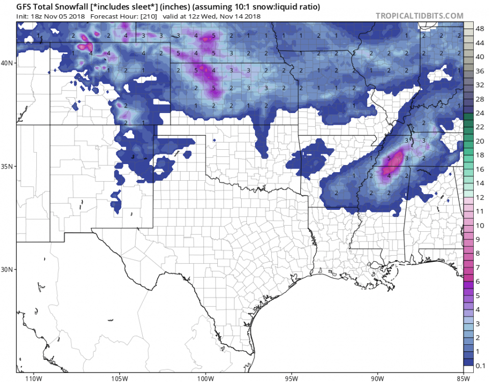
11/14-15 Early Season Westside Winter Event
in Tennessee Valley
Posted
Thanks bud, hopefully this is an early sign of things to come this winter!