

STILL N OF PIKE
-
Posts
14,848 -
Joined
-
Last visited
Content Type
Profiles
Blogs
Forums
American Weather
Media Demo
Store
Gallery
Everything posted by STILL N OF PIKE
-
Happy Birthday Old Man Winter storm obs
STILL N OF PIKE replied to Ginx snewx's topic in New England
nam delivers a spanking later today and tonite for Eastern Areas (E of ORH) def moved slightly west -
Happy Birthday Old Man Winter storm obs
STILL N OF PIKE replied to Ginx snewx's topic in New England
whats falling out that way. Sleet/ Snow? -
Happy Birthday Old Man Winter storm obs
STILL N OF PIKE replied to Ginx snewx's topic in New England
Nam definitely is cooler now for today. NIce bands throughout the day ....a bit hit and miss in nature but some heavy thru 10pm. Looks like inside 128 corridor could also make out nicely during day -
Happy Birthday Old Man Winter storm obs
STILL N OF PIKE replied to Ginx snewx's topic in New England
gonna be some fun bands in Mass today. I wonder if that 32 degree line pushes NW toward 495 with the minimal heating of day bringing temps from 30 to 33. Some meso's show that around 16z. -
LIft looks like its rapidly shutting off from You to Me in last 3 or so frames
-
I believe there is a increasing chance that Tommorrow afternoon from 18z to 2z could drop 4-6 w 8" lolli's for * SOME and almost replace round 2 which may or may not produce
-
I would bet they already do I'm hanging on to this tiny sliver of good lift that runs basically from N ORH county ENE into SE NH on Box radar i'll be at 10" by 2am.
-
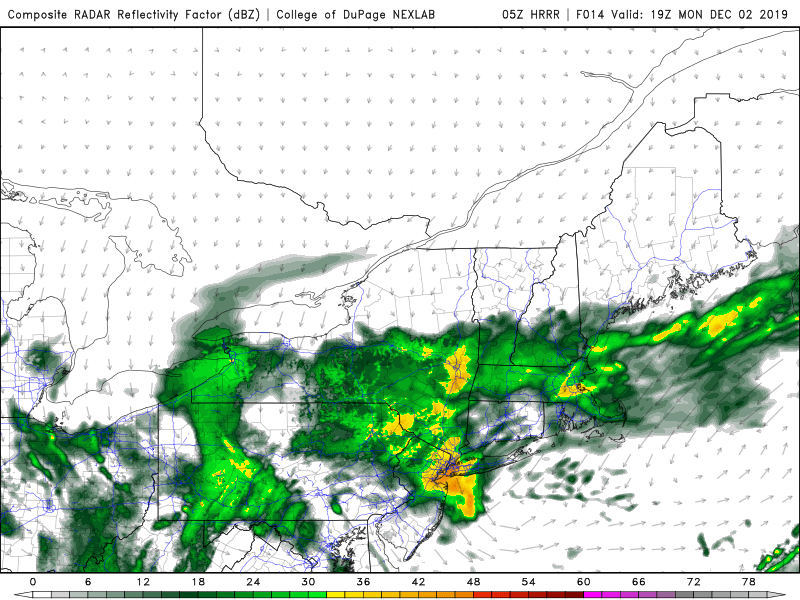
there was nothing several runs ago. Look at the second photo i just added. There is good lift along all of MA/NH border toward Route 2 into E MA showing so its definitely worth watching. Other models like the UKIE /GEFS/ICON also had very solid periods of precip in our area for that time frame 18z to 0z now
-
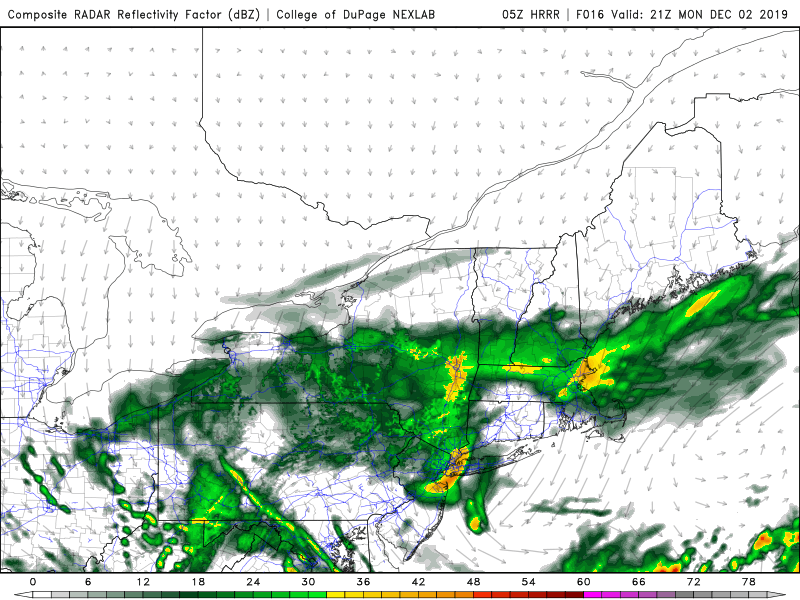
again HRRR is really producing some nice lift starting early afternoon from Route 2 corridor into Bos / essex county fir several hours tommorrow afternoon.
-
I believe we are seeing the ULL move East a bit faster which gives us only a little wiggle room To be honest...i'm interested and wouldn't sleep on some enhanced lift i'm seeing in models during the day tommorrow after 16-17z over N MA/S NH. Not light stuff and its still pounding fatties here
-
I still don't even trust Euro or any model w this feature
-
so UKIE has about 20" in same time frame and euro has 3-6" . NICE
-
Happy Birthday Old Man Winter storm obs
STILL N OF PIKE replied to Ginx snewx's topic in New England
0z Euro out past 24 hours.... 28F and big fatties falling as im on southern edge of that lift last 30 mins -
Happy Birthday Old Man Winter storm obs
STILL N OF PIKE replied to Ginx snewx's topic in New England
HRRR last few runs is building a band of MOD-HVY snow into NE essex country from 17z Monday till end of run at 22z. Generally increases lift across SNH N MA in that time frame . Def worth watching -
Happy Birthday Old Man Winter storm obs
STILL N OF PIKE replied to Ginx snewx's topic in New England
UKIE is a crush job ICON is really nice as well -
Happy Birthday Old Man Winter storm obs
STILL N OF PIKE replied to Ginx snewx's topic in New England
Go measure. We need reports near your area -
Happy Birthday Old Man Winter storm obs
STILL N OF PIKE replied to Ginx snewx's topic in New England
right on the doorstep. Jackson St and 213 is reading 30 pretty much bisecting CF edit now down to 29 there -
Happy Birthday Old Man Winter storm obs
STILL N OF PIKE replied to Ginx snewx's topic in New England
8.6" close to sleepy time -
UKIE still crushes round 2
-
They are at about 20" in the highest spots near Albany and Mitch in S VT.... and look at the radar.... so um ....
-
Happy Birthday Old Man Winter storm obs
STILL N OF PIKE replied to Ginx snewx's topic in New England
the radar around ALB to E slope is still insane and stationary. They are approaching 20" NOW in spots -
Happy Birthday Old Man Winter storm obs
STILL N OF PIKE replied to Ginx snewx's topic in New England
UKIE has a nice round 2 -
Happy Birthday Old Man Winter storm obs
STILL N OF PIKE replied to Ginx snewx's topic in New England
8.1" exactly Nashua Midnite -
Happy Birthday Old Man Winter storm obs
STILL N OF PIKE replied to Ginx snewx's topic in New England
2 inches in last 45 mins . 6.2 in Nashua. Just cleared -
Happy Birthday Old Man Winter storm obs
STILL N OF PIKE replied to Ginx snewx's topic in New England
GFS is taking MSLP back to CHH at 6z Tuesday

