CP_WinterStorm
-
Posts
26 -
Joined
-
Last visited
About CP_WinterStorm

Recent Profile Visitors
896 profile views


-
I'm happy for everyone that got some decent rain today. Ended up with 0.18" IMBY. While every drop counts, we are running a deficit somewhere in the ballpark of about 4" right now, so of course I would have loved to see more. The winner in northern Indiana so far looks to be north of Westville at 4.47".
-

2025-2026 ENSO
CP_WinterStorm replied to 40/70 Benchmark's topic in Weather Forecasting and Discussion
For those who are smarter than I, does the setup of the PDO make a difference? What I mean by this is, the current event seems to be driven more by the western Pacific anomalies than the eastern Pacific... June 2025: June 2011: Does the fact that this -PDO is being driven largely by the strength of the warm anomalies make any difference compared to -PDOs like 2011 where it's the cold anomalies? Anyone know?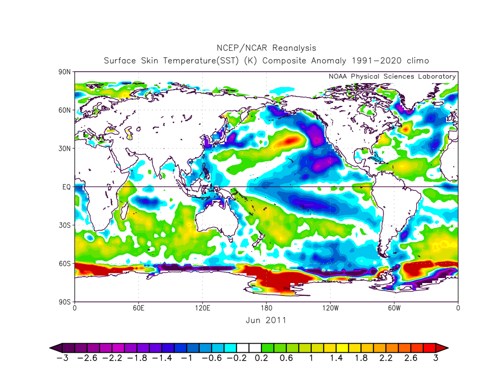

-
I just noticed that the last half of June should be the warmest on record at ORD by a large margin (1°F+) and the warmest since 2012. Yuck.
-
2025-2026 ENSO
CP_WinterStorm replied to 40/70 Benchmark's topic in Weather Forecasting and Discussion
¡Muchas gracias! -
2025-2026 ENSO
CP_WinterStorm replied to 40/70 Benchmark's topic in Weather Forecasting and Discussion
Where does this chart come from? I'd like to be able to monitor this myself but can't seem to find it on my own. -
Same here. There was a nice little storm yesterday that missed me by a half mile. I could smell the rain and see the lightning, but all I got was a few raindrops. Definitely look forward to a widespread rainfall.
-
2025-2026 ENSO
CP_WinterStorm replied to 40/70 Benchmark's topic in Weather Forecasting and Discussion
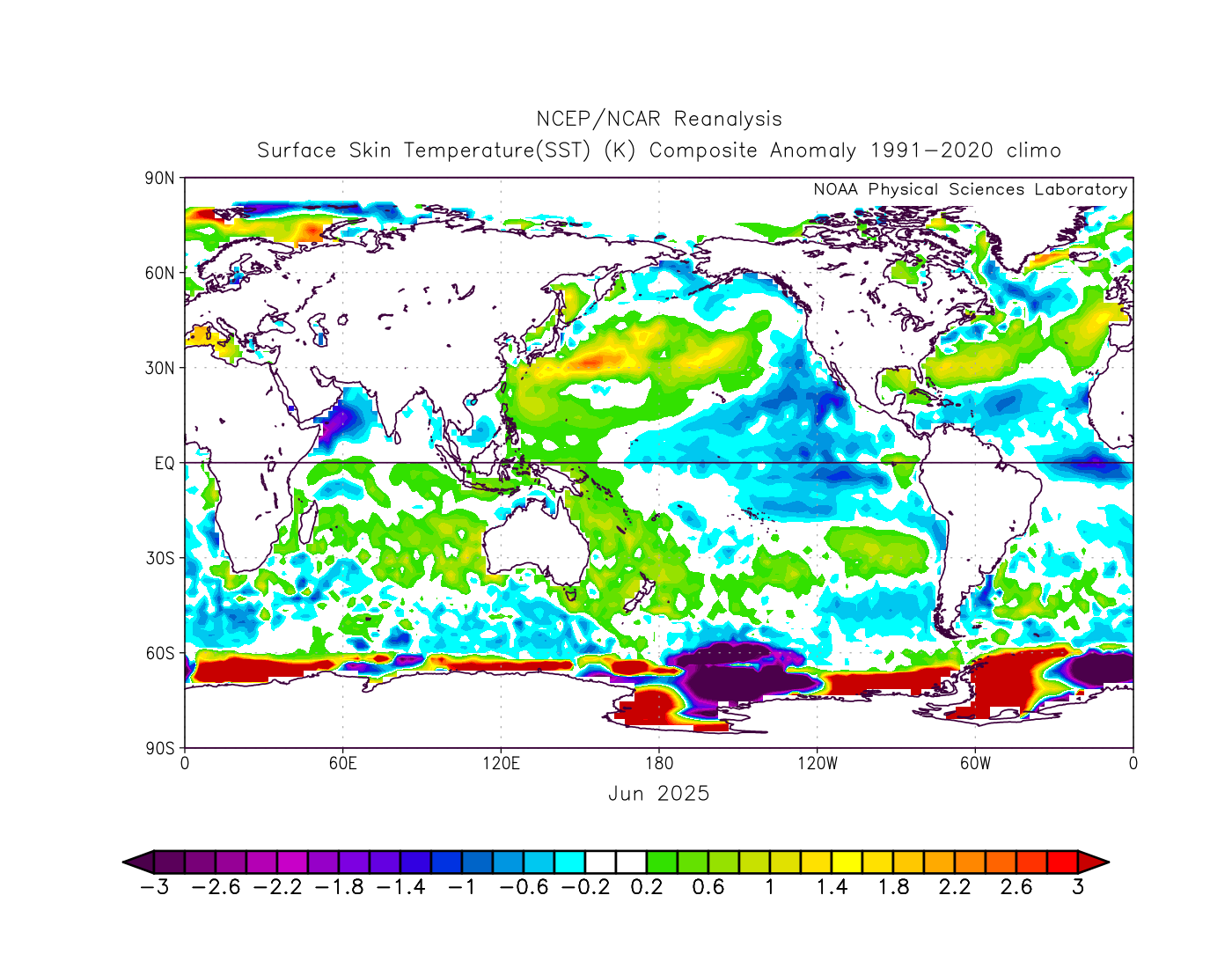
I've noted that the JAMSTEC actually does a decent job at this distance with the overall configuration of the SSTA in the Pacific during the DJF period. That said, the current forecast makes a half assed effort at a PDO regime change during the upcoming DJF period: Far from a solid +PDO but hopefully the severely negative period we're headed into, again, will be short lived.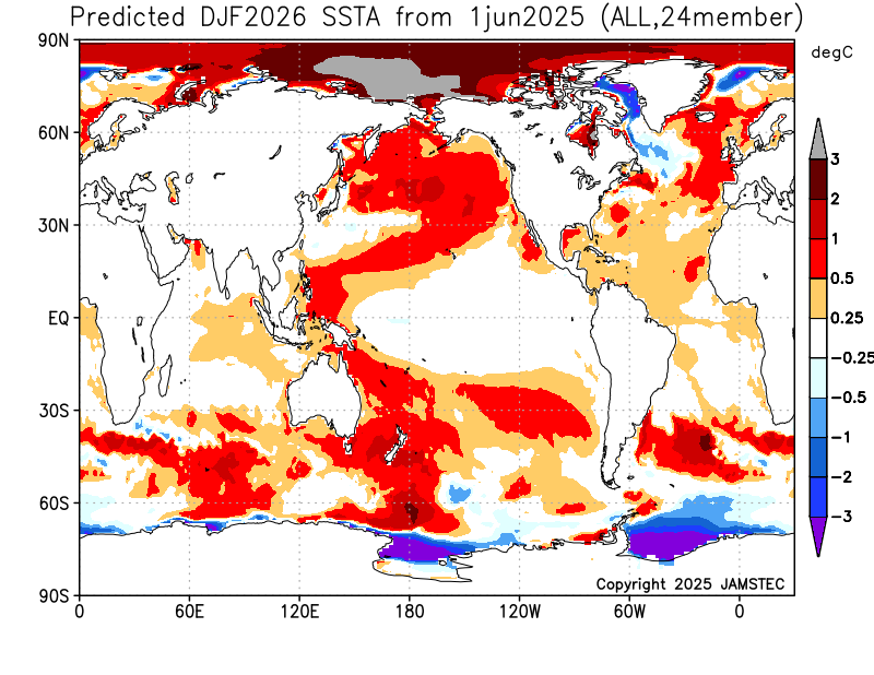
-
It looks like ORD hit 94°F again today, which makes this four consecutive days at or above 94°F. The last time that was achieved was 13 years ago during the summer of 2012.
-
2025-2026 ENSO
CP_WinterStorm replied to 40/70 Benchmark's topic in Weather Forecasting and Discussion
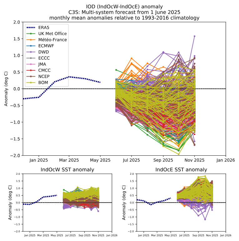
The Euro's Copernicus actually has an IOD forecast for most models: https://climate.copernicus.eu/charts/packages/c3s_seasonal/products/c3s_seasonal_plume_mm?area=iod&base_time=202506010000&type=plume Regardless, there is actually a pretty strong consensus towards a -IOD.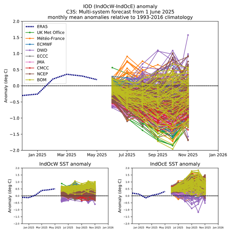
-
I'll gladly set a couple of fans outside to blow the severe weather back in your direction. I've had my fill of tornadoes and damaging wind for the year already!
-
Props to the AIFS, it's been south for days now with this system.
-
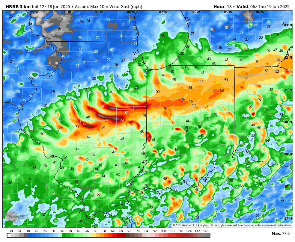
The last couple runs of the HRRR have been particularly ridiculous with that: I just want some good rain before the heat arrives this weekend.

-
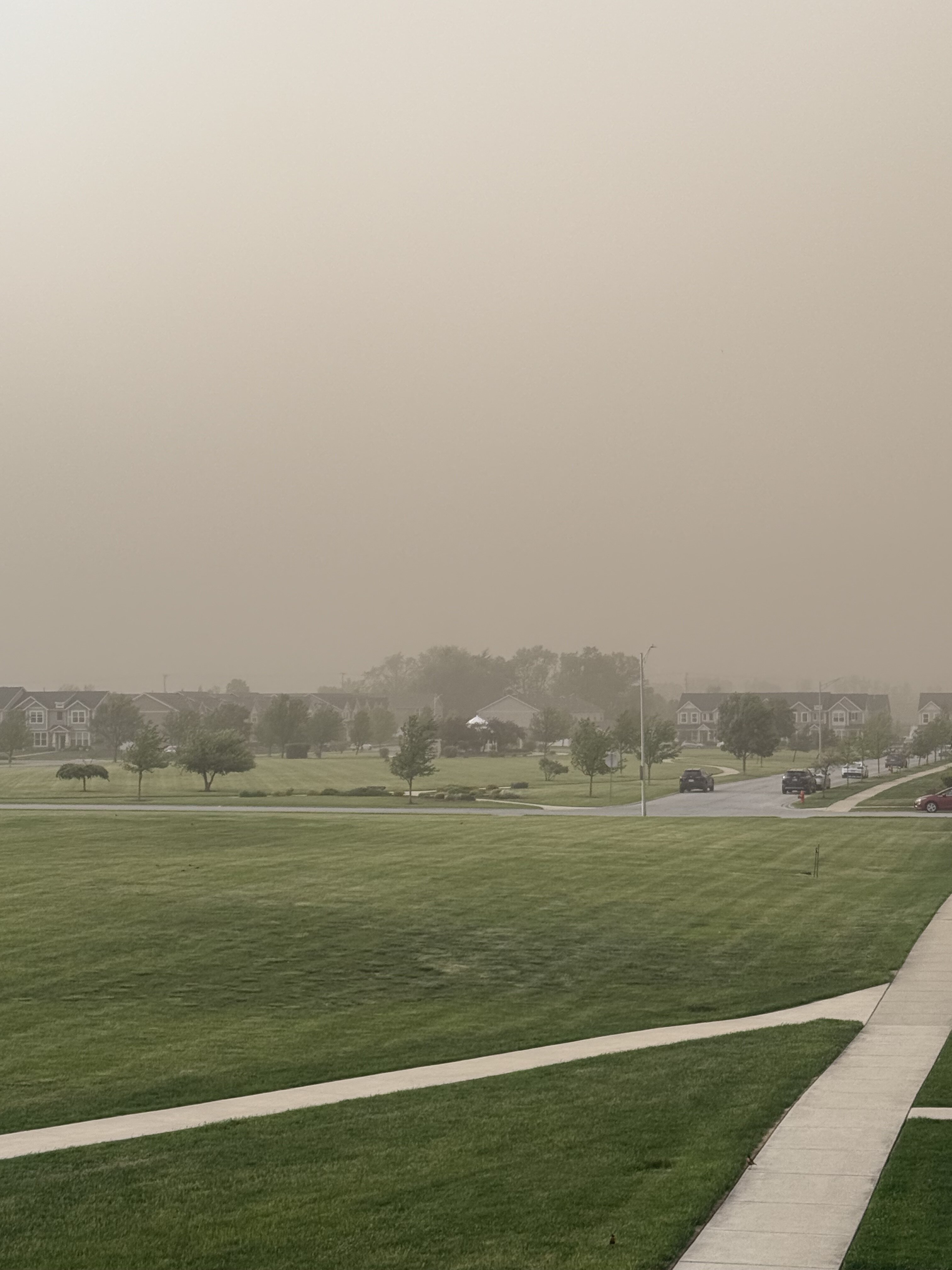
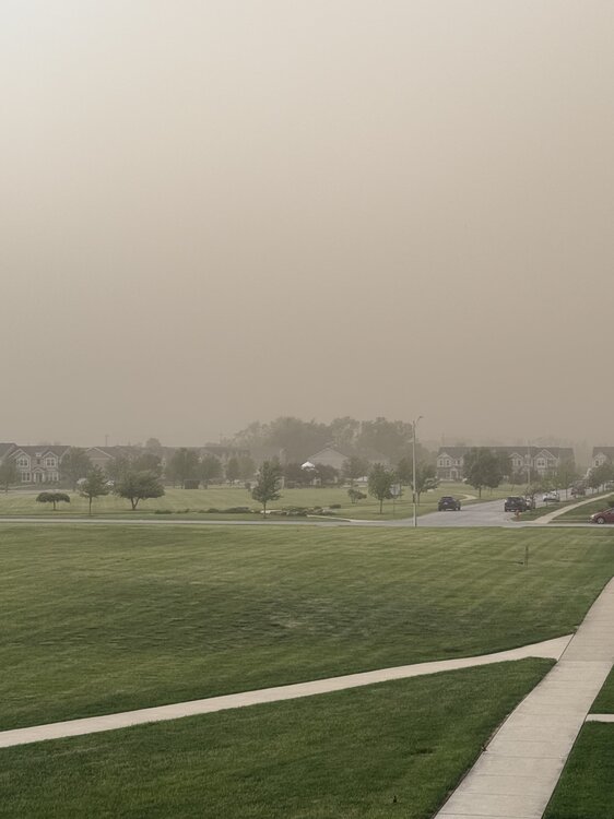
That was something not on my bingo card for the year, and unlike anything I've ever experienced. Not having power (from the 70mph winds the night before) made it all the more special as all our windows were open as it began. That bank of trees, barely visible behind the homes on the far right of the image, is just under half a mile away from me. So while we didn't experience the near zero visibility that some did in Illinois and further south of us, it was still a truly wild event. Definitely gave me an appreciation for what our ancestors went through in the 1930's with the Dust Bowl.
-
2025-2026 ENSO
CP_WinterStorm replied to 40/70 Benchmark's topic in Weather Forecasting and Discussion
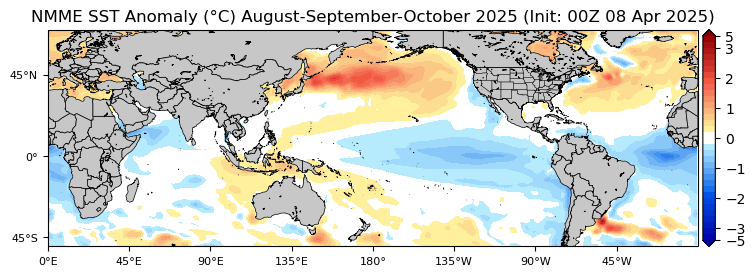
Interesting you point that out. This time of year I start periodically checking the hurricane season analogs from Tropical Tidbits, and at the moment the top analog is 2013: ' Of course things will change, but there's definitely a nod towards 2013 right now.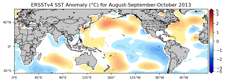
-
This. This is the shit that has made me a long time lurker instead of a regular poster. The high-schoolers I work with regularly behave better than some of ya'll. Grow up.