
-
Posts
1,994 -
Joined
-
Last visited
About TriPol

- Currently Viewing Forum: New York City Metro
Profile Information
-
Four Letter Airport Code For Weather Obs (Such as KDCA)
KEWR
-
Gender
Male
-
Location:
Hoboken, NJ
Recent Profile Visitors
7,920 profile views
-
TriPol started following Strong Nor'Easter/Hybrid Storm Late September 2026 and 2026 Atlantic Hurricane Season
-
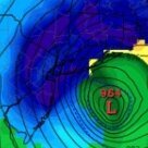
The new 00Z EC-AIFS has become more aggressive with the cyclone. At F78, 06Z Saturday Sep. 26, it's down to about 989 mb. Compare that with the 18Z AIFS at roughly the same point, which was around 997 to 988 mb depending on the exact six-hour frame. More importantly, look at the position: the 00Z AIFS still has the center much farther west than the 00Z GFS, sitting roughly east of the Delmarva/NJ corridor rather than racing harmlessly toward the open Atlantic. And look at the structure. The isobars are extremely tightly packed on the western and northwestern side, right toward the Mid-Atlantic and southern New England. That's a very substantial pressure gradient between the cyclone and the 1026 mb high to the north. The deepening sequence on this 00Z AIFS is also worth watching. We had approximately 999 mb at F54, and now 989 mb at F78. That's 10 mb in 24 hours, so this particular 24-hour interval is not bombogenesis. But the cyclone is already quite deep by Saturday morning, and what happens during the next 12 to 24 hours is the fascinating part.
-
Strong Nor'Easter/Hybrid Storm Late September 2026
TriPol replied to Rjay's topic in New York City Metro
Is there any way to increase the maximum file size of an upload? 52.47 kB isn't really a lot. -
Strong Nor'Easter/Hybrid Storm Late September 2026
TriPol replied to Rjay's topic in New York City Metro
The 00Z GFS has shifted the developing low a bit farther east than the 18Z run, at least in these early frames. On the 18Z GFS, by early Friday the center was tucked closer to roughly the 70°W corridor. On the new 00Z run, the F48 center is still farther offshore, around the upper-60s west longitude, so call it roughly 100 to 150 miles east of where the prior run was trying to organize the cyclone at a comparable stage. That is not a huge jump, but it is definitely not another westward correction yet. The important part is that the blocking high is still very strong, so an initially farther-east low does not necessarily mean the later retrograde will also be farther east. With this setup, the bigger question is still where the storm gets captured and starts bending back. So, early read: 18Z: farther west early. 00Z: modest eastward shift early. Block: still very much there. The F60-F84 frames will tell us whether that eastward difference survives or whether the 00Z run bends it back toward the 18Z/Euro idea. -
I'd say its time to get bread and milk, but there isn't going to be any snow.
-
Warm October = Cold Winter
-
We have the same argument every winter and the EURO usually more or less runs correct.
-
I have no idea what the 12z GFS is smoking, but it brings our nor'easter up the coast and slams it into Maine then has it at the same latitude as New Jersey.
-
That's just irresponsible. Yes, the storm is going to retrograde (unless all the models are wrong) but bad as Sandy is dumb.
-
Yeah. $5 says the EURO is right. You put $5 to bet the GFS. WinterWarlock puts in $5.... we all put in $5.
-
We need to create a bet on Kashi for this.
-
That's not even the GooFuS AI. I trust the baseline model GFS like I trust my dog not to eat a ribeye sitting in front of it for 5 minutes.
-
06z EURO holds serve. Retrograde around Riverhead and takes the LIE to NYC. Every weather model has the storm retrograding... it's just where. The less accurate models have it OTS and then hitting Nova Scotia, the GFS has it doing a circle around Boston and the Euro takes it on the Grand Central to NYC.
-
Zero chance of being "clear."
-
That depends on which model you trust. If you trust the EURO, yes. If you trust the GFS, no... unless you're flying out of nova scotia.
-