

hlcater
-
Posts
2,670 -
Joined
-
Last visited
Content Type
Profiles
Blogs
Forums
American Weather
Media Demo
Store
Gallery
Posts posted by hlcater
-
-
2 minutes ago, MattPetrulli said:
It's early but I am not entirely sure if that 12-16 ft surge verified, and if it did it seems like it was mostly over uninhabited areas. Highest report I saw was about 10 ft Laplace. Obviously, am open to be proven wrong.
It did in grand isle. Water topped Humphress's cam and it was 14ft ASL.
-
 3
3
-
 1
1
-
-
god what a chad
-
1
-
 3
3
-
-
Pressures havent risen so far.

-
1 minute ago, Will - Rutgers said:
if it makes you feel any better, the success of this camera guarantees someone will do this again for the next Cat4/5. probably put it up a bit higher on the pole. that thing was going to last all day if the ocean didn't get to it.
No one will ever top the Mexico Beach cam.
-
1
-
-
Just now, Will - Rutgers said:
7' above the ground, and Grand Isle is 7' above sea level
14 foot surge already is very respectable. IIRC surge shoots way up right as the eye passes. Still a bit out from that yet.
-
1
-
-
How high is the cam above sea level? Not how high on the pole, but relative to sea level.
-
Keep in mind the moat will collapse as soon as the storm starts to feel the effects of land interaction. EWRC came but not quick enough.
-
1
-
-
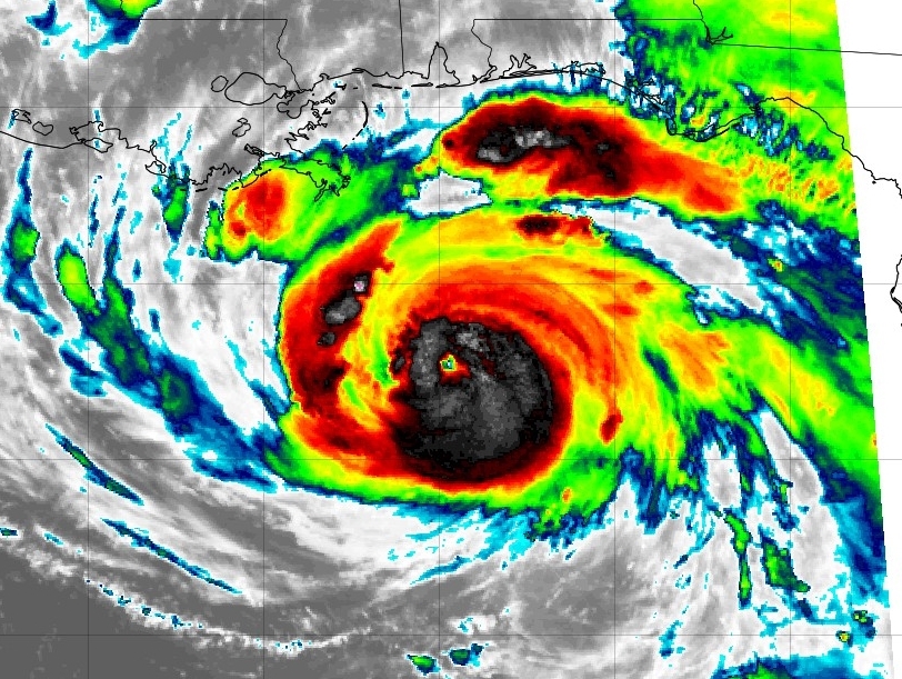
Mesovorts present in the eyewall. We are losing pressure and fast.

-
1
-
1
-
-
If this is the pace that is being set for the rest of the night, I wouldn't be surprised to see 940mb by 12z tomorrow.
-
Just now, WxWatcher007 said:
Should be a number of them down there. Will hate to miss this one but the calendar just didn’t work for me this time.
Jim Tang and Matt Coker will be there. As will Ryan Hearne/Ryan Darr.
-
3
-
-
If we were doing ~3.5mb/hr earlier, pressure is probably in free fall now. Closed -70 ring, universally cooling CDO and multiple convective bursts on all sides of the eyewall.
-
1
-
-
Starting to get an inner wind maximum indicative of greater core organization.

-
2
-
-
8 minutes ago, jojo762 said:
The storm is in a pristine environment for intensification, and its core has sputtered most of the morning and afternoon on satellite -- struggling to become inertially stable, which would allow more energy to be expended on intensification instead of structural matters.... Little doubt it will eventually undergo RI, but its current state at this moment in time does not seem like it would readily allow for it.
EDIT: There's been posts all morning and afternoon doing a PxP of "wow the IR presentation looks the best yet!!"
Well okay, think of it this way, when there’s continuous play by play with “this is the best it’s looked!!!1!1!!1!!” chances are the storm isn’t struggling at all, but rather continuing to steadily intensify.
-
1
-
1
-
-
I'm not sure why everyone seems to be so convinced that the storm is struggling. It's deepened more than 12mb since this morning. I'm not really sure what people expected?
-
9
-
3
-
-

More important than the pressure I think is the configuration of the core windfield. It's still quite broad and an intense inner wind max hasn't really developed yet. It has some work to do yet, and my guess is that the intense eyewall and inner wind max develops once we get a few really good, intense convective bursts in the core.
-
5
-
-
2 minutes ago, LakeEffectKing said:
This will be 140mph+ by morning, if not sooner...
What do you think about peak intensity?
-
2 minutes ago, MillvilleWx said:
It is. Just basically has that final hurdle to clear the eye and then all systems go. I wasn't expecting the storm to really go bonkers till tonight. Still much within the envelope.
Seeing some symmetry in convective bursts as well, at least relative to this morning. Tonight will be very interesting as it traverses the warmest part of the loop current at Dmax
-
1
-
-
1 minute ago, Wmsptwx said:
Things seem to have leveled off some.
Nah its still intensifying except thunderstorms in the eyewall have shrouded the eye. It's deceptive.
-
12
-
-
#1
#2
#3
#4
#5
-
13
-
-
13 hours ago, hlcater said:
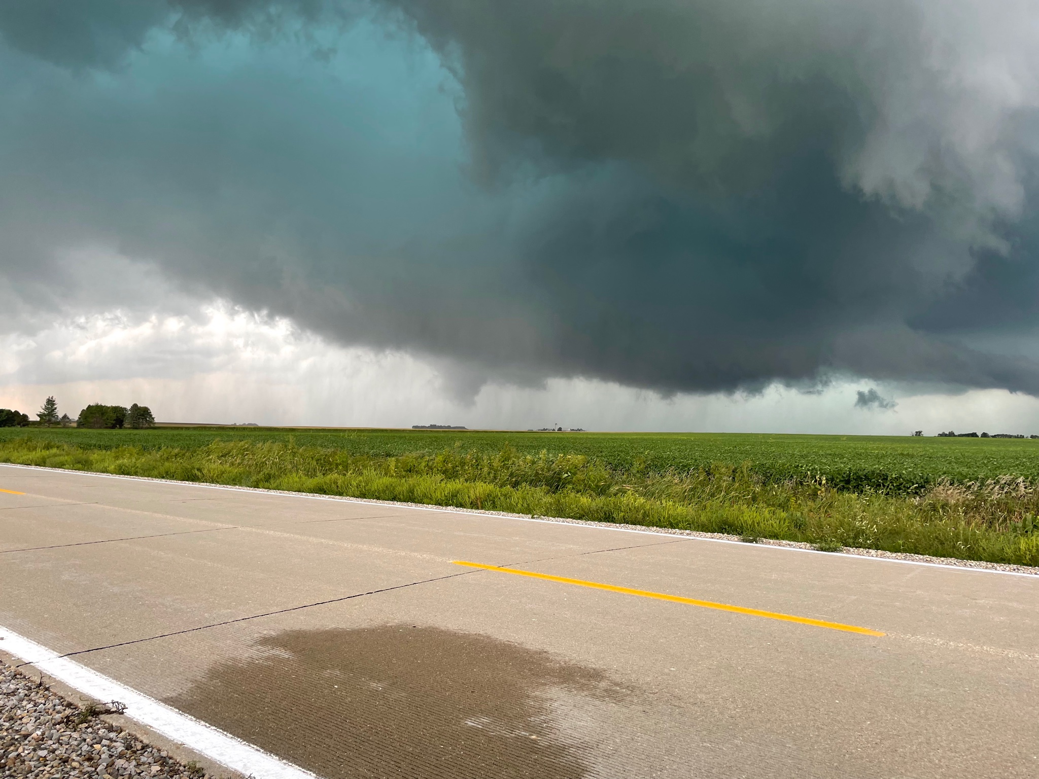
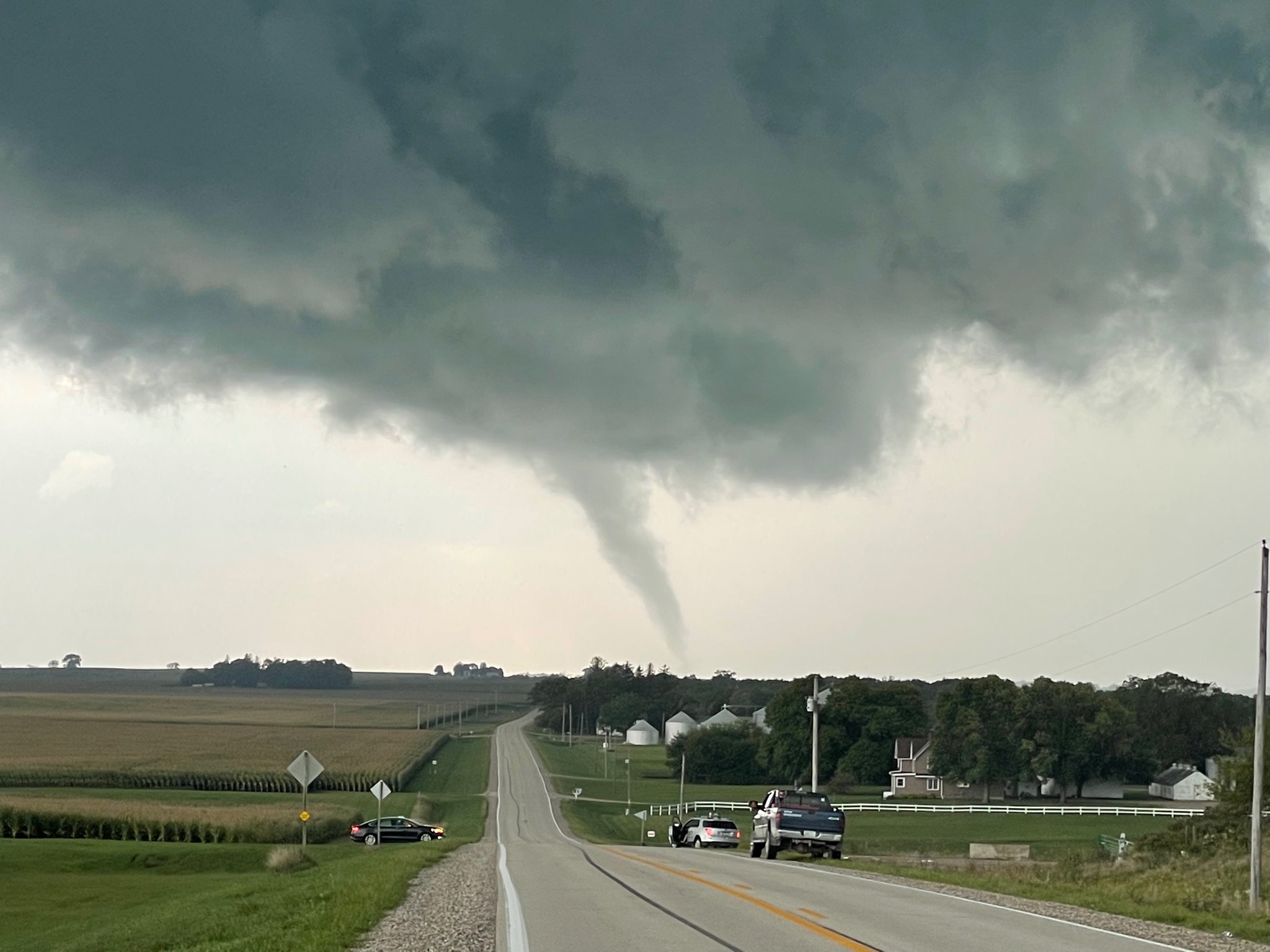
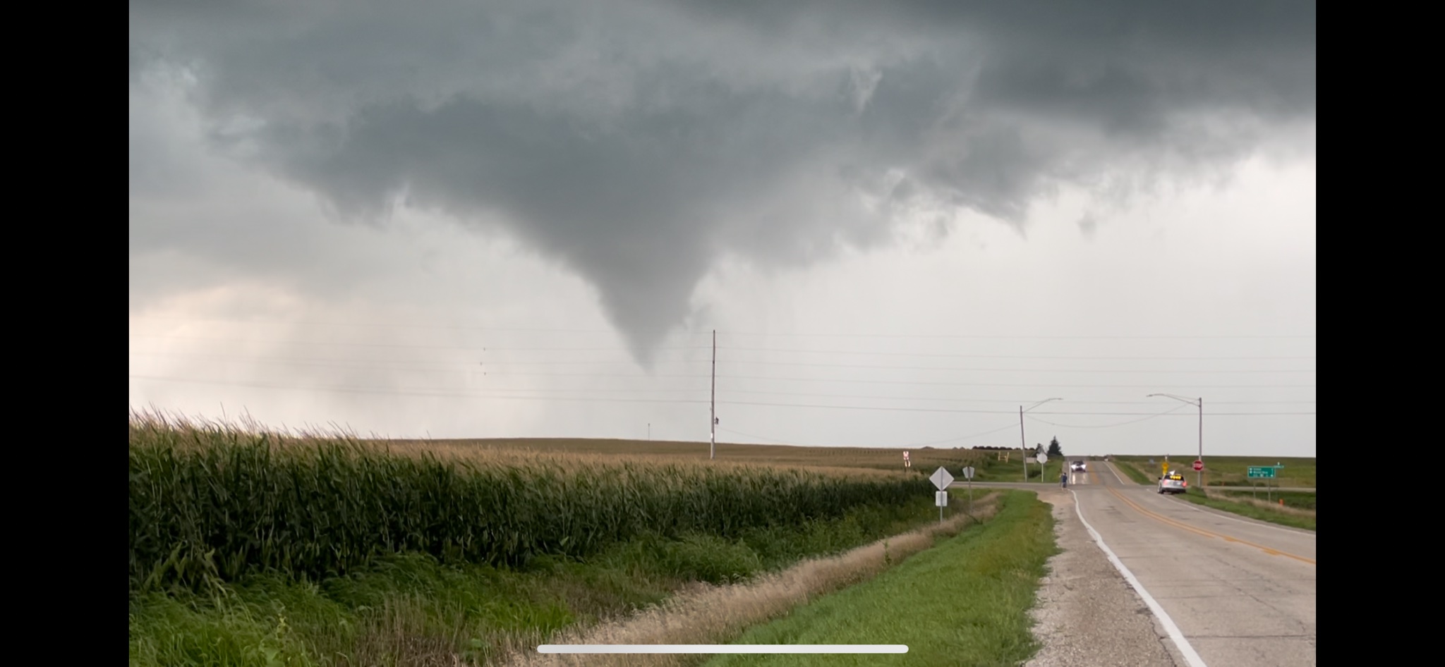
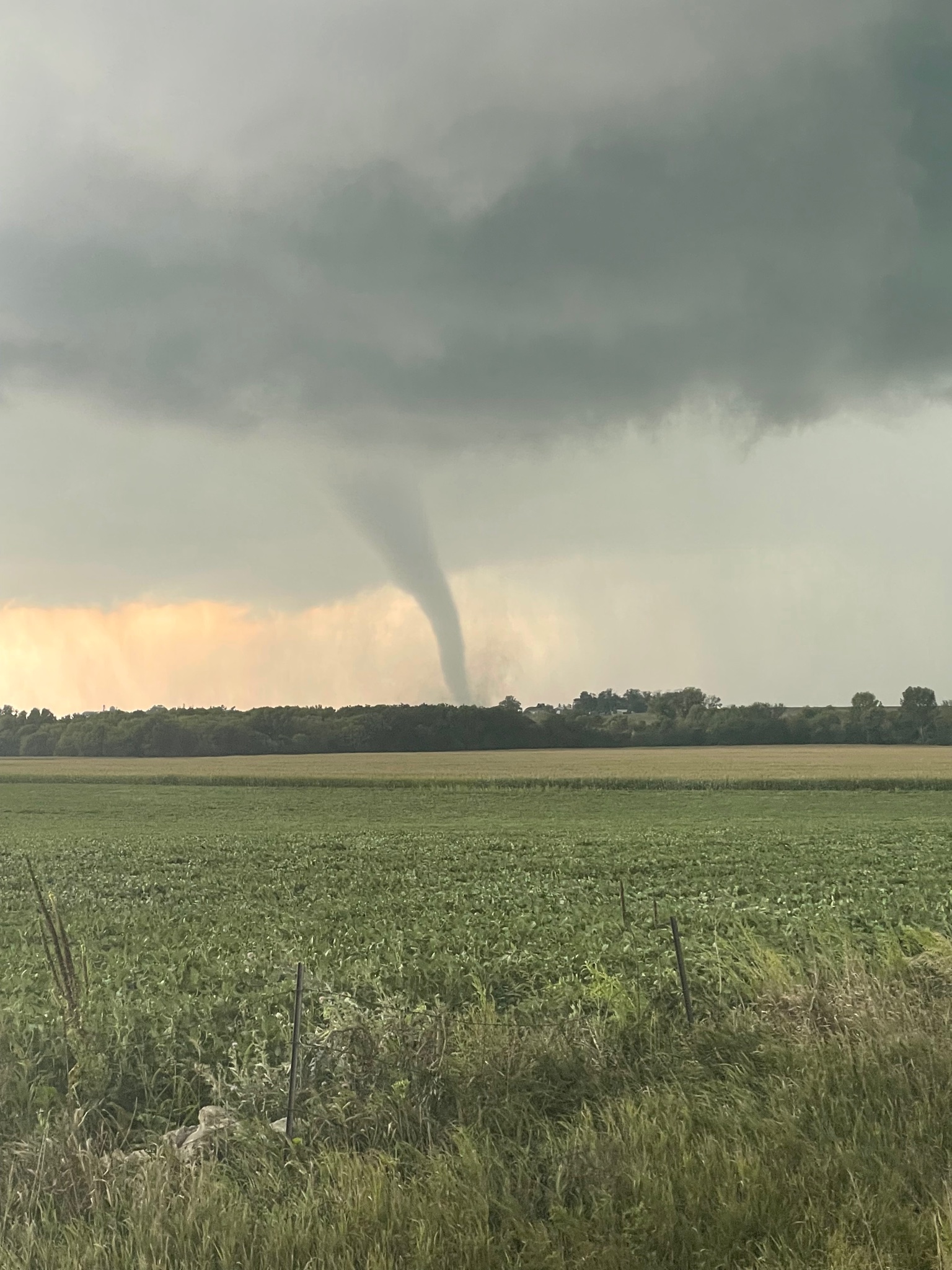
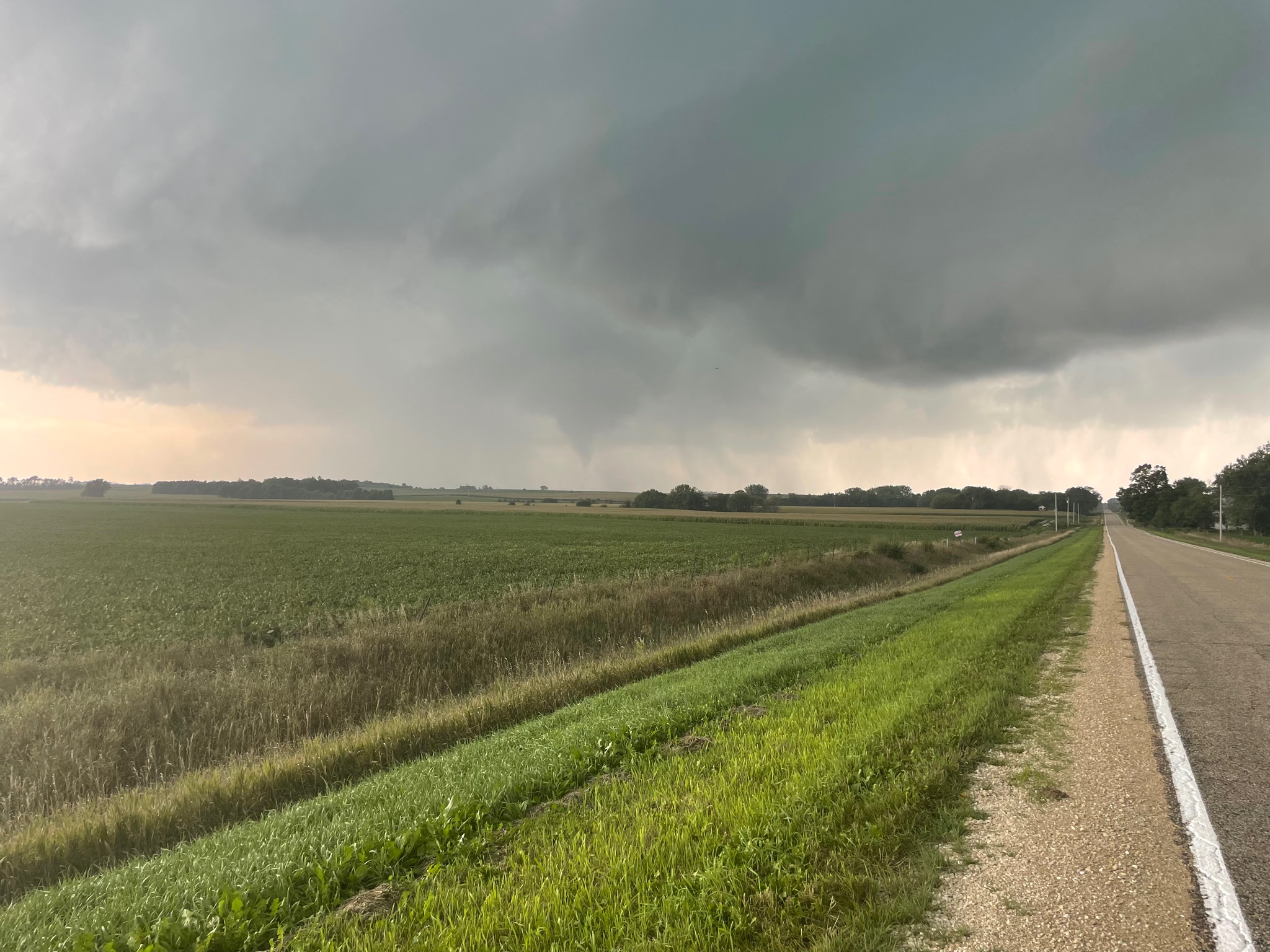
Today is looking like a must chase along the IA/MN border. Gonna do my best to be there but I cant leave IC any earlier than 1:30
Saw 5 tornadoes. Will post pics tomorrow.
-
2
-
-


-
1
-
4
-
 2
2
-
-
46 minutes ago, csnavywx said:
Short-term land disruption is generally more effective in limiting downstream intensification once an inner core has become established. This is due to wind curve flattening or spreading. This larger windfield becomes less concentrated near the core (because of frictional spin-down and interruption of latent heat flux) and also generally becomes pretty inertially stable -- making it more difficult for wind maxima to contract and spin back up. Irma and Isidore are good examples of this. It may not work very well in this case due to the fact that the inner core is still in a formative stage and the TS-force wind field is still pretty small.
Ida is moving at quite the clip to be fair. It probably only spends 3-4 hours over Cuba. Looks to miss Isla de Juventud to the east too.
-
Today is looking like a must chase along the IA/MN border. Gonna do my best to be there but I cant leave IC any earlier than 1:30
-
Thinking Ida is in the midst of an RI episode right now. Very intense convective burst overhead which corresponds to an intense curved inner band (formative eyewall?) on recon data. We'll have a hurricane before the sun sets tonight.
-
4
-
2021 Atlantic Hurricane season
in Tropical Headquarters
Posted
Do we need threads for every birdfart swirl out in the middle of the atlantic?