

PowellVolz
-
Posts
3,819 -
Joined
-
Last visited
Content Type
Profiles
Blogs
Forums
American Weather
Media Demo
Store
Gallery
Posts posted by PowellVolz
-
-
The RRFS CAM did well yesterday with the prefrontal supercells. It even got the storms in upstate SC right.


-
 4
4
-
-
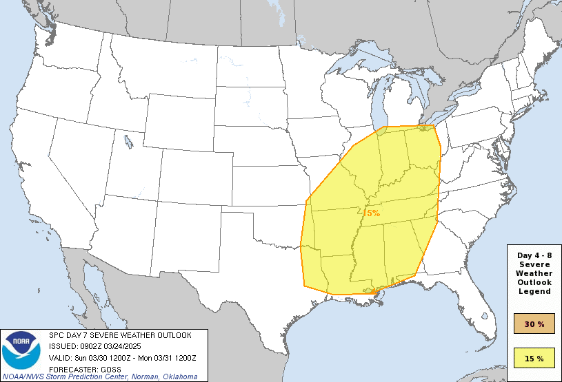
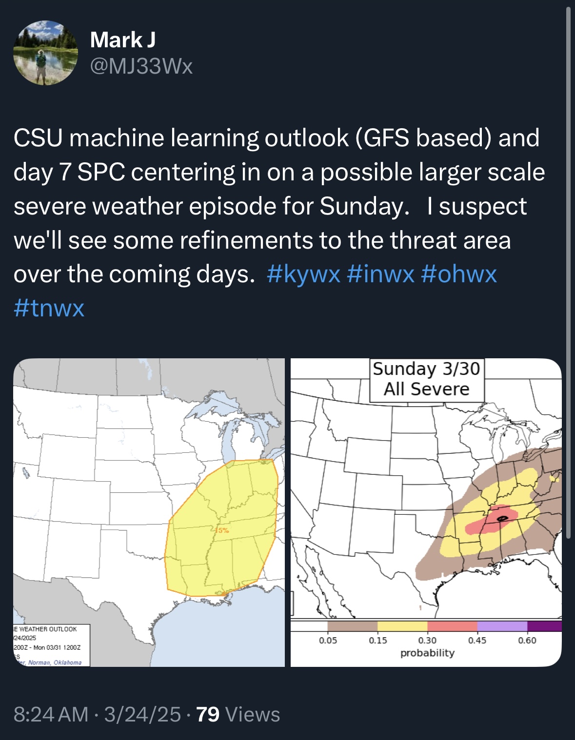
Looks like Saturday and Sunday are on the map. A couple of nots on this…. Looks like this week we will not have any real systems across the south to wipe clean the GOM. The active southern track has really benefited the region and kept the juicy stuff pinned down across the Deep South.
#2) NCAA basketball tournament. I’ve always worried about a situation with 20k in an arena and the unthinkable happens.


-
2
-
 2
2
-
-
-
-
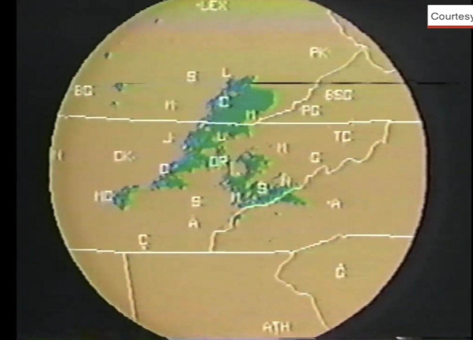
Found this video yesterday from the 93’ tornado across ETn. The one that went through Powell went right across my house but luckily no damage. 1/4 mile away Broadacres was messed up. FYI… this is still the strongest record tornado in Knox County an F3 at the time.
a couple of pics… Lenoir City tornado….

and this one got me… the radar WBIR was using then… my Atari had better graphics IMO. Lol

-
2
-
-
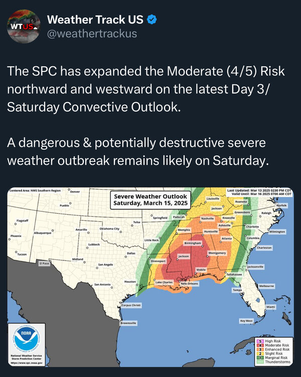
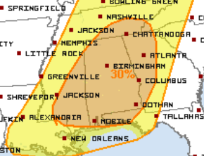
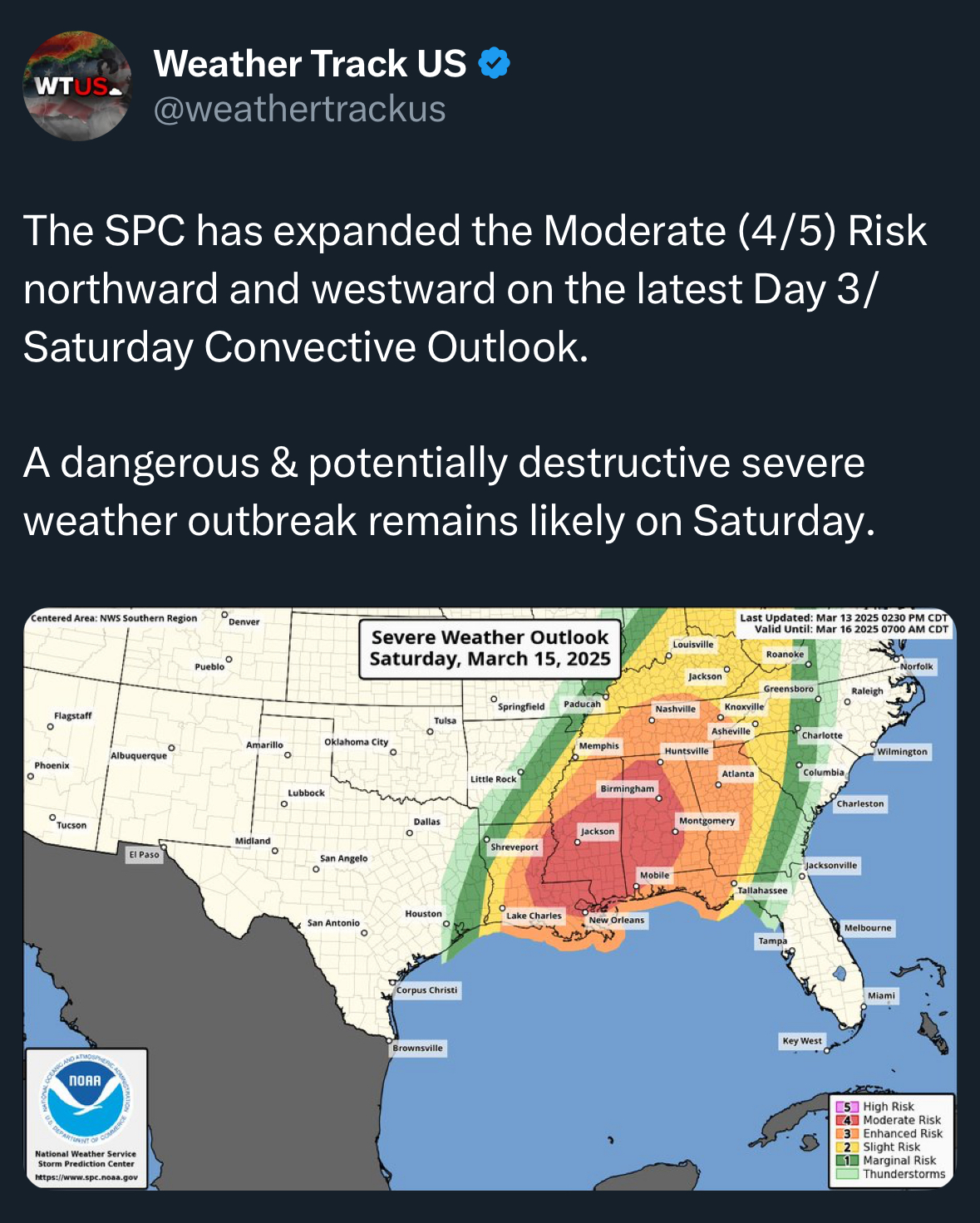
Mod risk moving north. Not surprised
-
1
-
1
-
 1
1
-
-
5 minutes ago, nrgjeff said:
Southern Illinois isn't great sound of I-64 but improves markedly toward I-70. Any of it is better than central Alabama.
My most likely TOR threat Saturday is wherever the outflow sets up. Right now I think the north border of MDT with ENH. I'll be shocked if Tennessee clears out.
It’s gonna be a close call but some of the mods are showing a break Saturday morning across MTn. Will also be interesting to see what happens in SE Tennessee up to Knoxville. This area could potentially get a longer rain free break after 12 noon. The LLJ really kicks in after 6pm in the valley. I won’t be surprised at all to see lots of wind damage reports from non thunderstorm wind gusts.
-
1
-
-
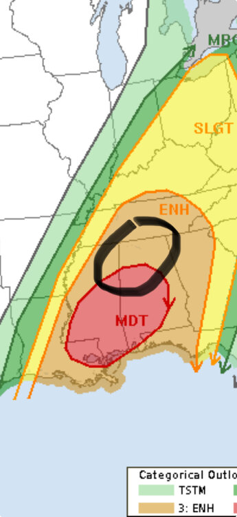
As of now IMO here’s where I think the greatest risk of tornadoes will be Saturday. This is contingent on a mostly rain free warm sector. When the CAM’s come into range, we will then be able to see where potential boundaries are that’s been left over after the morning convection. I won’t be surprised at all if the moderate and enhanced risk is moved north. A high risk doesn’t really matter at this point and I’m not sure it’s warranted until we get to Saturday morning and see what the radar looks like.
-
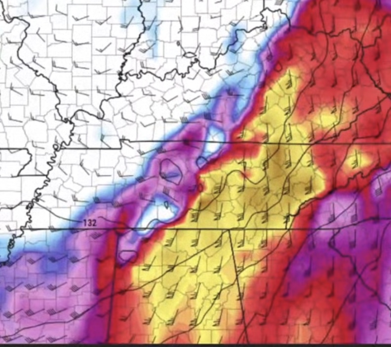
Mods are now showing less morning convection, especially to the south of Tennessee. Less clouds and showers are a result of a stronger EML and a little less forcing which is more confined to the cold front/dry line. The main issue for Tennessee, especially MTn to ETn is how quick does the warm front and elevated convection get north of Tennessee. A warm sector like this only needs 5 to 6 hours of rain free and broken clouds to recover. The trough looks a little flatter which means a little more zonal flow aloft. That typically leads to more of a discrete mode and less heavy rain. IMO…. This is looking worse the closer we get. Moisture transport won’t be a problem with the LLJ running more south to north which also gives a little more convenience degree when the LLJ interacts with the storms. This is the LLJ between 6pm and 10pm Saturday afternoon. You only need around 30mph or so of LLJ to help rotate storms. This LLJ is running 50-70mph.
-
2
-
1
-
-
3 minutes ago, nrgjeff said:
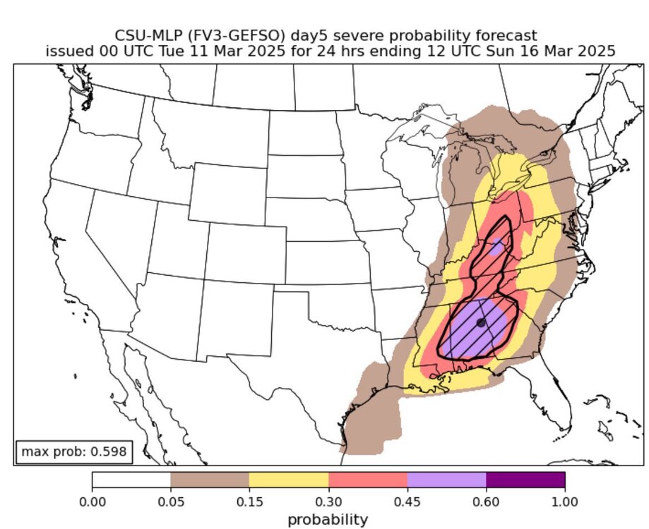
If the 12Z Tuesday forecast holds. Saturday is going to be a day. CSU model is probably keying in on outflow in Bama. Plus that surface low. Mass response (LLJ other levels) has trended up on Saturday due to the more obvious 2nd wave at the upper levels. Also the reason for the surface low. It's all connected.
kinda of a catch 22. The potential lack of moisture for Friday that the mods are now showing could mean less convection Friday/Friday night which could potentially allow for more moisture return on Saturday. However the mods are also showing a little less zonal flow and more 500mb winds running parallel to the CF. More zonal flow, more discrete cells. More parallel winds, more of a QLCS or squall line. Something to watch.-
2
-
 1
1
-
-
2 hours ago, nrgjeff said:
Saturday the South is going to get its own short-wave. Vort lobe should eject from the Plains trough. If trends hold we have less morning rain forecast. First short-wave is long gone over the Great Lakes. Two in a row is usually heavy rain, but not with this separation by almost a day.
Instead we may have a couple outflow boundaries cooking all morning. Seems early in the season, but that's what might happen. Then by Saturday afternoon.. I will be very interested in any intersection of outflow boundary and pre-frontal trough. Such surface details can't be discerned 5 days out, but the background parameter space will be robust.Outlook for Saturday
Mods are showing a secondary surface low pressure developing around the Arkletex region and tracking NW between Nashville and Jackson. I’m not gonna say what this setup reminds me of but i think it’s pretty dang close.
-
1
-
1
-
-
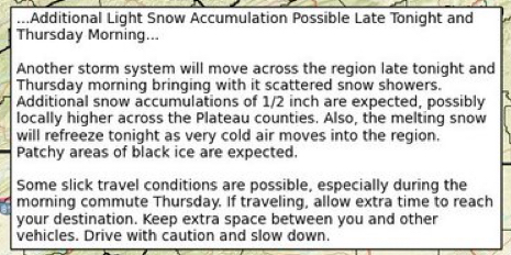
Guys…… we better hope that little short wave trough moving across the south on Wednesday clears out the GOM or we will have a problem
-
1
-
-
2 hours ago, Carvers Gap said:
Wind gusts pushing 50mph here at TRI. Sustained winds are as strong as I can remember in some time.
Cove Mt in Wears Valley had sustained winds of 57mph and recorded a gust to 97 around 11:45pn when the station went dead.
-
4
-
-
5 hours ago, John1122 said:
Models have been bulls-eyeing your area for a few days now.
You getting anything frozen now? Radar is looking like it.
-
Not sure if severe thunderstorms can go in this thread but thought I’d share this from MRX of the 2020 Easter tornadoes in SE Tennessee.
https://storymaps.arcgis.com/stories/55cc7aa49acc47839e8fa7010983ff83
-
2
-
-
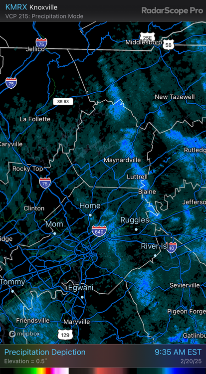
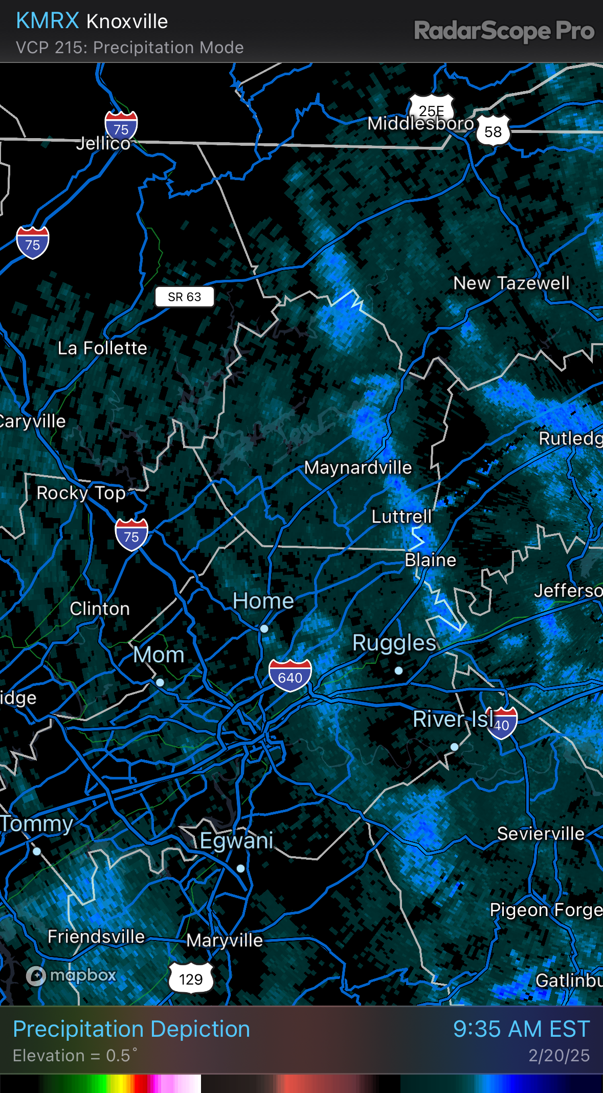
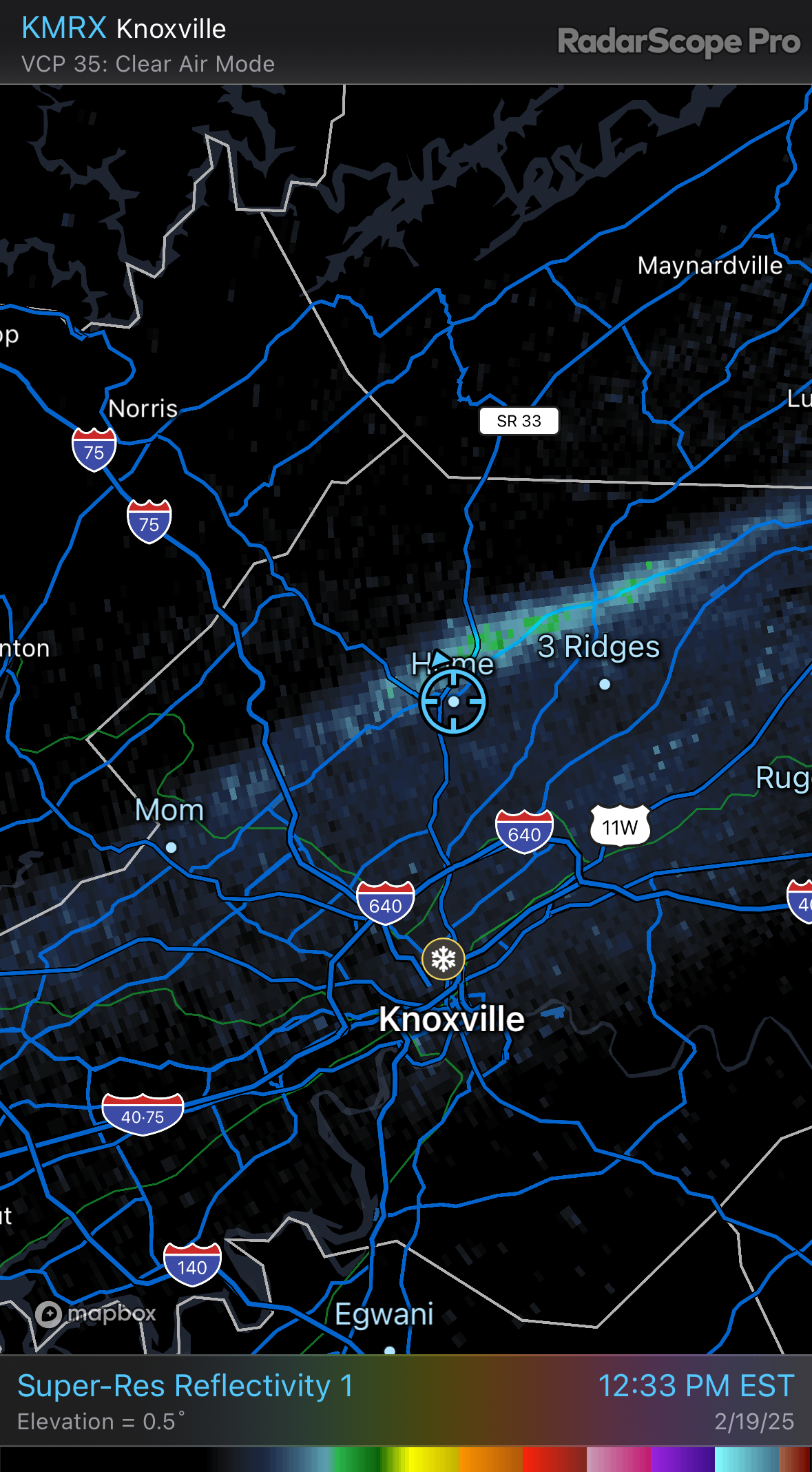
For the first time in a long time I’m lucky enough to have a 2 mile wide streamer set up over me. The one going through Luttrell is 40 miles long. It’s almost a white out when you get under one of these.
-
7
-
-
26 minutes ago, John1122 said:
In February 2001(I think) I got 7 inches off a streamer that connected to Lake Michigan. It was a county wide basically and it ran from NW Indiana all the way to here.
Wow that’s awesome
-
1
-
-
-
-
8 minutes ago, John1122 said:
Temp has crept up here after dropping through around 1pm.
MRX be like…….“we tried to tell you”
-
1
-
-
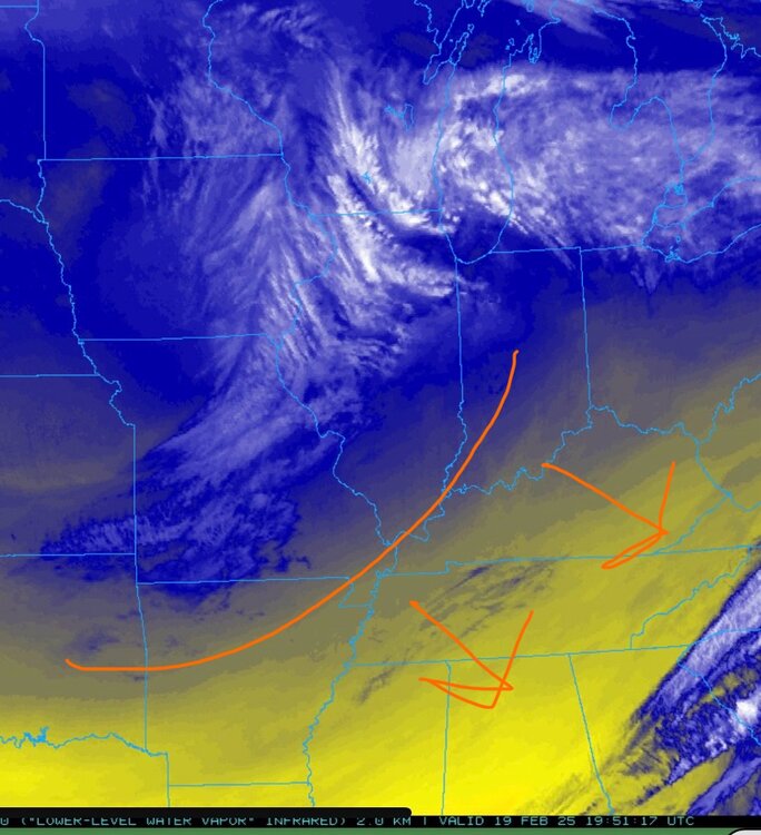
Interesting little piece of energy rounding the base of the trough that’s headed towards ETn. It’s on the low and ML water vapor. Not sure it actually causes any lift but….
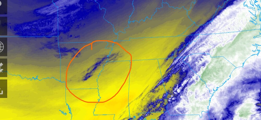
also the CAA behind the trough looks healthy and it looks like we will be really close to the right exit region. 500mb maps show some separation in the right exit region so diversion aloft may help some assuming the same effect that can increase thunderstorms can also aid winter weather.
-
7
-
 1
1
-
-
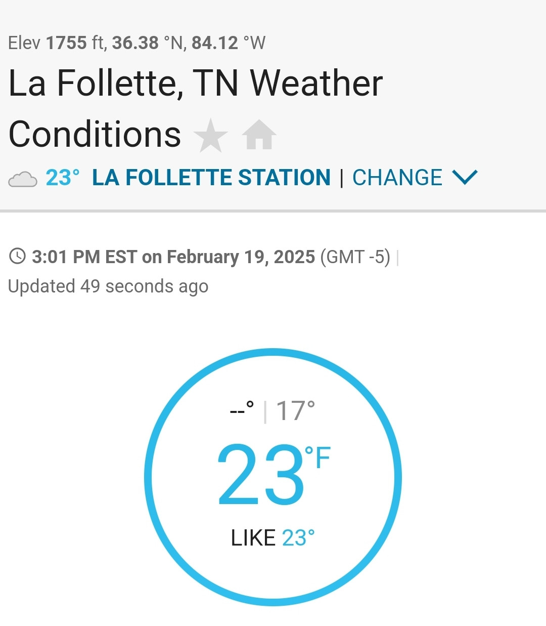
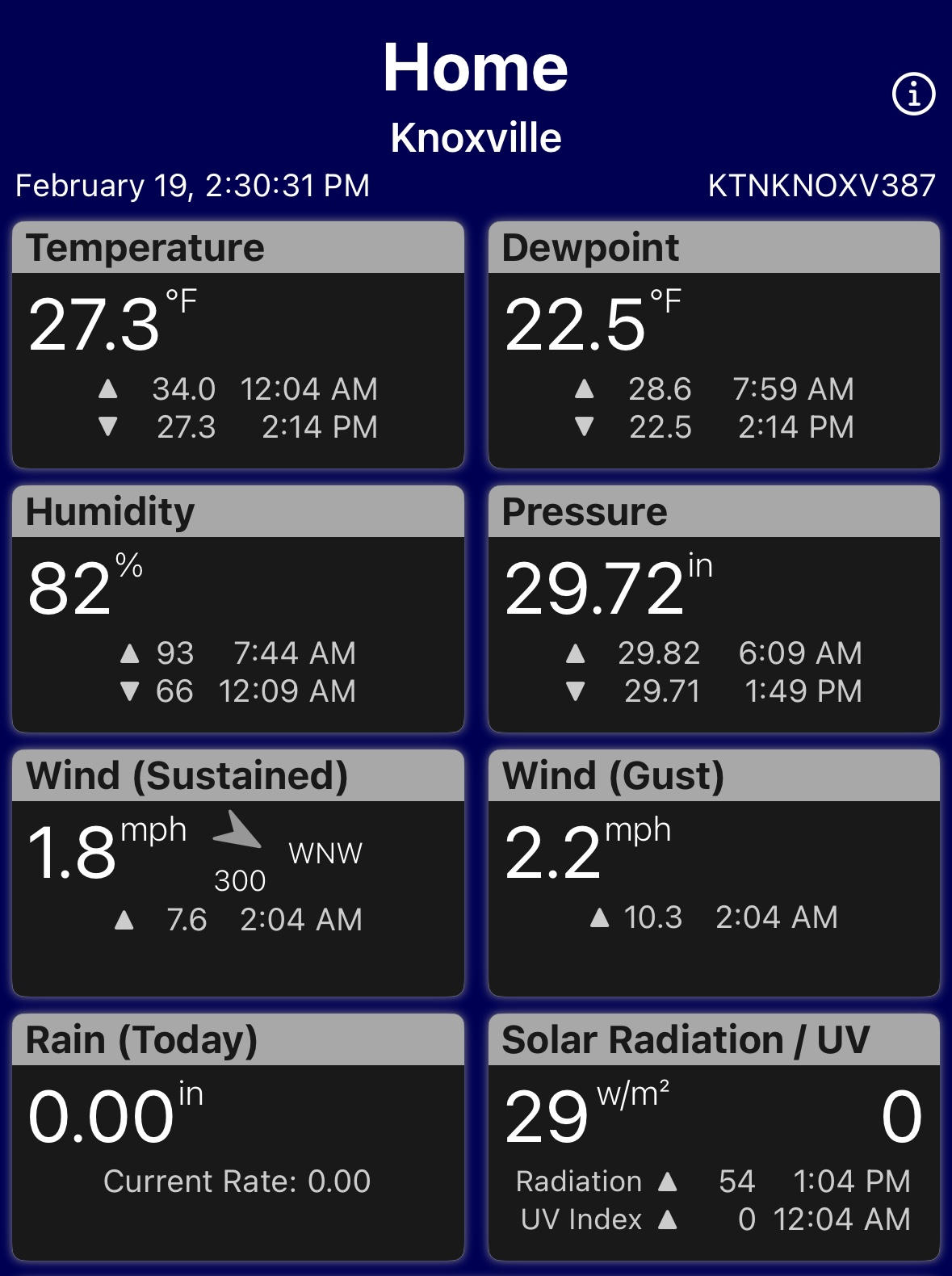
49 minutes ago, Daniel Boone said:
Wow. 28 here. 30's in East Tn Valley.
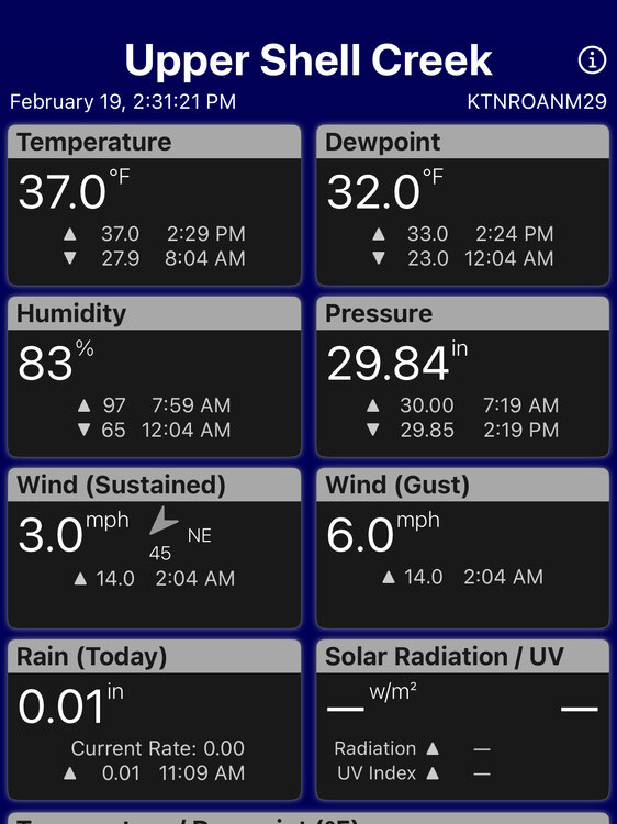
A good example of what you are saying… both of these PWS are on the same time. One at my house, the other in NE Tenn somewhere on Roan Mt.
-
2
-
-
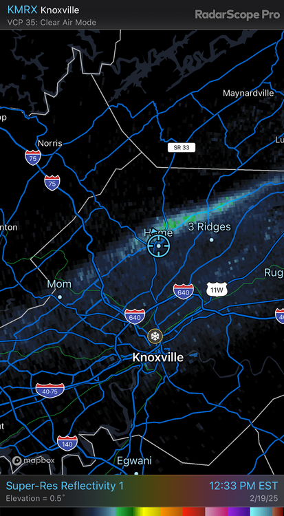
lol… figured out why it’s ripping it at my house while no one else is talking about it. This streamer has been sitting over me running SW to NE for the last 30 min. Streets are getting covered again.
-
9
-
-
I’m getting some pretty good high ratio rates right now and it’s a little bigger flake size than the normal NW flow stuff. Coming down pretty good.
-
2
-


Useful Weather Links - Tennessee Valley Style ***Updated Links Nov 2018***
in Tennessee Valley
Posted
Really cool meso page here guys. Everything you want in one stop, however some things are for a subscription but you can still do a lot, especially on the severe weather side.
https://aguacerowx.com/app/