

Frog Town
-
Posts
970 -
Joined
-
Last visited
Content Type
Profiles
Blogs
Forums
American Weather
Media Demo
Store
Gallery
Posts posted by Frog Town
-
-
It's the ICON!!!
-
Possible storms aside, it's just refreshing to see real cold and storms that won't die out at our door step due to confluence.
-
 1
1
-
 1
1
-
-
1 hour ago, Stebo said:
There are so many variables between now and next weekend. This could literally end up anywhere even the east coast, see 12z Euro.
Soooo, you're sayin there's a chance!?!
-
1
-
-
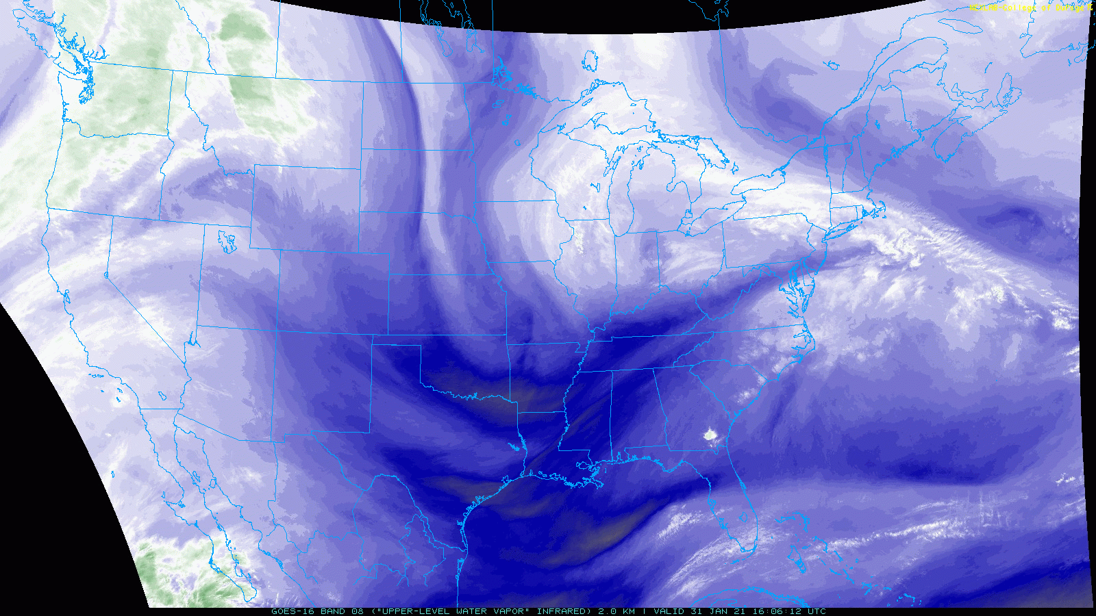
1 hour ago, Dustin said:
This isn't really the typical backside snow that under-preforms here (not to say this won't under-perform, but there is reason to think otherwise). There is a second vorticity max that forecast to deepen and crash down over the lakes.
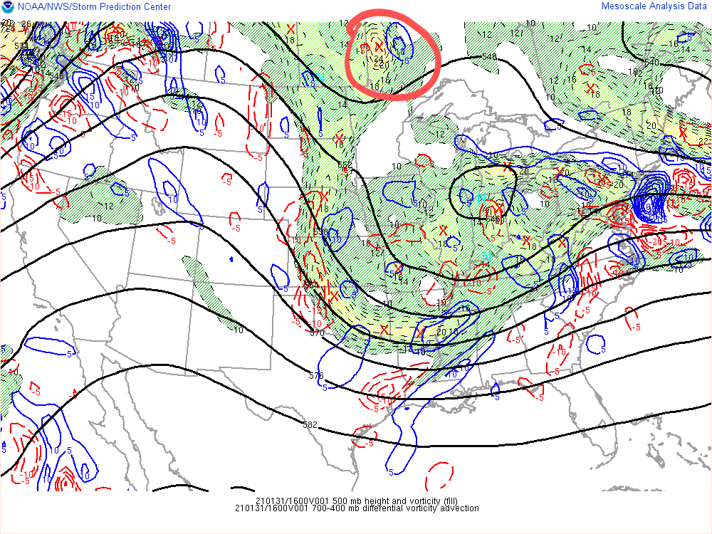
You can see it nicely on water vapor:
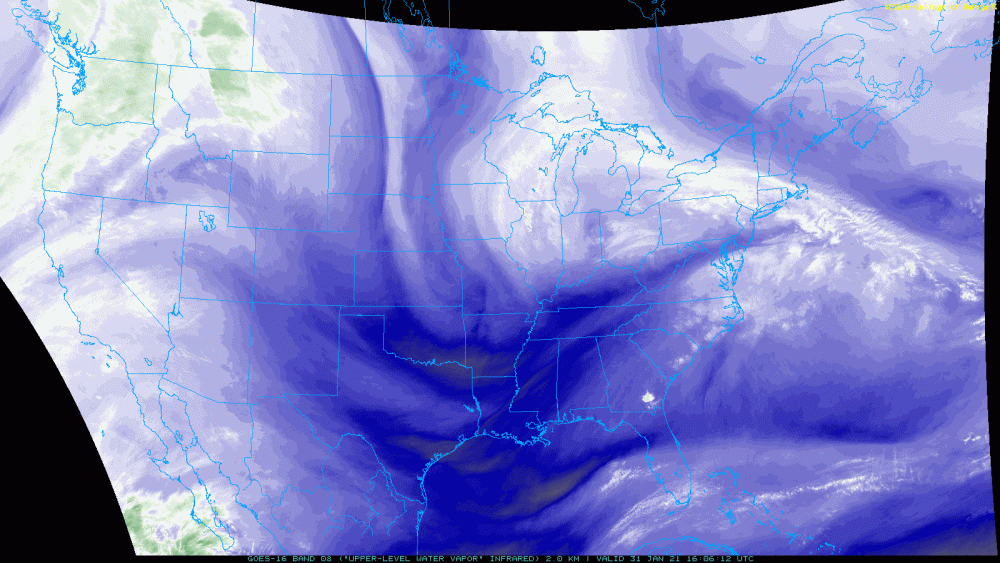
PVA from this feature seems to provide ample lift to sustain snow showers across the region into Tuesday morning. I can see some lake moisture enhancement creating some lollipops of 3+ over the course of the next 24-36 hours.
Do you think this will affect all of Ohio?? Thanks for brining this to our attention. Also, in this current set up, why doesn't Toledo get lake affect. Is it our Elevation??
-
What mesoscale model depicts lake affect/enhancement the best?? Sitting here in Toledo hoping for some lake enhancement with tomorrow's stiff easterly wind. Any help would be appreciated.
-
According to the 12Z GFS on 1/30 real winter will start the weekend of the 2/5 in the Great Lakes. Curious.
-
6" in Toledo final call. Wild card for busting low is rare lake enhancement that the models have been hinting at.
-
7.5" for Toledo. A bit wishful thinking but it feels right. First and final call.
-
11 minutes ago, WestMichigan said:
Given the lack of any significant snow in my area on the models I can assure you the more southern route is definitely the correct solution. You just can’t make it snow more than a few inches in the vicinity of GRR this year.
So not only do we use reverse psychology on our kids, but also on ourselves, LOL.
-
IF we learned anything from the last storm at this exact same time prior, congrats Mid-Michigan. Ok, let me have it.
-
1
-
1
-
-
Some serious cold starting to show up in the long range. Are teleconnections supporting this?? I thought this was supposed to stay in the NW and Alaska.
-
1
-
-
Living in Toledo, the most I've ever seen in 45 years was 13". The wind made a it seem like less.
-
2
-
-
Will never happen in my life time. Something like that happened in the early 1900's. I saw pics of the Railroad that takes that route from Toledo to Chicago.
-
1
-
-
1 minute ago, mimillman said:
Man this thing just runs into a wall on the 12z Euro.
Are you serious, Clark? What part of the sub does is putter out on??
-
It's kind of like watching Game of Thrones over and over again. Thinking something different is gonna happen
-
1
-
-
Honestly, this one just feels better. I'd be willing to bet that the current area of modeled snow will only shift 100 miles either way and gets a good portion of the sub!
-
1
-
 2
2
-
-
4 minutes ago, Harry Perry said:
Our biggest forecasted storm of the season dropped the least amount of snow. 3/4” - models, who needs them?
No Kidding. I'd almost rather just here the meteorologists interpretation of them, probably like it was 25 years ago. More reading, less looking.
-
1
-
-
Just now, A-L-E-K said:
buries us this weekend, are we gonna ride it to b2b disappointments?
It's like women having kids. After the experience, why do it again. It's a good thing they do though.
-
 3
3
-
-
23 minutes ago, MIstorm97 said:
last minute uptrend on the HRRR is welcomed here
My loss is your gain. I'm cool with it
-
Things definitely looking better for the SE MI area on the latest models. What did the 12Z Euro show?
-
Honestly, HRRR isn't terrible considering the confluence east of Lake Mi. Perhaps we'll get this to last a little longer through the mid part of the sub
-
What would delay the weakening? In other words, what would we need to see that could keep this going through the sub??
-
Does the NAM pick on Orthographic Lift?? Why do you suppose it's boosts totals in SE MI?? There is a Glacial Ridge in the spot.....Curious.
-
You blame them though?
-
1
-
Feb 6-7 storm?
in Lakes/Ohio Valley
Posted
I think something is about to happen, and I also believe no one has a clue, yet. The post above is hinting at it.