-
Posts
19,072 -
Joined
-
Last visited
Content Type
Profiles
Blogs
Forums
American Weather
Media Demo
Store
Gallery
Posts posted by Eskimo Joe
-
-
1 hour ago, Paleocene said:
Yeah, holy smokes on the bridge collapse. Not a good day in Maryland. RIP for those who are lost. This is going to have regional impacts for a long time.
The 4am wake up call for that was surreal. Weather isn't going to cooperate too much after tonight, with possible coastal flooding, rain, low ceilings, and wind.
-
On 3/24/2024 at 9:25 AM, Lowershoresadness said:
can an eclipse cause 4 minutes of rain changing to snow?
Good point. Maybe the models haven't taken this into account? /s
-
Our Lenten Rose's have finally come into their own. Amazing sustained blooms.
-
Wait, what?
-
17 hours ago, 87storms said:
Turned into a spectacular day…often times we’re cloudy and windy following a storm system. Late March sun ftw
Every station mesonet in Maryland recorded a perfect solar radiation curve today, with each site recording a daily maximum of over 900W/m².
-
 6
6
-
-
Garrett County got into the teens this morning. Impressive.
-
Baltimore City mesonet site is now live: https://weather.umd.edu/mdmesonet/?station=baltimore
For NOAA/NWS users, it should be in AWIPS/MADIS 12z on Thurs 3/28 as site 008MD.
-
 2
2
-
 1
1
-
-
-
Appears to be M1.3" storm total.
-
People would be jumping off the cliff if this were winter. We lost close to a foot of imaginary snow in 6 hours.
-
-
1 hour ago, yoda said:
I'm tired of the wind
-
 2
2
-
-
Another casual +15 departure at BWI...
-
 1
1
-
 2
2
-
-
14 minutes ago, nj2va said:
Looks like awful weather the rest of the month. Yippee.
20 years ago it'd be snow.
-
 3
3
-
 1
1
-
 2
2
-
-
4 hours ago, BlizzardNole said:
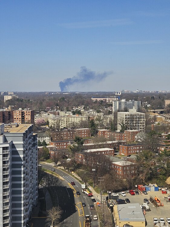
Already 72 in Germantown. That smoke you're seeing is from an Oil tank fire at asphalt plant
5 hours ago, Scuddz said:2 hours ago, pazzo83 said:we were out by Landover in PG County for a doc appt for my daughter and I thought I smelled something
-
On 3/13/2024 at 3:42 PM, pazzo83 said:
lmao mid 70s again today with filtered sunshine
We're so boned. We're racking up +15 days like it's nothing and the comments section on social media is willfully ignorant to it.
-
 1
1
-
 1
1
-
-
27 minutes ago, CAPE said:
Glass half full- we had a period with 2 snow events a few days apart, in the heart of winter. Snow on snow (here at least). There was a deep winter feel for 10 days. With a bit of luck/better wave timing, it could have easily been better. We had nothing like that last winter. Expectations were too high, as usual. We suck way more than not when it comes to snow, regardless of Enso state. As for the seasonal models and the persistently epic h5 looks depicted, lesson learned. Boilerplate warm ENSO. Lets remember that as we transition into a Nina, and we see consistently shitty looks advertised by the same models for next winter.
I was hoping for at least climo with a nice areawide 6-10" event. At least we got something.
-
 2
2
-
-
On 2/14/2024 at 1:36 PM, Terpeast said:
Even if this La Nina stays weak-moderate, the surrounding warmth of the oceans and the West Pac will create a very strong La Nina state much like 2022-23.
With a +QBO and solar cycle beginning to descend, we will likely have less blocking than even 2022-23. With all the cold air bottled up at the pole/Siberia or again dumping to the western NA, I'm thinking AN to much AN temps across the entire CONUS except maybe near normal over the Pac NW. East coast will likely be much AN+++ with 60s being commonplace, with strings of 70 degree days interspersed throughout even the deepest winter months.
Warmest winter on record across the east? Even higher chance of that happening than this year and last year.
Canceling winter before summer even hits. Classic Mid Atlantic.
-
That was a legit flizzard last night. Woke up to a light dusting on the deck. Officially recorded as a Trace in my Co-Op obs this morning. Our Frostburg mesonet site appears to have recorded a 1/2" measurement overnight, which now looks to have melted.
-
 2
2
-
-
19 minutes ago, PrinceFrederickWx said:
We were originally supposed to stay in Chagrin Falls, OH, but the owner canceled on us last year cause he was selling the property. So now we’re booked in Bristolville, OH. I’ll get fringed in a last minute north trend.

With the earth's axis tilting up for summer, wouldn't that imply a south trend? I don't think the model guidance will be honing on this until it gets closer to the event? /s
-
 1
1
-
 3
3
-
-
Forsythia bushes are starting to bloom. Tulips are coming up. Daffodils are blooming.
-
 1
1
-
-
1 hour ago, WxUSAF said:
Don’t know about snow, but I think a few hard freezes seem likely. Plenty cold to kill the magnolia tree blossoms that are going to come out next week probably…
Start the thread.
-
Look how warm the Great Lakes are, especially Lake Superior. Airmass modification for sure.

-
21 minutes ago, dailylurker said:
Moderate rain here. Looks like another soaker coming up the bay. It's going to be a wet day and night. I'm actually thinking about doing a rain hike this afternoon.
Our mesonet sites on the eastern shore are showing at least 1/2" of rain for the day. The speed of the system seems a bit faster than modeled maybe?
-
 1
1
-


The Key Bridge Collapse
in Mid Atlantic
Posted
Couple of key points: