

dwagner88
-
Posts
1,098 -
Joined
-
Last visited
Content Type
Profiles
Blogs
Forums
American Weather
Media Demo
Store
Gallery
Posts posted by dwagner88
-
-
6 minutes ago, Holston_River_Rambler said:
18z Euro still has it:

I don’t feel bad for them after the storm yesterday, but this would be a pretty big bust for western TN. Another maddening near miss here.
-
 1
1
-
-
It would take a very strange scenario to wind up with 3-4" of snow in downtown Chattanooga, and nothing in Polk Co. In fact that might be unheard of.
-
4 minutes ago, McMinnWx said:
LOCK IT IN!
Yeah! What could possibly go wrong with a 12" accumulation gradient cutting the Chattanooga area in half? I bet it's not handling sleet correctly.
-
2
-
 1
1
-
-
2 minutes ago, Hurricaneguy said:
The NE Valley has gotten zero snow love since Christmas Eve. It’s crazy these patterns keep snow away from us each time.
It could be worse. Trust me.
-
6
-
-
At this point I’m honestly so sick of the glancing blows and near misses, I’m just ready for 70’s and sun.
-
7
-
-
To my untrained eye, it appears that qpf is busting low in west TN and high in middle TN.
-
3
-
-
TDOT cameras in Memphis are crazy. Very low visibility.
-
1
-
-
QPF on the GFS is really high. Nearing 4” here.
-
2
-
-
Just now, WestTennWX said:
Interesting stat out of Memphis concerning temps, the extent and duration of this Arctic mass is impressive to say the least
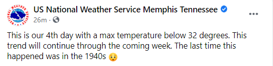
That’s a little bit ambiguous. Do they mean it will be the longest since the 40’s? Or that 4 days is the longest stretch since the 40’s? The latter would surprise me.
-
 1
1
-
-
I can’t recall ever seeing such a sustained temperature gradient as seen on the 18Z GFS. Comparing CHA to BNA over the next 10 days looks more like a comparison between CHA to CHI in January. We barely even get below freezing, they essentially stay below for 10 days straight with what appears to be 1.50” of ZR and barely any snow.
-
72 IMBY right now.
-
3
-
-
I have a feeling this one is going to be very frustrating to watch for those of us East of the Plateau. That SE ridge just isn’t going to allow the cold air into the valley.
-
Didn’t even manage a dusting here. Just some sleet in the gutters.
-
Warm nose is doing its work here. We got down to 34 as the precip started and even got some flakes mixed in. Now up to 36.5. I think it’s time to put a nail in this one for my area. Temp May continue to climb overnight.
-
 2
2
-
-
21 minutes ago, John1122 said:
If you're down to 34 I'm surprised you're not fully snowing yet. There must be a warm nose below 850.
I think you may be right. Back to 100% liquid and temp is 35.1. Let’s see if it drops again with heavier precip. In traditional southern valley fashion, it appears that Dalton and Rome are changing over, while we get rain. The shield has been raised.
-
43 minutes ago, Kasper said:
MRX actually dropped temps a degree or 2.
This is already wrong. I’m at 34 and not quite saturated yet. Snizzle falling at the moment. In a lull in the precip.
-
1
-
-
I have a few wet flakes mixing in.
-
4
-
-
14 minutes ago, PowellVolz said:
Low 30’s in N Georgia with heavy snow. Per friend of mine.
.Eh? Maybe in the blue ridge mountains of NE Ga. It’s certainly not snowing in the border areas. My backyard is at the GA state line. 38 and light rain here.
-
I’m actually feeling OK about this one. It’s definitely going to be an all or nothing event here. But the high rez NAM is clearly showing snow, just spotty accumulation around the ridge tops. I suspect reality will result in some grassy accumulations even at the lower elevations due to the timing. West of I-75 in the UHI will probably blank. Biggest question mark is a potential 850 warm nose.
-
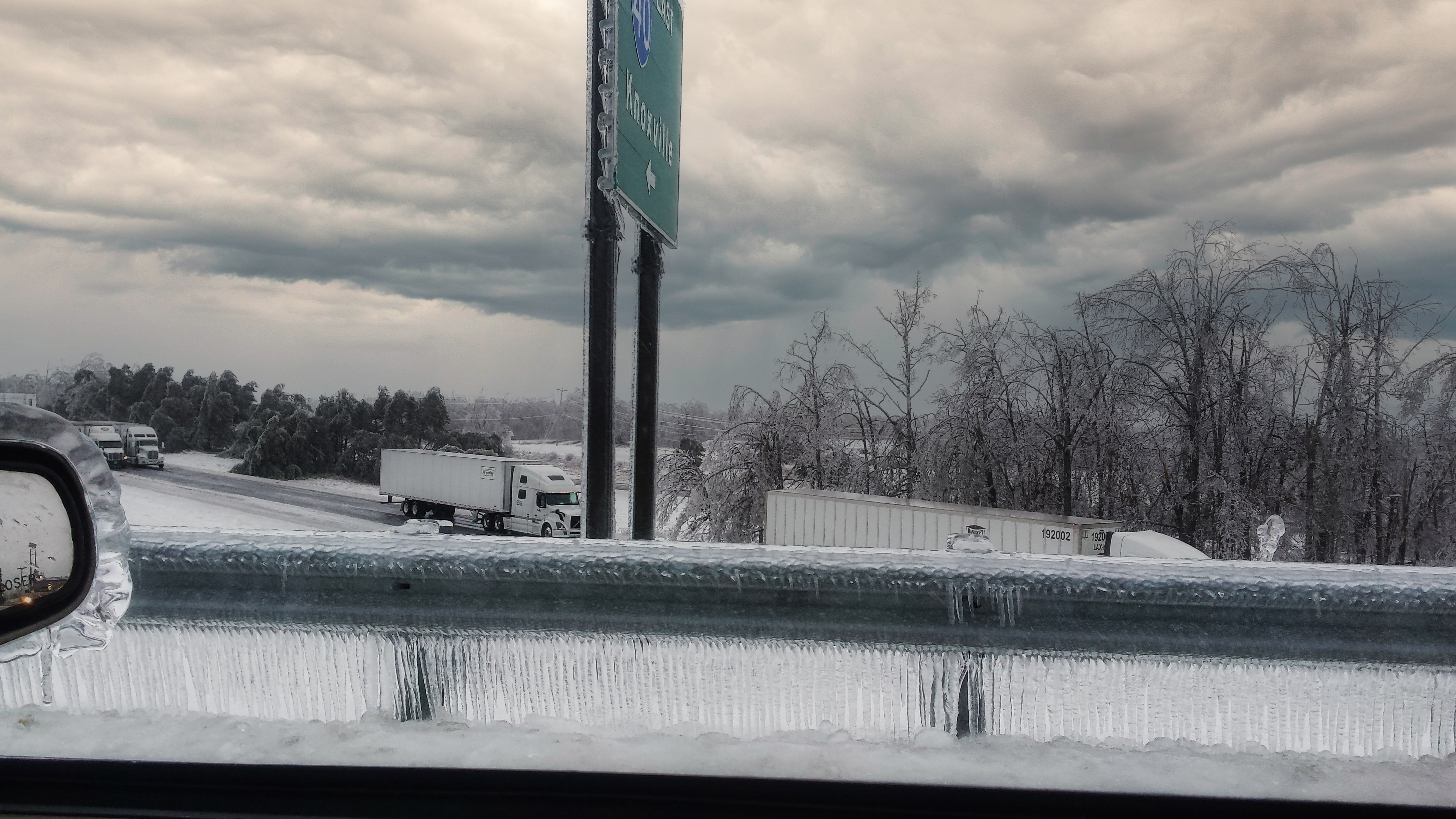
8 hours ago, Shocker0 said:
We had about 2 inches of ice here in that one :/. It was actually our second ice storm of the week in Crossville and I thought the first one was bad until this one hit.

Wow. I'd forgotten how bad this was just north of here. That's a crazy picture. One of those rare times I was glad to miss out on an event. Stayed at 33 here. Then we thankfully got rocked by the miller A on the tail end to the tune of 8-9".
-
1
-
-
49 minutes ago, Wintersnow888 said:
Don't know how reliable they are, haven't followed TWC much ....?
In this pattern, nothing is reliable at that range.
-
2
-
1
-
-
47 minutes ago, Blue Moon said:
The only association Birmingham has with the Tennessee Valley that I can think of is it has some municipalities serviced by TVA. Birmingham/Jefferson County, AL is not in the Tennessee Valley watershed. It's close, though. Huntsville, which is just 90 miles north, is most definitely in the Tennessee Valley region.
This map explains it pretty well, I think: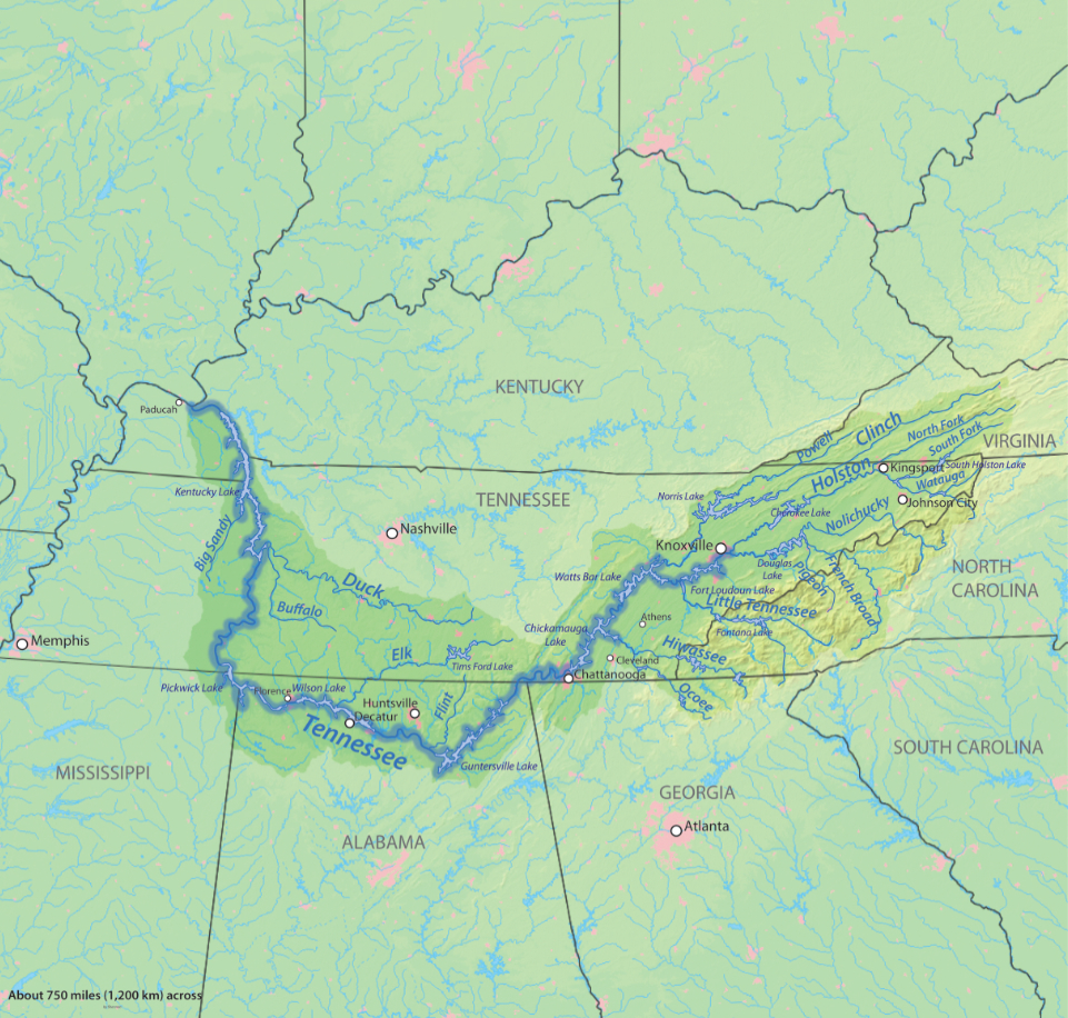
I always found it interesting that the only portion of TN that doesn’t drain to the Mississippi River is a very small slice of southern Bradley and Southwest Polk Counties. Conasauga river watershed.
-
2
-
-
Nothing here. Looks like signal and lookout mountains got a couple inches.
-
1
-
-
10 minutes ago, burrel2 said:
It looks like an area between Nashville and Chattanooga is getting buried right now. They had no warnings up a few hours ago... wwa now.
Buried? The highest reports I’ve seen are under 2”. It is falling a low elevations though. That surprised me. I figured it would only accumulate on the Cumberland Plateau.
February 17-18th Winter Storm Thread.
in Tennessee Valley
Posted
Was this winter storm Jonas in 2016? That event featured incredibly strong downsloping. I was working on Polk county at the time. It was 55 and sunny there but 36 and pouring rain in Chattanooga.