

dwagner88
-
Posts
1,203 -
Joined
-
Last visited
Content Type
Profiles
Blogs
Forums
American Weather
Media Demo
Store
Gallery
Posts posted by dwagner88
-
-
Blanked again. I think that's 5 days in a row of 60% or better POP's and only 0.06 total to show for it. I guess I start watering the lawn tomorrow. First time this year.
-
 1
1
-
-
On 6/28/2025 at 5:13 PM, John1122 said:
It's been incredible to see how the rain and storms have danced around my area this week. Only caught a few passing sprinkles as storms fired close and died out as they reached me. The high rain chances for today and tomorrow have faded too.
Same thing down here. I watched the storms pop up in the same areas three days in a row. Never rained more than a few drops IMBY. Some parts of town got 4"+ and flooding.
-
 2
2
-
-
3 hours ago, Carvers Gap said:
This is the best easy summer for rain in a long time IMBY. My garden looks like it is on steroids.
I haven't watered at all this year. Not even my planting beds. And I'm cutting my grass every 5 days.
-
We have many roads closed right now due to flash flooding. I’m betting the Hixson area has had 5” of rain this afternoon. Frequent hail too.
-
1
-
1
-
-
13 hours ago, John1122 said:
Huge dislike for this stalled front. I've no interest in seeing highs in the mid to upper 80s in early April. The fires have already been ridiculous in the area and they will be primed again with 3 or 4 days of strong winds and hot weather.
In 2023 we made it to July 1 before we hit 90. This year we may not make it through the first week of April. Friday and Saturday are going to be close. Official forecast is 88.
-
2
-
-
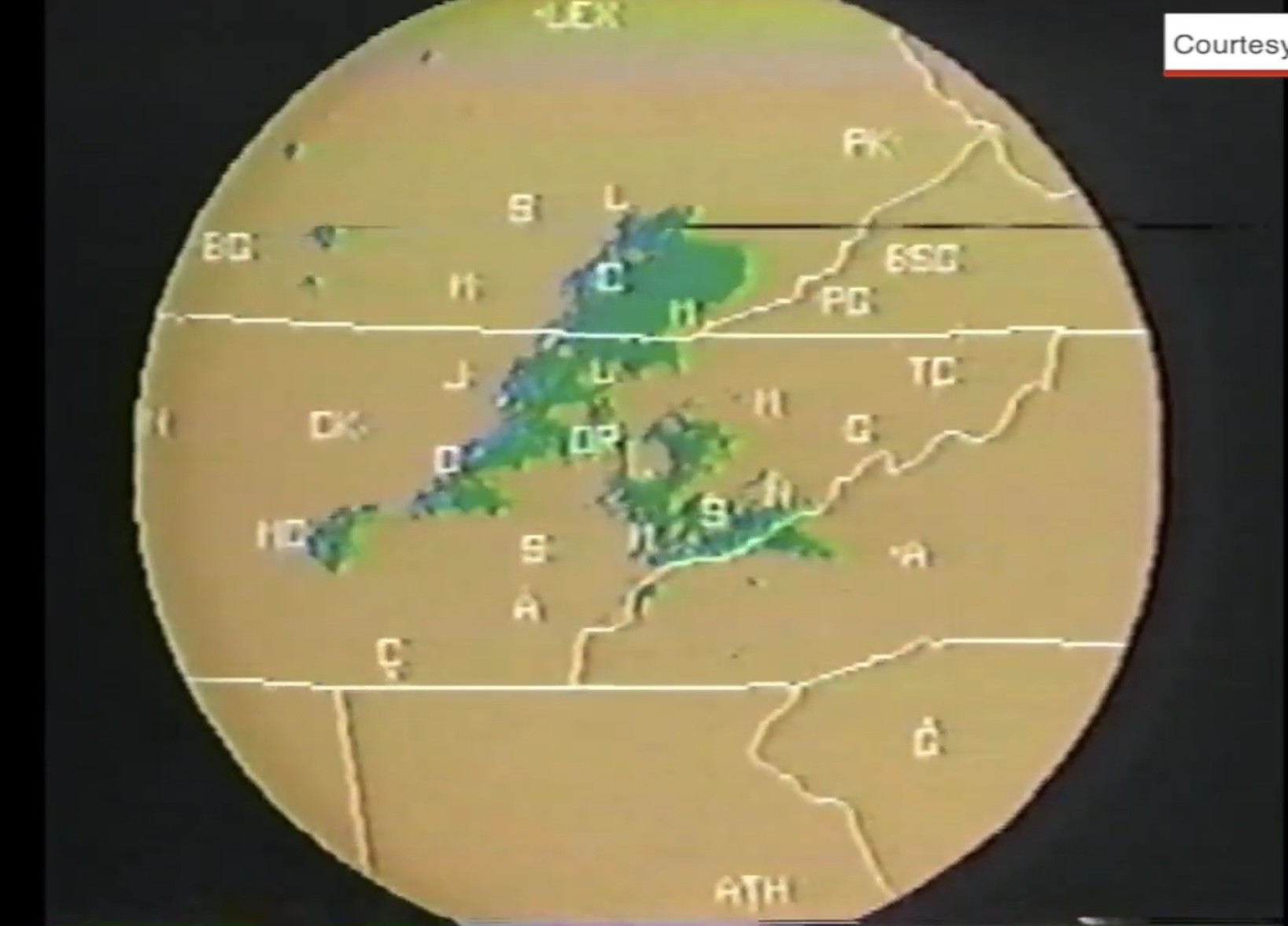
7 hours ago, PowellVolz said:
and this one got me… the radar WBIR was using then… my Atari had better graphics IMO. Lol

Athens and Asheville are both just "A" but Athens, GA is ATH. What a strange decision.
-
1
-
-
I'm a little surprised to not see a high wind warning from MRX for the valley tonight. We appear to be surrounded by them on all sides now. My point forecast mentions gusts to 55 mph, which I believe is well within warning criteria.
-
2
-
-
This is bordering on the most snow I've ever seen from NW flow here. Granted that isn't saying much, but there is a solid dusting. Usually it's just flurries.
-
4
-
-
The interstate is turning white in the ooltewah area.
-
4
-
 1
1
-
 1
1
-
-
Actually getting flow snow to accumulate down here in some areas this morning. The band orientation is almost due north to south which is limiting the downsloping that usually kills this variety of snow down here.
-
3
-
-
7 minutes ago, Holston_River_Rambler said:
Much vaunted late February sun angle has done exactly 0 to melt anything except on the roads.
It’s doing work here. Almost everything is gone even in the grass. Snow in Chattanooga is here for a good time, not a long time.
-
1
-
1
-
-
Getting some redevelopment down here. It stopped snowing about an hour ago, but has started back up again. Not super heavy, just light to moderate.
-
2
-
 1
1
-
-
Just under 2" here. Roads are just wet. It's very pretty. Stuck to every tree branch.
-
6
-
-
I’m kinda shocked to still be in the game at this point. Right now only the NAM is snowless.
-
5
-
-
4.25" IMBY. I think we wind up around 6" after Saturday. Worried about tree damage with any winds on the Saturday storms. The ground has gone from abnormally dry to totally saturated really quickly.
-
2
-
-
Just crossed 1” IMBY. Running way ahead of schedule per modeling so far.
-
3
-
-
I’m a little surprised to not see any flood watches up this morning from MRX. Maybe they are waiting until after the first impulse moves through.
-
5
-
-
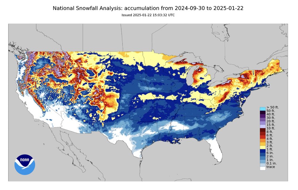
WPC 7 day rainfall forecast (live image link subject to change):

That's a large area of 7"+ and a huge area of 5"+.
-
4
-
 1
1
-
-
Man I wish we had totals like that down here. Only 0.60 so far. We have only had one heavy rain event (>2") since July. Helene.
-
2
-
-
Lots of freezing fog and slick roads this morning. We busted about 7 degrees low on temps last night.
-
4
-
-
1 hour ago, *Flash* said:
Certified wild, ya'll. For our areas, I'd say this winter is on pace for 'Could have been better, could have been worse' territory. We'll see how February/March fills this in...
Big ouch for northern LA and central MS.
-
6 minutes ago, PowellVolz said:
That’s gotta be 10+….. incredible
Still snowing there too. They may have another hour or two of good rates.
-
1
-
-
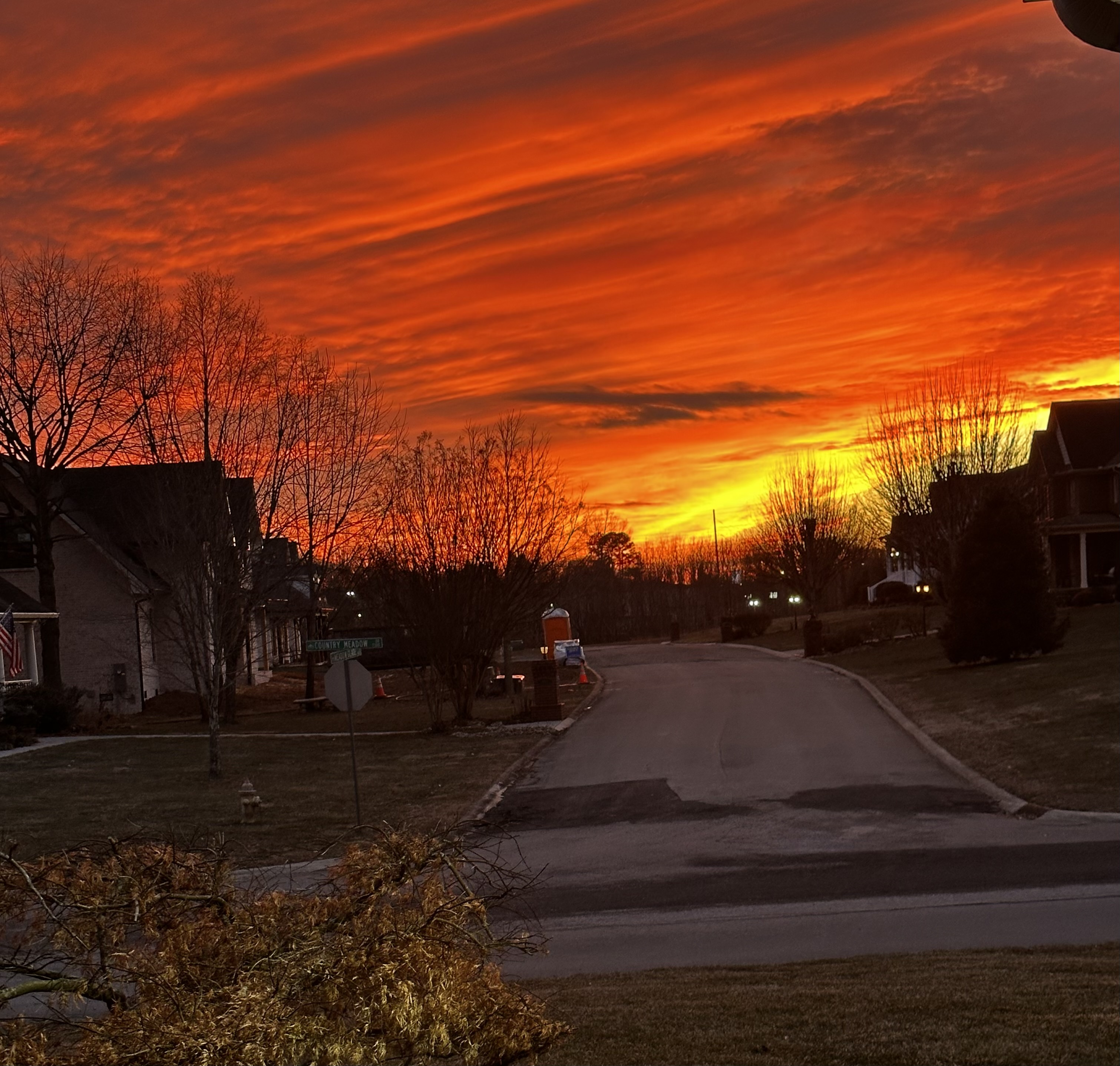
3 minutes ago, PowellVolz said:

Yeah we just had an absolutely incredible sunset here. One I will remember for a long time.
-
1
-
-
Just now, wncsnow said:
They are going to smoke Asheville, and Hickory too.
Probably most of the remaining southeastern US. They are getting hammered. I'm thrilled for them. That's awesome
Spring 2025 Med/Long Range Discussion
in Tennessee Valley
Posted
I still can't buy a raindrop here. Strangely, my only real rain the past three weeks came on a day with zero chance of it. I got a random shower that dropped 0.15" on Sunday. Nothing before and nothing since.