

Doramo
-
Posts
229 -
Joined
-
Last visited
Content Type
Profiles
Blogs
Forums
American Weather
Media Demo
Store
Gallery
Posts posted by Doramo
-
-
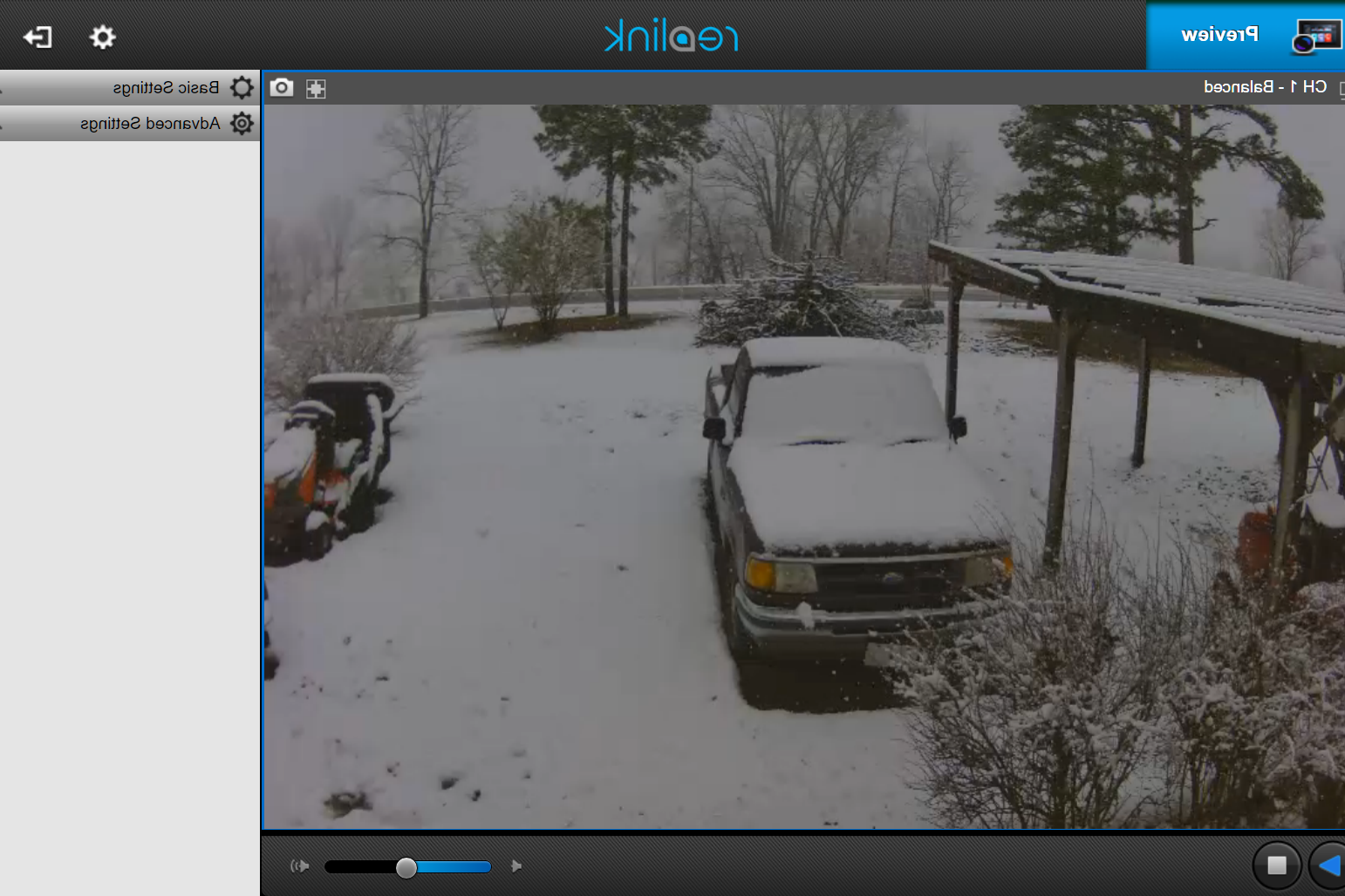
No additional snow accumulation here . Warmed to 35 and still spitting a few flakes now and then .
-
 1
1
-
-
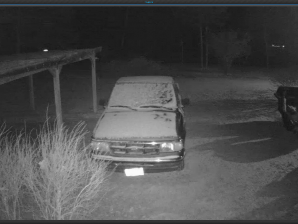
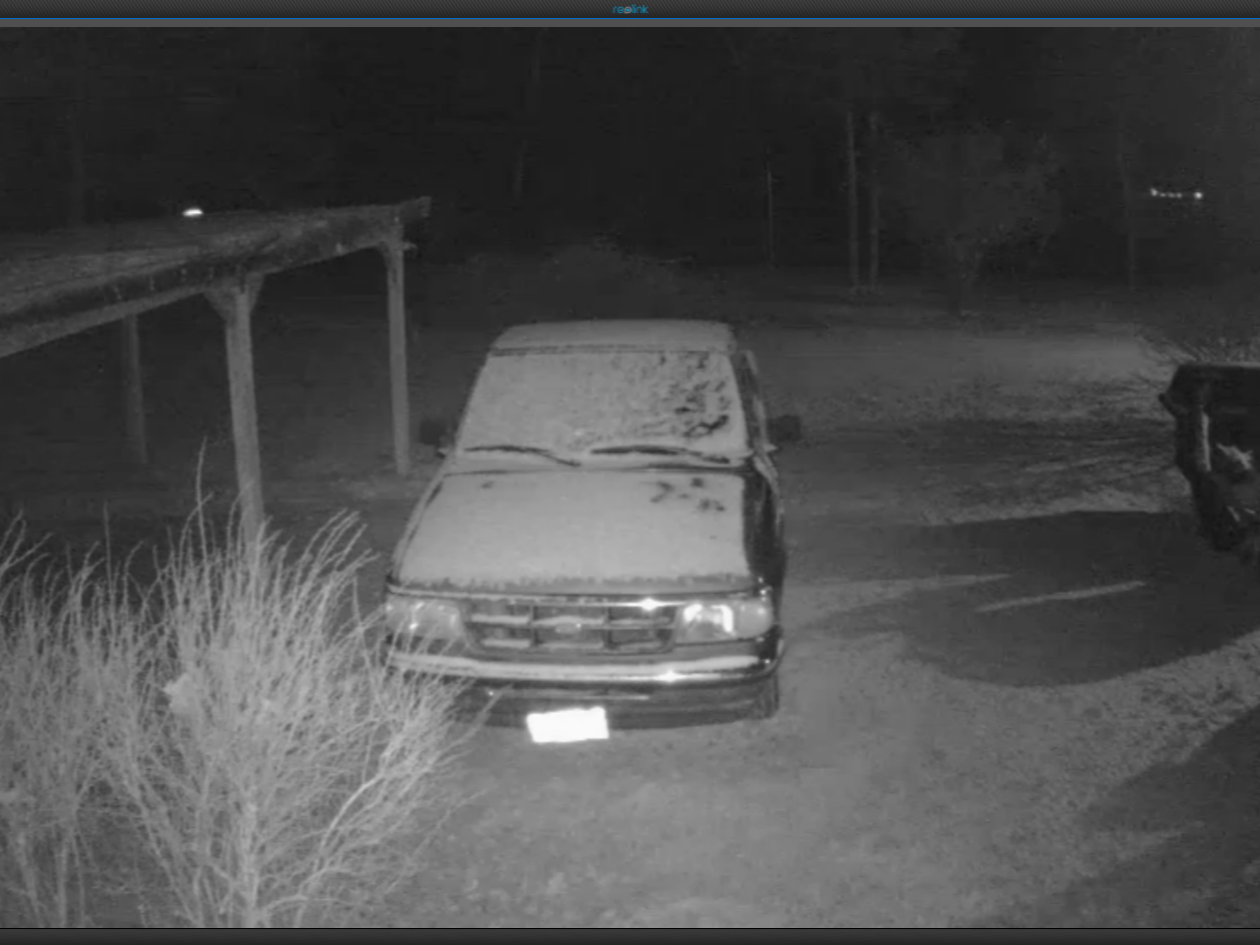
 WOW , 33 degress with 1 to 2 inch flakes coming down currently... About 1 1/2 in accumulation ..would be mush more if it was 32
  edit added pic .
-
3
-
-
1 hour ago, MUWX said:
Some places down in south central Missouri are getting a pretty good hit this morning. Seems to be over performing down that way.
Been/is snowing really good for the past four hours . It isn't amounting to much but it is sure nice to watch .
-
WINTER WEATHER ADVISORYISSUED: 2:55 PM JAN. 21, 2020 – NATIONAL WEATHER SERVICE
...WINTER WEATHER ADVISORY IN EFFECT FROM NOON WEDNESDAY TO NOON
CST THURSDAY...

* WHAT...Mixed precipitation expected. Total snow accumulations
of up to two inches and ice accumulations of a light glaze.

* WHERE...Portions of central, east central, south central and
southwest Missouri.

* WHEN...From noon Wednesday to noon CST Thursday.

* IMPACTS...Plan on slippery road conditions. The hazardous
conditions could impact the morning or evening commute.

* ADDITIONAL DETAILS...Locations along and south of Interstate 44
and east of Highway 65 will be the most vulnerable to hazardous
travel Wednesday evening as temperatures cool below freezing
with heavier precipitation moving in. Accumulations may not be
heavy, but icy roadways are anticipated as precipitation melts
and then freezes onto sub-freezing surfaces.
-
Snowed enough this evening to make the ground white...I did not expect it to do more than a few flurries so I am
")
-
3
-
-
When the big one hits this place will explode from 6yrs pent up energy

-
 2
2
-
-
Temps went to 33 and most ice melted at 11:am or so but now 3:15 pm temp dropped to 32 and ice is reforming . I thought the temp was supposed to continue to rise?
-
  The forecaster High of 45 actual 40  The accumulated ice prediction of .20 will make for a neat photo op


...WINTER WEATHER ADVISORY REMAINS IN EFFECT FROM 9 PM THIS
EVENING TO 6 PM CST FRIDAY...

* WHAT...Freezing rain expected. Total ice accumulations of up
  to two tenths of an inch. Isolated amounts up to a quarter of
  an inch. Winds gusting as high as 35 mph.
-
2 B or not 2 B?

DAYS TWO THROUGH SEVEN...Wednesday through Monday.

While there is a high degree of uncertainty at this time, there
is a chance for some wintry weather Thursday night into Friday
morning, especially over the eastern Ozarks. Stay tuned to later
updates.
-
1 hour ago, StormChazer said:
This Thurs-Sat system has the makings of something great IF we can get the cold air to stick around.
I say great, but if we get anything it would be an ice storm. But you know what? Give it to me.
I'm with you . Any frozen precipitation is welcome .
-
Was checking the long-range temp forecasts (Pivotal) and it is looking good about the 19 or so for cold temps to return . Now if the moisture coincides with the cold = good snow chances .

-
1
-
-
Freezing Rain/Sleet mix @ 31.6° 1" total predicted of mixed stuff. That is more than am expecting . Radar to the west/southwest of me is showing a moderate snow . Whether it gets here or not I don't know
-
1
-
-
I'm expecting to get lots of rain and maybe a flake or two of snow on the exit .

-
It is really nice to see this board come to life with something to actually follow
DAYS TWO THROUGH SEVEN...Thursday through Tuesday. Widespread rainfall will begin Thursday and will continue intermittently into Saturday. The heaviest rainfall amounts look to occur on Friday and Friday night. Two to four inches of rain will be possible across the Missouri Ozarks into southeast Kansas with the higher amounts expected over the eastern Ozarks. The heavy rain may lead to some flooding, especially near creeks, streams and low lying areas. Some strong to severe storms will be possible Friday into Friday night as the front moves into the area. Some limited instability will combine with strong shear and a strong cold front to provide the strong to severe storm risk. As the colder air moves in behind the front Friday night, precipitation may change over to some freezing rain over southeast Kansas into western Missouri. The transition to light snow will be possible on Saturday prior to the system exiting. Some accumulating snow will be possible. -
Nothing is definite as of yet but this is the closest chance of something significant this winter . Just hope it doesn't end with the Peanuts Lucy/ Charley Brown effect .
-
I like this fantasy, a YouTube forecaster , David Schlotthauer 's current take (ps I don't know how to resize this to be smaller ,sorry if it is too big )
projected forecast we may be in for a dilly...
-
"Here’s to hoping for a big storm soon, though. We’re due. " Hugely Way past due
")
-
2
-
-
Freezing rain and sleet here . Forecast sez some snow showers this afternoon . Nice break from what it has been recently .
-
1 hour ago, JoMo said:
And Springfield tossed me in the WWA an hour ago for an amazing dusting to 1" of snow and ice up to 1 tenth.
 nice !
-
the southward trend gives a tiny bit of hope....which is much better than nutten .
")
-
27 minutes ago, JoMo said:
Better look starting to show up on the GEFS long range.

Looking good
-
Had a mixed event at first yesterday but ended up with some nice flakes with a dusting of snow
-
3 hours ago, JoMo said:
I updated the title a few days ago for this year, hoping the 3rd time is a charm. Looks like winter will get started in the Northern Plains by the end of the week as the first big winter storm hits. Not sure what to expect this winter as there are some conflicting signals.
Thanks jomo...I should of looked at the ttile first... It had been the same for so long I guess I tired of looking...anyway my bad
 . And yeah as you mentioned winter in the plains etc. How about that snow monsoon they received in the North-West . I would so love a 3 ft snow here it our area. Anyway here is to hoping that the snow drought is finally over this winter and that mama nature reimburses us for the lack
-
Does anyone have an idea when there will be a winter 2019 - 2020 thread or is everybody still bummed out about 3rd (edit-3 yrs in a row) winter snow disparity ?
MO/KS/AR/OK 2019-2020 Winter Wonderland Discussion
in Central/Western States
Posted
We got 1/2" of snow . Enough to make things nice to view .