

Doramo
-
Posts
229 -
Joined
-
Last visited
Content Type
Profiles
Blogs
Forums
American Weather
Media Demo
Store
Gallery
Posts posted by Doramo
-
-
Don't know how much of what we may get over my way but as long as it is the frozen variety I is happy

-
26 minutes ago, WhiteoutWX said:
I’d say 18z GFS is likely about the ceiling for this event. Would definitely be a major storm for much of this sub
Now if it would hold steady and not pull a Nancy...
")
-
I sure hope that Feb is are jackpot month ?
-
29 degrees and a bit of freezing drizzle/light sleet coming down currently . 1/2" total of frozen stuff expected .
-
WednesdayNWS now has Snow Wednesday perhaps?NWS Springfield is forecasting this (https://forecast.weather.gov/MapClick.php?CityName=Dora&state=MO&site=SGF&lat=36.7768&lon=-92.2171A chance of rain before 2pm, then a chance of rain and snow between 2pm and 4pm, then a chance of snow after 4pm. Mostly cloudy, with a high near 43. Wind chill values as low as 19. North wind 6 to 15 mph, with gusts as high as 24 mph. Chance of precipitation is 50%.
-
edit( Just ended snowing ). We have around 1 - 1/2 " maybe 2" . Hard to measure with the melting affecting some areas more than others . But anyway I got to watch it snow for several hours
-
 5
5
-
-
Started snowing here about 2pm . Temp is now at freezing with around 1/2 inch of snow . So who knows we may end up with a couple inches, or more I hope.
-
Rain to snow has been moved up a lot was 3pm but now 11am to change to all snow . Only problem is temps not to drop to freezing till after 4pm or so . Maybe if snow start dumping it will bring temps down quickly .
SaturdayRain and snow showers, becoming all snow after 11am. The snow could be heavy at times. Temperature falling to around 33 by 4pm. Wind chill values as low as 22. Northeast wind 9 to 16 mph, with gusts as high as 31 mph. Chance of precipitation is 100%. New snow accumulation of 1 to 2 inches possible. -
12 hours out and the models still can't agree to what's if it is to rain/snow when or where . So I still can't decide to be disappointed or excited

-
I hope the cold air moves in faster then it will be interesting for sure . I will be impatiently waiting for the 06z model runs . Lucy stay away
-
1
-
-
Whoopie do dah...We gonna get some sloppy rain/snow according to NWS
 Friday NightRain and snow showers likely, mainly after midnight. Cloudy, with a low around 32. East wind 6 to 8 mph, with gusts as high as 18 mph. Chance of precipitation is 60%. New snow accumulation of less than a half inch possible.SaturdayRain and snow showers before 2pm, then rain showers likely between 2pm and 4pm, then rain and snow showers likely after 4pm. High near 38. Wind chill values as low as 26. Northeast wind 9 to 15 mph, with gusts as high as 24 mph. Chance of precipitation is 90%. New precipitation amounts between a half and three quarters of an inch possible.
 -
11 minutes ago, JoMo said:
Doramo probably has the best chances with the upcoming system. These 'clipper' type systems usually end up farther east.
That is nice for us but I'd like for all of us to get snow . So maybe it will expand more west and south with enough snow to get this blog rolling
-
1
-
-
Little over one inch of snow here with a few lingering snow showers about still
-
1
-
-
3 hours ago, MUWX said:
Euro, NAM and Canadian are showing some light snow for SWMO later this week. Not much but better than nothing.
I'm surprised that the GFS isn't showing anything , not even rain ?
 But Springfield NWS had this to say:

National Weather Service Springfield MO
243 AM CST Mon Jan 3 2022
DAYS TWO THROUGH SEVEN...Tuesday through Sunday.

 " South to southwesterly wind gusts of up to 30 to 40 mph are
  expected at times on Tuesday.
  A fast moving system will bring the chance for light snow to
  the region Wednesday night into Thursday morning. Some minor
  snow accumulations will be possible."
-
We got a dusting of snow here . Was nice to see some flakes coming down .
-
1
-
-
Merry Christmas to all
-
2
-
-
I had a Happy Thanksgiving and I trust all had the same...and now unto Merry Christmas Y'all
-
1
-
-
12 hours ago, JoMo said:
Did you feel the Earthquake? And yeah, it's still very much in the air about next week, everything would have to line up pretty well for it to happen.
I hadn't noticed the earthquake here .
-
On 11/15/2021 at 1:00 PM, JoMo said:
The Thanksgiving time period has switched around a lot on all the models from run to run. Theoretically, it's possible.
Although there is little chance of a huge snow event happening next week , just the mention stirred up my snow excitement

-
This is my go-to
 place for winter weather info!
-
22 hours ago, jojo762 said:
I'd take it... 2013 was VERY boring until the last two weeks in May -- which saw NINE Moderate risk days across the Plains, with some very notable tornadoes thrown in there: Our last official EF5 tornado, in Moore, and the El Reno 302mph, 2.6 mile wide tornado to name a couple.
The two E5's made the whole season in itself . I don't think we need another of those . Just give a bunch of E2-3's
-
Light snow beginning to come down . The snow showing on the radar isn't much . Will get a dusting at most . As always it is fun to watch .
-
1
-
-
NWS forecast tonight: " A slight chance of snow before midnight, then occasional light snow after midnight. Low around 10. Light and variable wind becoming north 5 to 7 mph in the evening. Chance of precipitation is 80%. Little or no snow accumulation expected." This is a bonus snow I guess . I Like! I think I will stay up late to watch .
-
2
-
-
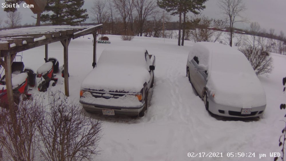
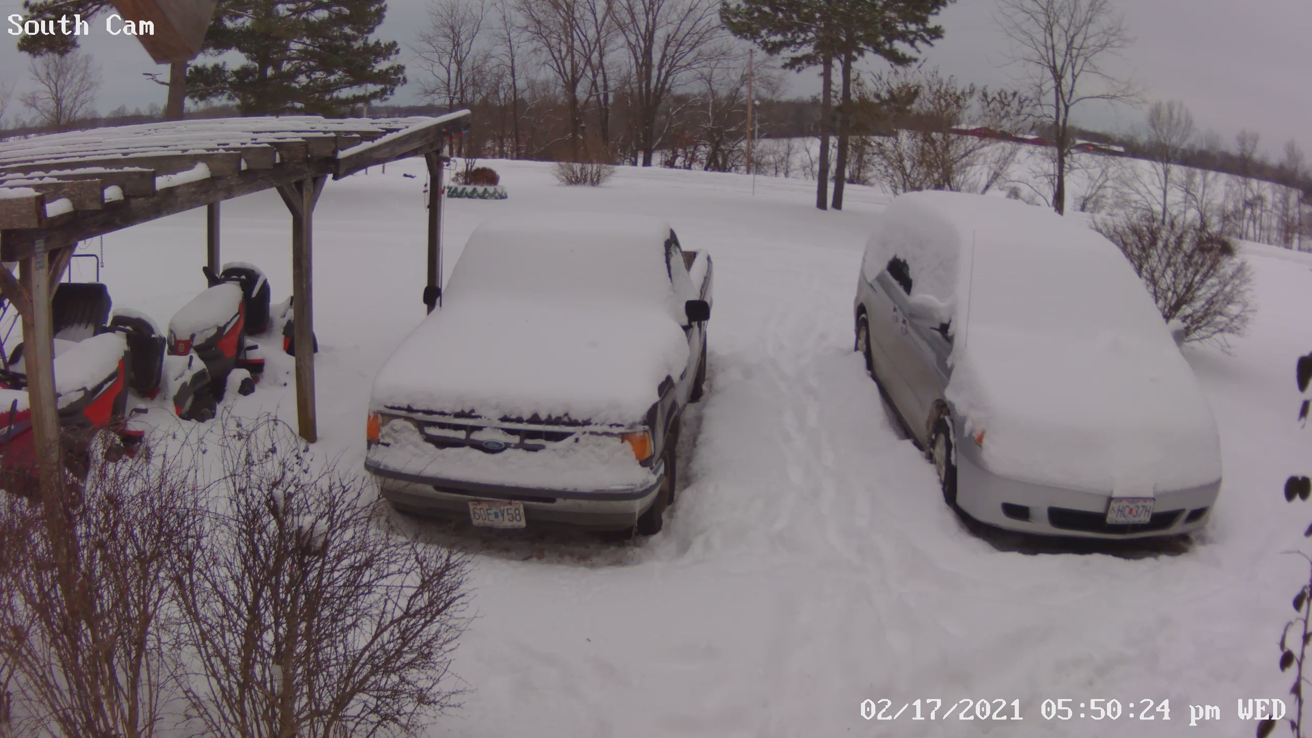
3" new snow here and happy as ever! No snow drought here ...

-
1
-
MO/KS/AR/OK 2021-2022 Winter Discussion
in Central/Western States
Posted
Temp finally got to 32 about 6:30 . It is currently 29 with freezing rain with a bit of sleet here. Just my vehicles and handrails iced up so far .