

Doramo
-
Posts
229 -
Joined
-
Last visited
Content Type
Profiles
Blogs
Forums
American Weather
Media Demo
Store
Gallery
Posts posted by Doramo
-
-
Latest NWS Springfield
"Area Forecast Discussion
National Weather Service Springfield MO
639 AM CST Mon Nov 14 2022------"

"Key Messages:--------

----"1. Light snow likely tonight with some light accumulation. Minor
road impacts are possible."
Confidence remains good that most locations will receive anywhere from a trace to an inch of slushy snow. This is backed well by the latest NBM and GEFS probabilities. The GEFS indicates about a 80-90% chance of measurable snow for the Ozarks with a swath of 30-40% probabilities for greater than one inch of snow that extends along the Ozark Plateau and across the eastern Ozarks noted by the HREF. Limited road impacted will be possible, which is supported by the experimental WSSI output with the best possibilities in the eastern Ozarks. -
Monday NightYeah, the " storm " is duding out . Was too much to expect for middle of November . But we did get an bit over an inch of snow already the night before last and that is the first time I can remember since I move here in 1989 that accumulating snow came this early. Usually snow doesn't happen here until the last week of November if then . So all in all I'm happy for whatever we get .
 Snow, possibly mixed with rain before midnight, then a chance of snow. Low around 28. Light and variable wind. Chance of precipitation is 80%. New snow accumulation of less than one inch possible.
-
 1
1
-
-
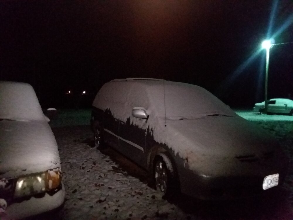
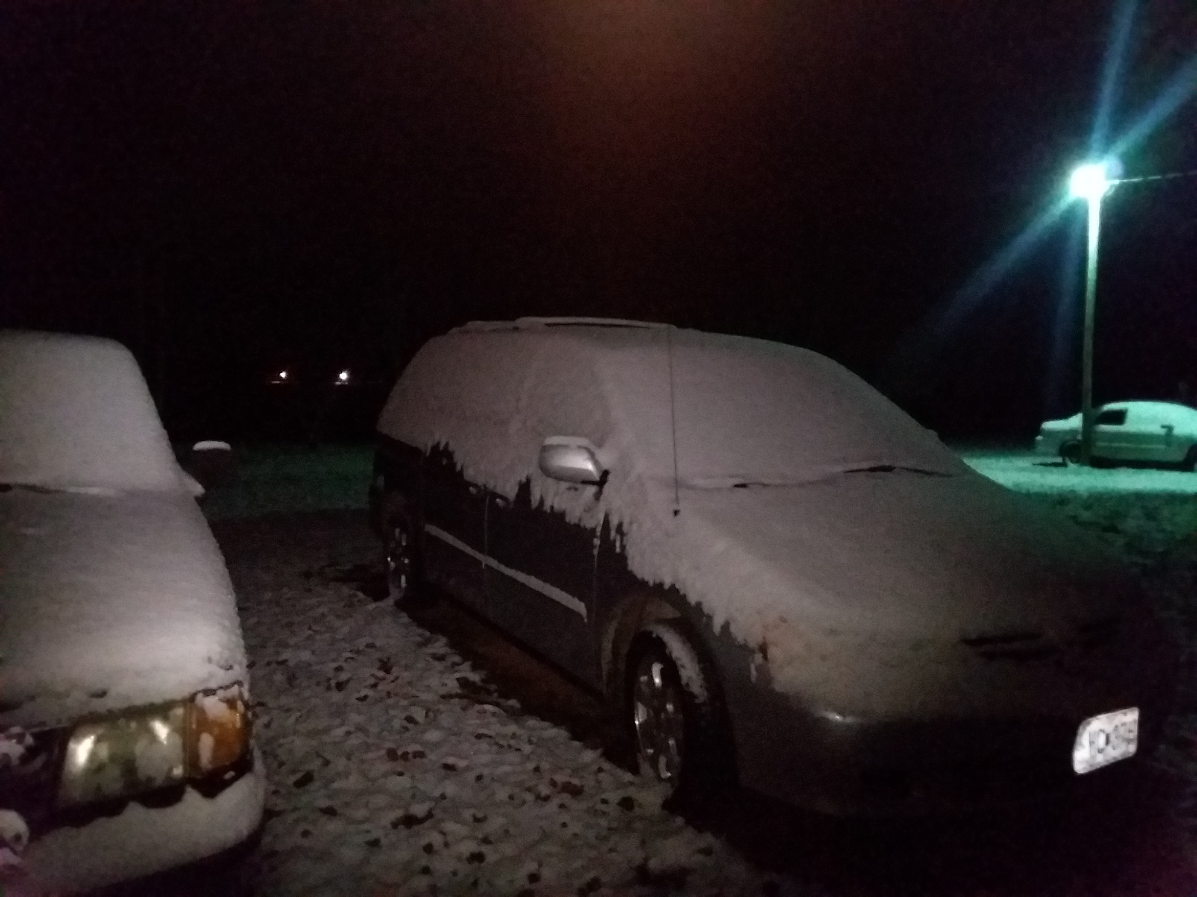
Snowed a little over one inch here.

-
4
-
-
NWS : Hazardous Weather Outlook is for portions of the Missouri Ozarks and extreme southeast Kansas. .DAY ONE...Today and Tonight. Weather hazards expected... Limited snow risk. DISCUSSION... A dusting to a half inch of snowfall will occur in grassy areas tonight along and south of a Winona to West Plains line. No impacts to roads are expected. .DAYS TWO THROUGH SEVEN...Saturday through Thursday. Light snow is becoming increasingly likely Monday night into Tuesday morning. Light accumulations are possible, however exact amounts remain highly uncertain.
-
Looks like La Nina again this 2022/2023 winter for an rare threepeat . La Nina not expected to go to a neutral phase until about February . So what does that mean for us this winter . Will it be near the same as last years 21/22 winter or what? Here in southwest Mo we had some nice snows of which I would like
. Just curious?
-
Ended up with a bit over 2" here
-
1
-
-
1.25" so far here in Dora, Mo and It's still coming down
-
1
-
-
11 hours ago, JoMo said:
We may have something to watch in the neighborhood in about 5 days or so? We'll see.
Looks like there is a good chance say 60% with the way NWS is currently talking .
-
1 minute ago, Doramo said:
+ 1
I would love to see big wet snow . It has been a long time so it is due
-
1
-
-
3 hours ago, stormdragonwx said:
So who thinks we might squeeze out one more decent snowstorm across the Southern Plains/Ozarks? I remember in the 90's 00's that was a regular thing in March. Including some of our biggest, wettest snowfalls.
+ 1
-
Something to keep an eye on....cold making a comeback in a big way.

-
The predicted monster storm was a wimp

Sleet total 2" with just a glaze of ice . Temp 28
-
2
-
-
Began sleeting here around 11:30am Heavy at times with a few snowflakes mixed in .
-
1
-
-
1 hour ago, Wx 24/7 said:
Sleet and freezing rain is going to be quite a mess. I am especially concerned about NW AR in the major cities of the area on up into far southern MO.
We're 30 miles north of Mt Home AR.... Things not looking good as far as freezing rain/sleet
" Winter Storm Warning"
* IMPACTS...Power outages and tree damage are likely due to the ice.
  Travel could be nearly impossible. The hazardous conditions could
  impact the Wednesday evening and Thursday morning commutes.
-
1 hour ago, Wx 24/7 said:
It is awfully quiet in here.
NWS Little Rock is on board with a Winter Storm Watch.
Springfield seems to be less aggressive at this point.
I agree ! Arkansas has winter storm warning and southern Missouri doesn't even have an advisory ? Yet the Springfield - NWS and local forecasters discussions have said significant freezing rain up to .25 " and sleet will happen . Hmmmm? I guess most are not buying into it . Would you all in the know give us your take on this event? Thanks
-
4 hours ago, Ozarkwx said:
Quite the ice or sleet storm for N. ARK and SE MO on Wednesday/Thursday depending on which model you believe (if you believe either one, lol). GFS is the sleet storm with freezing rain further south and Euro is the ice producer. Neither one shows quite as much precip further north where snow/sleet would be more likely.
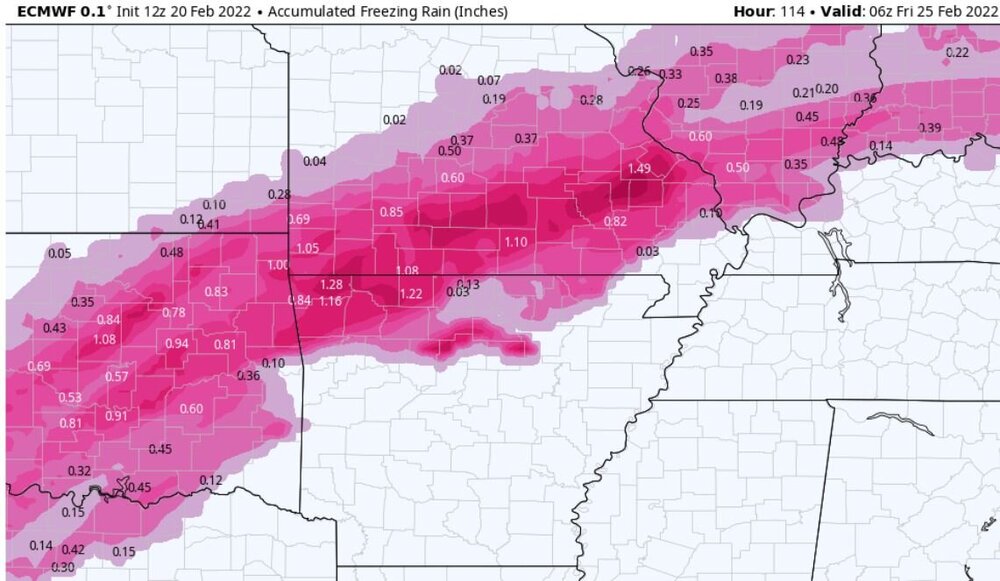
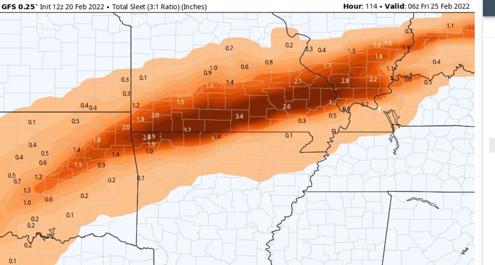
Wow! 3.4" sleet and 1" freezing rain ? I know it's not set in stone but I hope the snow line transitions farther south . The road department snow removal doesn't get in a hurry to do our road when it snows. So with that much ice n sleet I wouldn't be able to leave my house for several days .
-
7 hours ago, JoMo said:
12z Euro pretty nice for around these parts.
Looks to be a bit of everything . It will be interesting if this holds as the front comes on shore tomorrow .
-
NWS Springfield Mo. has this to say :
"
..."Ensembles then diverge slightly with the ejection of the trough
Wednesday through Thursday. The trend over the last 24 hours has
been to eject the trough further south into Texas and Arkansas.
This would generally allow for a warm period with rain Wednesday
and Wednesday night, then colder with some potential change over
to wintry precip on Thursday as the system departs. Recent NBM
runs continue to come in colder with temps on Thursday. GEFS and
ECMWF ensembles currently have probabilities over 50% for 1 inch
or more of rainfall with this system. The Extreme Forecast Index
does highlight the potential for a heavy precip event near the
area. NBM probabilities for any wintry precip on the backside of
this system is currently over 70% therefore will need to monitor
the track of this system as it comes on shore Monday."....
-
1
-
-
Something to keep an eye on next Wed/Thurs . Some models showing some snow possible freezing rain etc. during that time frame . It's a ways out so maybe it will turn into something tangible .

-
1
-
-
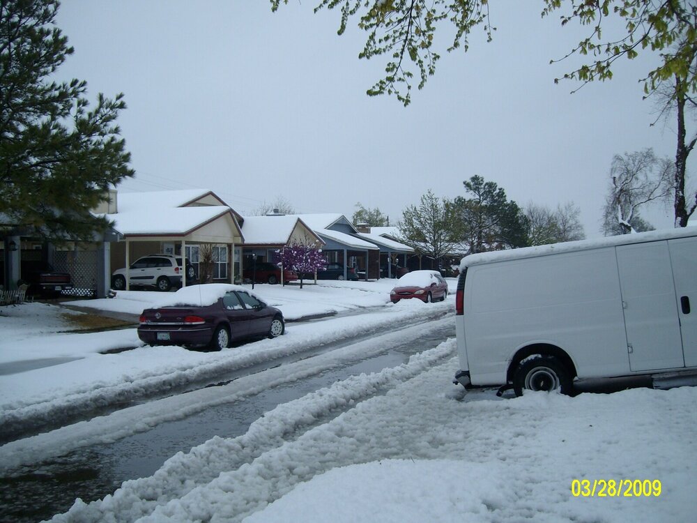
Got another 1/2 " here with total 6 1/2"
-
1
-
-
6" here ..... Snow is about done this round, now unto the final
-
1
-
-
1 1/2 inch of sleet 2 1/2 inches of snow . I was thinking that sleet was never going to stop . I went to bed at 2am it was still sleeting and I got up at 3am it had changed over to snow . It's still snowing moderately Supposed to get up to 3 inches more snow today (I hope) then another inch or more tonight through tomorrow morning . I'm a happy camper

-
1
-
-
All sleet here now although it is getting heavier . North Central Ar is calling for mostly sleet and snow up to 2 - 5 inches
 So maybe that's what we end up with here too .
"WHAT...Expect ice accumulations of a glaze to a quarter inch...
  with higher amounts of one-quarter to one-half inch in portions
  of Jackson, Independence, Cleburne, White and Woodruff counties.
  Snow and sleet accumulations of 2 to 5 inches...with locally
  higher amounts over 6 inches possible across the higher
  terrain. Lesser sleet/snow accumulations are expected where the
  higher ice accumulations are expected.

* WHERE...Northern and northeast Arkansas."
-
1
-
-
Small flakes/sleet coming down here with temp of 21 . The main event is 40 smiles away per radar .
-
1
-


MO/KS/AR/OK 2022-2023 Winter Discussion
in Central/Western States
Posted
Wow ! We currently have wet snow coming down. Now I'm really curious as to how this night unfolds.