frontranger8
-
Posts
398 -
Joined
-
Last visited
Content Type
Profiles
Blogs
Forums
American Weather
Media Demo
Store
Gallery
Everything posted by frontranger8
-
Yeah, severe t-storm watch and then couldn't even see any storms from here. Today looks a little less hazy, I think.
-
Occasional Thoughts on Climate Change
frontranger8 replied to donsutherland1's topic in Climate Change
Thanks. That is important when comparing this event to historical ones. The big numbers in that graphic are obviously due in part to short period of records. Not to say this event is not significant, it certainly is, but records have to be analyzed based on POR, etc. Context matters. -
2026-2027 Record-breaking El Nino
frontranger8 replied to Stormchaserchuck1's topic in Weather Forecasting and Discussion
Correct, I'm just talking about what exactly determines the PDO numbers. You can see it clearly looking back through the years. -
2026-2027 Record-breaking El Nino
frontranger8 replied to Stormchaserchuck1's topic in Weather Forecasting and Discussion
I believe the biggest factor for PDO calculations is that pool of water south of the Aleutians and to the north/northwest of Hawaii. -
Occasional Thoughts on Climate Change
frontranger8 replied to donsutherland1's topic in Climate Change
Is the 33 record breakers for stations with 80+ year histories all-time records or monthly records? -
2026-2027 Record-breaking El Nino
frontranger8 replied to Stormchaserchuck1's topic in Weather Forecasting and Discussion
I think the main issue with comparing the PDO from 2015 to 2026 is that was a second year Nino, which tend to have +PDO much more established by this point. Since it is a lagged response in part to ENSO. I would be surprised if the PDO is not at least moderately positive by early winter. -
Occasional Thoughts on Climate Change
frontranger8 replied to donsutherland1's topic in Climate Change
Not to downplay the casualties from this event at all, but that's one statistic that's a stretch to tie directly to the record heat. Heatwaves in general do increase drownings, but the evidence does not suggest that they rise in proportion to extreme heat. Heat waves increase the overall risk of unintentional drowning by approximately 17% to 26%, depending on the intensity of the heat wave. This spike is primarily driven by a surge of people seeking relief in unsupervised bodies of water. [1, 2] Key Risk Factors Activity: Swimming and bathing-related drownings see the largest jump, increasing by 28% compared to non-heat wave days. Demographics: People aged 65 and older are the most vulnerable, facing a 36% higher risk, followed by children/teens at 24%, and adults (20–64) at 7%. Gender: Men are disproportionately affected, being 22% more likely to drown during a heat wave compared to a 5% increase for women. [1] Geography & Extremes While risk generally climbs with heat, studies show that during extreme (the highest intensity) heat waves, drowning rates can actually fall slightly (to around a 9% increase), likely because the heat becomes so oppressive that people choose to stay indoors. -
2026-2027 Record-breaking El Nino
frontranger8 replied to Stormchaserchuck1's topic in Weather Forecasting and Discussion
Would not say it balanced out that month.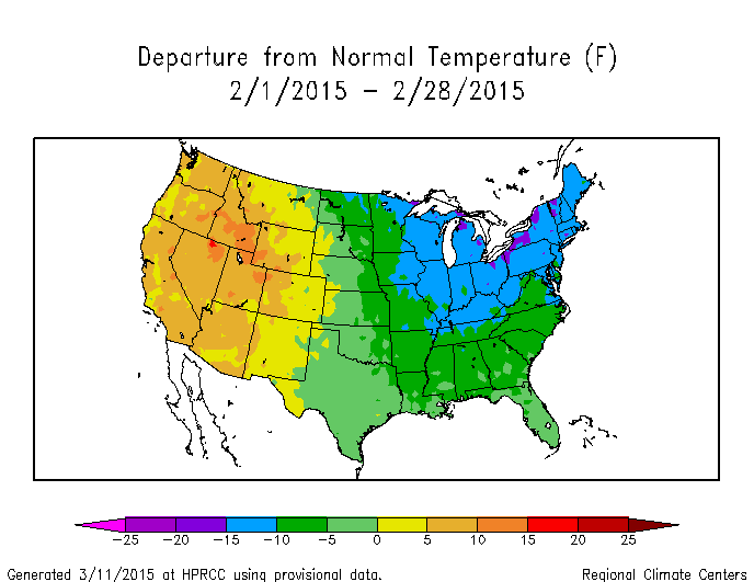
-
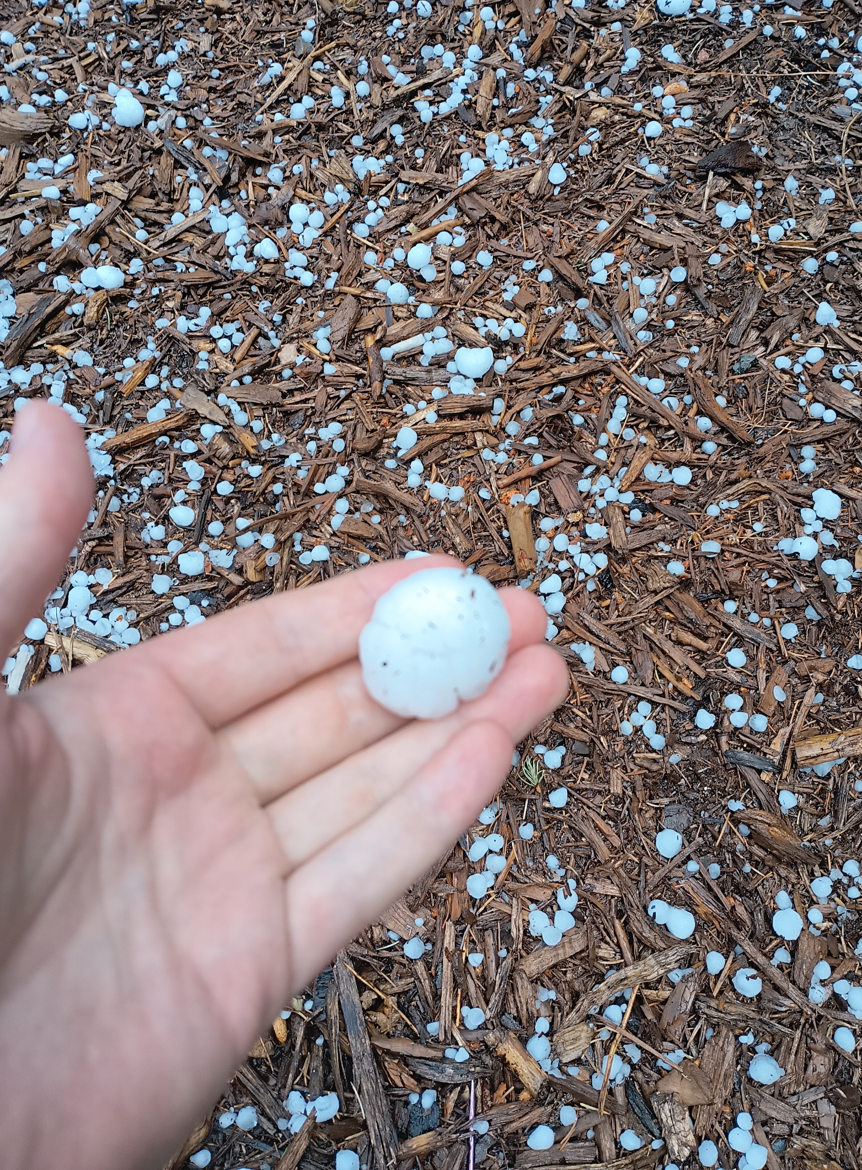
Got slammed again with .39" in less than an hour earlier. Some hail but nothing bigger than marble size.
-
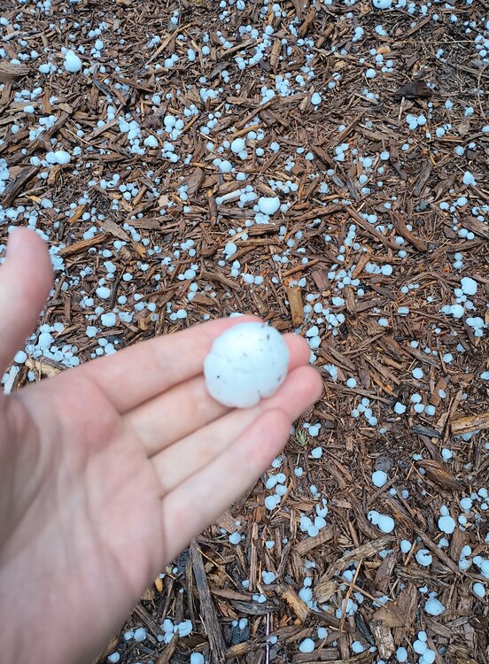
Got nailed today. Ping pong sized hail and .45" in 30 minutes.
-
Been the same here the past couple of days. Lots of lightning yesterday evening, storms all around...and .01".
-
I've seen more hype for a super Nino this coming winter than I ever remember before.
-
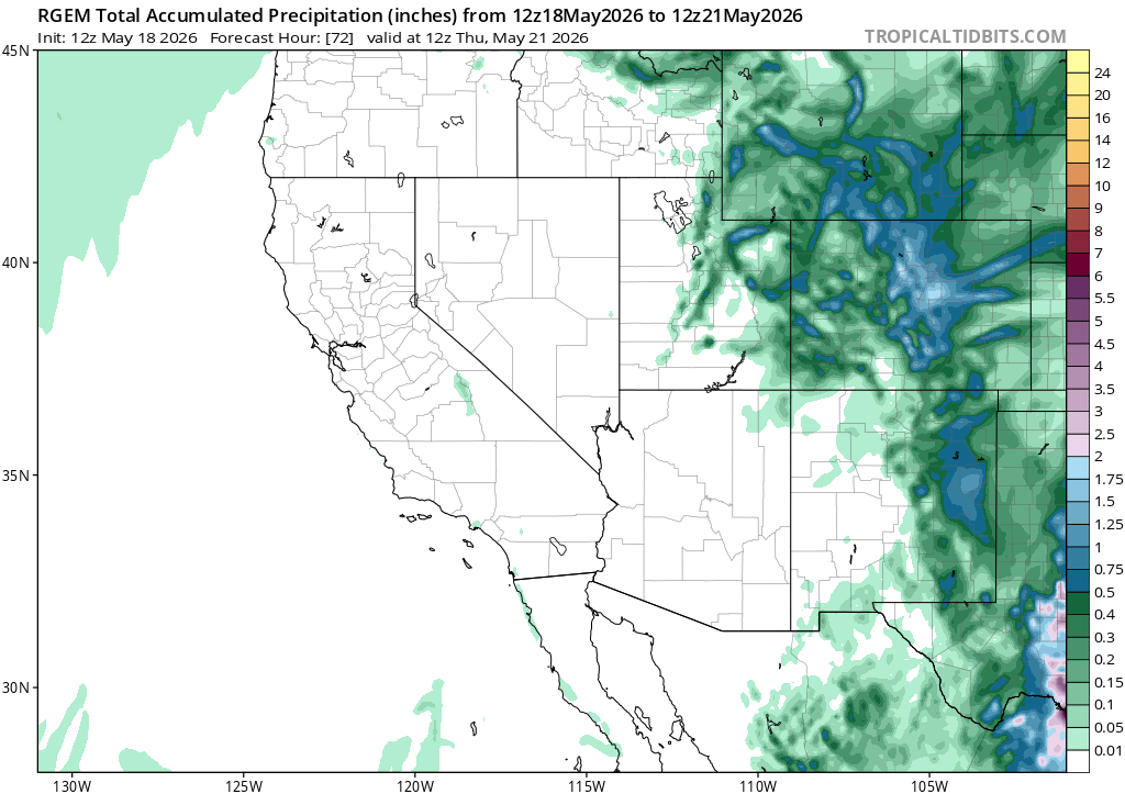
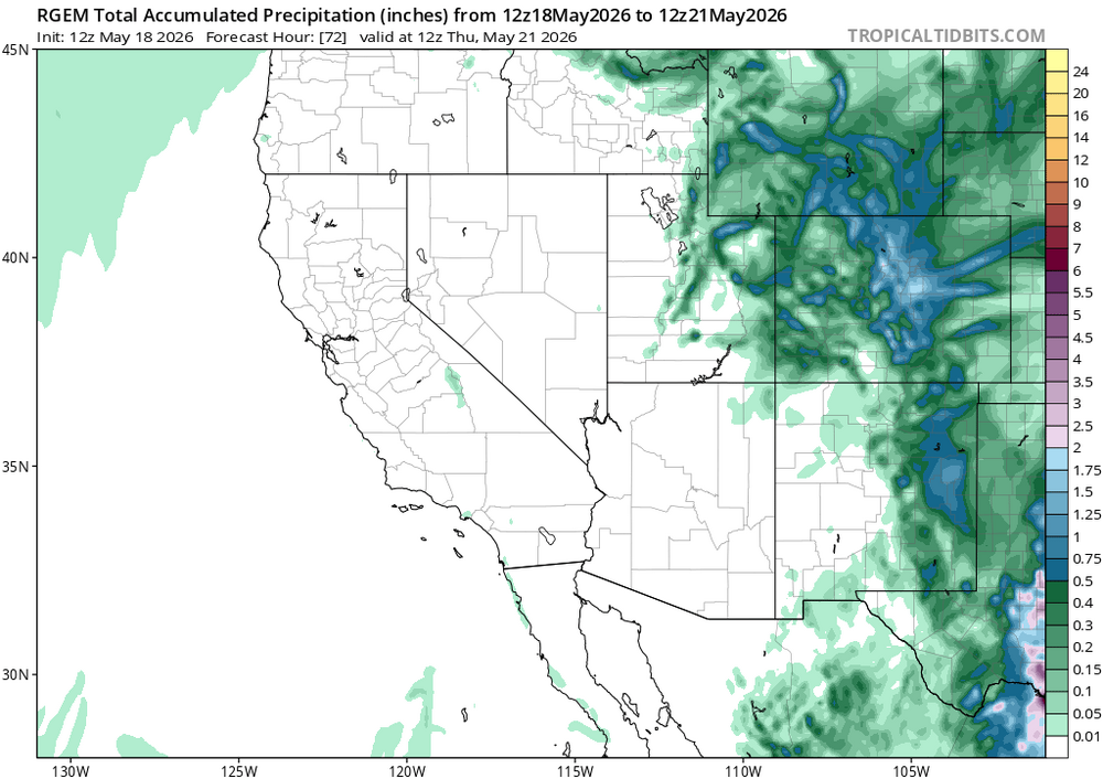
Most models are also showing a decent amount of additional precip Tue-Wed.
-
Had .3" yesterday and another .15" overnight from heavy drizzle. Still looks good to pick up at least another .5" from this storm today.
-
What's the latest you've seen snow there? I don't think I've seen it more than a day or two after Mother's Day here.
-
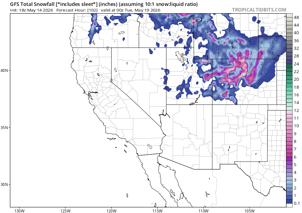
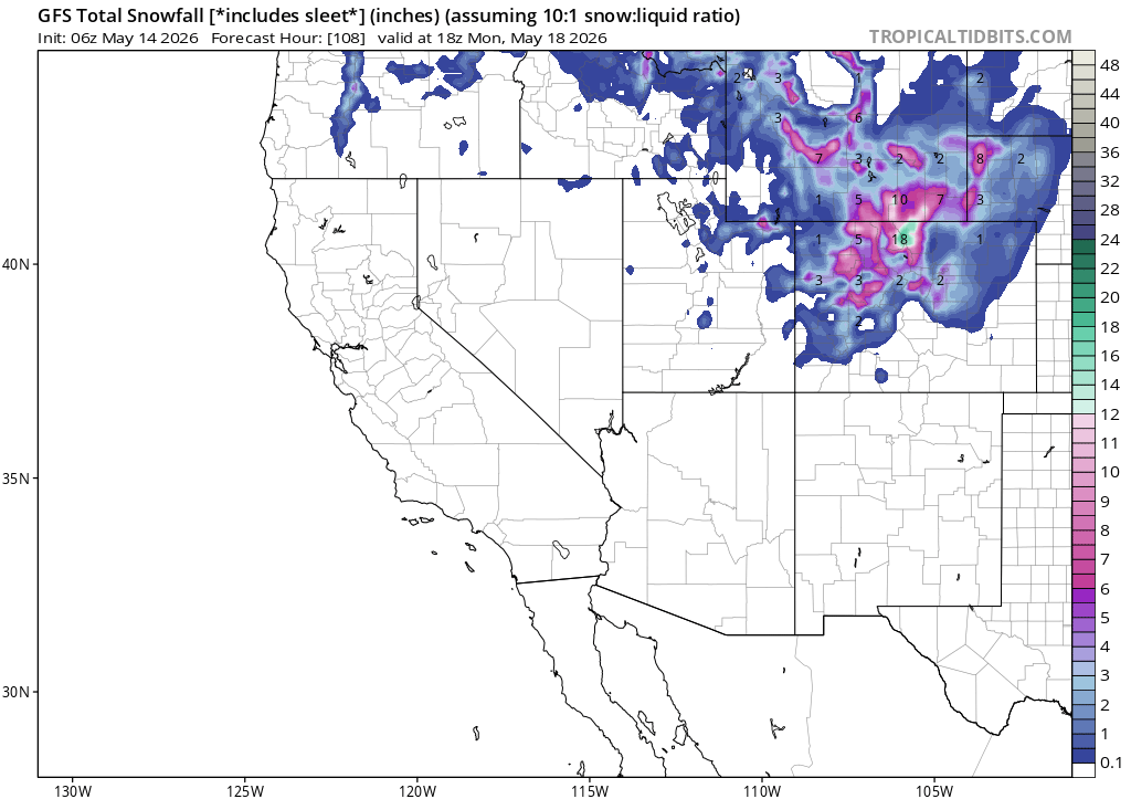
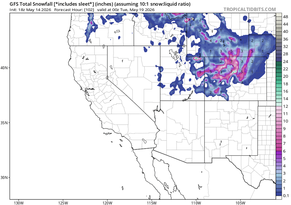
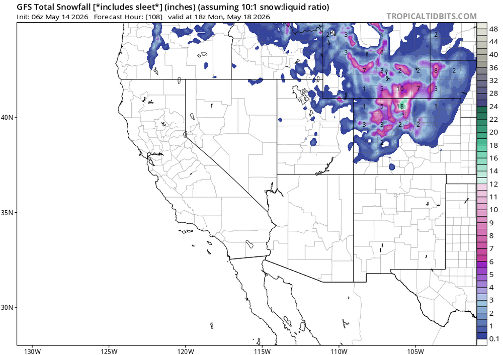
GFS doubling down lol
-
WTF
-
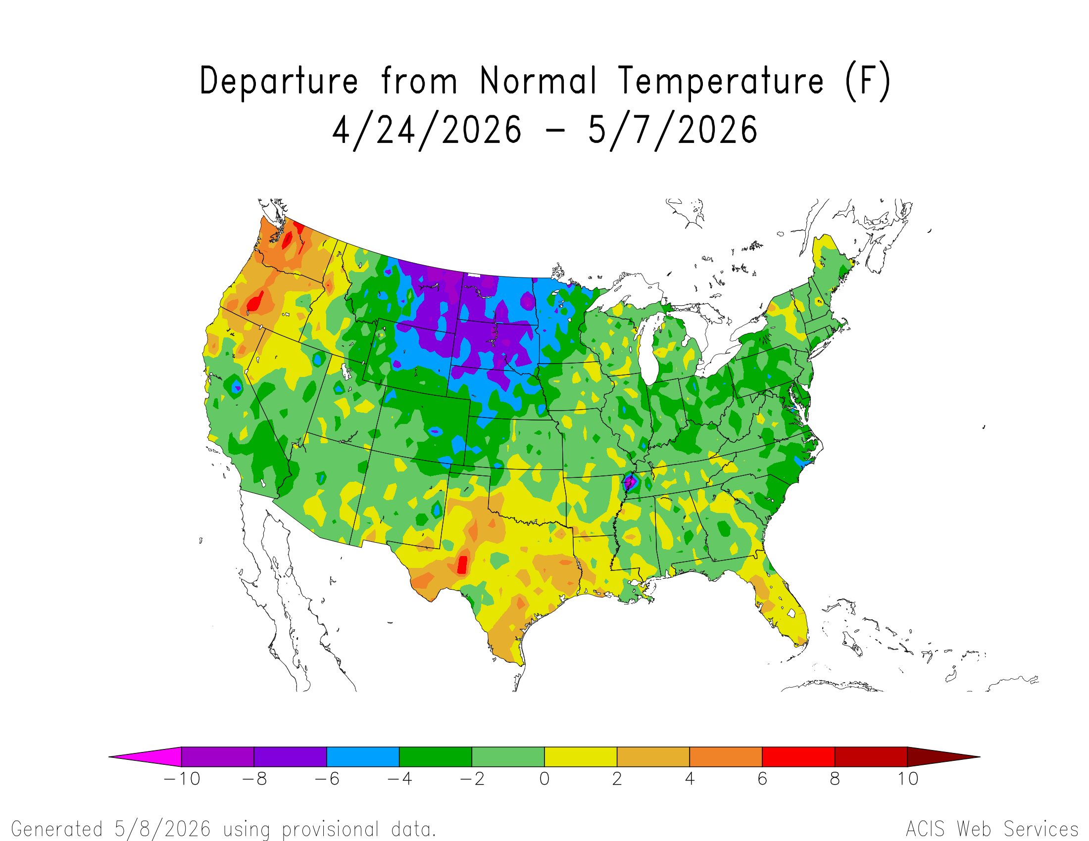
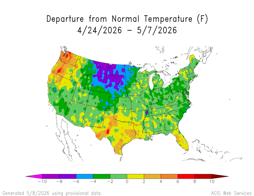
Been nice to get a pretty cool stretch the past couple weeks.
-
The snowstorm this week officially delivered 5.8" to the airport, making it the biggest May snowfall for Denver since 2003. It also pushed 2025-26 down to 6th least snowy winter on record, with 33.1" for the season.
-
I'm totally fine with that! Just happy to get one more snowy day in after a terrible winter, and a bunch of drought-fighting moisture. The green up over the next week should be epic.
-
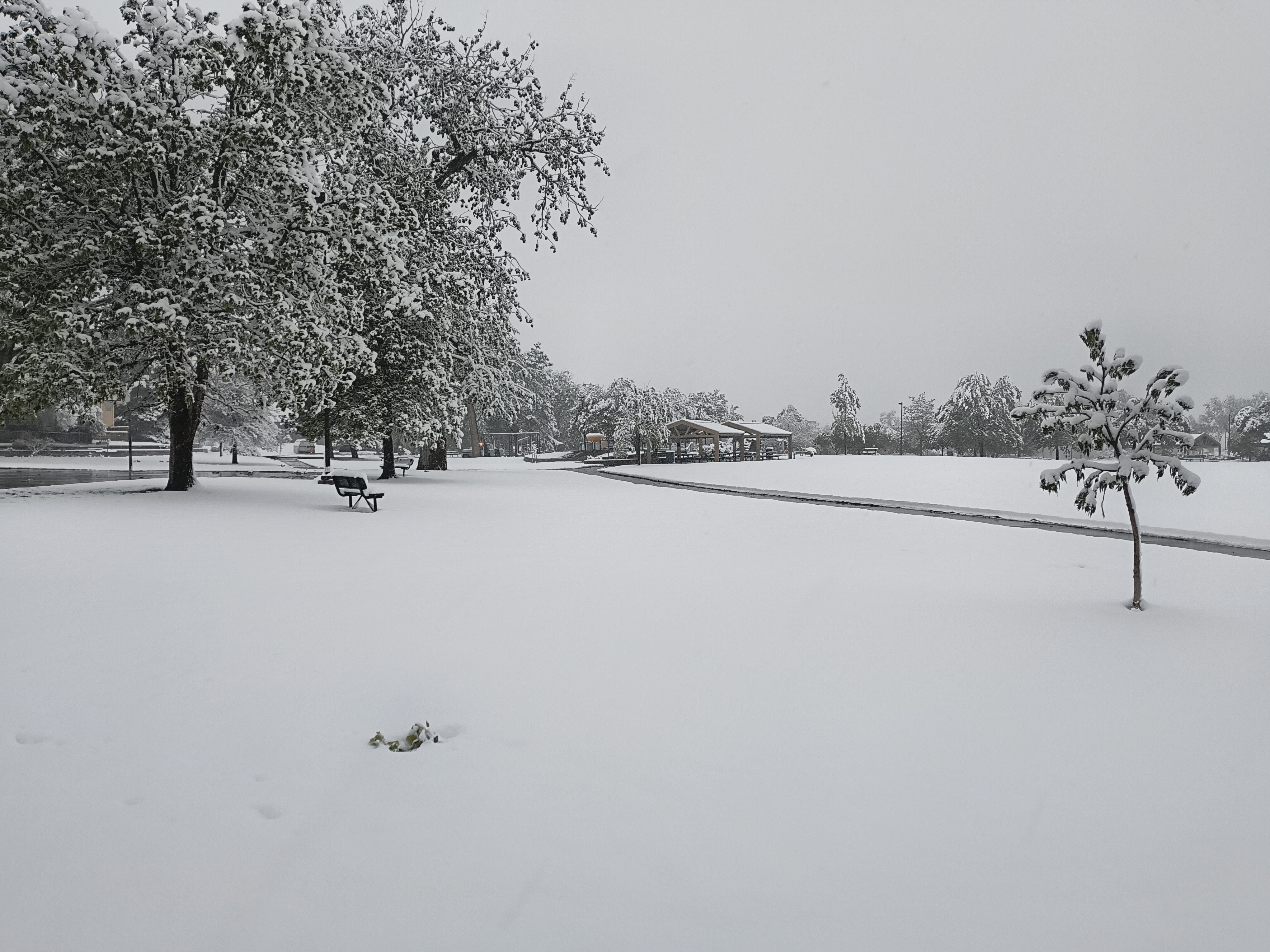
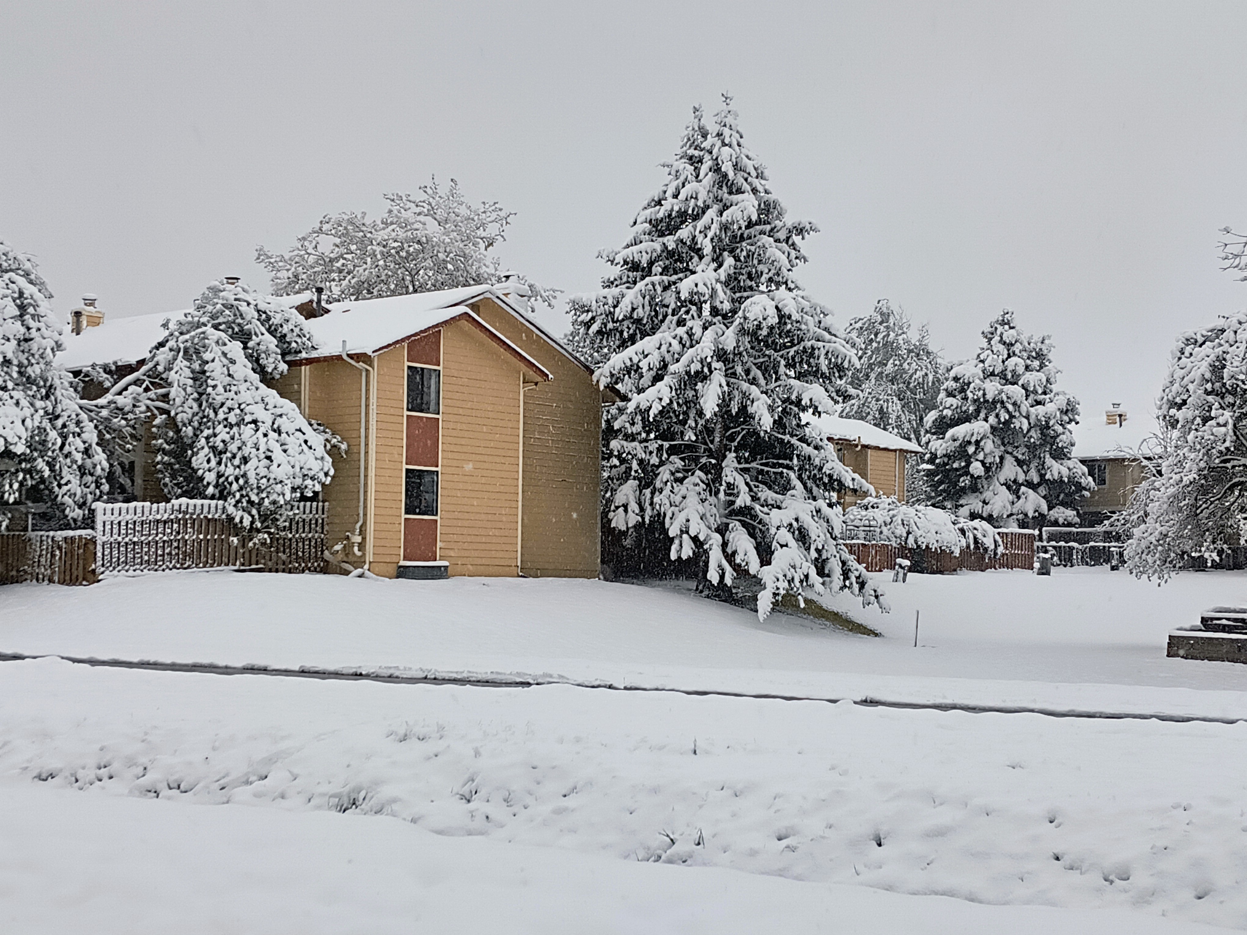
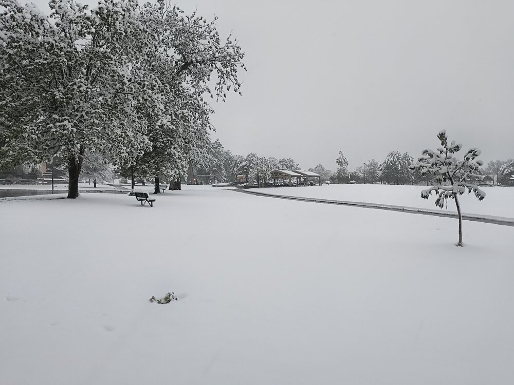
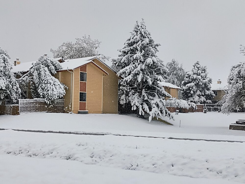
8" storm total here. By far the most I've seen in May in my 19 years here. 3.5" was my record.
-
Pretty much exact same here. Just light snow past couple hours, very little additional accumulation. Gonna be all about rates the rest of the storm.
-
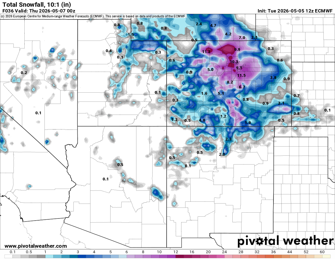
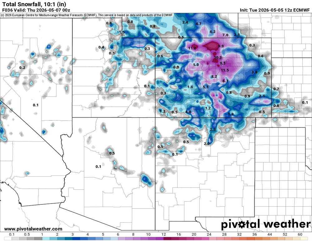
All the 12z models are coming in snowier, especially for your area it seems. 12z Euro...
-
This one's looking pretty juicy. Not sure how long temps will be cold enough for snow, but I don't think precip will be an issue.
-
Think this is the first time I've seen a WSW in May. URGENT - WINTER WEATHER MESSAGE National Weather Service Denver CO 116 PM MDT Mon May 4 2026 COZ038>041-050800- /O.CON.KBOU.WS.A.0003.260506T0200Z-260506T2100Z/ Larimer County Below 6000 Feet/Northwest Weld County-Boulder And Jefferson Counties Below 6000 Feet/West Broomfield County-North Douglas County Below 6000 Feet/Denver/West Adams and Arapahoe Counties/East Broomfield County-Elbert/Central and East Douglas Counties Above 6000 Feet- Including the cities of Golden, Elbert, Highlands Ranch, Brighton, City of Denver, Longmont, Kiowa, Fort Collins, Denver International Airport, Larkspur, Lakewood, Littleton, Fondis, Parker, Arvada, Loveland, Nunn, Boulder, Hereford, Aurora, and Castle Rock 116 PM MDT Mon May 4 2026 ...WINTER STORM WATCH REMAINS IN EFFECT FROM TUESDAY EVENING THROUGH WEDNESDAY AFTERNOON... * WHAT...Heavy snow possible. Total snow accumulations between 3 and 8 inches possible, heaviest on colder surfaces and west of I-25. * WHERE...Fort Collins, Boulder and the western suburbs of Denver, Denver, and Castle Rock. * WHEN...From Tuesday evening through Wednesday afternoon. Heaviest Tuesday night into Wednesday morning. * IMPACTS...Heavy wet snow will accumulate on tree branches and powerlines, possibly causing them to break and lead to power outages. Despite lesser accumulations on roadways, slick and hazardous conditions are still possible for the Wednesday morning commute.