frontranger8
-
Posts
370 -
Joined
-
Last visited
Content Type
Profiles
Blogs
Forums
American Weather
Media Demo
Store
Gallery
Everything posted by frontranger8
-
2026-2027 Super El Nino
frontranger8 replied to Stormchaserchuck1's topic in Weather Forecasting and Discussion
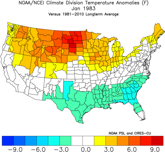
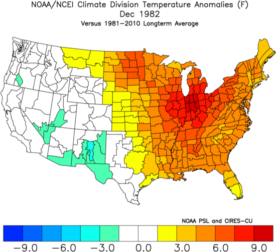
Bigger picture for 1982-83. Interesting how Jan/Feb had nearly identical anomaly patterns.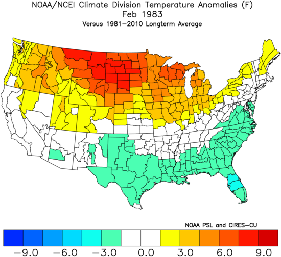
-
Models are insistent that rains return next week with a surge of monsoonal moisture. Really hope so...camping with fire bans sucks.
-
Occasional Thoughts on Climate Change
frontranger8 replied to donsutherland1's topic in Climate Change
Thankfully, it appears some relief is imminent.
-
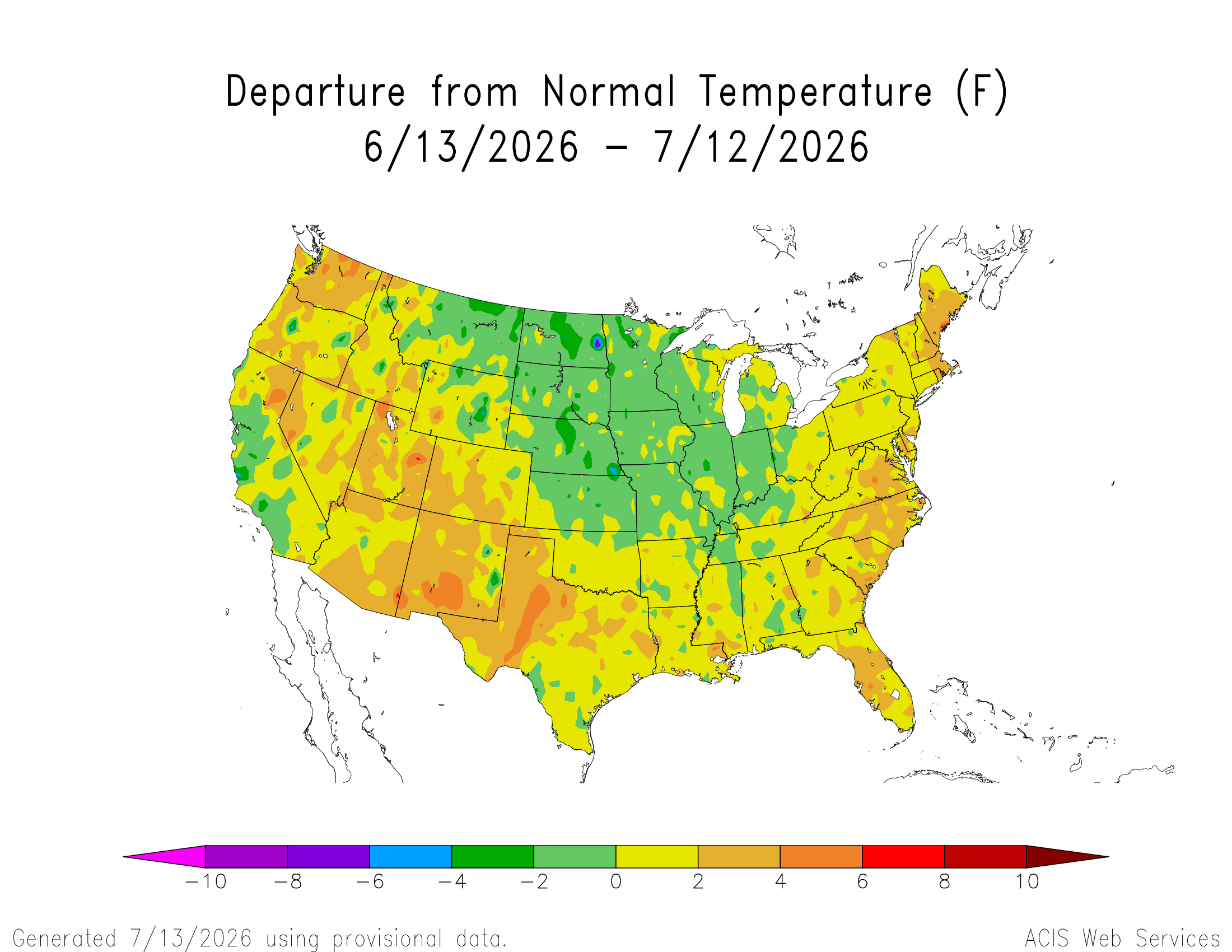
97 for DEN. Highest temp of the year, fourth time they've touched it.
-
2026-2027 Super El Nino
frontranger8 replied to Stormchaserchuck1's topic in Weather Forecasting and Discussion
The northern tier trough signal was more apparent looking at the past 30 days. Focused in the middle of the country.
-
Feel lucky to only be getting 95 here lol.
-
Looks like the hottest stretch since July 2022 coming up.
-
Occasional Thoughts on Climate Change
frontranger8 replied to donsutherland1's topic in Climate Change
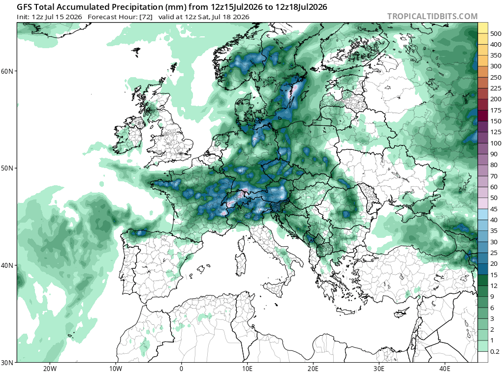
This east coast heat wave was not in the same ballpark as what just occurred in Europe. Historically inaccurate to make a real comparison between the two. -
2026-2027 Super El Nino
frontranger8 replied to Stormchaserchuck1's topic in Weather Forecasting and Discussion
Goofus at 246 hours....here is what latest Euro shows for same time.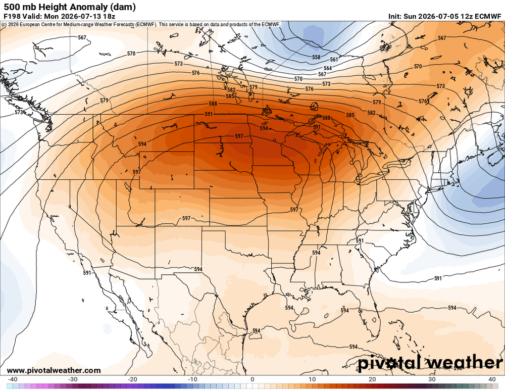
-
2026-2027 Super El Nino
frontranger8 replied to Stormchaserchuck1's topic in Weather Forecasting and Discussion
Have to consider where the cold is and what areas are being melted out. The low hanging fruit that isn't as far north has been melted out over the past few weeks. -
Occasional Thoughts on Climate Change
frontranger8 replied to donsutherland1's topic in Climate Change
I think to me what really stands out is the heat just isn't spread out evenly. And the climates that have seen the most summer warming tended to be fairly similar. -
2026-2027 Super El Nino
frontranger8 replied to Stormchaserchuck1's topic in Weather Forecasting and Discussion
Yeah, strong Ninos almost always deliver at least one 12"+ storm here. Most commonly late Oct-mid Dec and then Mar/Apr. -
2026-2027 Super El Nino
frontranger8 replied to Stormchaserchuck1's topic in Weather Forecasting and Discussion
That's definitely true here in CO. Many of our biggest storms have been early/late in El Nino winters. -
Occasional Thoughts on Climate Change
frontranger8 replied to donsutherland1's topic in Climate Change
Breathing fire, eh? Extreme, unprecedented hyperbole warning! -
Another .3" here on Thursday.
-
Squall line moving south down the Front Range from WY, kinda unusual. Will be interesting to see how far it makes it.
-
Occasional Thoughts on Climate Change
frontranger8 replied to donsutherland1's topic in Climate Change
It's interesting that 2 of the 3 areas that have seen the biggest increase in extreme heatwaves, western North America with a focus on BC/the PNW and NW Europe, have pretty similar climates. Traditionally very temperate and mild in both the winter and summer, and similar latitude. -
Damn, got hit pretty good here last night. Nearly continuous thunder/lightning for a couple hours, .34" of rain and some hail. Looked like the Littleton area really got slammed. Getting some more light rain this morning, too.
-
Occasional Thoughts on Climate Change
frontranger8 replied to donsutherland1's topic in Climate Change
Yep. You chose the hottest one lol, and not the official airport one. Is what it is. -
Occasional Thoughts on Climate Change
frontranger8 replied to donsutherland1's topic in Climate Change
The official high for Paris was 105.6F. -
Occasional Thoughts on Climate Change
frontranger8 replied to donsutherland1's topic in Climate Change
There's kind of a built in assumption in these posts that we don't have the technology to help with these issues. This isn't 1850...both from a global temps perspective or a tech one. -
Occasional Thoughts on Climate Change
frontranger8 replied to donsutherland1's topic in Climate Change
No sh*t. It's also fair to point out that there were far fewer records from the stations with long periods of record. Both things can be true. -
Yeah, severe t-storm watch and then couldn't even see any storms from here. Today looks a little less hazy, I think.
-
Occasional Thoughts on Climate Change
frontranger8 replied to donsutherland1's topic in Climate Change
Thanks. That is important when comparing this event to historical ones. The big numbers in that graphic are obviously due in part to short period of records. Not to say this event is not significant, it certainly is, but records have to be analyzed based on POR, etc. Context matters. -
2026-2027 Super El Nino
frontranger8 replied to Stormchaserchuck1's topic in Weather Forecasting and Discussion
Correct, I'm just talking about what exactly determines the PDO numbers. You can see it clearly looking back through the years.