NEOH
-
Posts
3,366 -
Joined
-
Last visited
Content Type
Profiles
Blogs
Forums
American Weather
Media Demo
Store
Gallery
Everything posted by NEOH
-
That is an impressive squall... wonder if there will be any thunder with it. Hopefully it strengthens as it moves east
-
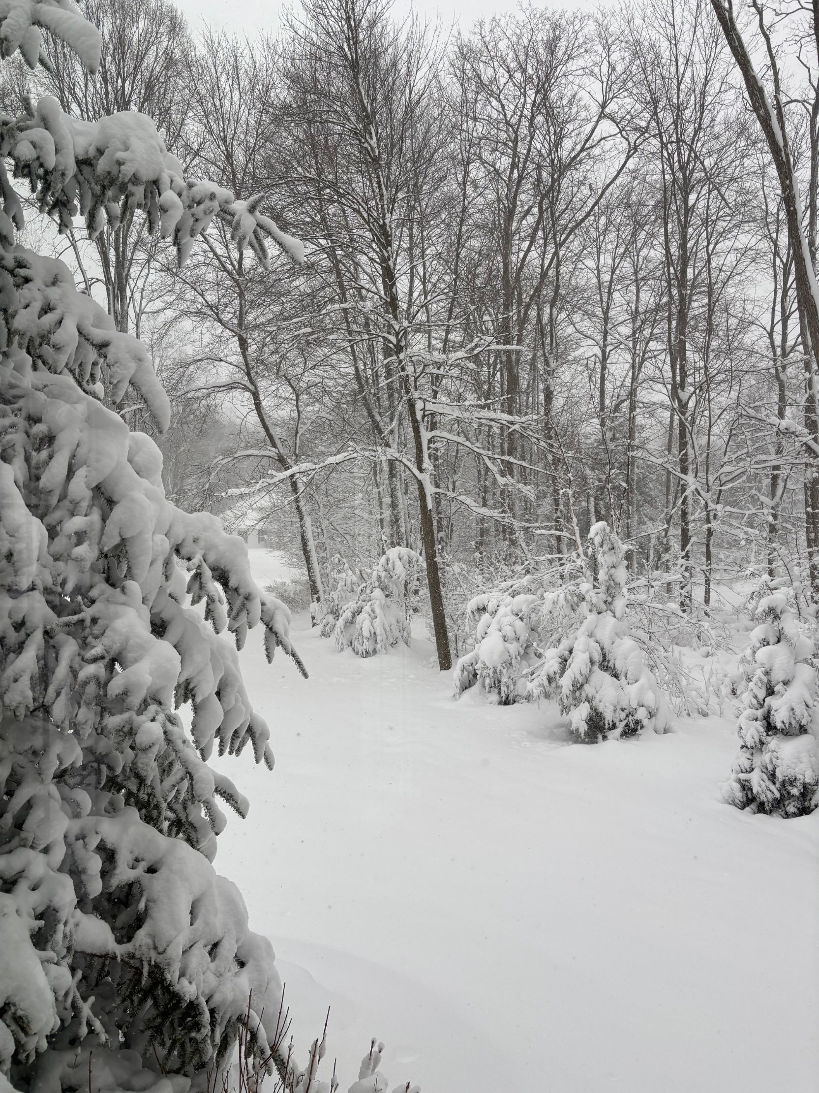
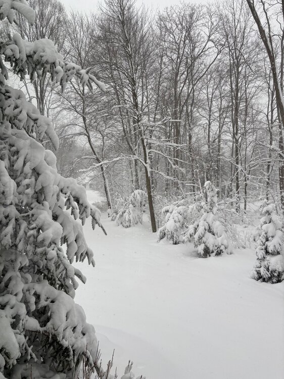
Snowed on and off much of the day yesterday... picked up around 2" of pure fluff. Snowing again lightly now with 1-3" in the forecast.
-
Yesterday morning vs. this morning...
-
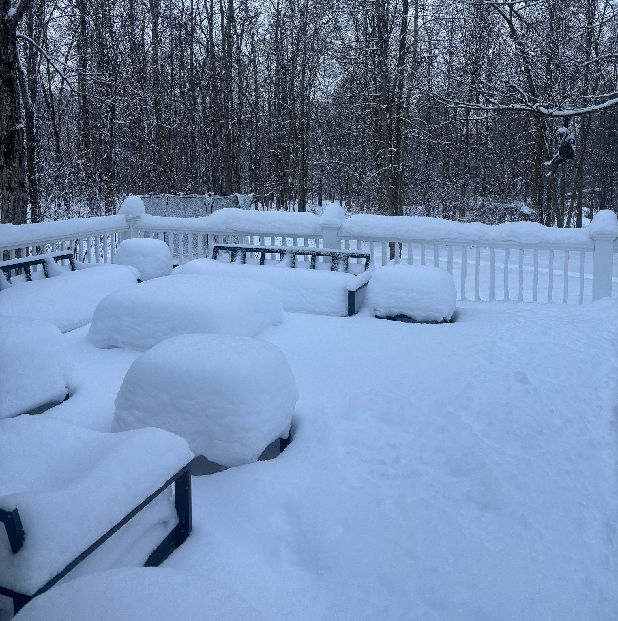
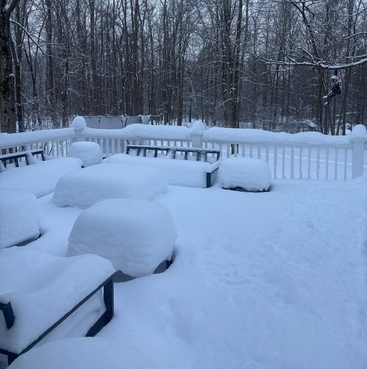
Picked up a couple of more inches of fluff over night to push the total to 10.5". Still snowing out there now. We just didn't get the good ratio's yesterday. The snow was like sugar and much more dense than I anticipated. Still a nice storm.
-
I’m around 7” so far. The snow is much more dense than expected… sugary snow. Still another 6 to 7 hours of snow to come. It has been light to moderate since noon.
-
Nice to wake up and see the snow falling… thought the dry air might delay things. Eyeballing 2” already. CLE bumped up totals to 10-15”. Gonna be a fun day.
-
12z euro is .77". Tight cut off to the NW. Hopefully we can avoid any further shifts. Seems like the primary low always winds up a little more NW than forecast so hopefully that holds true.
-
Here's a recap of total precip from the 12z runs... fairly uniform and with ratio's around 15:1 that's a good storm. GFS AI - .79 GFS - .71 CMC - .75
-
Seems like the 12z models shifted south a bit... or maybe a quicker transfer to the EC. Still like where we sit at this point if the energy can hang back longer.
-
Definitely looking forward to OHWeather's thoughts. Complete whiteout in South Russell now with the squall pushing through.
-
7" - 10" does seem a bit conservative. Maybe that is based on 10:1 ratios. Most models have at least .7" of precip... so there is upside if we can get better ratios.
-
The roads were bad this morning. The ground is very cold so perhaps that had an impact. Not sure the plow crews (at least locally) were planning on the snow. They weren't out until 5 or 6 am.
-
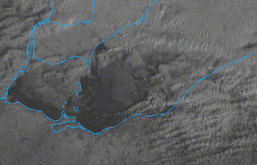
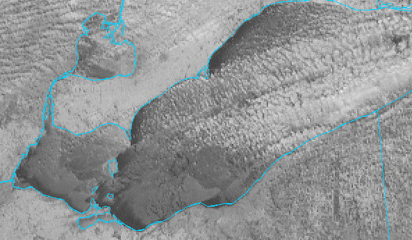
Heard a little thunder with the squalls last night... that's 2x this week. Picked up just under 2". Looks like the strong winds have pushed the thin ice around quite a bit. It will likely refreeze quickly with the cold temps but could add some lake enhancement with the storm over the weekend.
-

Let’s talk winter!! Ohio and surrounding states!! 24'-25'
NEOH replied to buckeye's topic in Lakes/Ohio Valley
All good model trends.... can't ask for much more as this point. Much of Ohio is in the game for a significant storm. Hopefully no significant changes on today's runs... nice to have some wiggle room for a change. -
Let’s talk winter!! Ohio and surrounding states!! 24'-25'
NEOH replied to buckeye's topic in Lakes/Ohio Valley
This set-up is different than what we've dealt with in the past. What is encouraging to see is the expansive precip shield. The 12z CMC and 00z Euro both hinted at energy hanging back which would be a good scenario. -
Lots of ice on the lake... most of it is probably mobile but its not going anywhere anytime soon. Seems like these arctic outbreaks always come with WSW wind lake effect events. Would have been nice to squeeze in one more event prior to the ice cover.
-
Let’s talk winter!! Ohio and surrounding states!! 24'-25'
NEOH replied to buckeye's topic in Lakes/Ohio Valley
How many times in the past have we been sweating the inevitable NW trend and WTOD. Still a long way to go but good model trends for a widespread snowfall throughout OH. -
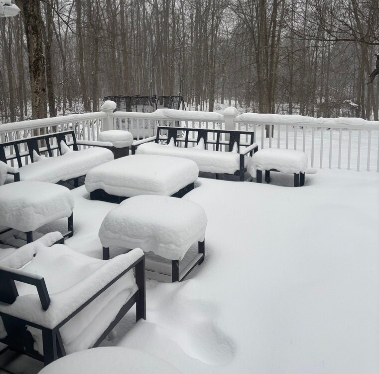
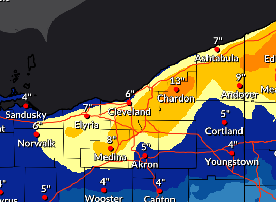
Going with a storm total of around 16" IMBY. Very scenic out there. I'd imagine the lake is rapidly building ice cover... hopefully we can maintain some open water.
-
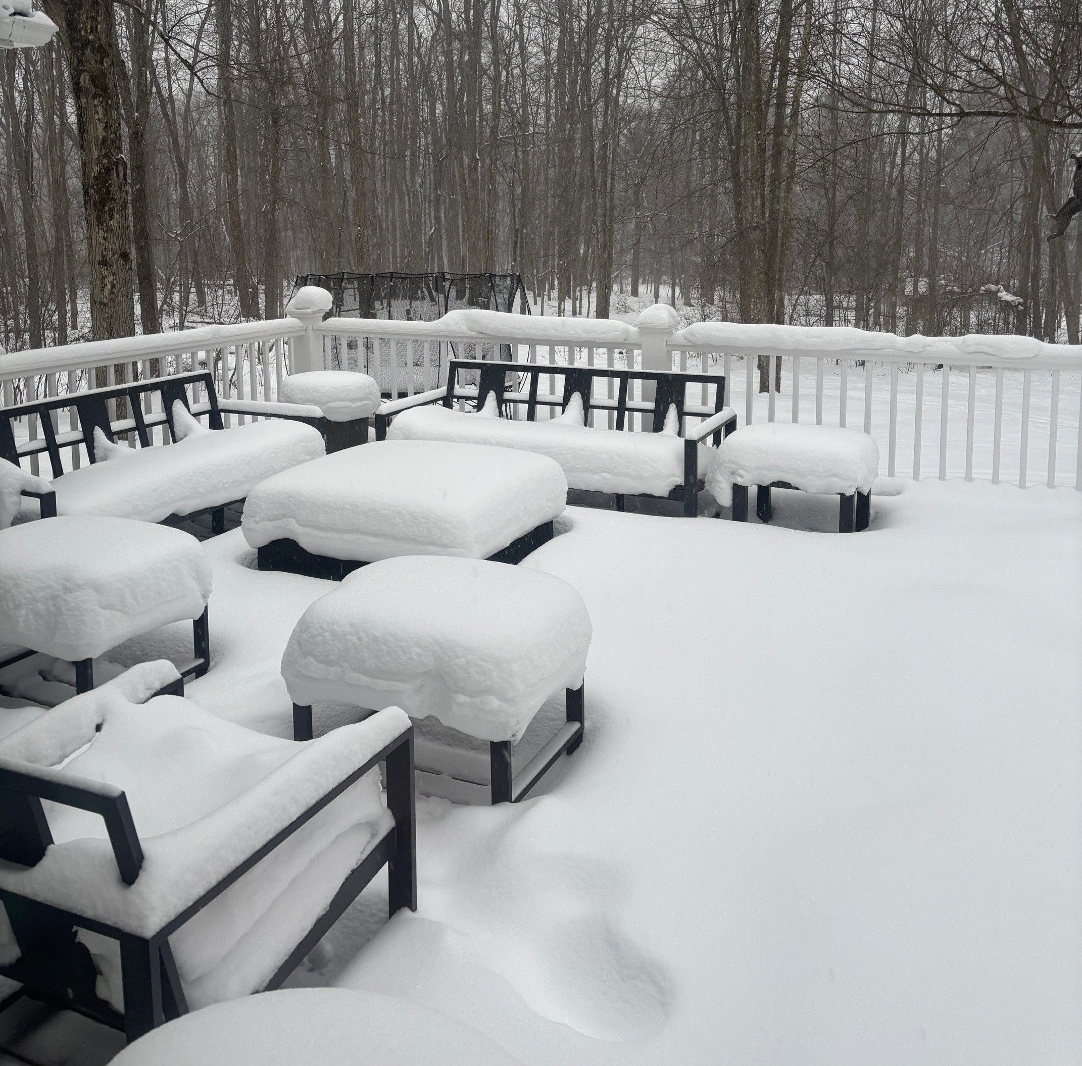
Heavy snow most of the morning. You can see it starting to wind down west to east on radar. Pines are getting buried.
-
What an event so far... measured 10" and the radar looks great. Really heavy snow within the stronger bands. Looks like the 422 corridor is locked in again.
-
Great to see such positive trends today. Rain has flipped over to snow in the Chagrin area.
-
Just noticed that... and bumped up snow totals quite a bit. Great trends today.
-
Just looked at the 12z runs and they have improved with more precip. Snow is down to patches around here so it will be nice to rebuild the snowpack again.
-
Thanks. I know we've talked about CLE's measuring in the past. It just sticks out more when locations directly adjacent measure 2x as much . Looking forward to the upcoming pattern... we'll have snow flying for several days it looks like.
-
CLE only reported 1.3" yesterday. Seems like that area specifically always comes in with the lowest totals. Looking at the PNS reports areas right around there reported more.