

Blizzard of 93
-
Posts
11,781 -
Joined
-
Last visited
Content Type
Profiles
Blogs
Forums
American Weather
Media Demo
Store
Gallery
Posts posted by Blizzard of 93
-
-
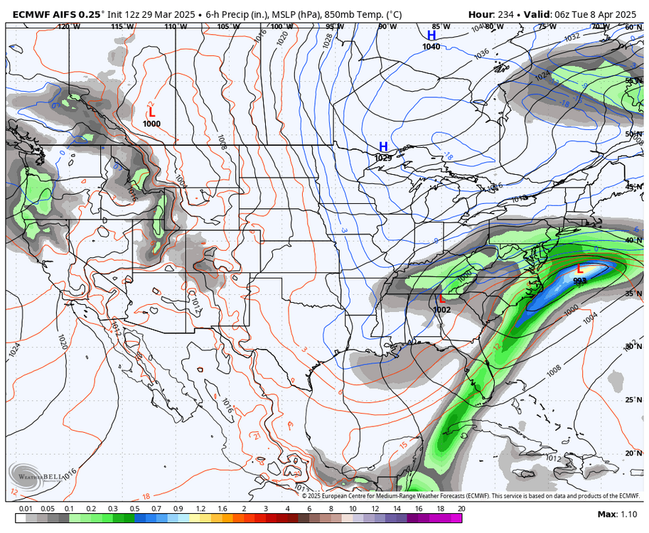
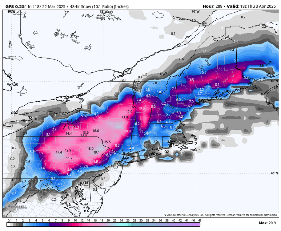
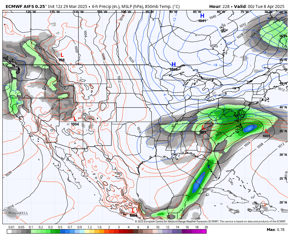
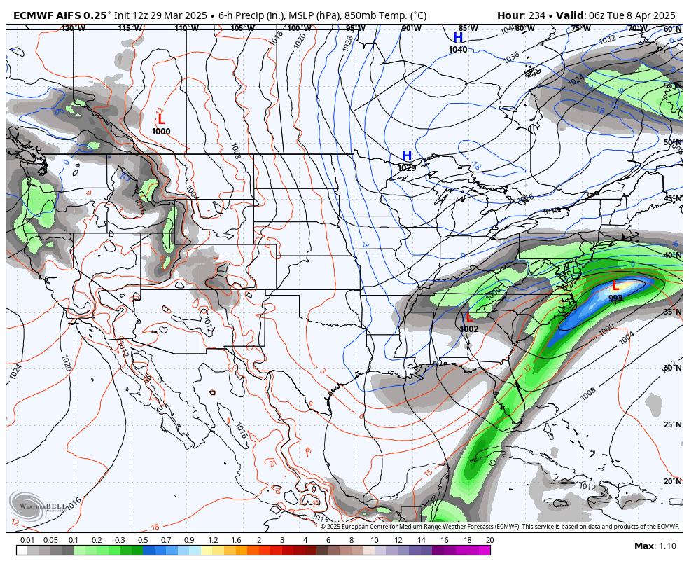
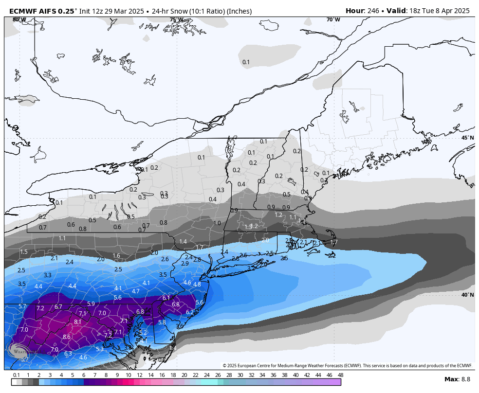
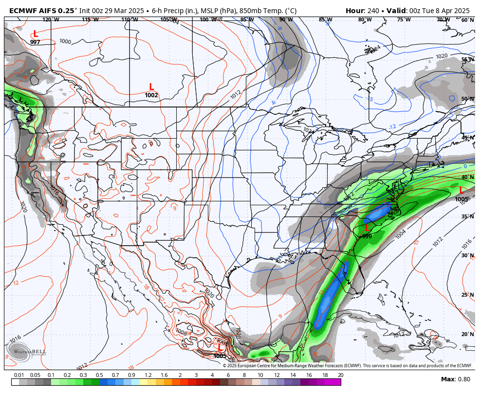
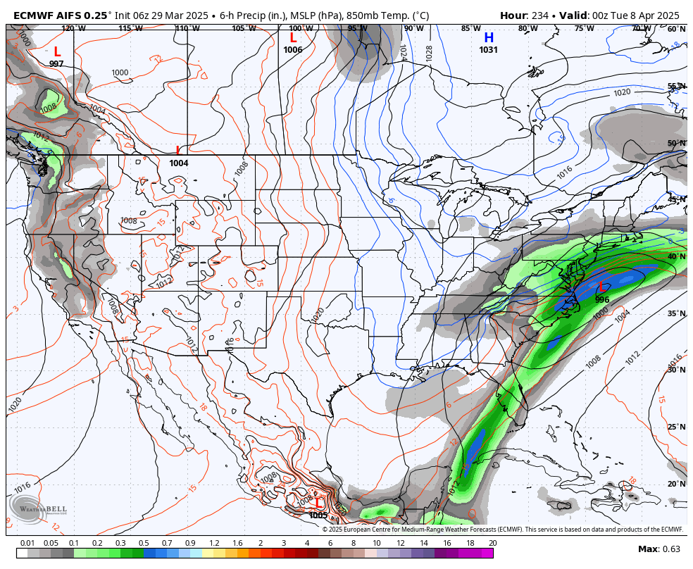
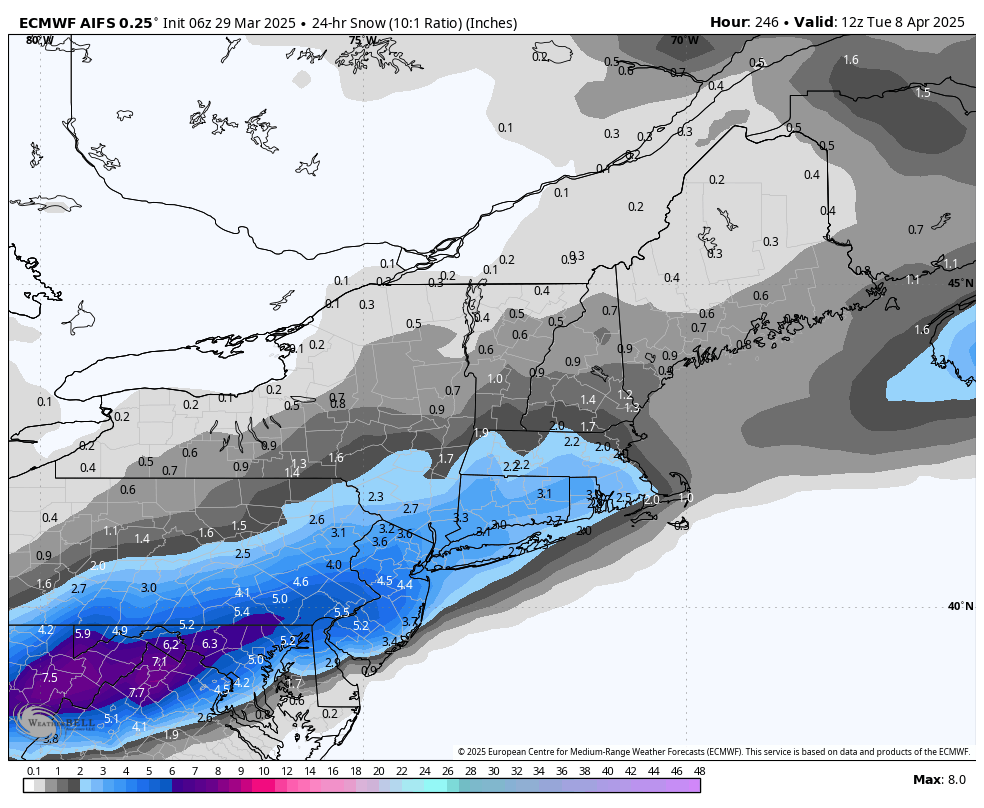
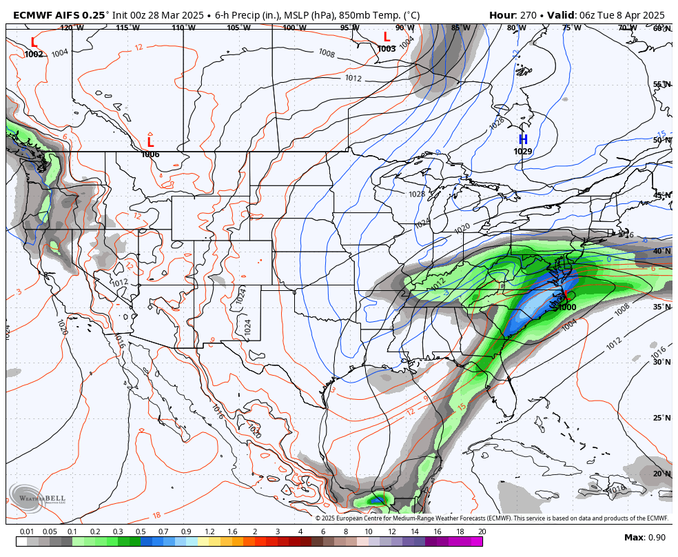
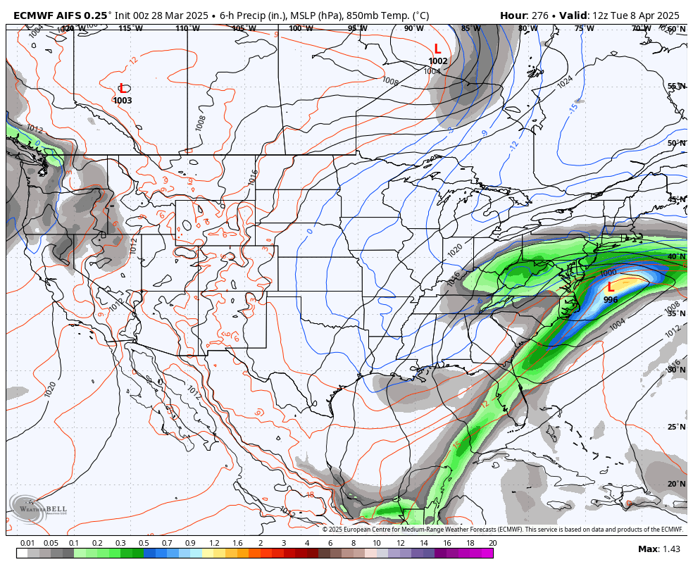
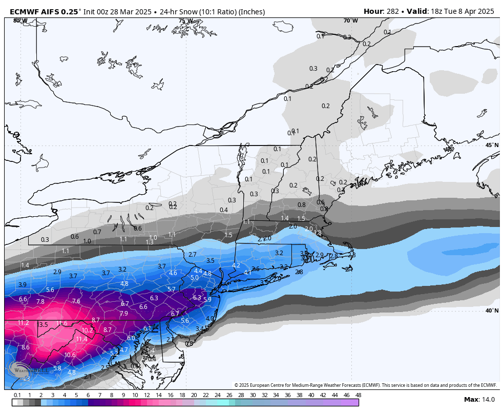
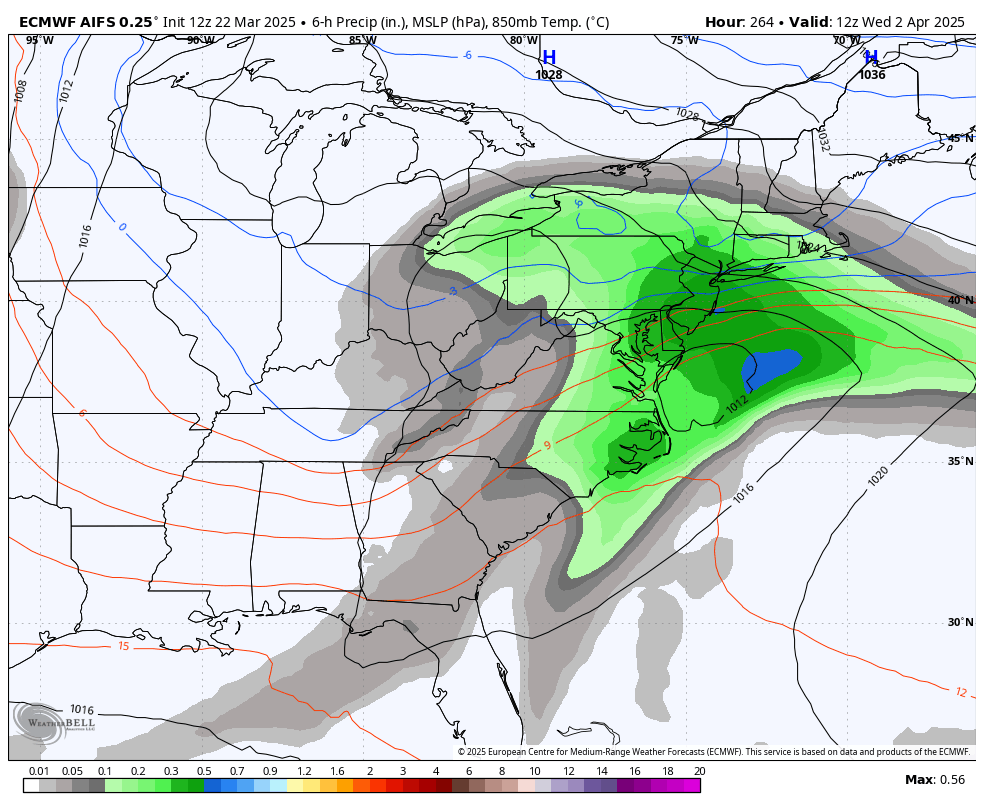
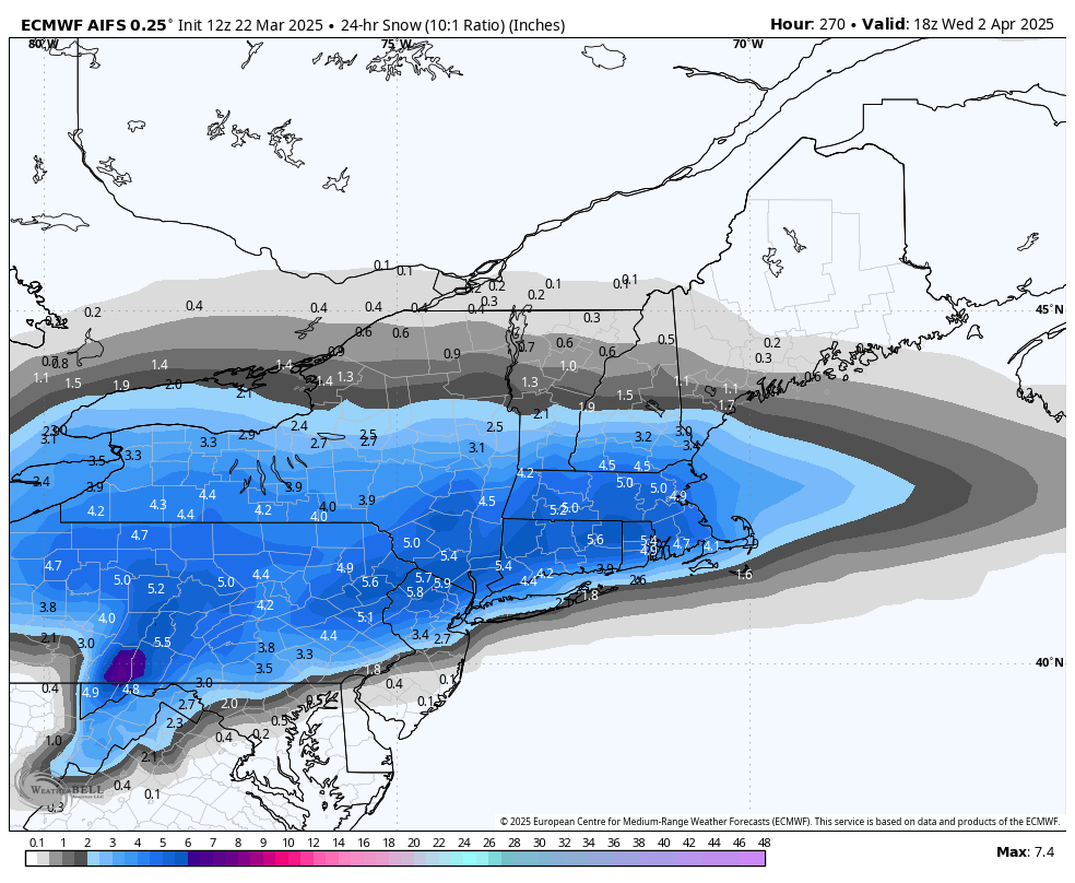
12z AI Euro still has the snow chance for the 8th.

-
3 minutes ago, Blizzard of 93 said:
The last 2 runs of the Euro AI have brought back the late season snow look for us around April 8th.


-
 2
2
-
-
1 hour ago, Blizzard of 93 said:
I’m still tracking late season snow chances.
The last 2 runs of the Euro AI have brought back the late season snow look for us around April 8th.
-
8 minutes ago, canderson said:
I think MDT get to 81 today.
Lol, what happened to your 82 call?
-
 1
1
-
-
1 hour ago, mahantango#1 said:
I think some of those people with more experience have now left the forum, never to return. And that is a shame imo.
I’m still tracking late season snow chances.
-
1
-
-
44 minutes ago, Mount Joy Snowman said:
86 from 1945 is the number to beat. Tough.
Always remember, MDT compares monthly means to the most recent 30-year climate normal period, whereas MU compares against its entire period of record, leading to MU always having more positive extreme departures. It's as simple as not being an apples-to-apples comparison.
Thanks, something seemed off with how cold the rest of our region was this Winter.
-
8 hours ago, Blizzard of 93 said:
Maybe we get another April of 82 event next month to up the seasonal snow totals?
The latest Euro AI run likes this idea, right on the Anniversary of April 82.


-
35 in Marysville now.
-
Just now, Voyager said:
Interesting how as the forecast temperature has gone up for Saturday, so has the wind speed. At first it was 20 mph gusts, then it was 26 mph. Now, look...
SaturdayMostly sunny, with a high near 77. West wind 10 to 17 mph, with gusts as high as 34 mph.I’ve officially had enough of the wind this year already. This week was my breaking point.
It’s actually remarkable when there is Not any wind at any given time, Lol!
-
2
-
-
1 hour ago, Itstrainingtime said:
It was all about the night time low temps.
For all of my life I have always been colder than MDT for low temps. The only exceptions are special situations involving a cold front that came through MDT but not through my area yet OR a winter storm situation where warm air invades my area quicker off the ocean. Outside of that, I'm going to be a few degrees colder than MDT 95% of the time. For whatever reason, this winter MDT was running consistently about 3-5 degrees colder than down here almost every night. No idea what changed, but that's where the difference happened.
My original point was much more specific to snowfall because you were calling a bust for Elliott prematurely and it came back to get you.
")
Maybe we get another April of 82 event next month to up the seasonal snow totals?
-
21 minutes ago, Blizzard of 93 said:
They made a good call on the snow, but we just missed out on a few events that could have padded the stats. There was plenty of cold air around this year, but the lack of moisture continued to be an issue.
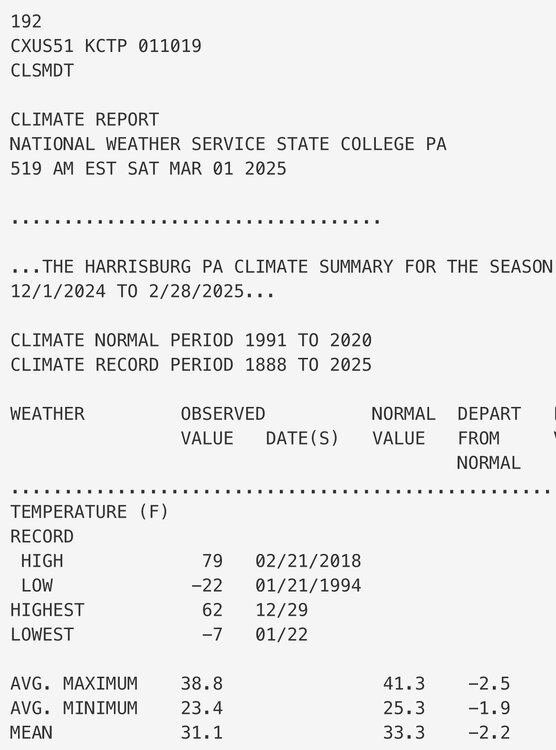
MDT finished -2.2 in average temps for Met Winter. The coldest Met Winter in 10 years.
Lol, MU must be located on a heat island similar to where you & @canderson live. How the heck did MU finish above normal in December & February?
Furthermore, MU’s rough average Met Winter temperature for the 3 monthly departures that you listed above would be an average of +43.
His prediction of +2 for the season was a bit off if we’re being technical (which I know that you appreciate…lol).
-
6 hours ago, Itstrainingtime said:
Final winter stats for Lanco (MU) vs Elliott's Winter Forecast:
Total snowfall: 16.5" (prediction was 10-20") Snowfall for this past winter was LESS than last winter's 18.0")
Temps: Dec: 1.6 AN, Jan: 2.2 BN, Feb: 1.9 AN (prediction was 2+ degrees AN for the season)
MU forecast 3 weeks of extreme winter from approximately 12/20 through 1/10. We had just about 3 weeks of extreme winter though it came about 2 weeks later than he predicted on 11/1.
Overall: Perfect snow forecast, he went too cold for the season overall mainly due to January being even colder than he saw but he had the spirit of length of time correct.
@Blizzard of 93 you were sort of mocking his forecast as a major bust back in January in regards to snowfall but he ended up nailing it.
They made a good call on the snow, but we just missed out on a few events that could have padded the stats. There was plenty of cold air around this year, but the lack of moisture continued to be an issue.
MDT finished -2.2 in average temps for Met Winter. The coldest Met Winter in 10 years.
Lol, MU must be located on a heat island similar to where you & @canderson live. How the heck did MU finish above normal in December & February?
-
Low of 26 in Marysville this am.
-
Mrs. Blizz reported that there were flurries today in Colonial Park.
My kids also said that there were flurries at school today as well.
-
1
-
-
37 minutes ago, Jns2183 said:
Is @Bubbler86 coming back anytime soon. I miss his analysis
Sent from my SM-G970U1 using Tapatalk
I miss him as well.
Hopefully he returns soon.
-
2
-
-
37 minutes ago, Jns2183 said:
It's become depressingly slow in here
Sent from my SM-G970U1 using Tapatalk
Just wait until our early Spring snow…
-
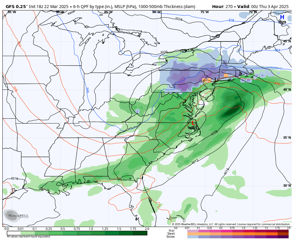
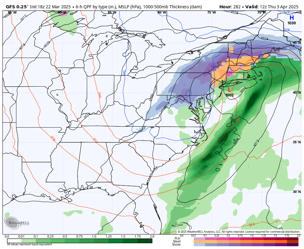
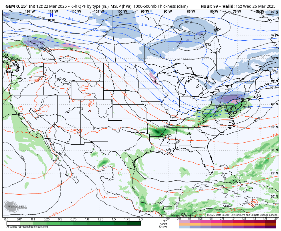
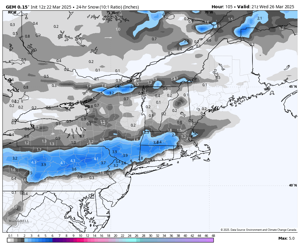
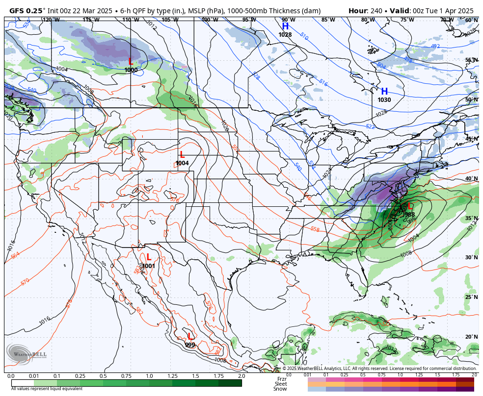
18z GFS had this early April chance this run.


-
31 minutes ago, canderson said:
Way windier than forecast. In the upper 30s all day and now at 45 mph.
That wind was brutal today indeed.
-
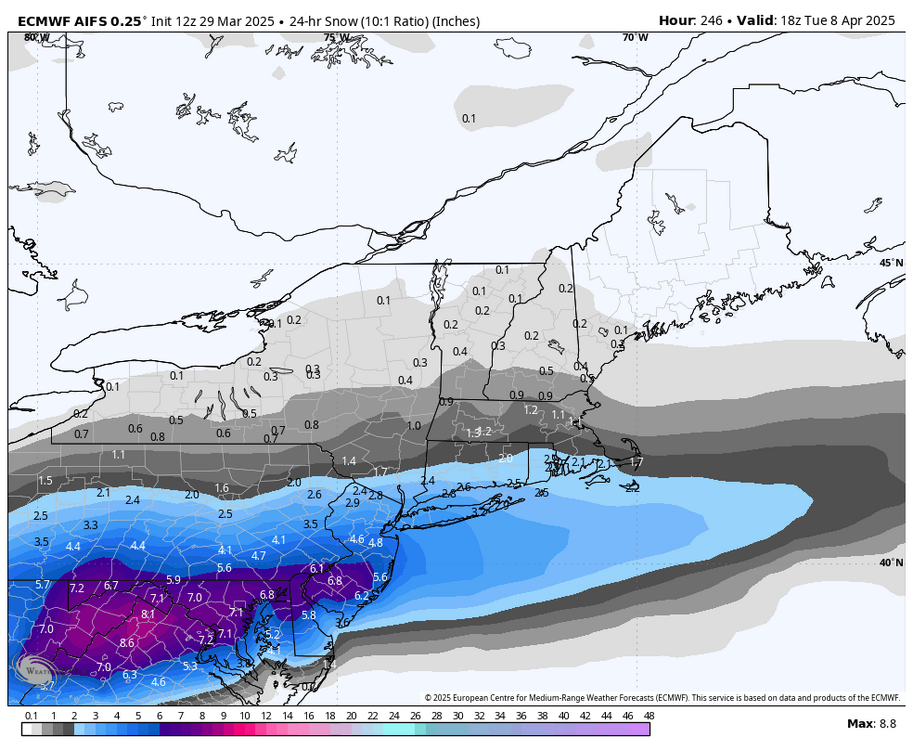
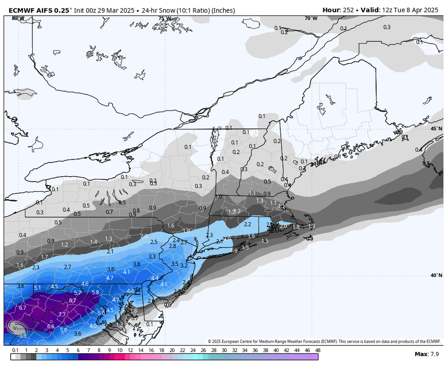
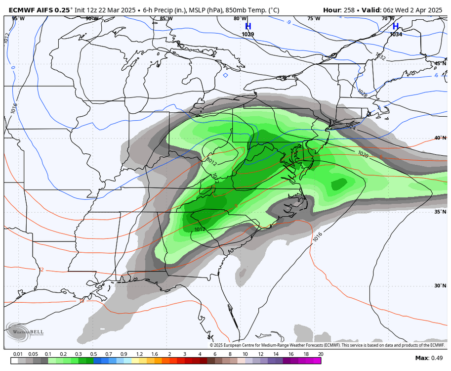
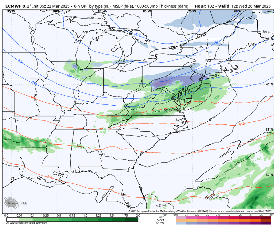
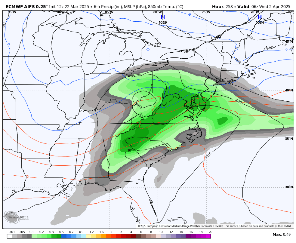
12z Euro AI has some early April snow for us & and he Northeast this run.


-
Just now, Blizzard of 93 said:
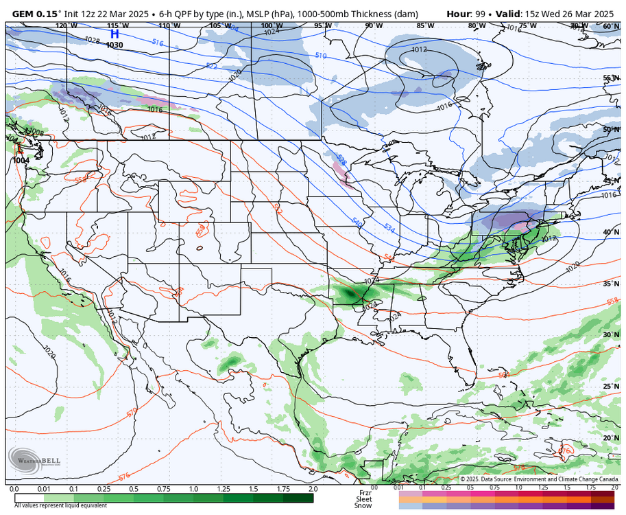
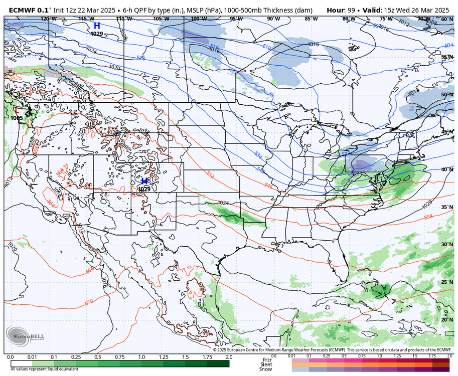
12z Canadian & Euro both like the idea of a little CTP snow on Wednesday am.

-
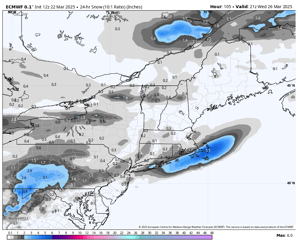
12z Canadian & Euro both like the idea of a little CTP snow on Wednesday am.
-
40 minutes ago, canderson said:
Today’s rain has basically been canceled. It’s quite remarkable.
It looks like a line of light showers are approaching the western half of the LSV now.
-
0z GFS had this April Fool’s special for us, Lol.

-
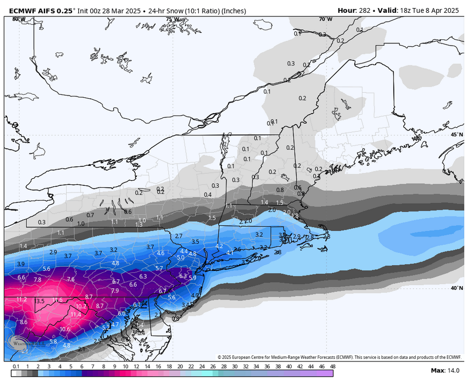
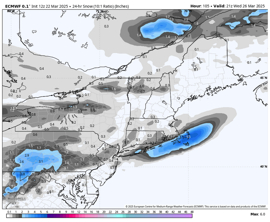
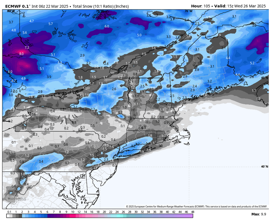
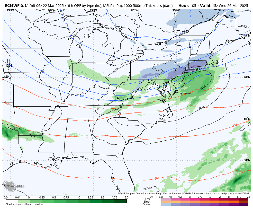
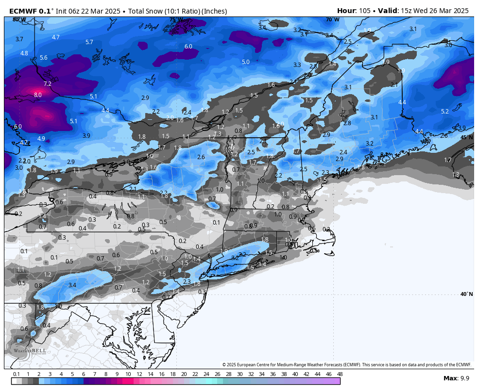
The last few Euro Op runs show a little s ow for many of us this Wednesday am


Central PA Spring 2025
in Upstate New York/Pennsylvania
Posted
Everyone should try to stick around. We have a good group that is entertaining & informative. There is a role here for everyone. We all know each other’s tendencies & general personalities. The common ground is an interest in the weather. Some of us can push each other’s buttons at times, but most of the time we resolve it quickly and at times laugh it off & then move on to the next day.
Hopefully in a little time we can get the band back together.