

LakeEffectKing
-
Posts
4,475 -
Joined
-
Last visited
Content Type
Profiles
Blogs
Forums
American Weather
Media Demo
Store
Gallery
Posts posted by LakeEffectKing
-
-
2 minutes ago, CoastalWx said:
Yeah definitely agree with that.
I don't think the eye will clear out till about 8:00 or 9:00 (eastern) tonight. Takes several hours after closed EW is observed per aircraft, in my experience.
-
13 minutes ago, 40/70 Benchmark said:
I had 125mph yesterday.....the 150 peak may be off, though. I think the delay means maybe a slightly lower peak, but negligible impact on LF intensity.
Still thinking 140 is very plausible late tonight...then a slight weakening just prior to landfall...
RI, I would think is about 6 -12 hours away.
-
 2
2
-
-
56 minutes ago, WEATHER53 said:
How have you been?
Good Howard! Just not posting as much. Always have a little time when there's going to be a big one.
-
1
-
-
-
2 minutes ago, WxSynopsisDavid said:
Once that vertical column stacks, it’s game on. We are close now to that happening.
Probably in the next 18-24 hrs. Takes a bit of time to get all levels aligned AND to clear out the center....then boom!
-
8
-
-
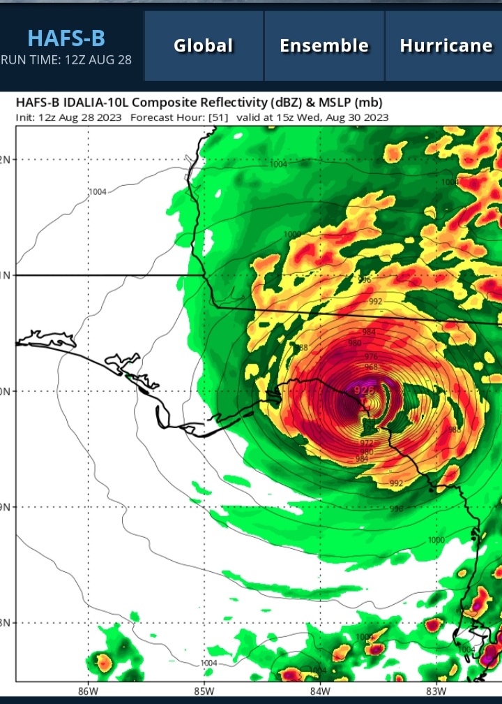
Seen this dog and pony show before....too many parameters trending positive for RI in 18-36 hrs.
Idalia should easily be a major by tomorrow, and may very well be CAT 4 by 06z Wed.
-
19
-
-
The cleanness of the rapid EWRC, happened at the worst time. It expanded the wind field, and now is tightening the core...
In the span of 12 hrs., this went from a very bad situation to a likely catastrophic one.
-
7
-
-
000
WTNT34 KNHC 280856
TCPAT4

BULLETIN
Hurricane Ian Advisory Number  22
NWS National Hurricane Center Miami FL       AL092022
500 AM EDT Wed Sep 28 2022

...AIR FORCE HURRICANE HUNTERS FIND IAN HAS STRENGTHENED INTO AN
EXTREMELY DANGEROUS CATEGORY 4 HURRICANE...
...EXPECTED TO CAUSE LIFE-THREATENING STORM SURGE, CATASTROPHIC
WINDS AND FLOODING IN THE FLORIDA PENINSULA...


SUMMARY OF 500 AM EDT...0900 UTC...INFORMATION
----------------------------------------------
LOCATION...25.6N 82.9W
ABOUT 75 MI...125 KM WSW OF NAPLES FLORIDA
ABOUT 105 MI...165 KM SSW OF PUNTA GORDA FLORIDA
MAXIMUM SUSTAINED WINDS...140 MPH...220 KM/H
PRESENT MOVEMENT...NNE OR 15 DEGREES AT 10 MPH...17 KM/H
MINIMUM CENTRAL PRESSURE...942 MB...27.82 INCHES


WATCHES AND WARNINGS
--------------------
CHANGES WITH THIS ADVISORY:

None

SUMMARY OF WATCHES AND WARNINGS IN EFFECT:

A Hurricane Warning is in effect for...
* Chokoloskee to Anclote River, including Tampa Bay
* Dry Tortugas

A Storm Surge Warning is in effect for...
* Suwannee River southward to Flamingo
* Tampa Bay
* Lower Florida Keys from Big Pine Key westward to Key West
* Dry Tortugas
* Flagler/Volusia Line to the mouth of the St. Mary's River
* St. Johns River

A Tropical Storm Warning is in effect for...
* Cuban provinces of La Habana, Mayabeque, and Matanzas
* Indian Pass to the Anclote River
* All of the Florida Keys
* Flamingo to South Santee River
* Flamingo to Chokoloskee
* Lake Okeechobee
* Florida Bay
* Bimini and Grand Bahama Islands

A Storm Surge Watch is in effect for...
* Florida Keys from the Card Sound Bridge westward to east of Big
Pine Key
* Florida Bay
* Mouth of St. Mary's River to South Santee River

A Storm Surge Warning means there is a danger of life-threatening
inundation, from rising water moving inland from the coastline, in
the indicated locations. For a depiction of areas at risk, please
see the National Weather Service Storm Surge Watch/Warning Graphic,
available at hurricanes.gov.  This is a life-threatening situation.
Persons located within these areas should take all necessary actions
to protect life and property from rising water and the potential for
other dangerous conditions.  Promptly follow evacuation and other
instructions from local officials.

A Hurricane Warning means that hurricane conditions are expected
somewhere within the warning area.  Preparations to protect life and
property should be rushed to completion.

A Tropical Storm Warning means that tropical storm conditions are
expected somewhere within the warning area.

A Storm Surge Watch means there is a possibility of life-
threatening inundation, from rising water moving inland from the
coastline, in the indicated locations during the next 48 hours.

For storm information specific to your area, please monitor
products issued by your national meteorological service.


DISCUSSION AND OUTLOOK
----------------------
At 500 AM EDT (0900 UTC), the center of Hurricane Ian was located
near latitude 25.6 North, longitude 82.9 West. Ian is moving toward
the north-northeast near 10 mph (17 km/h).  This general motion with
a reduction in forward speed is forecast today, followed by a turn
toward the north on Thursday. On the forecast track, the center of
Ian is expected to approach the west coast of Florida within the
hurricane warning area this morning, and move onshore later today.
The center of Ian is forecast to move over central Florida tonight
and Thursday morning and emerge over the western Atlantic by late
Thursday.

Very recent data from an Air Force Reserve Hurricane Hunter aircraft
indicate that the maximum sustained winds have increased to near 140
mph (220 km/h) with higher gusts.  Ian is a category 4 hurricane on
the Saffir-Simpson Hurricane Wind Scale.  Some fluctuations in
intensity are possible before Ian reaches the coast of Florida.
Ian is forecast to approach the west coast of Florida as an
extremely dangerous major hurricane.  Weakening is expected after
landfall.

Hurricane-force winds extend outward up to 40 miles (65 km) from the
center and tropical-storm-force winds extend outward up to 175 miles
(280 km).

The estimated minimum central pressure is 942 mb (27.82 inches).


HAZARDS AFFECTING LAND
----------------------
Key messages for Ian can be found in the Tropical Cyclone Discussion
under AWIPS header MIATCDAT4 and WMO header WTNT44 KNHC and on the
web at hurricanes.gov/text/MIATCDAT4.shtml.

STORM SURGE:  The combination of storm surge and the tide will cause
normally dry areas near the coast to be flooded by rising waters
moving inland from the shoreline.  The water could reach the
following heights above ground somewhere in the indicated areas if
the peak surge occurs at the time of high tide...

* Middle of Longboat Key to Bonita Beach, including Charlotte
Harbor...8-12 ft
* Bonita Beach to Chokoloskee...6-10 ft
* Anclote River to Middle of Longboat Key, including
Tampa Bay...4-6 ft
* Chokoloskee to East Cape Sable...4-7 ft
* Suwannee River to Anclote River...3-5 ft
* Lower Keys from Key West to Big Pine Key, including the
Dry Tortugas...3-5 ft
* Flagler/Volusia County Line to Savannah River including St. Johns
River...3-5 ft
* St. Johns River south of Julington...2-4 ft
* Savannah River to South Santee River...2-4 ft
* East Cape Sable to Card Sound Bridge...2-4 ft
* Florida Keys east of Big Pine Key...2-4 ft
* Patrick Air Force Base to Flagler/Volusia County Line...1-3 ft
* Indian Pass to Suwanee River...1-3 ft

The deepest water will occur along the immediate coast near and to
the right of the center, where the surge will be accompanied by
large waves.  Surge-related flooding depends on the relative timing
of the surge and the tidal cycle, and can vary greatly over short
distances.  For information specific to your area, please see
products issued by your local National Weather Service forecast
office.

WIND:  Catastrophic wind damage is likely where the core of Ian
moves onshore.  Hurricane conditions will begin along the west
coast of Florida within the Hurricane Warning area later this
morning, with tropical storm conditions beginning before daybreak.

Tropical storm conditions are occurring in the warning area in the
Florida Keys, and will continue this morning.  Tropical storm
conditions are expected in the warning area on the east coast of
Florida beginning today, and should spread up the Georgia and
South Carolina coasts tonight and Thursday.  Tropical storm
conditions are expected within the warning area in Cuba for the
next few hours.

RAINFALL: Ian is expected to produce the following storm total
rainfall:

* Florida Keys and South Florida: 6 to 8 inches, with local maxima
up to 12 inches.
* Central and Northeast Florida: 12 to 18 inches, with local
maxima up to 24 inches.
* Eastern Georgia and Coastal South Carolina: 4 to 8 inches, with
local maxima of 12 inches.

Widespread, life-threatening catastrophic flash, urban, and river
flooding is expected across central Florida.  Widespread
considerable flash, urban, and river flooding is expected across
portions of southern Florida through Wednesday, and northeast
Florida, southeastern Georgia, and coastal South Carolina later this
week through the weekend.  Limited flash, urban, and river flooding
is possible over portions of the Southeast and southern Mid-Atlantic
later this week through the weekend.

TORNADOES: Tornadoes are possible today and tonight across central
and south Florida.

SURF:  Swells generated by Ian are affecting the northern coast
of Cuba, the northeastern coast of the Yucatan peninsula, the
Florida Keys, and the Gulf coast of Florida.  These swells will
spread westward along portions of the north-central Gulf
coast during the next day or so. Swells will increase along the
east coast of Florida, Georgia, and South Carolina tonight and
Thursday.  These swells are likely to cause life-threatening surf
and rip current conditions. Please consult products from your local
weather office.


NEXT ADVISORY
-------------
Next intermediate advisory at 800 AM EDT.
Next complete advisory at 1100 AM EDT.

$$
Forecaster Brown
-
3
-
-
411
WTNT34 KNHC 271156
TCPAT4

BULLETIN
Hurricane Ian Intermediate Advisory Number 17A
NWS National Hurricane Center Miami FL       AL092022
800 AM EDT Tue Sep 27 2022

...IAN BATTERING WESTERN CUBA WITH HIGH WINDS AND LIFE-THREATENING
STORM SURGE...


SUMMARY OF 800 AM EDT...1200 UTC...INFORMATION
----------------------------------------------
LOCATION...22.6N 83.6W
ABOUT 10 MI...15 KM NNE OF THE CITY OF PINAR DEL RIO CUBA
ABOUT 130 MI...240 KM SSW OF THE DRY TORTUGAS
MAXIMUM SUSTAINED WINDS...125 MPH...205 KM/H
PRESENT MOVEMENT...N OR 360 DEGREES AT 12 MPH...19 KM/H
MINIMUM CENTRAL PRESSURE...950 MB...28.05 INCHES


WATCHES AND WARNINGS
--------------------
CHANGES WITH THIS ADVISORY:

None

SUMMARY OF WATCHES AND WARNINGS IN EFFECT:

A Hurricane Warning is in effect for...
* Cuban provinces of Isla de Juventud, Pinar del Rio, and Artemisa
* Bonita Beach to the Anclote River, including Tampa Bay
* Dry Tortugas

A Storm Surge Warning is in effect for...
* Anclote River southward to Flamingo
* Tampa Bay

A Tropical Storm Warning is in effect for...
* Cuban provinces of La Habana, Mayabeque, and Matanzas
* Lower Florida Keys from Seven Mile Bridge westward to Key West
* Flamingo to Bonita Beach
* Suwannee River to the Anclote River
* Volusia/Brevard County Line south to Jupiter Inlet
* Lake Okeechobee

A Storm Surge Watch is in effect for...
* Florida Keys from the Card Sound Bridge westward to Key West
* Dry Tortugas
* Florida Bay
* Aucilla River to Anclote River
* Altamaha Sound to Flagler/Volusia County Line
* Saint Johns River

A Hurricane Watch is in effect for...
* North of Anclote River to the Suwannee River

A Tropical Storm Watch is in effect for...
* North of the Suwannee River to Indian Pass
* Altamaha Sound to Volusia/Brevard County line
* Deerfield Beach to Jupiter Inlet

A Hurricane Warning means that hurricane conditions are expected
somewhere within the warning area.  Preparations to protect life and
property should be rushed to completion.

A Tropical Storm Warning means that tropical storm conditions are
expected somewhere within the warning area.

A Storm Surge Warning means there is a danger of life-threatening
inundation, from rising water moving inland from the coastline, in
the indicated locations. For a depiction of areas at risk, please
see the National Weather Service Storm Surge Watch/Warning Graphic,
available at hurricanes.gov.  This is a life-threatening situation.
Persons located within these areas should take all necessary actions
to protect life and property from rising water and the potential for
other dangerous conditions.  Promptly follow evacuation and other
instructions from local officials.

A Storm Surge Watch means there is a possibility of life-
threatening inundation, from rising water moving inland from the
coastline, in the indicated locations during the next 48 hours.
For a depiction of areas at risk, please see the National Weather
Service Storm Surge Watch/Warning Graphic, available at
hurricanes.gov.

A Hurricane Watch means that hurricane conditions are possible
within the watch area.

A Tropical Storm Watch means that tropical storm conditions are
possible within the watch area, generally within 48 hours.

Interests in central Cuba, the remainder of the Florida Keys, and
the Florida peninsula should monitor the progress of Ian.

For storm information specific to your area, please monitor
products issued by your national meteorological service.


DISCUSSION AND OUTLOOK
----------------------
At 800 AM EDT (1200 UTC), the center of Hurricane Ian was located by
NOAA Hurricane Hunter aircraft, Cuban and Key West radar data near
latitude 22.6 North, longitude 83.6 West. Ian is moving toward the
north near 12 mph (19 km/h), and this motion is expected to continue
today.  A turn toward the north-northeast with a reduction in
forward speed is forecast tonight and Wednesday.  On the forecast
track, the center of Ian is expected to emerge over the southeastern
Gulf of Mexico in a couple of hours, pass west of the Florida Keys
later today, and approach the west coast of Florida within the
hurricane warning area on Wednesday and Wednesday night.

Maximum sustained winds are estimated near 125 mph (205 km/h) with
higher gusts.  Ian is a category 3 hurricane on the Saffir-Simpson
Hurricane Wind Scale.  Little change in strength is expected while
Ian moves over Cuba.  Strengthening is expected later this morning
after Ian emerges over the southeastern Gulf of Mexico. Ian is
forecast to approach the west coast of Florida as a dangerous major
hurricane.

Hurricane-force winds extend outward up to 35 miles (55 km) from
the center and tropical-storm-force winds extend outward up to 115
miles (185 km).

The estimated minimum central pressure is 950 mb (28.05 inches)
based on NOAA Hurricane Hunter data.


HAZARDS AFFECTING LAND
----------------------
Key messages for Ian can be found in the Tropical Cyclone Discussion
under AWIPS header MIATCDAT4 and WMO header WTNT44 KNHC and on the
web at hurricanes.gov/text/MIATCDAT4.shtml.

STORM SURGE:  The combination of storm surge and the tide will cause
normally dry areas near the coast to be flooded by rising waters
moving inland from the shoreline.  The water could reach the
following heights above ground somewhere in the indicated areas if
the peak surge occurs at the time of high tide...

* Anclote River to Bonita Beach, FL including Tampa
Bay and Charlotte Harbor...5-10 ft
* Suwannee River to Anclote River... 5-8 ft
* Bonita Beach, FL to Chokoloskee, FL... 4-7 ft
* Chokoloskee, FL to East Cape Sable, FL...3-5 ft
* Flagler/Volusia County Line, FL to Altamaha Sound including
St. Johns River...2-4 ft
* East Cape Sable, FL to Card Sound Bridge, FL including Florida
Bay...2-4 ft
* Aucilla River to Suwannee River...2-4 ft
* Florida Keys including the Dry Tortugas...2-4 ft
* Indian Pass, FL to Aucilla River...1-3 ft

The deepest water will occur along the immediate coast near and to
the right of the center, where the surge will be accompanied by
large waves.  Surge-related flooding depends on the relative timing
of the surge and the tidal cycle, and can vary greatly over short
distances.  For information specific to your area, please see
products issued by your local National Weather Service forecast
office.

Storm surge could raise water levels by as much as 9 to 14 feet
above normal tide levels along the coast of western Cuba in areas of
onshore winds in the hurricane warning area early today.

WIND: Hurricane conditions are expected within the warning area in
Cuba through this morning. Destructive winds are expected where the
core of Ian moves across western Cuba. Tropical storm conditions
are expected within the tropical storm warning area in Cuba today.

Hurricane conditions are expected along the west coast of Florida
within the Hurricane Warning area on Wednesday morning, with
tropical storm conditions possibly beginning by late today. Tropical
storm conditions are expected in the Tropical Storm Warning area
along the southwest coast of the Florida peninsula by this evening,
and along the west coast north of the Tampa Bay area and along
portions of the east coast of Florida on Wednesday. Hurricane
conditions are possible in the watch area beginning on Wednesday,
and tropical storm conditions are possible in the Tropical Storm
Watch area on Wednesday into early Thursday.

Tropical storm conditions are expected in the warning area in the
lower and middle Florida Keys beginning later today.

RAINFALL: Ian is expected to produce the following rainfall through
Thursday night:

* Western Cuba: 6 to 12 inches, with isolated totals up to 16
inches. These rains may produce flash flooding and mudslides in
areas of higher terrain over western Cuba.
* Florida Keys and South Florida: 4 to 6 inches, with isolated
totals up to 8 inches
* Central West Florida: 12 to 16 inches, with isolated totals up to
24 inches.
* Northeast Florida and the remainder of the Central Florida
Peninsula: 5 to 10 inches, with isolated totals up to 12 inches.

Heavy rainfall is expected to affect the southeastern United States
Friday and Saturday.

Widespread considerable flash and urban flooding are expected
mid-to-late week across central and northern Florida, southern
Georgia, and coastal South Carolina, with significant, prolonged
river flooding expected across central to northern Florida. Flash
and urban flooding are also expected with rainfall across southern
Florida through mid week. Limited flash and river flooding is
expected over portions of the southeastern United States into the
Mid-Atlantic mid-to-late week.

TORNADOES: Tornadoes are possible today through Wednesday across
the Florida Keys and the southern and central Florida Peninsula.

SURF:  Swells generated by Ian are affecting the western Caribbean,
and will begin to affect the Florida Keys today, and will spread
northward throughout the eastern Gulf of Mexico tonight and
Wednesday. These swells are likely to cause life-threatening surf
and rip current conditions. Please consult products from your local
weather office.


NEXT ADVISORY
-------------
Next complete advisory at 1100 AM EDT.

$$
Forecaster Blake
-
Should see 120mph by 12z...probably 945-950mb.
-
5
-
 4
4
-
-
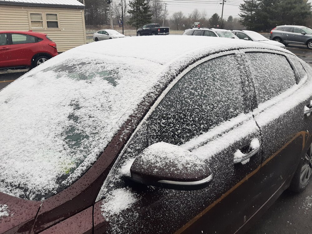
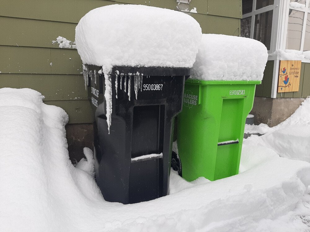
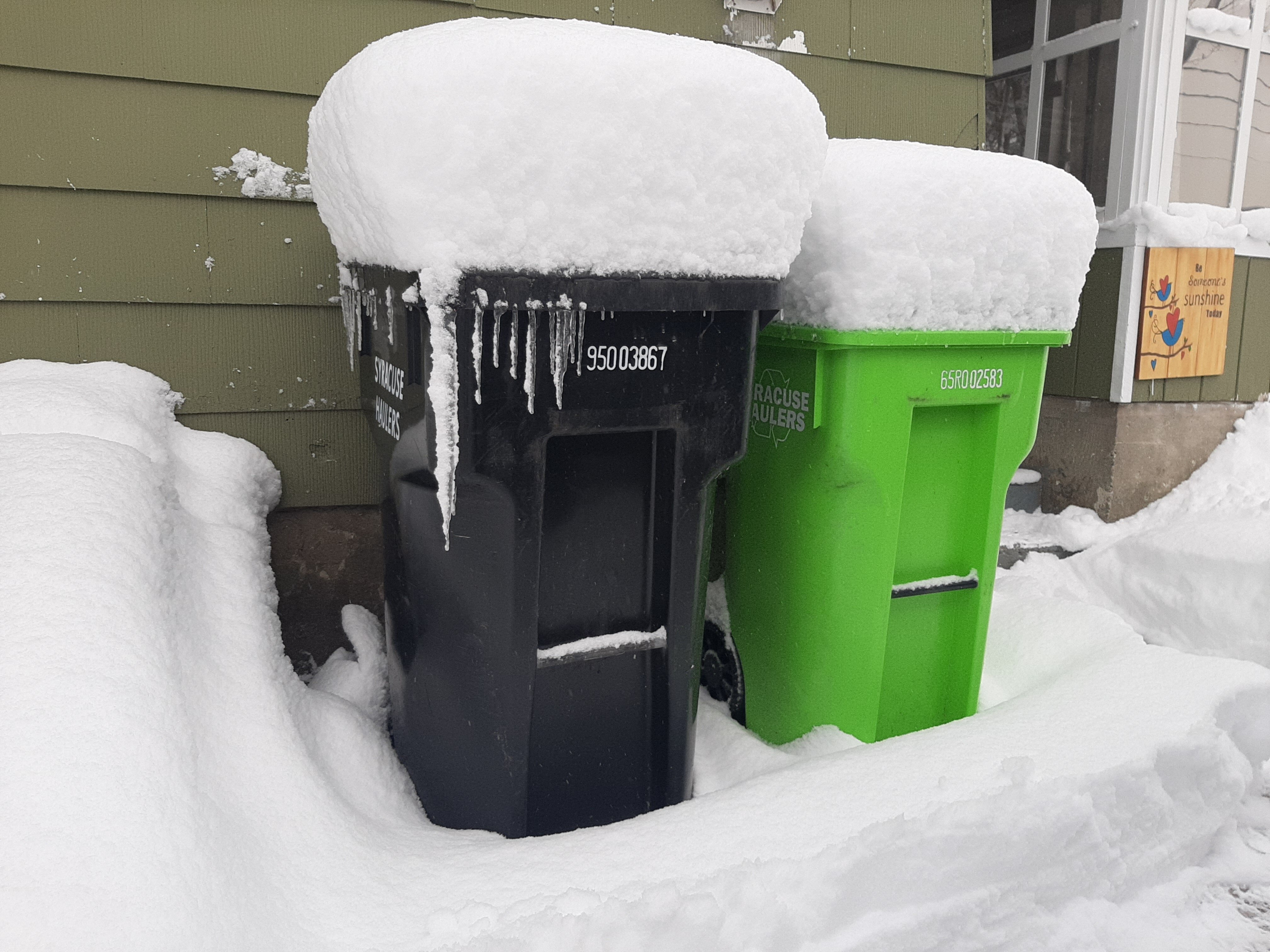
8" so far for Storm here. Still snowing lightly. Right at 140" for this long season.
-
4
-
-
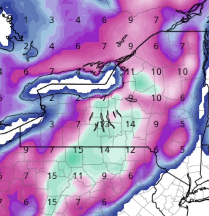
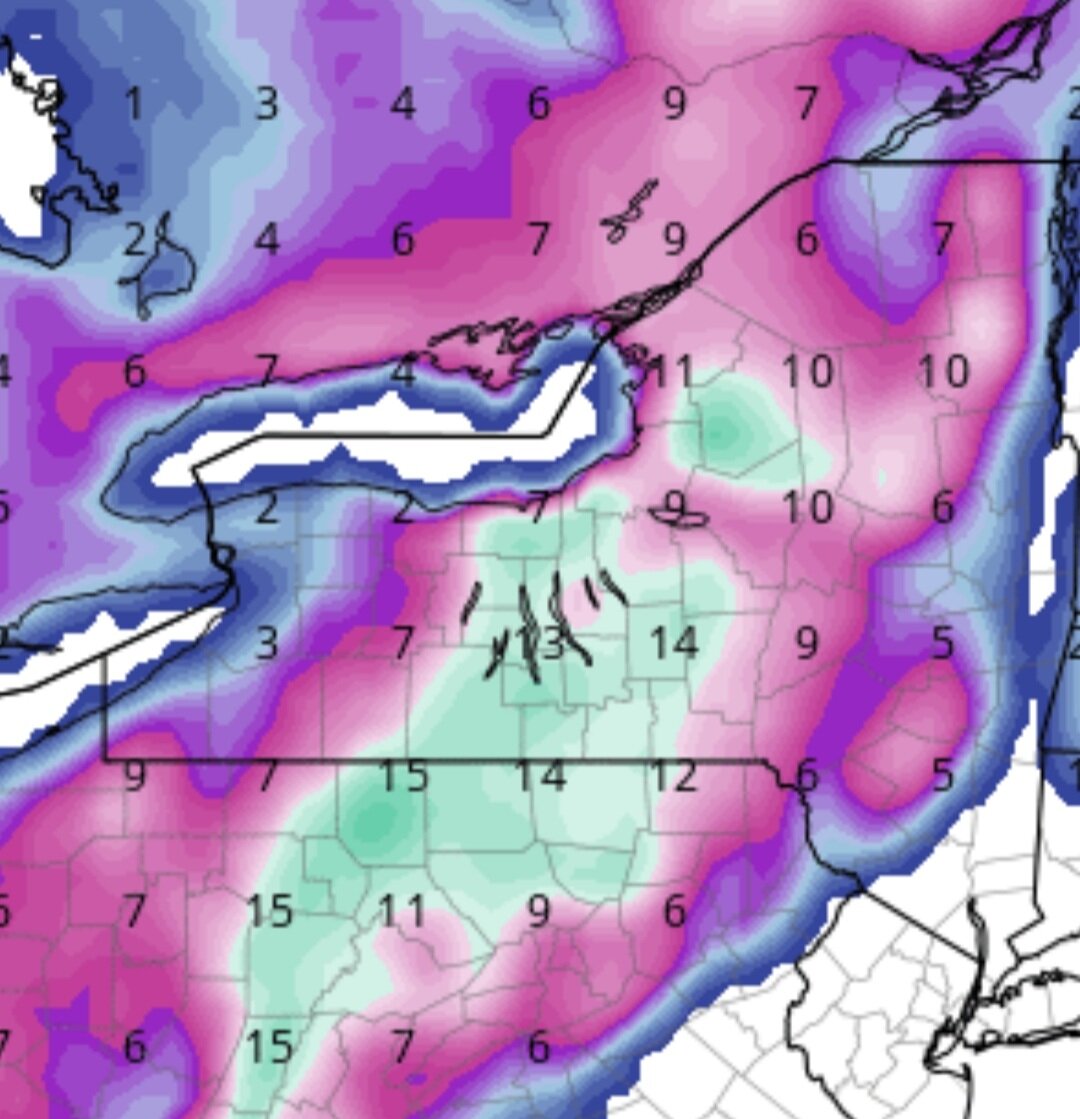
NAM 12z...
-
2
-
-
-
-
Syracuse's expected high is 62 today. I bet a ton of money it will be above that. I'll go with 67.
-
2
-
-
On 4/10/2022 at 9:29 AM, CNY_WX said:
There were a few snow showers here a couple of hours ago. It’s already transitioned to rain. LEK, what’s your elevation in Cazenovia?
1250'
-
1
-
-
Caz. Spring!
-
2
-
-
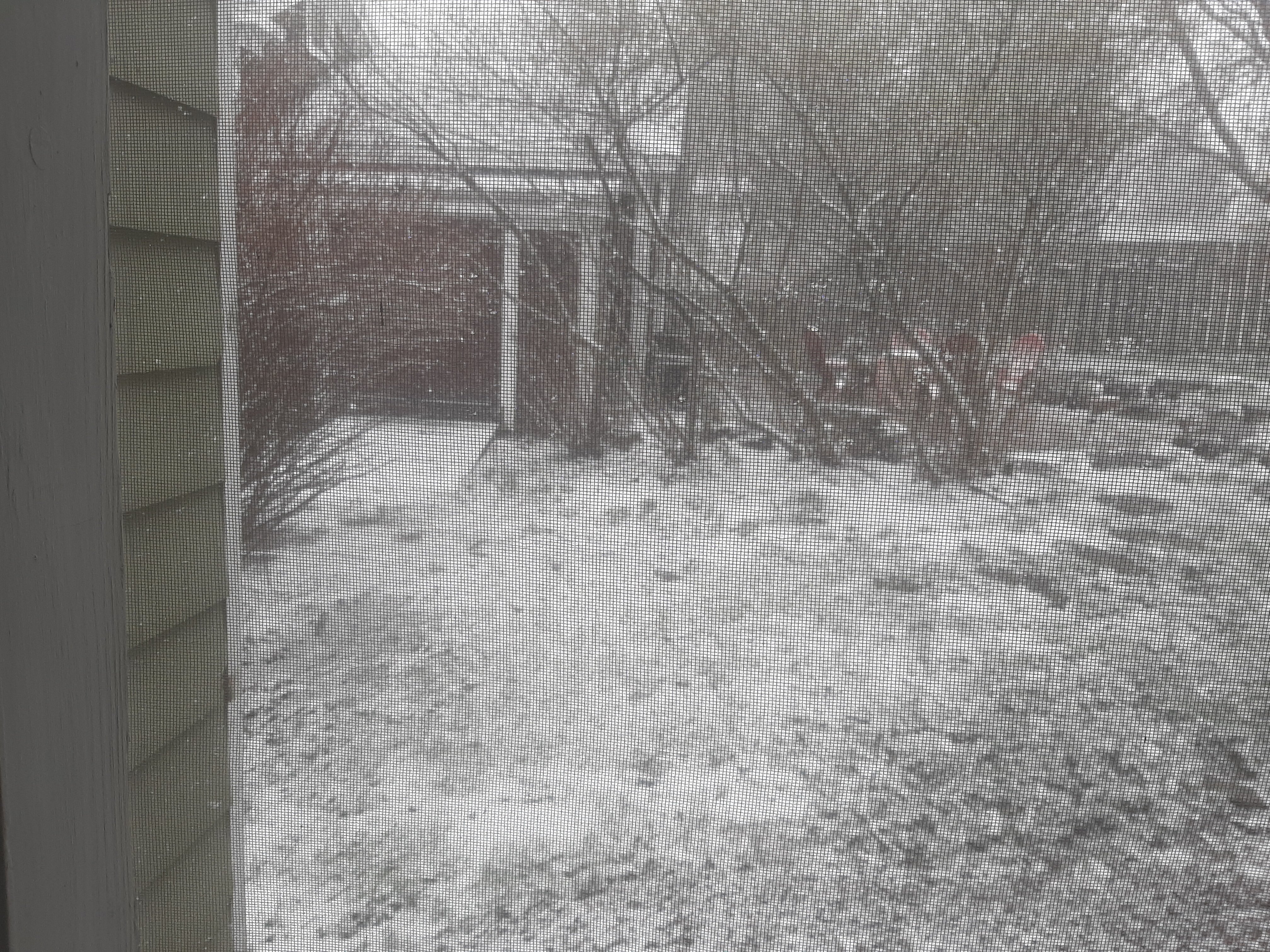
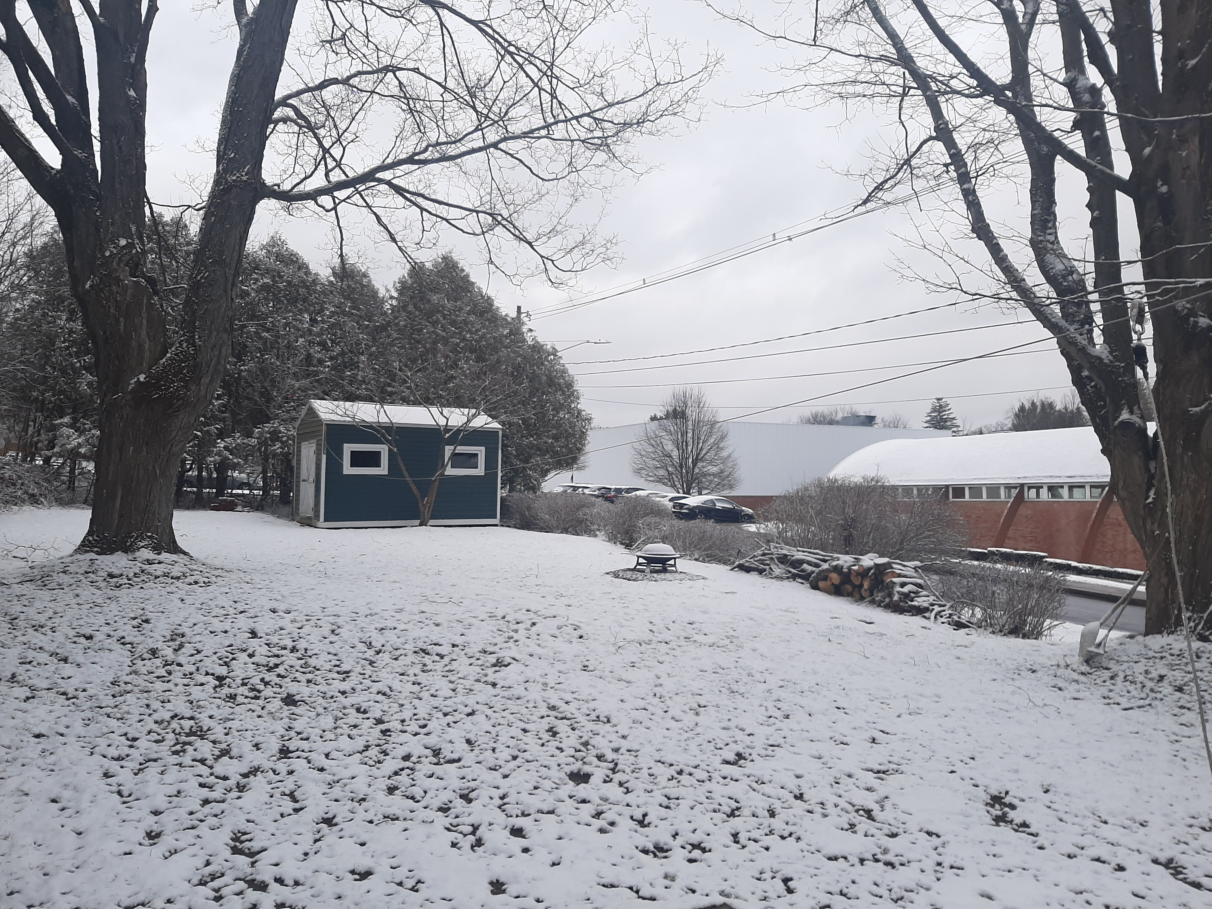
April 4th winter wonderland in Caz.
Currently:
-
4
-
-
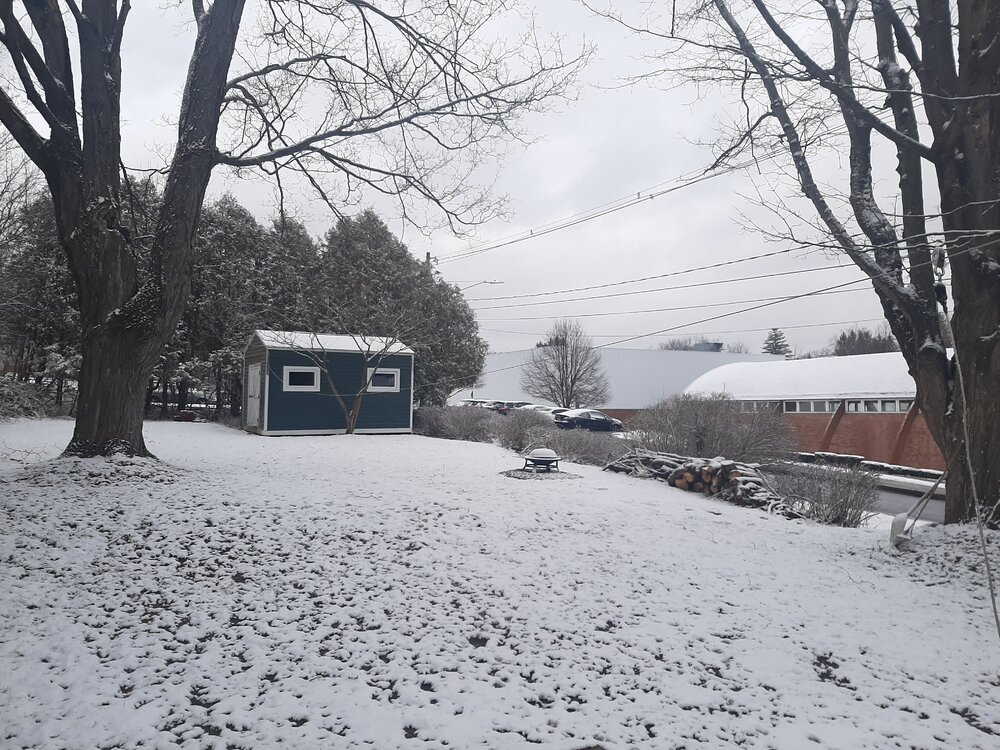
No April fool's joke here. 1.5" of snow here today in Caz. All of the earlier weeks snow was gone.
-
2
-
-
2 more inches last evening and overnight in Cazenovia. 22" for the event. 129" on the season.
Deep winter feel this morning.

-
3
-
-
3 more inches during day...20" for the event. Still poundtown.
-
3
-
1
-
 1
1
-
-
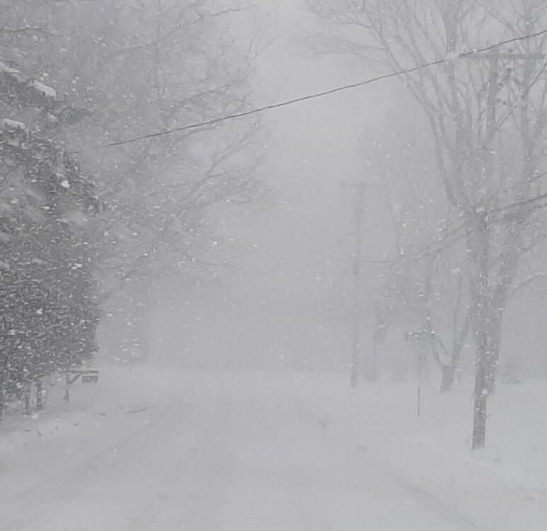
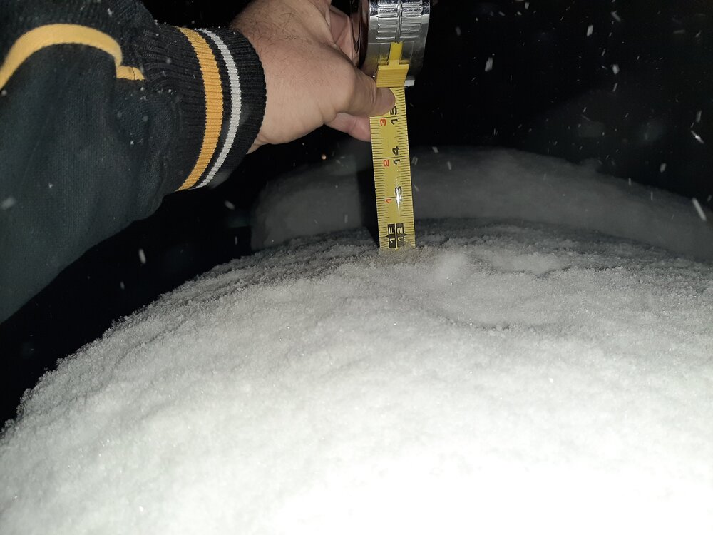
Snow has pretty much stopped ended up with about 14" overnight.
-
9
-
-
15 minutes ago, vortmax said:
I guess you were. Dang!
Yeah, We were in-and-out of heavy snow all night long.
-
1.5 hrs. after 1st pic. Same spot.
-
3
-


Hurricane Idalia
in Tropical Headquarters
Posted
Next 6-8 hrs should see another 15mb drop...it's go time for RI.