

CCHurricane
-
Posts
540 -
Joined
-
Last visited
Content Type
Profiles
Blogs
Forums
American Weather
Media Demo
Store
Gallery
Everything posted by CCHurricane
-
Cape is getting creamed right now. Not great ratios and mixing should begin over the next 60-90 minutes...but heavy stuff and great radar imagery nonetheless.
-
Mixing has begun to overtake Nantucket. Will be interesting to see when an eventual mix/sleet occurs on Cape Cod. Most short range models were targeting 3-4AM.
-
Central Cape Cod up to ~4 inches. FWIW 0z Euro really amps up precip totals north of MA boarder into central and southern VT and NH. NAM did a great job showing this trend and sticking with it across what was really the past +8 model runs.
-
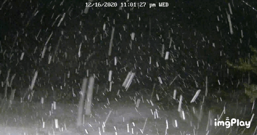
View from the webcam down on the south facing beaches of Cape Cod
-
Flurries beginning in Hyannis down on Cape Cod. Will be interesting to see how long the warm ocean air and coastal front can be kept at bay.
-

Active mid December with multiple event potential
CCHurricane replied to Typhoon Tip's topic in New England
If this storm was in January or February, perhaps. Have to remember ocean temps are running ~10 degrees above that. Lower level warming at the surface will be no joke and hard to combat. -
Active mid December with multiple event potential
CCHurricane replied to Typhoon Tip's topic in New England
Right!? Was looking pretty solid for SE Mass up until last night. We should be used to this by now though. -
Active mid December with multiple event potential
CCHurricane replied to Typhoon Tip's topic in New England
Unfortunately I would take Euro 10:1 output with a grain of salt down here near the canal and on the Cape. While cold aloft, surface temps look to be running north of 35. Will be hard for meaningful accumulation to happen at those temps, probably closer to 5:1.
