Buffalo Bumble
-
Posts
1,613 -
Joined
-
Last visited
Content Type
Profiles
Blogs
Forums
American Weather
Media Demo
Store
Gallery
Posts posted by Buffalo Bumble
-
-
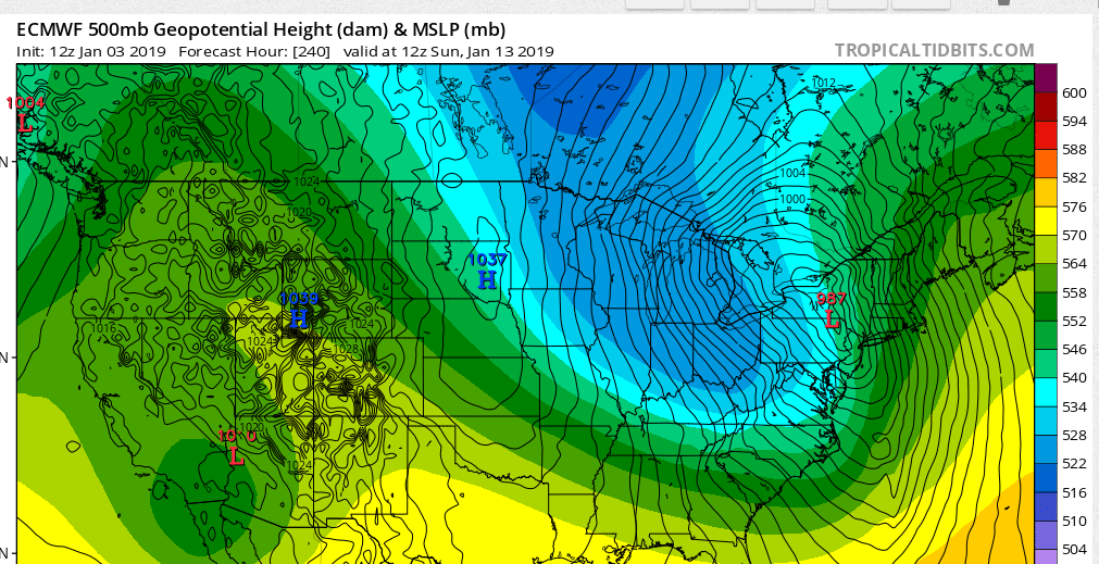
Desperate times call for desperate measures...I'll go ahead and post the 12z Euro 240 hr map. Double phaser on top of Freak's barcalounger

-
 1
1
-
-
3 hours ago, BuffaloWeather said:
It's our only hope to save this winter. I mean look at this forecast for middle of winter. Was planning on going boarding next weekend. The lows for the next 2 weeks barely dip below freezing. I won't complain about some sunshine though.
FridayMostly sunny, with a high near 44.SaturdayMostly sunny, with a high near 46.SundayMostly cloudy, with a high near 38.MondayMostly cloudy, with a high near 35.TuesdayCloudy, with a high near 40.Not to mention next week right now looks like near 50 for a few days.Perusing the 0z models I just about dropped my phone looking at the ridge the Canadian pops over us towards the end of next week. Maybe something like that is needed to really bust out of this pattern. Seems like some of our best transitions happen when cold air dives deep into the middle of the country first, torching us for a bit before the trof gradually settles east.
-
2 hours ago, wolfie09 said:
Don't forget to drink responsible tonight

We don't need anyone to become a statistic..
I'll be at the safest place possible, home, drinking water lol
Happy New Year’s all! Ball drops tonight, then the weather hammer drops in 10 days! It’s coming!!!
-
 1
1
-
 1
1
-
-
I'm always interested in how close we are to "real" winter whenever we're stuck in a bad winter pattern. The next 24-48 hours is a good example. We're all looking at mid to upper 40's tomorrow with rain, and for the most part back to no snow cover. But just go about 100 miles north of Lake Ontario and they're in line to add up to a foot of snow on top of a current 8-16" snow pack.
Kind of makes me think I should start planning a winter trip or two up into southern Ontario where winter conditions are pretty much a lock.
-
Meltdowns across most of the forums have been entertaining to read today. As much as I want cold/snow this time of year, a devious little part of me is amused by what’s transpiring. Seems the vast majority of the pros have been trumping a cold to very cold January for a while now. The Modoki El Niño will bring it home! All the top analogs say so! Warm blob in the gulf of Alaska! Rapid snow cover increase in Siberia in late October! Low sea ice in Barents/Kara! Sudden strat warming to unleash the polar vortex!
And here we are on Dec 29 with long range models more or less torching CONUS on average thru Jan 15, after a warm Dec. Just comfirms long range forecasting is a crapshoot at best, and not worth taking seriously.
-
2
-
-
9 minutes ago, BuffaloWeather said:
Here is the look for what is normally "prime" winter.


Well sh^%#t. Open the marinas on Lake Erie and bust out the jet skis?
-
 1
1
-
-
Happy Spring everyone! Went out for a run in shorts and tee shirt this morning, heading to the golf course this afternoon to play a few holes (seriously, I am). Looking forward to doing it again on NY day.
Trust me, I would rather be talking about upcoming or future snowstorms and cold, but not seeing it right now...
-
1
-
-
1 hour ago, CNY-LES FREAK said:
Everyone's in panic mode, lol, who cares about 2-3 bad model runs as it can change, and probably will change, but I doubt we're snow free the first 2-3 weeks of January. If that does happen to occur, then that'll be the first time that it's happened in my 15 years of living here. Its gonna snow, its Upstate NY not DC.
Sent from my SM-G930V using Tapatalk
I hear ya, but it's getting hard to look at every model run with seasonal cold/dry, followed by warm/rain, rinse and repeat. Such is climo I suppose...That said, I might be getting at least a little nervous if I was one of the many mets/pros forecasting a cold Jan. IF the last few long range model runs pan out, most of the U.S. gets to mid Jan with a pretty good positive departure in the books.
But like you said, the models can certainly change on a dime for the better moving forward. Maybe the strat warming that's supposed to be happening right now somewhere about 25 miles over Khatanga, Siberia will help us out...

-
1
-
1
-
-
Merry Christmas all!!! Dusting on the ground here, but big flakes have been slowly falling all morning ❄️❄️
-
1
-
-
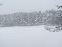
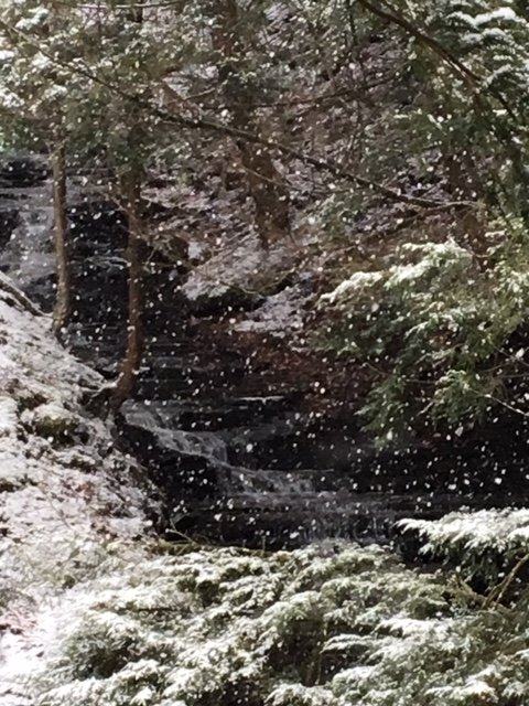
Winter wonderland at Hunter Creek in East Aurora today. About 5” fell during a long hike.
This is why living in the BUF north towns doesn’t faze me. I can drive 20 minutes and spend the day in snow in beautiful country. Anything I get at home is a bonus.
-
2
-
-
1 hour ago, champy said:
We lucked out here in Skaneateles. Flipped around 1am and pasted everything.
Nice! Great pics too! Nada on the Niagara Frontier.
-
6 hours ago, BuffaloWeather said:
GEFS say cutter next Friday too.

Yep, I think we have a better chance of hitting 60 deg next Friday than seeing any frozen precip.
-
1
-
-
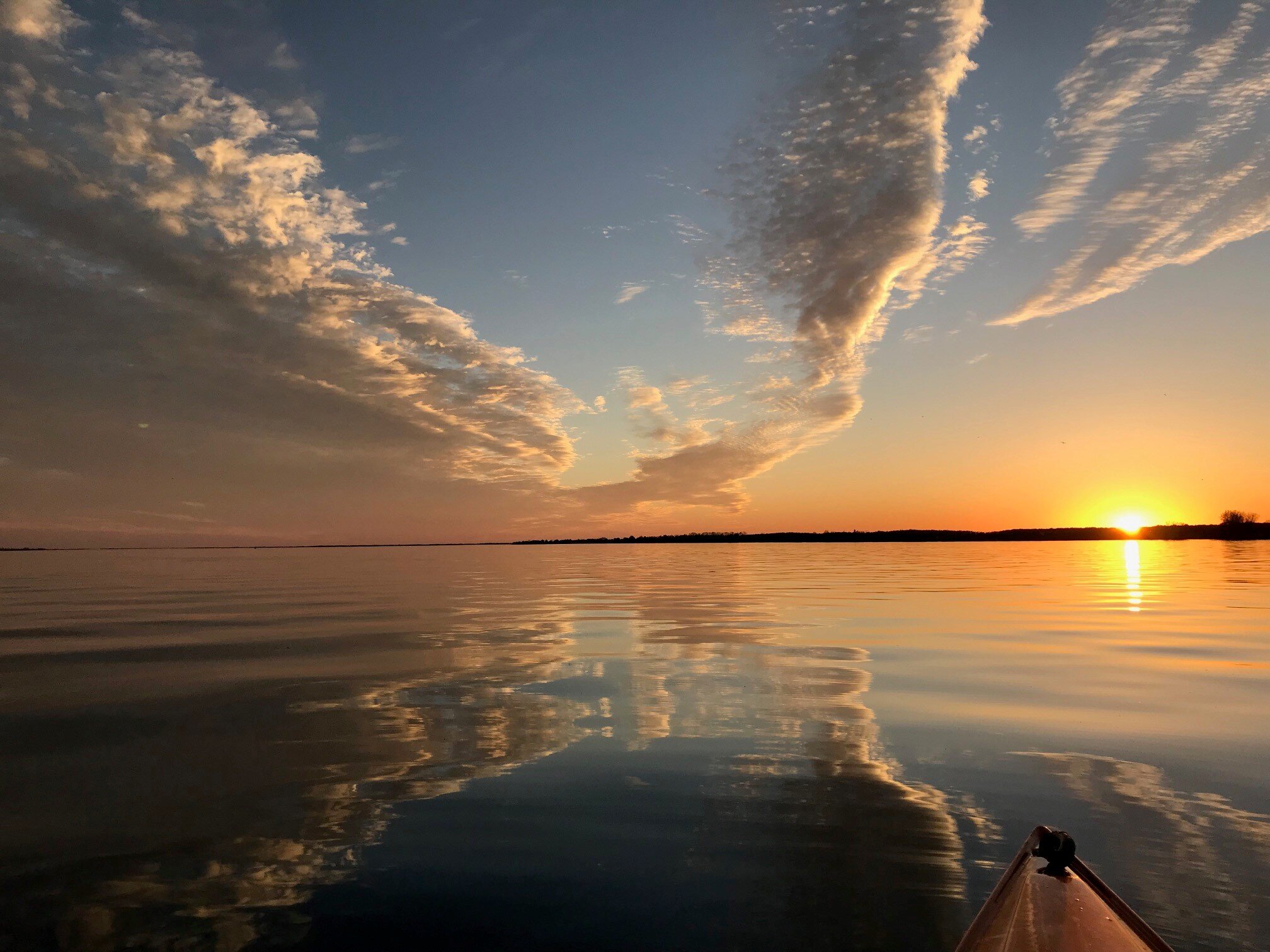
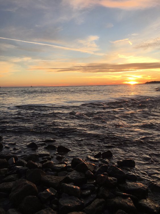
Same location, different view across the lake/river interface. Pretty cool how the current really picks up here as (I presume) the lake flows over a shelf and the channel starts to narrow.
.thumb.JPG.bd1d67a841795642bb218d7115f550a1.JPG)
-
1
-
-
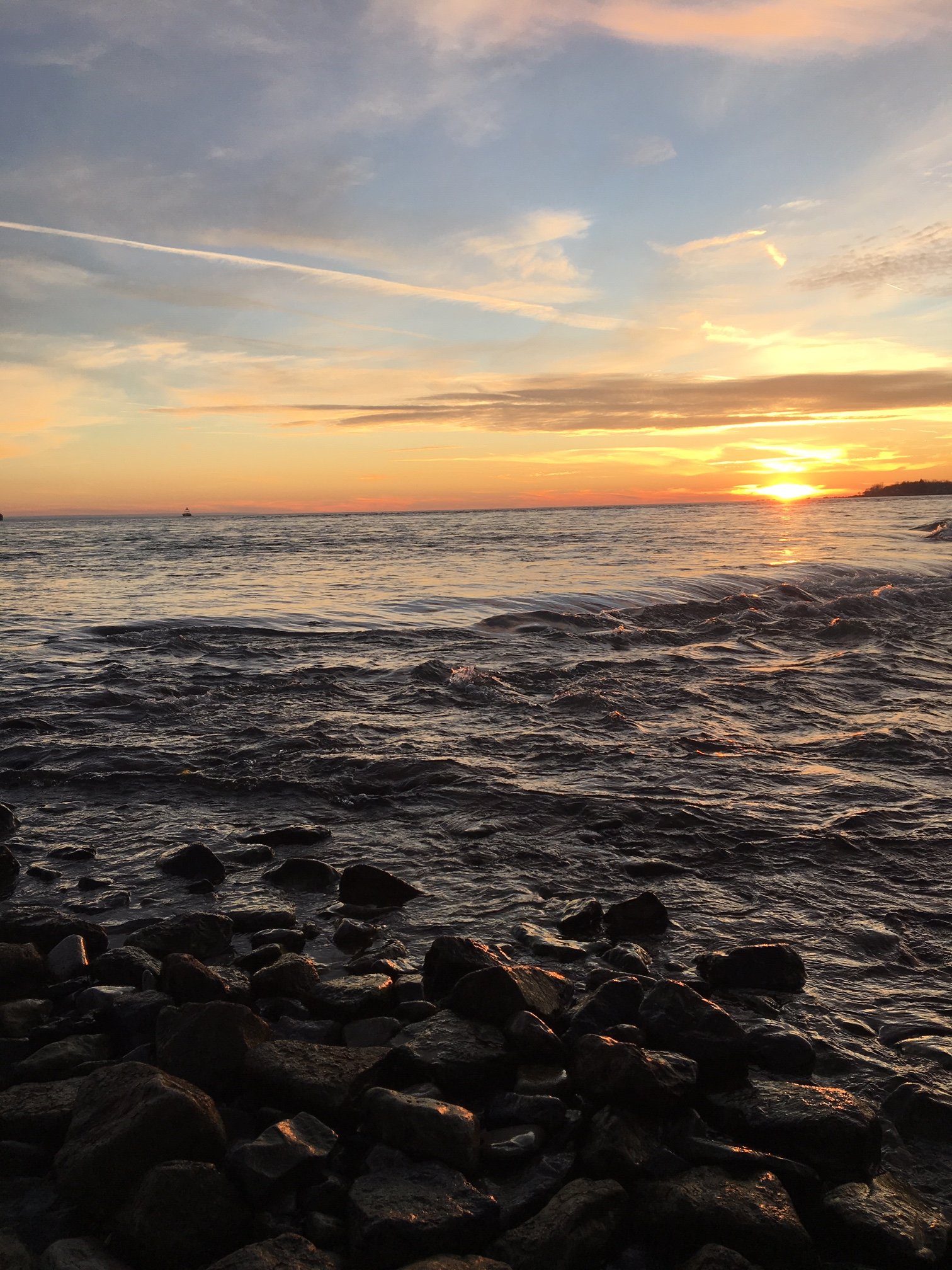
Took this shot this evening at the northeast end of L Erie, where the Niagara River starts. Not a trace of ice anywhere out on the lake. The shallower canal on the other side of the pier is totally ice free as well.
-
2
-
-
48 minutes ago, BuffaloWeather said:
Would be quite surprised if anyone but highest elevations in upslope areas and the tug have white Christmas.
Agree. Temps look to jump above freezing both Sunday and Monday, so any little accumulation lower elevations get after the deluge will likely sublimate to green. Plus we'll be fighting an increasing sun angle now that days will be getting longer (full sarcasm intended there!).
-
1
-
-
2 hours ago, BuffaloWeather said:
I'll see you guys in January.
https://www.esrl.noaa.gov/psd/forecasts/reforecast2/teleconn/forecast.html
Yeah, I was thinking the same today perusing the op models. Maybe upstate will sneak in a minor event before the calendar flips, but not seeing any sustained winter weather before then.
-
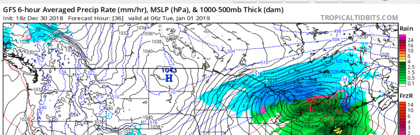
Models showing quite the solstice soaker. Nothing says Christmas like plastic Santa’s getting washed down the road in a raging torrent.
Looks ok for a little whitening in time for Christmas Eve though.
-
Reports through 945 pm Thursday. ********************STORM TOTAL SNOWFALL******************** LOCATION STORM TOTAL TIME/DATE COMMENTS SNOWFALL OF /INCHES/ MEASUREMENT NEW YORK ...Erie County... Buffalo Airport 6.2 651 PM 12/06 NWS Office 1 NW Williamsville 5.3 800 PM 12/06 NWS Employee 1 WNW Alden 4.8 700 PM 12/06 TRAINED SPOTTER Tonawanda 4.5 600 PM 12/06 Trained Spotter Springville 3.0 700 PM 12/06 Co-Op Observer 5 NE Springville 3.0 700 PM 12/06 Co-Op Observer Sardinia 2.0 900 PM 12/06 Snow Spotter ...Jefferson County... S Watertown 22.7 900 PM 12/06 Snowfall through 9 pm Carthage 20.0 700 PM 12/06 CoCoRaHS Watertown 18.0 840 PM 12/06 Social Media 1 S Watertown 18.0 700 PM 12/06 Social Media Adams Center 7.1 524 PM 12/06 Snow Spotter ...Lewis County... Copenhagen 16.0 703 PM 12/06 Social Media ...Monroe County... Rochester Airport 0.6 700 PM 12/06 ASOS 2 NE Webster 0.5 800 PM 12/06 Co-Op Observer ...Niagara County... Lockport 4.0 700 PM 12/06 Co-Op Observer 4NE Lockport 4.0 700 PM 12/06 Co-Op Observer ...Orleans County... Albion 1.2 500 PM 12/06 Co-Op Observer -
Heavy snow here for the last hour. The L Erie band exploded nicely as the cold front got closer. Always amazed to watch lake effect events unfold.
Sagging southward now, I should end up with about 6" for the day. Very nice little event on the Niag Frontier.
-
3
-
-
She's alive...
-
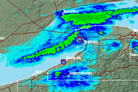
Kind of a convoluted mess over Lake Erie right now. Time's running short to get a new consolidated band to fire up. Like Freak said, the band over Ontario looks pretty sweet right now though.
-
About 3" of fresh snow cover IMBY. Snow is actually quite heavy, not the usual fluffy LE. It will be interesting watching the radar thru the afternoon to see if/where the band becomes reestablished off L Erie as the trof swings through, and how intense it becomes on its journey south.
-
2 minutes ago, Thinksnow18 said:
+SN in Williamsville. Roads are trash already.
Same here. Flake size decent, eyeballing 1.5”/hr rate.
-
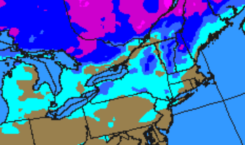
Good write-up from BUF on the upcoming LE. Throwing lots of caveats in about parameters and band placement. Which I have no problem with considering that predicting lake effect for any one area is really just a well educated guessing game.
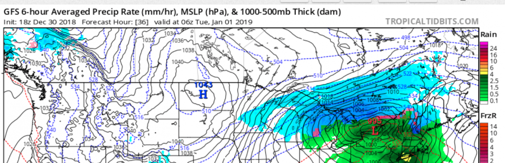
BTW - that's quite an atmospheric perturbation modeled over our area at hour 240. La la land, but shows up on both GFS and Euro.
Tonight the axis of the surface ridge will slip a little further
southeastward...while a modest clipper system over the Upper Great
Lakes slowly pushes toward our area. Consequently...the general
weak westerly flow across our region will gradually turn more west-
southwesterly...strengthen...and become more sheared...while
inversion heights will climb a little to around 7 kft over Lake Erie
and to around 8 kft over Lake Ontario. With a cold enough airmass
remaining in place for a lake response...this will result in light
to modest lake snows developing east of both lakes this
evening...with these then slowly becoming better organized and
shifting northward to the Buffalo and Watertown areas overnight. At
this point it still appears that the aforementioned cap and
increasing shear should help to keep the lake snows on the weaker
side through most of, if not all of tonight...which in tandem with
the migratory nature of the snow should translate into total
nighttime accums remaining confined to the 1 to 2 inch range. A
notable increase in synoptic moisture will commence overnight
tonight ahead of the approaching clipper system. Outside of these
areas of lake snows... it will be generally dry with just some
scattered snow showers or flurries...and nighttime lows ranging from
the lower 20s across far interior sections to the upper 20s to near
30 along the lakeshores.

On Thursday, steepening boundary layer lapse rates, increasing
moisture, and still present cold 850Ts of around -9C, will help
intensify the lake bands off of each lake. Both lake effect
snowbands, one off of Lake Erie, the other off of Lake Ontario, will
shift north to the Buffalo Metro and toward Watertown Thursday
morning into the afternoon. Wind profiles are still suggesting
enough shear to lower some of the snowfall potential. Meandering of
the lake band over the northtowns and northwestern Jefferson County
on Thursday will also help aid in reducing snow amounts that any one
place in particular will receive. It is important to note, that if
winds are less sheared, or weaker in general it will result in
higher snowfall amounts over areas where the band(s) of snow persist
the longest. Temperatures hovering around freezing will also help
keep snow ratios down, with most areas on Thursday receiving around
3 to 5 inches of snow where the lake effect snow band persist the
longest off of Lake Erie. Off of Lake Ontario, snow accumulations of
3 to 6 inches will occur in areas of higher terrain and where the
snow band persists the longest.

As the clipper shifts from the Georgian Bay to western Quebec
between Thursday morning and evening, it will drag a cold front
across the area. Timing of this cold frontal passage will also be
key to the timing of both lake effect snow bands to move south. If
this cold front is slower to move through then that will help keep
lake snows farther north for longer, resulting in some higher
snowfall amounts.

Gusty winds on Thursday will be strongest within and near the
strongest portions of the lake effect snow bands, with some wind
gusts to 35 MPH possible, resulting in areas of blowing snow and
reducing visibilities even more so than with just the snowfall.
Temperatures on Thursday will be in the lower to mid 30s, with the
warmer areas being away from the lake snows and in the lower
elevations. With temperatures in the low to mid 30s on Thursday,
blowing snow will be limited some, but should still occur within
areas of the strongest bands of snow as winds will also be strongest
there.
-
1
-
.JPG.b246163821cc3f8acd87c18a991ad506.JPG)
Upstate/Eastern New York
in Upstate New York/Pennsylvania
Posted
Now watch things turn on a dime and the arctic gates burst open!