Buffalo Bumble
-
Posts
1,613 -
Joined
-
Last visited
Content Type
Profiles
Blogs
Forums
American Weather
Media Demo
Store
Gallery
Everything posted by Buffalo Bumble
-
Upstate/Eastern New York
Buffalo Bumble replied to BuffaloWeather's topic in Upstate New York/Pennsylvania
Getting a little concerned that us far WNY peeps might be fringed. Not worried about a complete whiff yet, but more like every single county in BUF's CWA is lit up pink under WS warnings, while northern Erie and Niagara counties are blue balled under WW advisories. At any rate, I still don't think confidence for any particular area should be too high until the 0Z runs tonight. -
Upstate/Eastern New York
Buffalo Bumble replied to BuffaloWeather's topic in Upstate New York/Pennsylvania
Canadian looks a tad bit south of 12Z to me. But still looks like a solid thump region-wide. -
Upstate/Eastern New York
Buffalo Bumble replied to BuffaloWeather's topic in Upstate New York/Pennsylvania
Watch the Euro run the low up to Detroit and rain on us all, just to really mess with us... -
Upstate/Eastern New York
Buffalo Bumble replied to BuffaloWeather's topic in Upstate New York/Pennsylvania
Yeah, it does look goofy. Between hrs 90 and 96 looks like it jumps the low due south from KY to AL. I'll pull the "it's suffering from convective feedback" card out for this run. -
Upstate/Eastern New York
Buffalo Bumble replied to BuffaloWeather's topic in Upstate New York/Pennsylvania
Sure is. I would love to ride out a storm like this somewhere high up in the Sierra's when it slams into the coast. Just a general 80-120" snowfall at about 8K feet... -
Upstate/Eastern New York
Buffalo Bumble replied to BuffaloWeather's topic in Upstate New York/Pennsylvania
Here's a current shot of the weekend storm out in the PAC. Very impressive bundle of energy spinning out there. Can't help but think/worry that the models are going to burp out some unexpected solutions after the more robust sampling data gets ingested starting tomorrow night.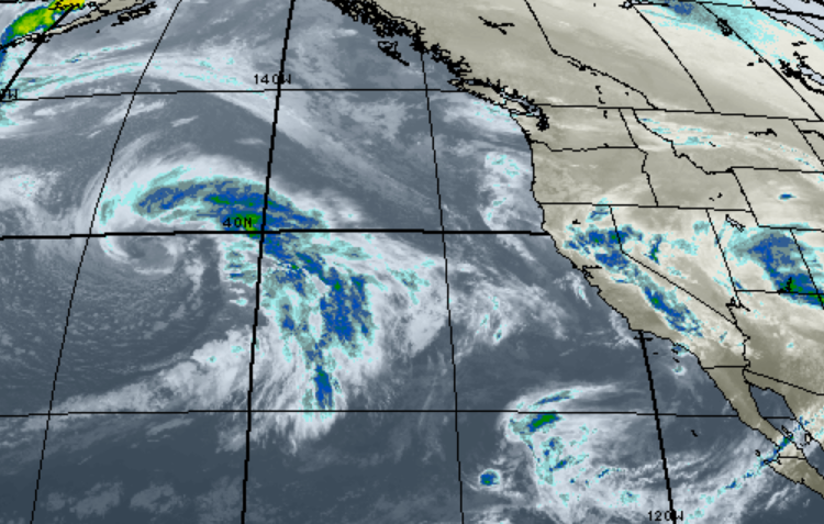
-
Upstate/Eastern New York
Buffalo Bumble replied to BuffaloWeather's topic in Upstate New York/Pennsylvania
Love the positive thinking! Blizzard watch would be better, but let's keep something in our back pocket. -
Upstate/Eastern New York
Buffalo Bumble replied to BuffaloWeather's topic in Upstate New York/Pennsylvania
Looks like someone’s blue pen exploded on the Great Lakes! Quite the run of modeling today. -
Upstate/Eastern New York
Buffalo Bumble replied to BuffaloWeather's topic in Upstate New York/Pennsylvania
Yep, these runs are fun to track but as far as sensible weather next weekend I wouldn’t jump on anything until middle of the week. If synoptic misses I just hope lake effect kicks in somewhere on its heels. -
Upstate/Eastern New York
Buffalo Bumble replied to BuffaloWeather's topic in Upstate New York/Pennsylvania
Shave the “2” off that 274 hour run and I’ll paddle board naked through the inner harbor with weenie flying at full staff. Crazy potential in the upcoming pattern. -
Upstate/Eastern New York
Buffalo Bumble replied to BuffaloWeather's topic in Upstate New York/Pennsylvania
Don’t know if I’ve ever seen a “spread the wealth” event look better than that. Is that map from the Buf blizzard book? I need to track that down... -
Upstate/Eastern New York
Buffalo Bumble replied to BuffaloWeather's topic in Upstate New York/Pennsylvania
Wow! Looks like the PV dropped straight down over the west side of Lake Superior. That would certainly ruin your outdoor plans at BUF...Thanks for posting - great maps. -
Upstate/Eastern New York
Buffalo Bumble replied to BuffaloWeather's topic in Upstate New York/Pennsylvania
https://www.nytimes.com/1985/01/22/nyregion/snowfall-brings-buffalo-region-to-a-standstill.html This one was before my time in Buffalo, so did a bit of research. Without seeing a weather map, sounds like the PV made a journey into Ontario. Probably southwest of Hudson Bay to get such incredibly cold temps at BUF with a mean SW wind. It would be interesting to see what triggered this event in terms of broad scale circulation. Must have been some wicked blocking. -
Upstate/Eastern New York
Buffalo Bumble replied to BuffaloWeather's topic in Upstate New York/Pennsylvania
So close, yet so far away! If we can get a look like that to line up with about a 4-day lead time....the possibilities are endless. -
Upstate/Eastern New York
Buffalo Bumble replied to BuffaloWeather's topic in Upstate New York/Pennsylvania
The dreaded jackpot 7 days out from an event...Could be looking at quite a fun week of model agonizing, er analysis, coming up. -
Upstate/Eastern New York
Buffalo Bumble replied to BuffaloWeather's topic in Upstate New York/Pennsylvania
I know exactly where you’re talking about and it’s one of my fav places too. There’s a trail that runs from the park entrance road through the woods for about 1 mile to the beach. Very secluded pristine sand beach south of the park with wide open view straight across the lake. If you were dropped there you would swear you were at the ocean. -
Upstate/Eastern New York
Buffalo Bumble replied to BuffaloWeather's topic in Upstate New York/Pennsylvania
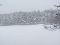
I love these fluff bomb blobs when the rotate over our area in these synoptic/lake enhanced set-ups.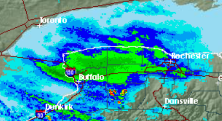
-
Upstate/Eastern New York
Buffalo Bumble replied to BuffaloWeather's topic in Upstate New York/Pennsylvania
SN+ here as another band slides across the Niagara Frontier from the north. -
Upstate/Eastern New York
Buffalo Bumble replied to BuffaloWeather's topic in Upstate New York/Pennsylvania
I’ll triple that. Mike Greenberg on ESPN said same exact thing on air about 10 years ago. Back on topic...1-2 hour bonanza here earlier was great. Quick 2-3 inches down. Snow picking back up again now. -
Upstate/Eastern New York
Buffalo Bumble replied to BuffaloWeather's topic in Upstate New York/Pennsylvania
Definitely a primarily NW flow event with that snow distribution. Don't underestimate the power of enhancement on the Tug in a multi-band NW flow set-up. The southern half of the Tug in particular has plenty of wide open Lake Ontario water upstream to produce nicely in these situations. -
Upstate/Eastern New York
Buffalo Bumble replied to BuffaloWeather's topic in Upstate New York/Pennsylvania
Yes it is. Trying to decide if I should head down to the hills tomorrow or Thursday. I like to chase during the heaviest snow, as opposed to at the tail end of events to see depth...so thinking late tomorrow afternoon might be best time. -
Upstate/Eastern New York
Buffalo Bumble replied to BuffaloWeather's topic in Upstate New York/Pennsylvania
Euro looks more like Canadian to me for next week, if not even more impressive with building heights into AK. Next week might be sneaky good... -
Upstate/Eastern New York
Buffalo Bumble replied to BuffaloWeather's topic in Upstate New York/Pennsylvania
Latest Canadian actually shows that period being quite chilly, if not cold, as a pretty good block stays in place up near AK. Let's see what Euro looks like, but I wouldn't bank on a warm period next week quite yet. -
Upstate/Eastern New York
Buffalo Bumble replied to BuffaloWeather's topic in Upstate New York/Pennsylvania
Love that look, just wish it wasn’t over 2 weeks out! Hopefully the modeling keeps trending in that direction so we can have something legit on the table to really start tracking after mid month. -
Upstate/Eastern New York
Buffalo Bumble replied to BuffaloWeather's topic in Upstate New York/Pennsylvania
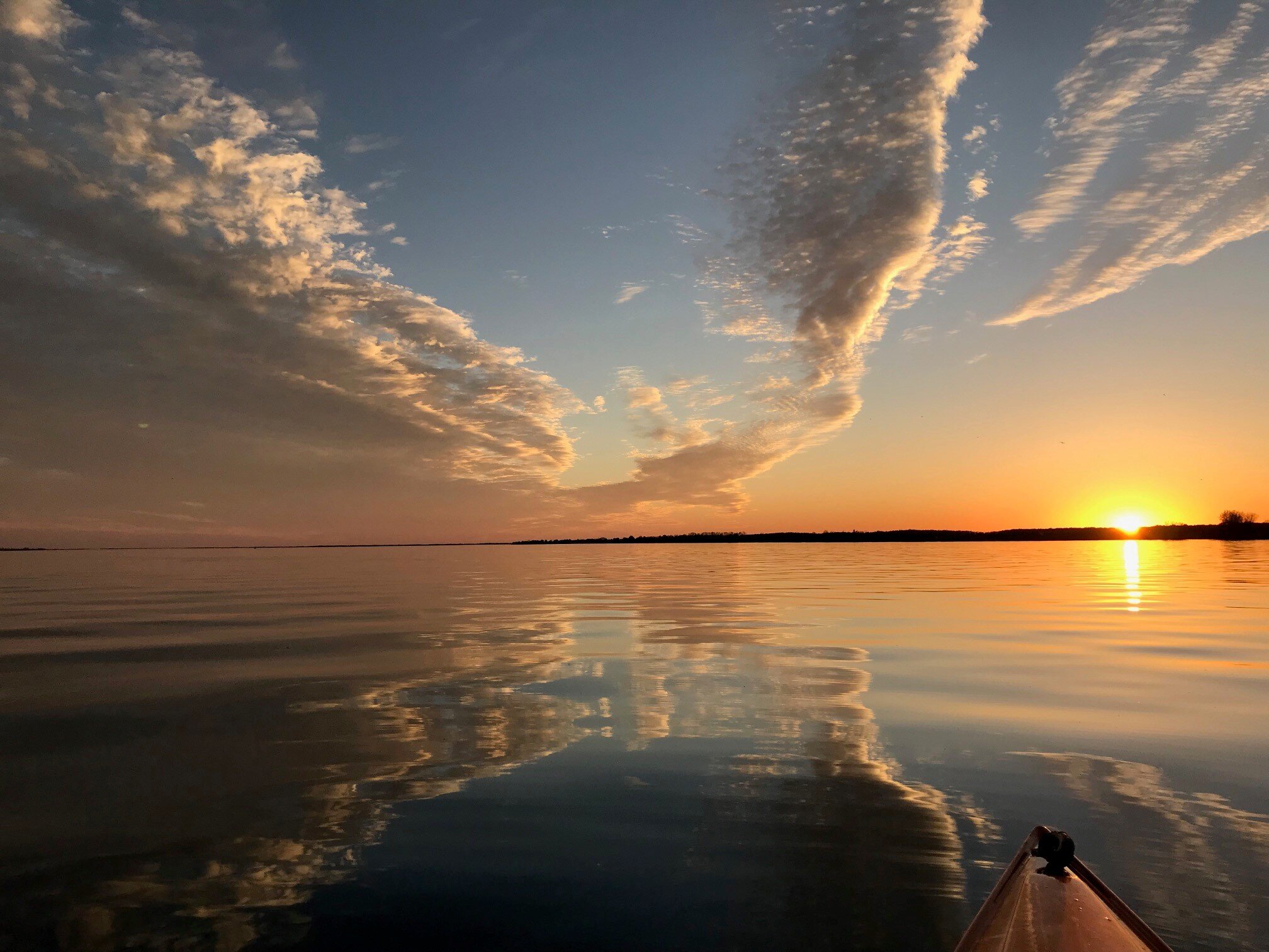
I know, crazy! Really nice April day outside.

