Buffalo Bumble
-
Posts
1,613 -
Joined
-
Last visited
Content Type
Profiles
Blogs
Forums
American Weather
Media Demo
Store
Gallery
Everything posted by Buffalo Bumble
-
Upstate/Eastern New York
Buffalo Bumble replied to BuffaloWeather's topic in Upstate New York/Pennsylvania
Snowing heavily here, big flakes accumulating quickly. Was it supposed to start this early? I was expecting a lull until later this afternoon... -
Upstate/Eastern New York
Buffalo Bumble replied to BuffaloWeather's topic in Upstate New York/Pennsylvania
Nice, sounds like you're well prepared. You should be in for a great show the next few days. If/when the band drops south of Watertown onto the Tug, you might consider taking a short drive west on Rt 3 to Sackets Harbor. Great elevated views of the lake there, you could probably get some epic pictures of the band coming off the lake. Couple nice restaurants/breweries there too. -
Upstate/Eastern New York
Buffalo Bumble replied to BuffaloWeather's topic in Upstate New York/Pennsylvania
Pretty impressive and fast temperature rise here. I was at 16 deg around 3 PM, up to 32 now. Dunkirk up to 35 with a strong south wind. And quite the temp gradient across upstate right now with the north country at or below 0. CITY SKY/WX TMP DP RH WIND PRES REMARKS WATERTOWN CLOUDY 3 -6 66 NE14 29.89F WCI -15 FORT DRUM NOT AVBL OGDENSBURG CLOUDY 0 -17 46 NE7G15 29.98F WCI -13 MASSENA CLOUDY 1 -13 51 E15G23 30.06F WCI -18 SARANAC LAKE FAIR -4 -12 68 NE8 29.88F WCI -19 PLATTSBURGH CLOUDY 0 -14 51 NW5 30.12F WCI -10 $$ NYZ001>004-010>016-019>021-085-290400- WEST CITY SKY/WX TMP DP RH WIND PRES REMARKS NIAGARA FALLS CLOUDY 23 14 68 E6 29.66F WCI 16 BUFFALO CLOUDY 31 17 56 CALM 29.66S DUNKIRK CLOUDY 35 19 52 S18G40 29.63F WCI 24 JAMESTOWN CLOUDY 27 13 55 S14G20 29.66F WCI 16 WELLSVILLE CLOUDY 22 8 55 S9G17 29.73F WCI 12 ROCHESTER CLOUDY 23 11 60 SE8 29.76F WCI 14 PENN YAN CLOUDY 26 9 48 S10 29.80F WCI 16 -
Upstate/Eastern New York
Buffalo Bumble replied to BuffaloWeather's topic in Upstate New York/Pennsylvania
Hey, props to you for making the trek to Watertown to chase this event! Just curious, have you chased lake effect events before? This one could be pretty high on the danger side with the combination of heavy snow, strong winds, and frigid temps... -
Upstate/Eastern New York
Buffalo Bumble replied to BuffaloWeather's topic in Upstate New York/Pennsylvania
For entertainment purposes only...here's my WAG at upcoming snowfall through Friday: Erie Jack: BUF Airport - 27" Other notable Erie locations: Williamsville - 18"; West Seneca - 23"; Hamburg - 20"; Colden - 19" Ontario Jack: Barnes Corners: 47" Other notable Ontario locations: Watertown - 23"; Osceola/Highmarket - 29"; Redfield - 14" -
Upstate/Eastern New York
Buffalo Bumble replied to BuffaloWeather's topic in Upstate New York/Pennsylvania
It's raining and 40 deg in Cleveland right now. Probably not warm enough to open much water up down there, but any little melting will help to prime the pump. -
Upstate/Eastern New York
Buffalo Bumble replied to BuffaloWeather's topic in Upstate New York/Pennsylvania
I'm surprised at that map. Figured with the strong band that fired up in southern Erie County late yesterday afternoon that a good chunk of the central basin was still open. -
Upstate/Eastern New York
Buffalo Bumble replied to BuffaloWeather's topic in Upstate New York/Pennsylvania
Snow must be really piling up down there, been more or less in a band all day. Look forward to your report! -
Upstate/Eastern New York
Buffalo Bumble replied to BuffaloWeather's topic in Upstate New York/Pennsylvania
Interesting...was thinking the Tuesday night to Wed night period would be the best shot for northtowns, but per this maybe dry air will hold things down during that time. Hopefully things trend better and we start to at least see some watches pop up in WNY by tomorrow afternoon. -
Upstate/Eastern New York
Buffalo Bumble replied to BuffaloWeather's topic in Upstate New York/Pennsylvania
Same here, figured any lake effect this week off Erie would be battling a lot of ice cover. That band this morning in southern Erie was cranking, so that’s a good sign too. -
Upstate/Eastern New York
Buffalo Bumble replied to BuffaloWeather's topic in Upstate New York/Pennsylvania
To each his own, but as a northtowner I would chalk up yesterday as a great event. If I’m expecting a 12”+ lake effect event here every couple years I’m gonna be disappointed a lot. -
Upstate/Eastern New York
Buffalo Bumble replied to BuffaloWeather's topic in Upstate New York/Pennsylvania
Yeah, band looks great right now. South Buf to West Seneca should be in the thick of it. -
Upstate/Eastern New York
Buffalo Bumble replied to BuffaloWeather's topic in Upstate New York/Pennsylvania
Pretty cellular here for last couple hours. But when it comes down it pounds. Fun watching this wiggle around and spit little bursts around. -
Upstate/Eastern New York
Buffalo Bumble replied to BuffaloWeather's topic in Upstate New York/Pennsylvania
Should be some big totals with that band just north of the Tug. Copenhagen to Carthage jackpot? -
Upstate/Eastern New York
Buffalo Bumble replied to BuffaloWeather's topic in Upstate New York/Pennsylvania
Yeah, it's almost mesmerizing, isn't it? -
Upstate/Eastern New York
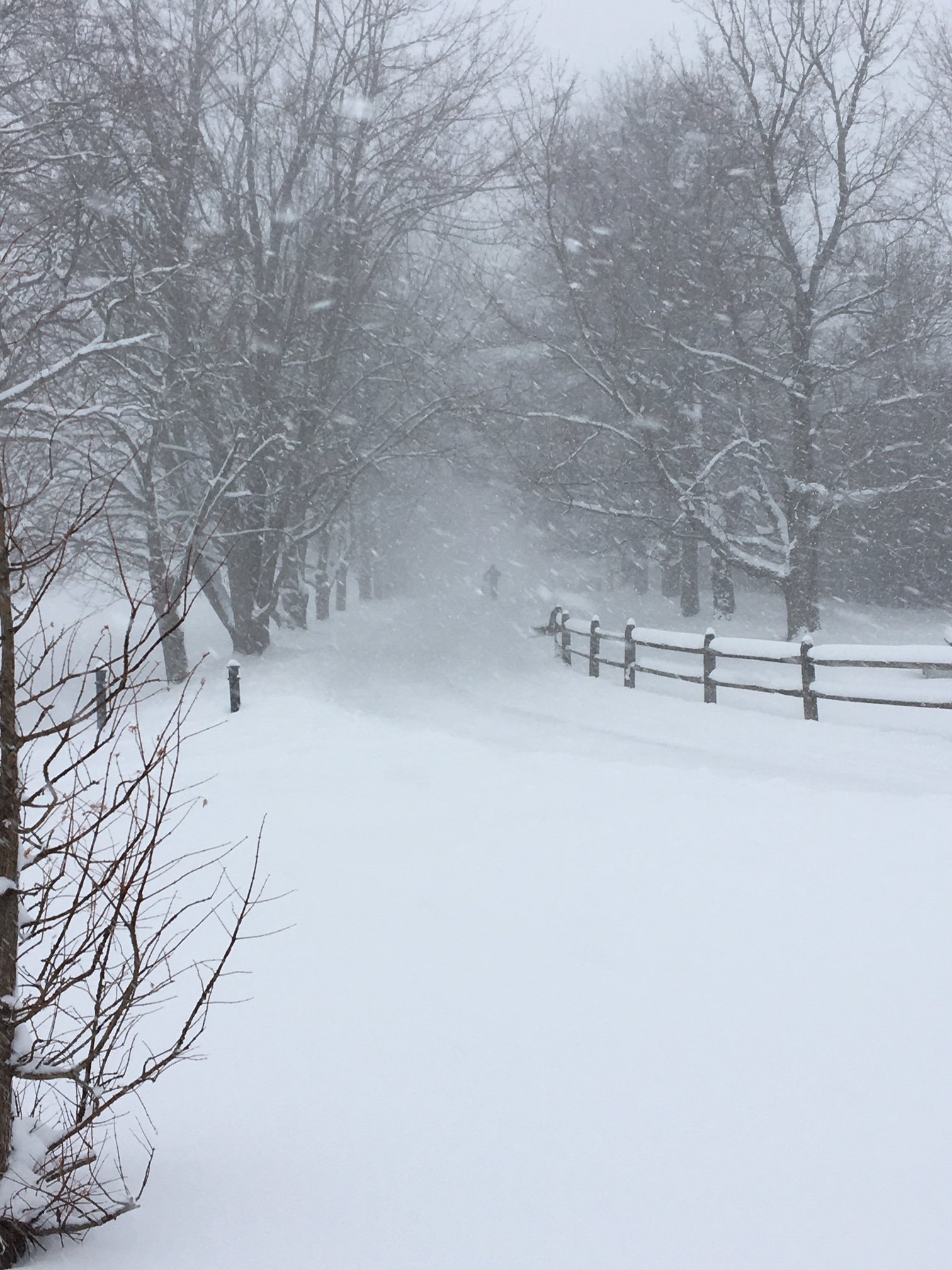
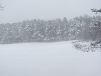
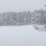
Buffalo Bumble replied to BuffaloWeather's topic in Upstate New York/Pennsylvania
Couple pics from this afternoon's ski at Knox Farm. In a funny twist...I left home around 2:30 today to chase the snow in southern/central Erie County, and it ended up chasing me right back home!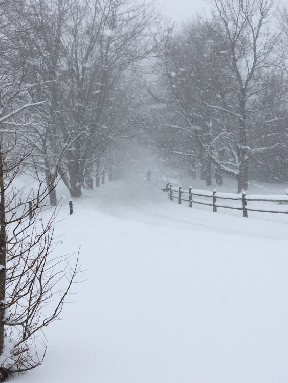
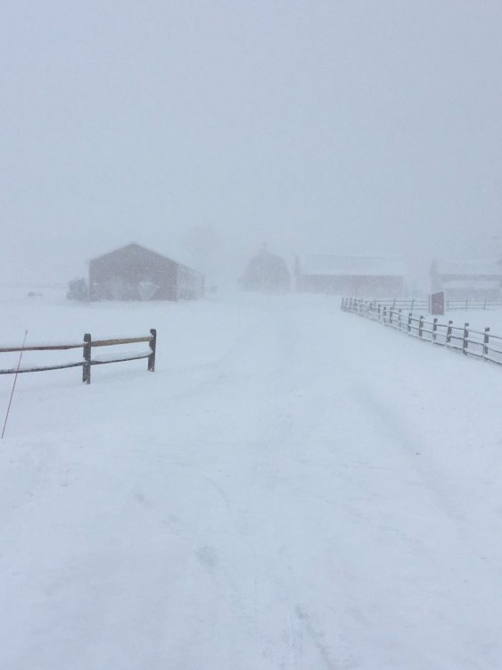
-
Upstate/Eastern New York
Buffalo Bumble replied to BuffaloWeather's topic in Upstate New York/Pennsylvania
Snow++ here! -
Upstate/Eastern New York
Buffalo Bumble replied to BuffaloWeather's topic in Upstate New York/Pennsylvania
About to hit the road north from EA. Still ripping here, eyeballing 2”/hour. -
Upstate/Eastern New York
Buffalo Bumble replied to BuffaloWeather's topic in Upstate New York/Pennsylvania
I’m out Cross country skiing at Knox Farm in EA. Band just moved in here. Vis way down. Pics later! -
Upstate/Eastern New York
Buffalo Bumble replied to BuffaloWeather's topic in Upstate New York/Pennsylvania
I'm very curious to see what the Euro snow map looks like for next week. I have absolutely no idea what the weather would look like in upstate as depicted on the Euro with a 1002 mb low over Delta's house on Tuesday, then a 985 mb low screeming up the CT river valley on Wednesday. Won't happen, but wonder what kind of snow/rain that sucker spits out... -
Upstate/Eastern New York
Buffalo Bumble replied to BuffaloWeather's topic in Upstate New York/Pennsylvania
I’m in Snyder, just west of the village of Williamsville. So yeah, probably outside the band last night by about 2,000 feet... -
Upstate/Eastern New York
Buffalo Bumble replied to BuffaloWeather's topic in Upstate New York/Pennsylvania
Couple inches here overnight. Looks like Hamburg to Colden getting pounded. BUF Weather probably out doing snow angels as I type this. -
Upstate/Eastern New York
Buffalo Bumble replied to BuffaloWeather's topic in Upstate New York/Pennsylvania
I’m trying to wrap my head around what the sensible weather will look like around here IF the PV somehow deposits itself in the upper GL’ next Tue-Thur. Bitter cold bone dry air with blue skies...bands of lake effect as thermal trofs pinwheel around the lakes...mothers crying in the streets for their babies...Oh the possibilities. -
Upstate/Eastern New York
Buffalo Bumble replied to BuffaloWeather's topic in Upstate New York/Pennsylvania
Sunday? -
Upstate/Eastern New York
Buffalo Bumble replied to BuffaloWeather's topic in Upstate New York/Pennsylvania
Held on to some snow cover here, and the heavy snow this morning is a nice refresher. Looks like about 2” so far, sticking to everything. Welcome back winter.