
ers-wxman1
-
Posts
2,525 -
Joined
-
Last visited
Content Type
Profiles
Blogs
Forums
American Weather
Media Demo
Store
Gallery
Posts posted by ers-wxman1
-
-
16 minutes ago, MillvilleWx said:
That in itself is insane. I need to move back to bring the snow back with me
")
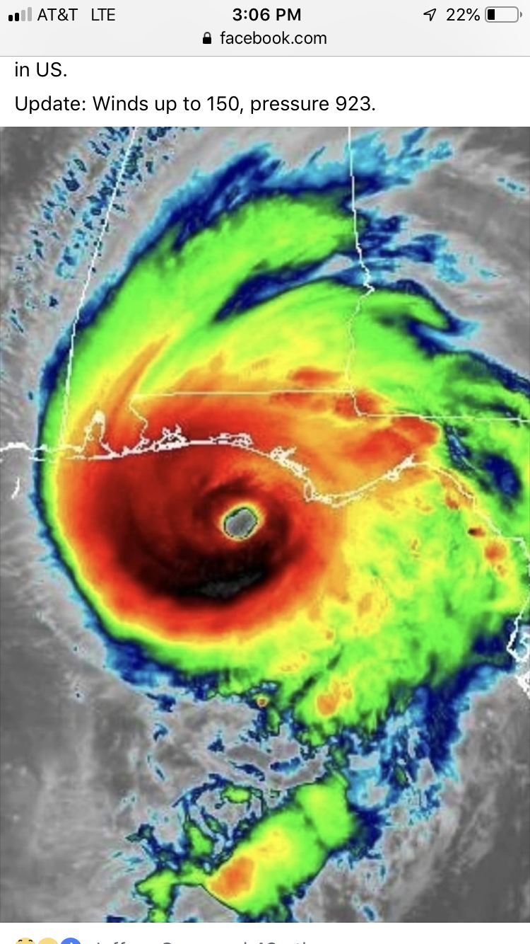
We sure need some kind of help.
-
 1
1
-
-
Just now, MillvilleWx said:
The run wasn't the 12z run but it wasn't that far from being a monster hit. At Day 5/6, just having the 5H potential is pretty solid. Don't get sold on one or two operational runs. Use them as ensembles for potential. We likely saw the max potential for this storm on the 12z ECMWF. This isn't bad for part of the sub-forum. HECS would be cool, but they are so low probability. MECS is certainly at play with the type of energy being depicted on guidance. Negatively tilted troughs near my hood, moving eastward are pretty good to see at inside 72 hr leads. From there, lots of variables at play. If you think models have a handle on this in full, then you haven't been looking at east coast weather long enough. Get some sleep y'all. A potentially long weekend ahead full of highs/lows, head fakes, disappointments, and potential jubilation.
The voice of reason has arrived. Good to see you on here! MAF had more SN than 3 years at IAD
-
2
-
-
Just now, jayyy said:
The problem is everybody is so snow hungry from the past 2 winters that they are fiending for snowmaggedon.
when you’re not hitting the ball, sometimes you need to bunt to get on base. I would be ecstatic to see an easy 4-8” over some complex mess that ends up giving Binghamton another 30”
To each his own.
-
2
-
-
Just now, jayyy said:
What? This is a 12+ run for much of VA and a mere 20-30 mile jog north gets DC-BAL along i95 in on it too.
Why does everybody need to see 12-24+ ? Lmao. Can we just settle for a damn warning event at this point?
I’m not in it for that! If I want a 6-10 run I’ll go skiing! I’m in it for the big events, it’s what I work for in this field.
-
3
-
-
Just now, jayyy said:
We have time for those details to iron out. This run certainly exposes everything that can go wrong with this one though.
PSU analyzed this storm into his worst nightmare.
That is the problem with getting hopes up on a few operational runs. It’s day 5/6 and models are only simulating what could happen with pieces of energy that may not even be over the CONUS yet. Any one of these pieces initializes off it can make things very uncertain.
-
This is not going to get it done unfortunately. Energy does not phase and the wave hitting the coast is a baggy mess.
-
500 low is more baggy, elongated this run. Needs to be deepening and cutoff swinging through south of our area.
-
2
-
-
GFS not going to get the job done. Upper energy looks baggy and transfer too late to the coastal. We get waa front end and that is all.
-
2
-
-
15 minutes ago, psuhoffman said:
Thanks for the write up. That’s the control btw though. This is the eps mean same time. Just for reference.

The eps mean is a little better then the 18z control imo. Control dove the h5 low too far south for my liking.
There are subtle differences but same reasoning.
-
13 minutes ago, losetoa6 said:

The 500mb pattern depicted on the ENS is close to something big but not quite there yet. The best look the Mid Atlantic has had in two years, but ideally we need the western ridge more amplified and further west with the 500 low deepening and closed as it passes south of us and off the coast. Tilt going more negative and a phase to cutoff and keep the CCB going. It’s close, but not quite there yet. Fortunately we have cold high pressure over southern Canada vs that upper low which suppressed the Thursday system.
Given trends this year, if we continue to see the ECMWF holding the pattern into 72 hours from onset with the ukmet and icon following along we will be in a favorable trend. These models have been consistent in showing the suppression patterns, more conservative. Coastal transfer time and deepening is crucial with Miller B type systems. If the Midwest low is too strong the transfer gets delayed and not favorable per GFS. Hoping for a win for this forum. But, let’s also keep in mind that the pieces to the puzzle are all being simulated at various points...some outside the U.S. so swings and uncertainty will be factors this far out. I think by Thursday there should be much better consistency and a better picture of where we are headed with this. Just my two cents.ERS
-
9
-
 13
13
-
-
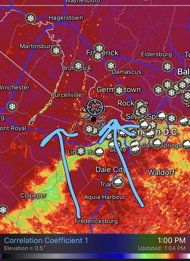
Rain and sleet in Ashburn.
-
Unfortunately in this case the upper level pattern is trending unfavorably for our latitude. The 500 ridge out west is setting up too far east over the Plains where ideally it should be over the western states. Upper level low over southern Canada with the high nosing leads to a more progressive and southern system. The 500 energy comes at us more west to east vs a larger cutoff feature given the pattern. Unless we see changes to these features, the southern/progressive/slider type of a system would continue.
-
4
-
2
-
 2
2
-
-
Final point to make is to not throw out the NAM if it might be outside it’s “wheel house”. At 48, 60, 72 hours we are not to accept its exact QPF or low position but more so it’s giving shorter range clues as to what might be happening with all the pieces sampled with the globals over the medium range, at lower resolution. The NAM outside its wheelhouse picked up on this pronounced warm injection, quick changeover. It’s QPF was way to high over the northern tier but we want features and potential evolution vs exact QPF amounts 2 to 3 days out. No forecaster in the weather business understands how to predict exact QPF, it’s like coastal flooding, smoke and mirrors at times and formulated with a blend of guidance. Focus on features and their evolution vs nailing down amounts and exact track.
-
6
-
-
4 minutes ago, osfan24 said:
Is there a reason why this didn't close or it took so long to close off?
Weakening upper level energy as it approached. Just made a post above. No phasing where we needed it
-
1
-
1
-
1
-
-
It’s important to try not to hug the snowiest model solutions several days out. If you think about it, 120 hours out is 5 days and most pieces of energy that would come together for a MA storm may not even be over the U.S. yet. It’s a simulation of what could happen and with high uncertainty built into it. So many pieces to come together and if timing is off on one of them, a model can go from a 20” snow to a miss or rain just like that. Tempting not to grab on as a snow lover, but helps to avoid disappointment later on. It’s more important to understand synoptically the “why” vs the “what” and know how weather typically behaves here. A 10-20” snow sampled by the euro, cmc, and gfs at day 4/5 would be in the record books especially for the big cities in December. Records are called records for a reason, they don’t happen too often. Big snows in a model outside the favored climatology should be looked at with caution...biggest one here being the CAD. Yes the signature was there, but the source region of the airmass was modified and not very cold in depth. No closed low was big red flag. 50 degree Atlantic water with easterly flow aloft another flag. The ship began to sink. It’s tough to not latch on. We all feel it, Met or hobbyist, but we can’t overlook the factors that work against us.
-
14
-
2
-
-
Some have mentioned why given the setup all the warm air filtered in.
best setups for the MA are closed upper low, passing near or just south of us and also deepening.
The CAD, while in place was marginal. Air being drawn into our region was not all that cold and it was shallow. Advection aloft came right off the mild Atlantic regardless of the low track and caused the changeover. These factors started showing up in the guidance Sunday night/Monday.
At our latitude we need many pieces to come together just right to give a classic heavy snow setup.
-
5
-
6
-
-
10 minutes ago, Eskimo Joe said:
Don't look now, but SPC mesoanalysis has the surface low at 1000mb off the mouth of Chesapeake, well east of any of the warmer NAMs, eta.
Best forcing and dynamics will be going north of our area. Wrap around CAA is always tricky. Areas closer to the Mason Dixon line would do better than areas further south.
-
1
-
1
-
-
30F: freezing rain, mostly slush on the roads but seeing light ice accretion on elevated surfaces such as trees, banister rails, power lines, overpasses etc. Rates are too high and temperatures a bit warm to see major ice impacts that would threaten widespread power outages or transportation issues.
-
For reference, the average December monthly snow for IAD, BWI, DCA is 3.5, 3.0, and 2.3. Not the kind of storm we originally hoped for, but a 12”+ event is not all that common for this time of the year in the MA. We are starting the year off pretty good.
-
12
-
3
-
-
All sleet in Ashburn. 2.5” total snow.
-
1
-
-
Large flakes in Ashburn. Highest rate so far. Mixing line encroaching from the south. Already switched to sleet in Herndon per WFO. Hoping to hold on in the Ashburn/Leesburg area through 20z to verify warning.

-
3
-
-
Ashburn, VA.
28F, moderate snow. Nearing 2” on the deck. Roads covered. Few hours of snow left before the mixing line. Expecting 4-6 prior to IP.
-
3
-
-
30/23: flurries
-
1 minute ago, stormtracker said:
Ok, now see. He was saying this isn't a hobby, it's like an illness. A sickness we're addicted to.
Got it :-).
-
2
-


January Storm Term Threat Discussions (Day 3 - Day 7)
in Mid Atlantic
Posted
Icon solution pumps in too much warm air off the Atlantic when the best stuff gets going from the coastal.