
ers-wxman1
-
Posts
2,525 -
Joined
-
Last visited
Content Type
Profiles
Blogs
Forums
American Weather
Media Demo
Store
Gallery
Posts posted by ers-wxman1
-
-
37 minutes ago, WEATHER53 said:
WWA for tomorrow?
Commuter advisory for rush hour impact.
-
1 minute ago, ravensrule said:
OMG the dangers of a 1/2", the commuters have gotten softer than Charmin.
Squirrel and stray cat advisory
-
 2
2
-
-
30 minutes ago, ravensrule said:
This has to be a joke.
Commuter advisory
-
1
-
-
Steady light snow in Warrenton at the office. Coating.
-
 3
3
-
-
1 hour ago, RVAman said:
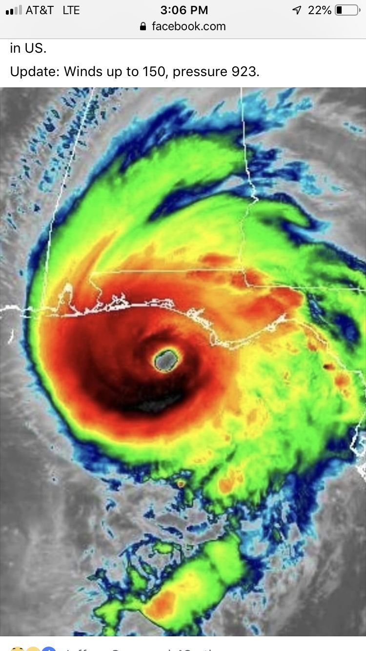
DT : “*ALERT* YES THE 0z NAM DID NOT PRODUCE LIKE I EXPECTED. ITS BS- the 06z WILL SHOW WHY MY FINAL CALL MAP IS THE MOST ACCURATE MID ATLANTIC SNOW MAP. LOCAL STATIONS WILL GET ON BOARD.
The biggest run of our lives!
-
Here comes the 00z NAM tease
-
3
-
-
7 minutes ago, AlexD1990 said:
Holding you to that...
You’re on!
-
3
-
-
2 minutes ago, PrinceFrederickWx said:
6-8" for me... sure

If I get 3 inches in Reston I’ll take 5 of you to Ruth’s Chris for steaks!
-
8
-
1
-
 1
1
-
-
18z GFS will keep the toughest of weenies in the game until 00z.
-
1
-
-
8 minutes ago, Solution Man said:
Fwiw

Bust: P6SM FEW050
Boom: P6SM SCT030 BKN060
-
1
-
3
-
 1
1
-
-
7 minutes ago, stormtracker said:
Thanks for letting us know this. We would have never known otherwise.
Elegance of words. Masterpiece of American literature
-
You guys are beating a dead horse. This is great for trying to keep a business alive, not for snow. Even if the NAM throws a snow swath over us it’s never going to reach the ground! It’s bone dry. Would take half the day to moisten the column let alone fringe bands. It’s a dead deal!
-
1
-
1
-
 3
3
-
-
3 hours ago, WEATHER53 said:
Thank you. When it shows 20” and two days later zero, what am I supposed to learn and take with me as to their value?
And how about the times it gives the solution you want 7 days out then verified! What do you make of the model then?
-
 1
1
-
-
Just now, WEATHER53 said:
Do you believe that models are efficient with mid Atlantic winter storms?
It’s not the model that’s important, it’s the pattern recognition. Models are just simulating possible solutions, taking into account a variety of features. Understanding what drives a 1-2 foot storm in our area is more important than models spitting out a HECS at day 7.
-
4
-
-
Synoptically, there is not a single feature that supports a Mid Atlantic event. Everything is in the wrong place. We are hanging on by a needle thread with the fantasy driven NAM. I’m not even sure we will see enough cloud cover to block the Sun.
-
4
-
6
-
 1
1
-
 1
1
-
1
-
-
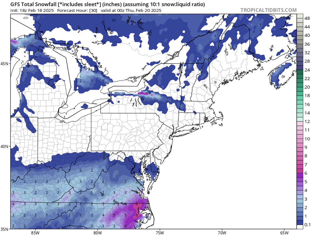
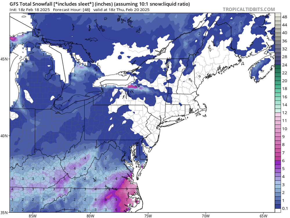
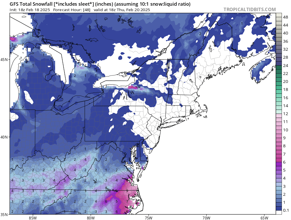
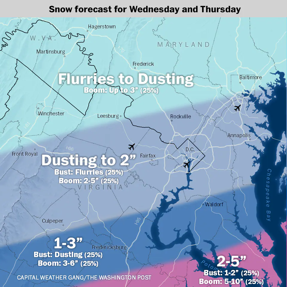
We all got caught in the day 5-7 model fantasy. Potential is still there for warning level snows for all of the sub forum, but the phased nor’easter solution is least likely given the upper level synoptic pattern that is evolving. Need strong ridge over the west and the 500/700/850 low to be closed and tracking to the south of DC with phasing to get a 1-2 foot + event here. I think this scenario is just about off the table. What is more conducive is a 4-8 type of event with a boom scenario to 12 for those that get under better forcing likely east given a low deepening offshore. Bad press/backyard Mets put this HECS wording out there and the public is going halfway nuts with degreed Mets trying to walk them off the edge.
-
16
-
-
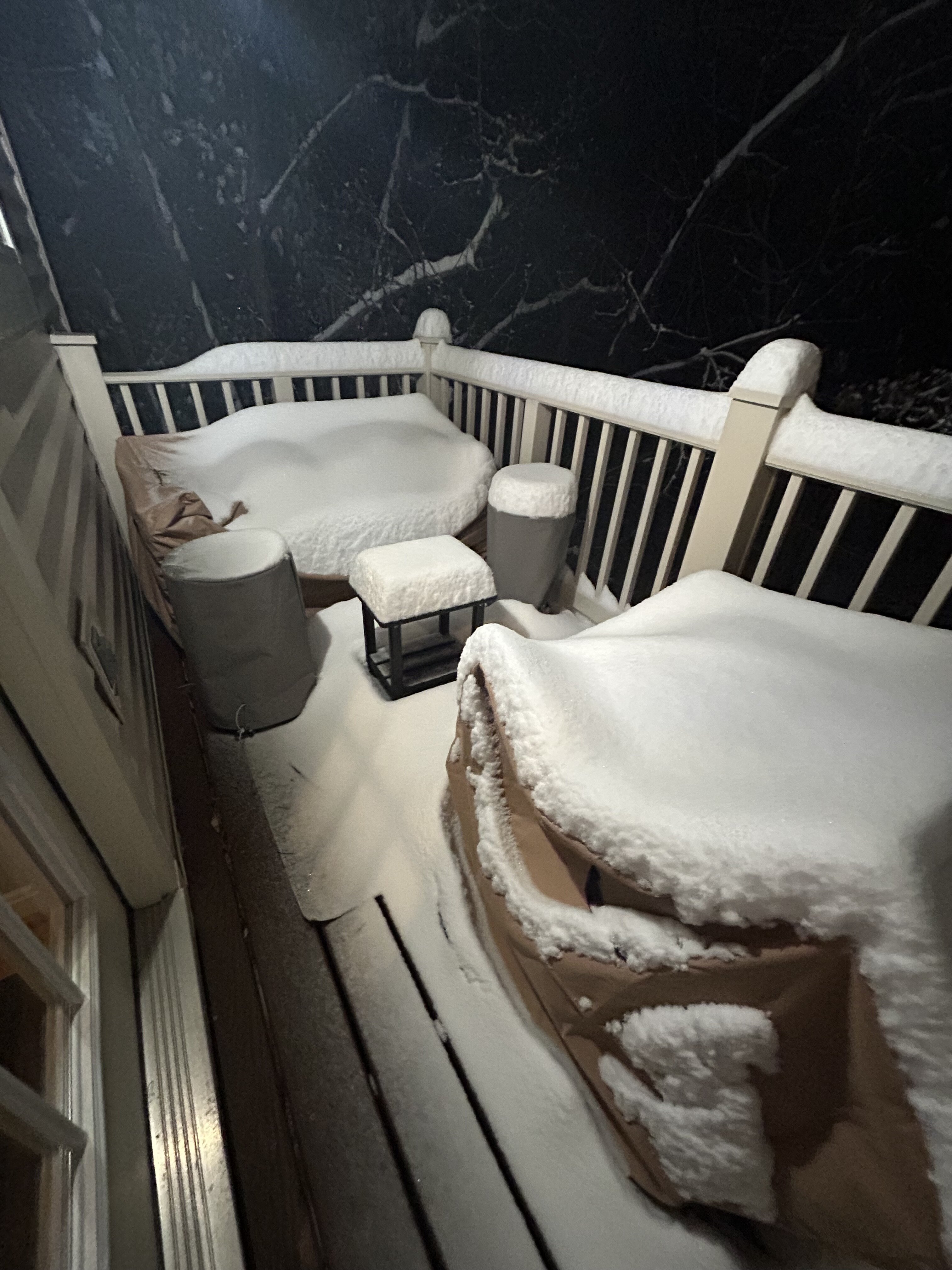
Close to 6” for the event here in Reston. Wet snow and compacting/melting.

-
5
-
-
5 minutes ago, Eskimo Joe said:
^soid map @ers-wxman1. Happy to see the lowlanders get something.
This is a solid event. Somebody will jackpot over 12”. Plenty of precip to go and near ideal forcing in the right spot. Bullish NAM was solid this go around and I think areas north of 66 are going to easily go over 6”. This is one example where the 90th percentile works.
-
7
-
1
-
-

-
11
-
1
-
-
All roads caving in Reston. Boom scenario I believe.
-
6
-
-
-
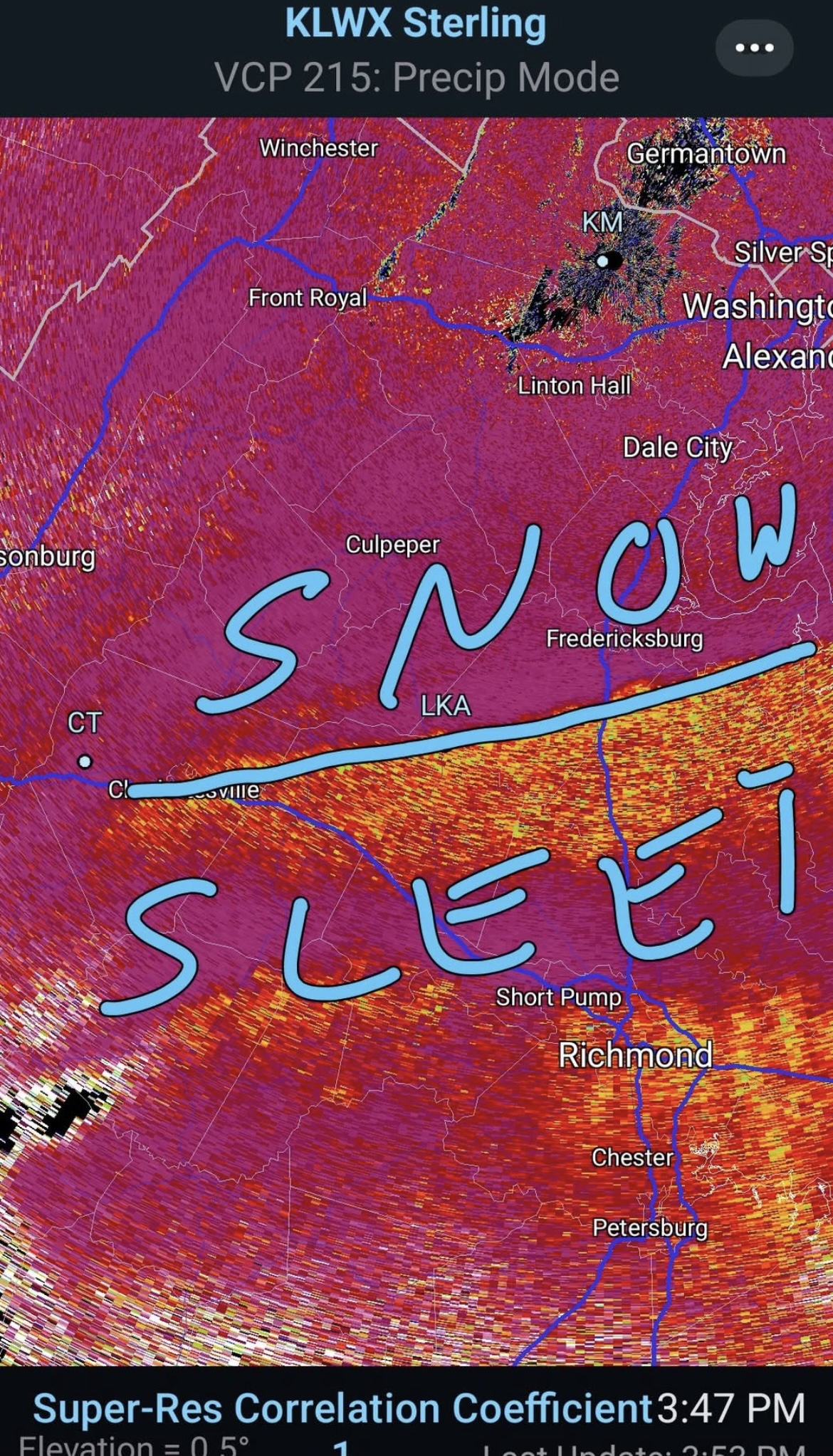
Soundings are impressive…saturated in the -10 to -20 layer indicating strong forcing and lift in the dendritic snow growth region. Expect efficient rates and fast caving of roads after sunset for most areas. Wouldn’t be surprised to see that 6-8” line coming north a jog. Areas south of town esp Warrenton, Gainesville east may hit 8-12 in a narrow band if sleet line doesn’t push north.
-
9
-
 1
1
-
1
-
 3
3
-
-
Steady light snow in Warrenton. Vint Hill road.
-
6
-
-
12z NAM shows a later start time up through Loudoun/Fairfax/DC. -SN toward 20z vs 17z. Delayed onset closer to sunset now with heavier bands working in. Might see higher end of the 4-6, possibly 8” with cooler night time ground and more efficient accumulation. Soundings also showing decent lift in the dendritic snow growth region.
-
12
-
2
-
1
-
1
-
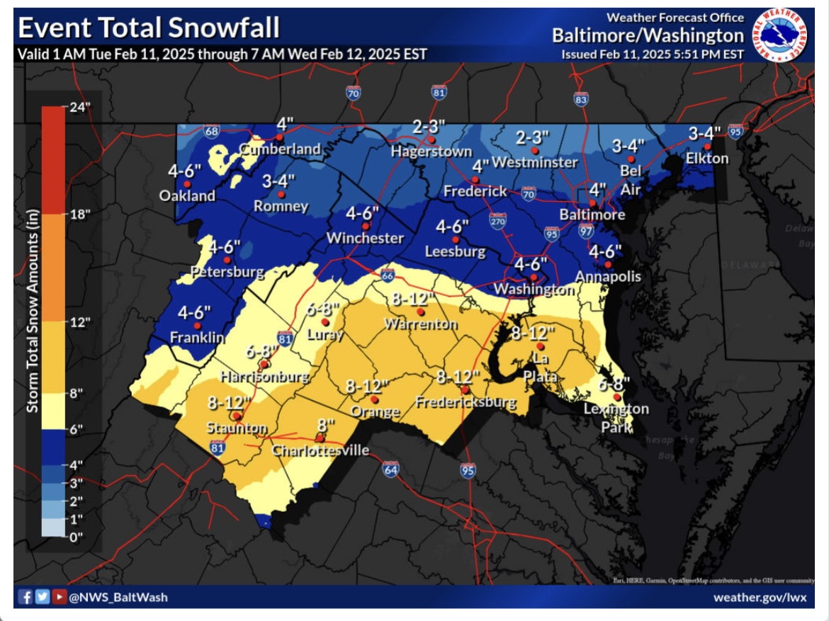
Winter 2024-25. Lets grade it.
in Mid Atlantic
Posted
B+ for Reston. 15” I’ll take it, though we have not seen a 20” storm since 2016. We are overdue.