dryslot
-
Posts
62,800 -
Joined
-
Last visited
Content Type
Profiles
Blogs
Forums
American Weather
Media Demo
Store
Gallery
Everything posted by dryslot
-

December 2021 Obs/Disco...Dreaming of a White-Weenie Xmas
dryslot replied to 40/70 Benchmark's topic in New England
Lol, The thing is slowly the others are trending towards it but not in nuclear form. -
December 2021 Obs/Disco...Dreaming of a White-Weenie Xmas
dryslot replied to 40/70 Benchmark's topic in New England
Gfs not backing off. -
16-17"? Seems low.
-
December 2021 Obs/Disco...Dreaming of a White-Weenie Xmas
dryslot replied to 40/70 Benchmark's topic in New England
It has here........lol -
December 2021 Obs/Disco...Dreaming of a White-Weenie Xmas
dryslot replied to 40/70 Benchmark's topic in New England
I saw the vid, I don't think that was her first rodeo ha ha. -
December 2021 Obs/Disco...Dreaming of a White-Weenie Xmas
dryslot replied to 40/70 Benchmark's topic in New England
Hey, You could probably get a lap dance, Looked like she could handle anything from the north pole. -
December 2021 Obs/Disco...Dreaming of a White-Weenie Xmas
dryslot replied to 40/70 Benchmark's topic in New England
I thought they looked ok. -
December 2021 Obs/Disco...Dreaming of a White-Weenie Xmas
dryslot replied to 40/70 Benchmark's topic in New England
GYX's take on the Saturday-Sunday event. Overall models continue to struggle in the mid range due at least in part to the transition from ridging to troughing across New England. The GFS has been consistent for several runs with a more robust system for late Saturday and Sunday, while the Euro has had almost nothing across New England. However, the latest 00z run of the Euro and the Euro ensembles show a dramatic shift from earlier thinking toward the GFS/GEFS solutions. Meanwhile, the GFS remains consistent with the system overall, but has trended even stronger and slightly farther north with it. The overall driving force for this system derives from two short waves approaching New England, and how much they merge with each other before moving out to sea. The latest model runs are in better agreement in a faster second wave merging and amplifying across New England. With this solution, it`s possible that light precipitation with the first shortwave could break out across southern and western areas by Saturday morning, with precip intensity increasing late Saturday and Saturday night as the system amplifies. It`s possible there wouldn`t be much of a break in the precip through the event if the waves merge quickly enough. This is a dramatic shift in the model consensus for a system that`s only 2.5-3.5 days away. With this forecast we raised POPs from the NBM solution to a mid to high chance for most areas, with southern and western areas seeing a greater chance on Saturday, while northern areas hold off until Saturday night and Sunday. We held off on going higher on POPs to give time to make sure this early morning`s runs aren`t just a blip. -
December 2021 Obs/Disco...Dreaming of a White-Weenie Xmas
dryslot replied to 40/70 Benchmark's topic in New England
If you give him abbreviations he could end up anywhere. -
December 2021 Obs/Disco...Dreaming of a White-Weenie Xmas
dryslot replied to 40/70 Benchmark's topic in New England
Healthy clown. -
December 2021 Obs/Disco...Dreaming of a White-Weenie Xmas
dryslot replied to 40/70 Benchmark's topic in New England
That's warning snow up here on the 12z GFS on the 26th -
December 2021 Obs/Disco...Dreaming of a White-Weenie Xmas
dryslot replied to 40/70 Benchmark's topic in New England
-
December 2021 Obs/Disco...Dreaming of a White-Weenie Xmas
dryslot replied to 40/70 Benchmark's topic in New England
I look at them all but doesn't mean i believe everything i'm seeing........lol -
December 2021 Obs/Disco...Dreaming of a White-Weenie Xmas
dryslot replied to 40/70 Benchmark's topic in New England
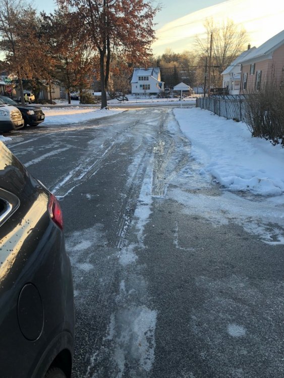
If you need some ice, Let me know. -
December 2021 Obs/Disco...Dreaming of a White-Weenie Xmas
dryslot replied to 40/70 Benchmark's topic in New England
Here too, But its not consistent so far run to run as usual. -
December 2021 Obs/Disco...Dreaming of a White-Weenie Xmas
dryslot replied to 40/70 Benchmark's topic in New England
Kid suck? -
So far it is, We will see what 12z does today.
-
December 2021 Obs/Disco...Dreaming of a White-Weenie Xmas
dryslot replied to 40/70 Benchmark's topic in New England
Better then most but not very well, 9.6" so far when we avg 22" in Dec. -
December 2021 Obs/Disco...Dreaming of a White-Weenie Xmas
dryslot replied to 40/70 Benchmark's topic in New England
Good luck Jay, These things have a way of working out. -
December 2021 Obs/Disco...Dreaming of a White-Weenie Xmas
dryslot replied to 40/70 Benchmark's topic in New England
-
December 2021 Obs/Disco...Dreaming of a White-Weenie Xmas
dryslot replied to 40/70 Benchmark's topic in New England
Especially when they added the 06-18z to the euro, I had said that all along but now they screwed up the 0z-12z runs too............. -
December 2021 Obs/Disco...Dreaming of a White-Weenie Xmas
dryslot replied to 40/70 Benchmark's topic in New England
-
County got there's. 000 NOUS41 KCAR 230227 PNSCAR MEZ001>006-010-011-015>017-029>032-231427- Public Information Statement National Weather Service Caribou ME 927 PM EST Wed Dec 22 2021 ...SNOWFALL REPORTS... Location Amount Time/Date Provider ...Maine... ...Aroostook County... Van Buren 12.0 in 0911 PM 12/22 Public Woodland 10.0 in 0658 PM 12/22 Public Stockholm 9.0 in 0527 PM 12/22 Public 3 NNE Caribou 9.0 in 0800 PM 12/22 NWS Employee 3 WNW Guerette 8.5 in 0648 PM 12/22 Public New Sweden 8.5 in 0730 PM 12/22 Public 2 NE Fort Fairfield 8.5 in 0805 PM 12/22 NWS Employee Lille 8.4 in 0635 PM 12/22 Public 3 SE Fort Fairfield 8.0 in 0546 PM 12/22 Trained Spotter 3 SSE Caribou 8.0 in 0748 PM 12/22 Public 1 NW Ashland 7.5 in 0702 PM 12/22 Public 2 SSE Ashland 7.5 in 0758 PM 12/22 Trained Spotter 1 WNW Ashland 7.2 in 0606 PM 12/22 Public 3 ENE castle hill 7.2 in 0657 PM 12/22 Trained Spotter 1 SE Presque Isle 7.0 in 0630 PM 12/22 Trained Spotter Limestone 7.0 in 0723 PM 12/22 Public 4 SE Washburn 7.0 in 0725 PM 12/22 Trained Spotter Caribou 7.0 in 0730 PM 12/22 Trained Spotter 3 ESE Caribou 7.0 in 0805 PM 12/22 Trained Spotter 2 SSE castle hill 6.9 in 0822 PM 12/22 NWS Employee 1 WSW Blaine 6.5 in 0722 PM 12/22 Public 2 S Caribou 6.0 in 0504 PM 12/22 Cocorahs Saint Francis 6.0 in 0642 PM 12/22 Public Wallagrass 6.0 in 0714 PM 12/22 Public 1 N Caribou NWS 5.7 in 0700 PM 12/22 Official NWS Obs Fort Kent 5.5 in 0711 PM 12/22 Public Crystal 5.0 in 0710 PM 12/22 Public 1 N Danforth 4.9 in 0753 PM 12/22 Public 1 WSW Madawaska 4.7 in 0852 PM 12/22 Trained Spotter Sherman 3.0 in 0748 PM 12/22 Public ...Penobscot County... Millinocket 6.0 in 0717 PM 12/22 Public Lincoln 4.0 in 0700 PM 12/22 Public 3 WSW Orrington 1.0 in 0837 PM 12/22 Trained Spotter ...Piscataquis County... Greenville 7.5 in 0720 PM 12/22 Public 4 E Greenville 6.5 in 0253 PM 12/22 Trained Spotter Shirley 5.0 in 0224 PM 12/22 Public Sangerville 4.0 in 0648 PM 12/22 Public Medford 4.0 in 0718 PM 12/22 Public 2 SSE Kingsbury 3.5 in 0406 PM 12/22 Trained Spotter Milo 3.5 in 0826 PM 12/22 Public &&
-
December 2021 Obs/Disco...Dreaming of a White-Weenie Xmas
dryslot replied to 40/70 Benchmark's topic in New England
Its quite bad here too.